This was part of a backpacking trip by my brother and me with an original itinerary to cover Bangalore- Kumbakonam – Gangaikondacholapuram – Chidambaram – Pichavaram – Pondicherry – Tiruvannamalai – Bengaluru
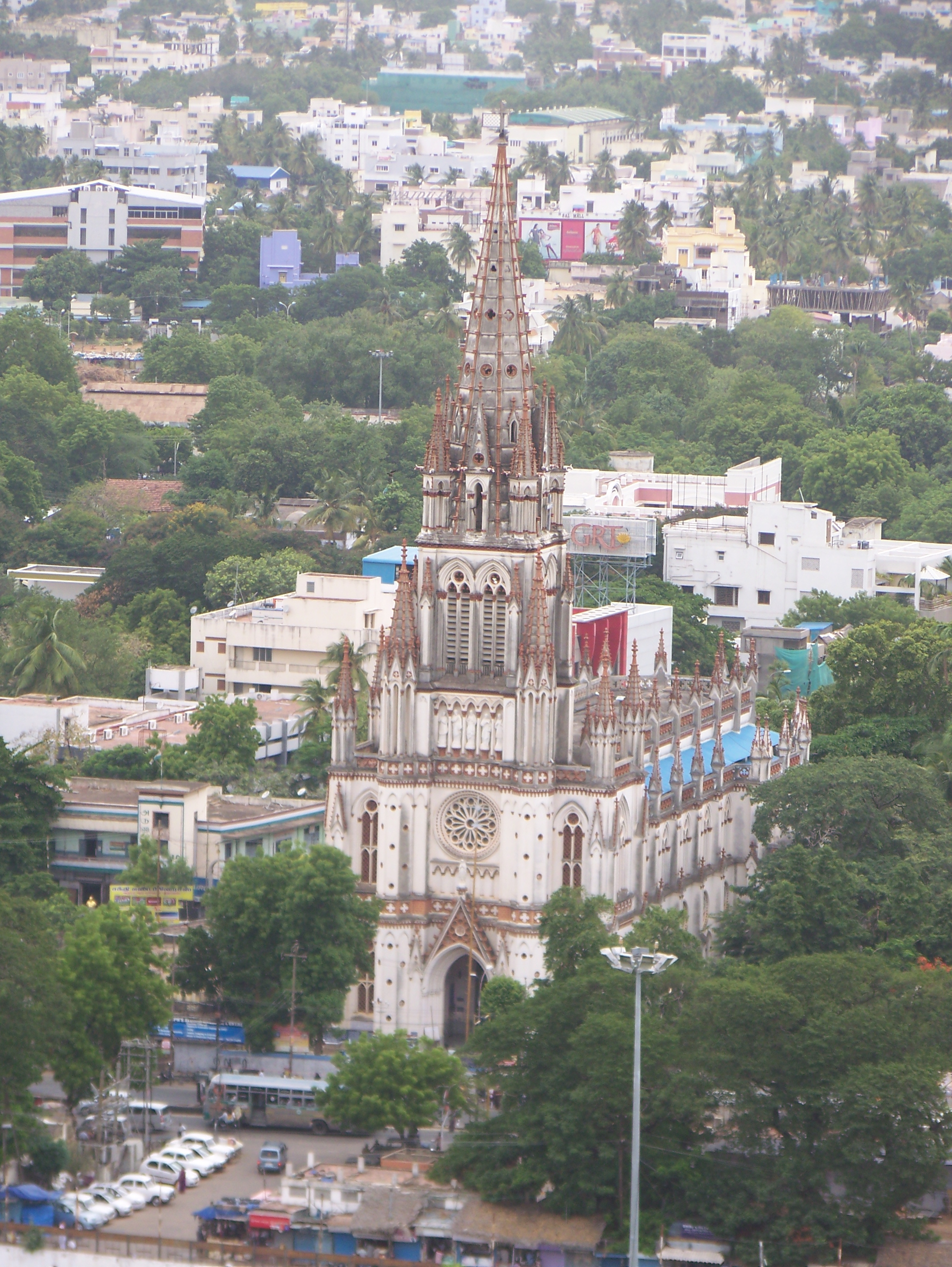
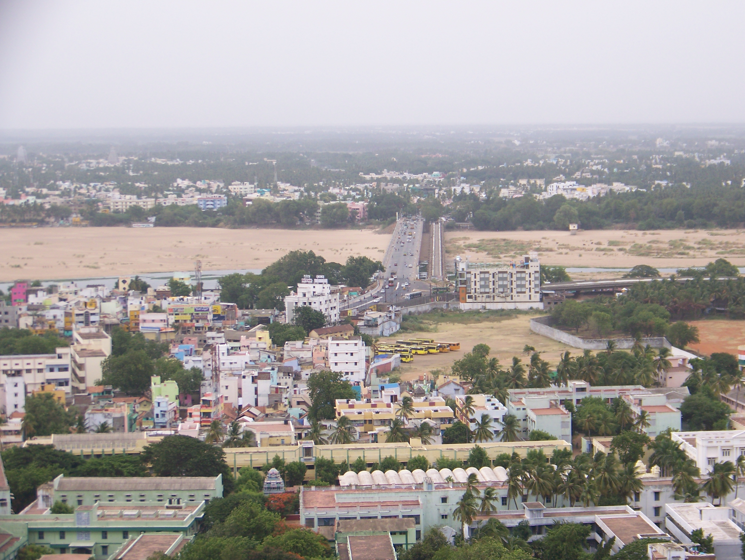
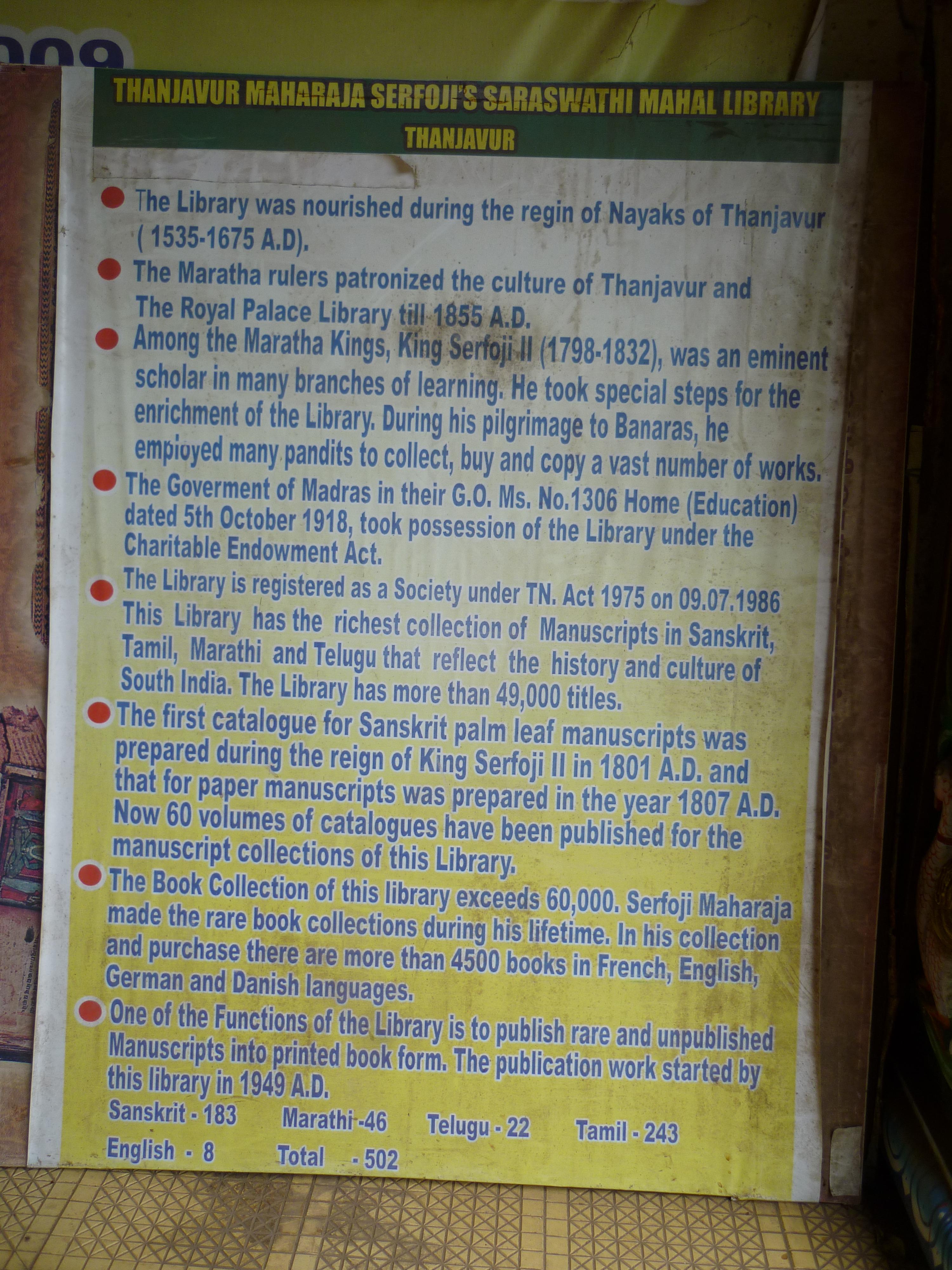
Although being located in the same district, soaked in history and RICH architectural heritage from the Chola era, Kumbakonam is a place that is mostly overshadowed by its counterpart at Tanjavur town. Hence, it is a place that is often spoken less about on a typical tourist’s circuit. I was curious to cover this city and absorb as much of it as possible. While I embarked on a weeklong backpacking trip through some parts of the East Coast road, I had enlisted the temples that seemed culturally important and hoped to visit them while I passed through the city of Kumbakonam.
Getting around:
As you may know, most of my trips are by using public transportation. During this trip, all the places within the city were covered on foot. (You can alternatively hire an autorickshaw to show you around and save some time). All other places located on the outskirts were explored through public/ local buses that are very frequent and extremely light on the pocket. If you are using this blog as a reference to explore this ancient city of the Cholas, you can plan your commute accordingly. Places to visit in Kumbakonam city largely comprise temples and can be broadly grouped into three categories depending on their location and proximity of accessibility.
a. Temples within a cluster within the city (temples 1~5 and 11~12 in my list)
b. Temples within a cluster on the city outskirts (temples 6~8 in my list)
c. Temples located in separate locations on the city outskirts (9~10 and 13~18 in my list)
Accommodation:
It was raining cats and dogs when we alighted at Kumbakonam bus stand in the morning. We had pre-booked a hotel in Kumbakonam city through an online portal. But after reaching the place, we realized that there was a mistake on the portal, and the hotel was closed for the Deepawali vacation. We sat there and browsed through websites to find alternate accommodation options. Meanwhile, the pounding rain had mellowed down to a drizzle. We finally managed to find a hotel nearby where we dumped all our baggage, freshened up, and ventured out to explore. Bonus for the online goof up by the website: We had a room upgrade.
So, here are the places we visited during our short stint of 2 days at this historical city of Kumbakonam in the order of our travel.
Day 1:
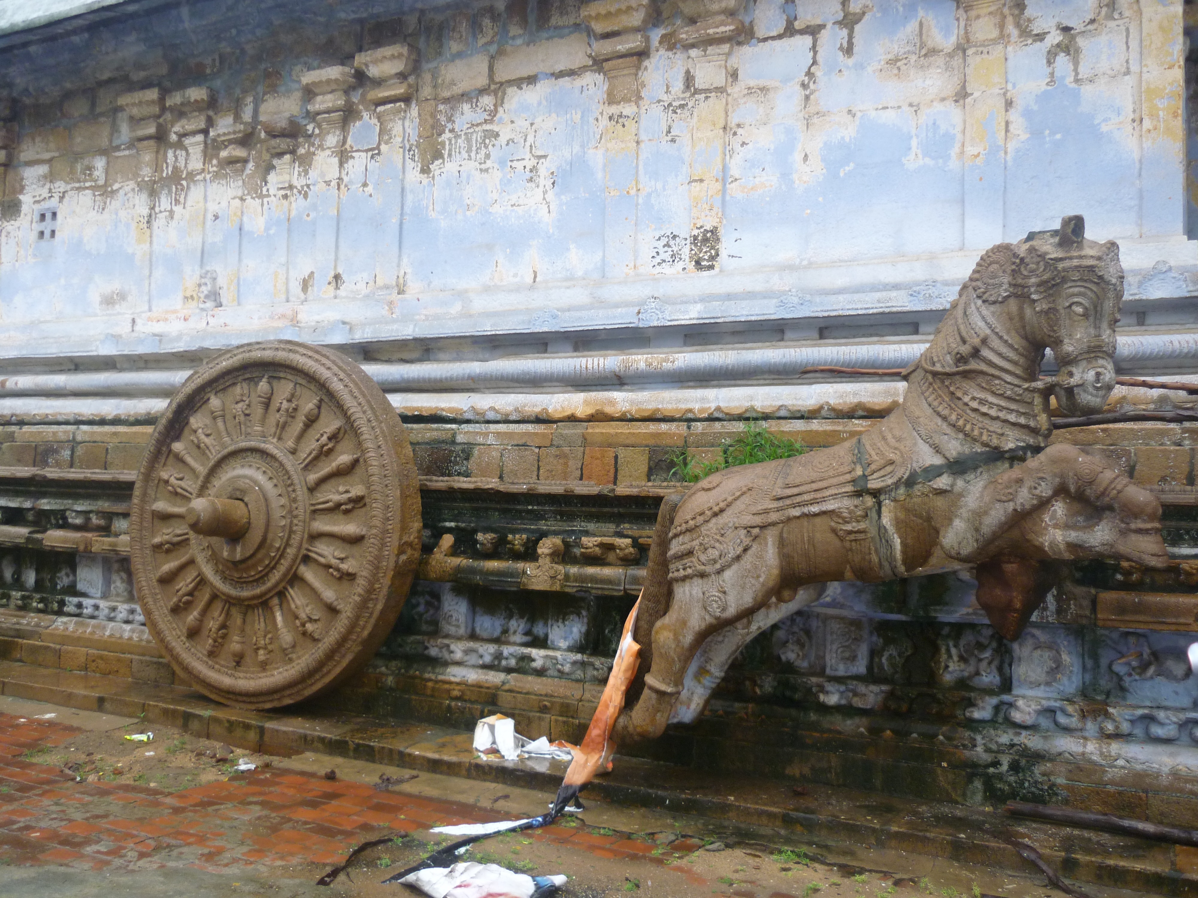
- The Nageswara temple: A sizable temple dedicated to the Snake king Adishesha, who is believed to have offered his prayers to Lord Shiva here. An interesting part of this vast 1000-year-old temple premise is the kalyana mantap. The Cholas have sculpted this stone structure in the form of a chariot being drawn by life-sized elephants and horses with the suspension technique.
2. Sarangampani: We reached this temple that follows the Vaishnavism cult after wading through a flooded road. Notable contributions have been made by the Cholas, Vijayanagar, Madurai Nayaks, etc., to the overall architecture of this temple. A temple tank is located on the western side of this temple.

3. Someshwar temple: This is located adjacent to the Sarangampani temple. We skipped an exclusive visit to this temple after getting some photos from the outside of the temple. From there, we continued through the busy shopping lanes of the town to reach our next landmark.
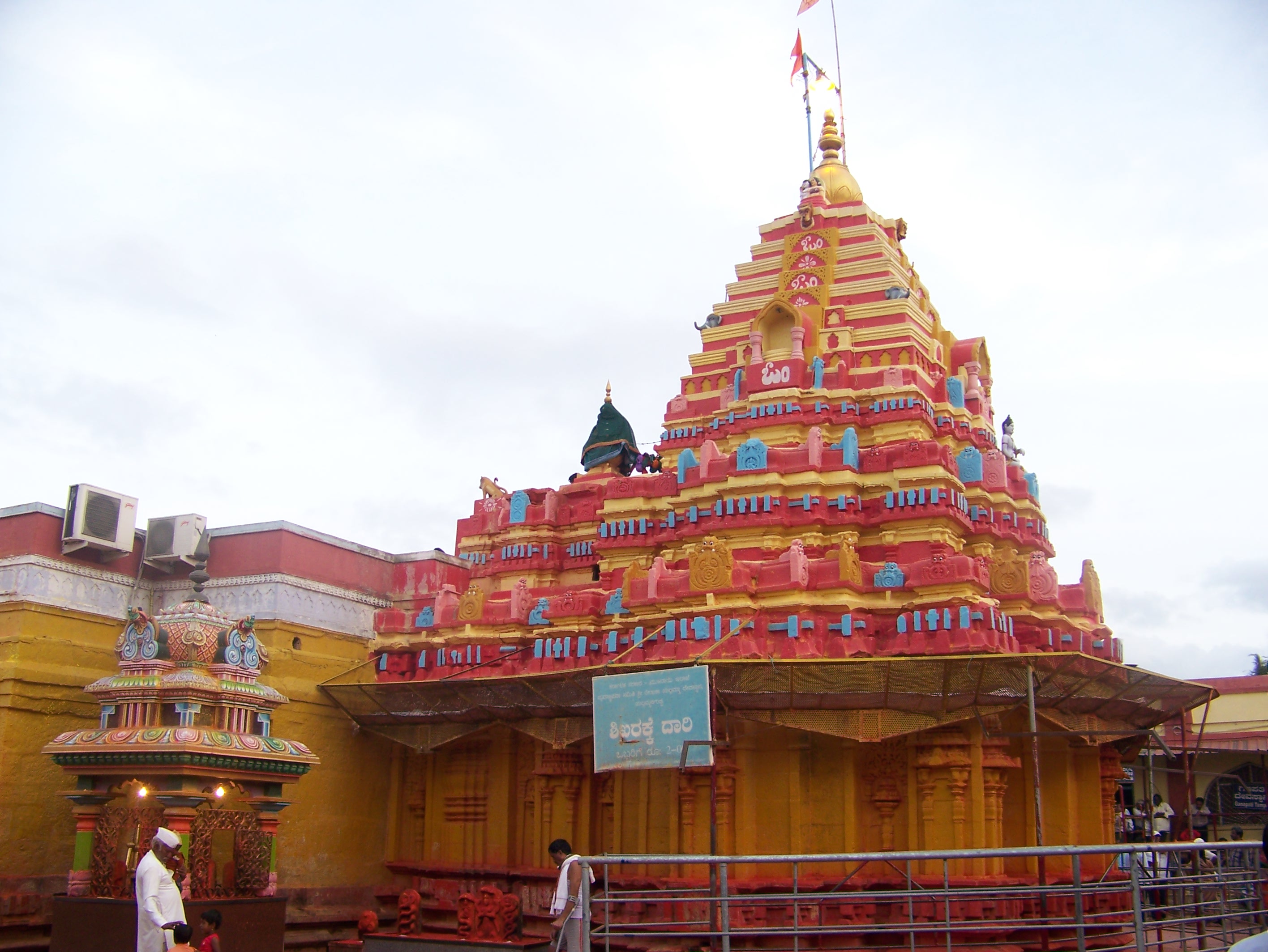
4. Adikumbeshwara temple: It is believed that Kumbakonam gets its name from this Shiva temple. Legend has it that lord Brahma’s pot (Kumba), containing the nectar of worldly lives, was rolled down and stopped at this town after being hit by Shiva’s arrow. The sculptures at the temple are interesting, where a 16-pillar hall built by the Vijayanagar kings has all the 27 stars and 12 zodiacs sculpted on a single stone. Also, the piped instruments(nagaswarams) etched out of stone and the cattle shed are noteworthy. Today, this vast temple premise is also used for commercial purposes with several shops and restaurants setup in this complex.
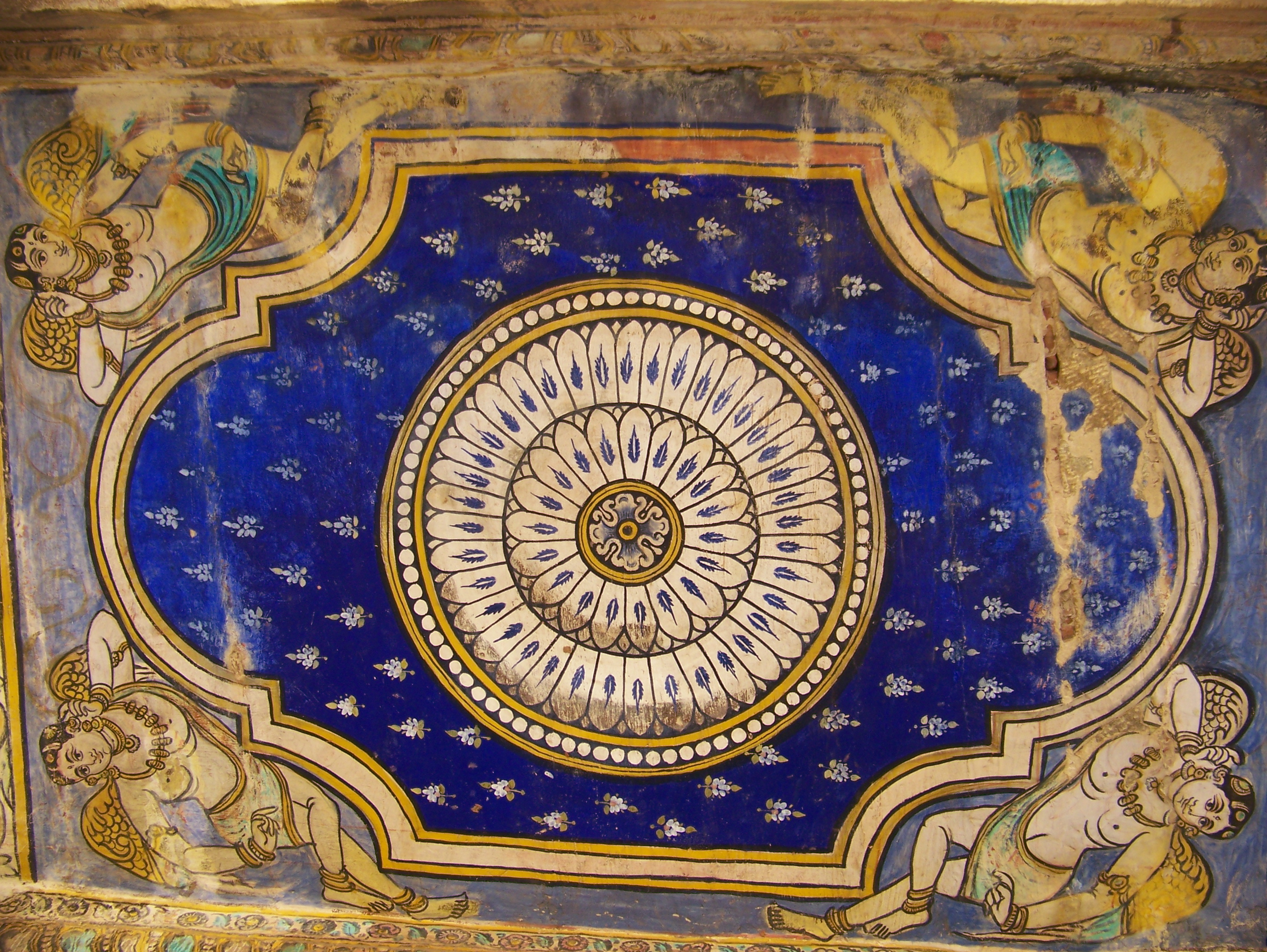
5. Ramasamy temple: A place dedicated to lord Rama; it is believed to be the only temple that houses the idols of Rama & Sita along with all his brothers inside the sanctum Sanctorum. The entire story of Ramayana has been painted on the corridor walls of this temple. And hence, for someone interested in art and beyond just checking places, it would require at least a day or two to observe the murals here.
Obviously, we did not have the luxury of more than a couple of hours to spend, and hence our visit was limited to just a quick brush-up on whatever we could understand of the images there.

6. Mahamahan tank: We timed our visit to this place around noon, when all temples in South India usually close down. This mythologically important tank is spread across 6 acres and is believed to have been created out of the nectar that was spilled from Brahma’s pot.
7. Kashivishwanathar temple: This is located at the entrance of the Mahamahan tank. It is believed that the navakannigas or the 9 maidens of Shiva (Ganga, Yamuna, Saraswathi, Kaveri, Godavari, Narmada, Krishna, Tungabhadra & Sarayu) representing 9 rivers visit and bathe in this tank once in 12 years. A day when lakhs of devotees flock here. It is believed that people who cannot make it to Kailash / Manasa Sarovar visit this temple as an alternative to wash off their sins. Though the temple was closed when we reached there, we were very fortunate to get the prasadam that made a nice filling lunch.
8. Abhimukeshwara temple: Located nearby, on the other side of the tank, we only walked past this place as it too remained closed. From there, we boarded a bus to our next major landmark on my ‘to visit’ list.
9. Airavateshwara temple at Darasuram: We visited this temple, on the outskirts of Kumbakonam (one of the three living Chola temples), when no one else would! By the time we walked from the bus stop to the temple, our umbrellas were flipped by the heavy winds, and the pounding rain had battered and gotten us drenched to our bones. The entire temple complex was FLOODED (with knee-deep water). It was an insane visit where my brother and I both decided to go ahead, wade through the water, and have the entire place for ourselves. We climbed up a ladder (placed by the temple priest to perform the daily rituals) to reach the temple corridor. It was BEAUTY, up there! Bonus: The sight of the entire temple complex in a reflection in the accumulated water. (I know this photo is not its best, but still the best memory that our mobile phone camera could capture for our grandkids when we would tell them about this place!).

After getting some nice shots, we made our way out to the main road to catch a bus to our next destination. The short journey thereon reminded us of Sebastian Vettel cruising on narrow countryside tarmac amid overflowing potholes and LOUD tapangucchi music in the background. With nothing to hold on to during the frequent braking by the driver to stop the bus for passengers to board/alight, the bus kept coming to screeching halts from the revving speeds. It was a fun ride that ended in a few minutes as we alighted at our next planned landmark.
10. Pateeswaran temple: This is originally a Shiva temple, but the goddess has been given prime importance here. It is said that the Cholas offered prayers to the goddess Patti(daughter), calf of the sacred cow Kamdhenu, here before proceeding for any battles during their reign. However, when we arrived here, it remained closed only to open again at 05.00.p.m.
As the rain gods again took over the silent skies, we decided to head back to the city. After reaching Kumbakonam city, we looked out for a place that served the trademark ‘Kumbakonam degree coffee’, our piping hot cuppa filter coffee to warm ourselves to some extent from the chilling rain. It was only 06.00.p.m but already dark. As planned, we set out to find our way through the super crowded streets of the city to find the remaining two temples from our list.
The main bazaar street is a state highway- All thanks to the festival of Deepawali, it seemed like the entire district had come down to one street in Kumbakonam for shopping. The street was jam-packed with not even an inch of breathing space. We somehow managed to get out without actually facing a stampede. Albeit the heavy rain, we closed our umbrellas and stood amid the crowd. The crowd pulled us along to reach the exit of the street, from where we walked to the next temple on our list.
11. Chakrapani temple: Here, Vishnu is worshipped in his sleeping posture holding his ‘Chakra’ on one finger. We witnessed the last pooja of the day, after which we wondered if we had to continue to the next temple or not, since all the nearby temples had started to close down. Anyway, we had a lot of time to kill and walked across to take a chance.
12. Brahma temple: We considered ourselves to be fortunate to have decided to take a chance and arrive here. The temple was still open, and we had made it to the last pooja at this temple as well. The priest was ecstatic to greet us, who went on narrating us stories from mythology and depicting the importance of this otherwise small temple in Kumbakonam. We were told that it was 1 of the only 2 temples in all of Tamil Nadu that are dedicated to Lord Brahma. We were happy to savor the prasadam, which was very unexpected.
We then had a sumptuous supper at a restaurant before we called it a day. It took the same amount of pain to cross the crowded bazaar street to return to the hotel and catch a good night’s sleep.
Day 2:
On the following morning, we were early risers to catch up with our planned itinerary. We boarded a 07.00.a.m. bus to our first destination of the day, situated on a small hillock on the outskirts of Kumbakonam.
13. Swamimalai: Abode of one of the six important Murugan temples in Tamil Nadu, Swamimalai is also an important destination for idol making in India. A limited number of artisans who all live in clusters around the temple here, have carried along a science and art of bronze idol making from the Chola period. The technology used in the ‘lost wax method’ of metal casting is practiced as per the Vedas and is something that needs a more elaborate citation, in another post.
After offering our prayers, we decided to head back to the city to get buses to the other places on our list.

Meanwhile, we couldn’t locate any restaurant that was open for breakfast even at 08:00 a.m. Hence, we decided to have lunch once and for all wherever we would reach. If one had the convenience of an own transportation, there are several other ancient temples that I would recommend visiting. It would be ideal to have an additional day in hand and make Kumbakonam the central place, as all these recommended places are located in different directions, forming somewhat of a radius around this town. Local buses are available from Kumbakonam to each of these places, but it would be very time-consuming to come back to Kumbakonam to change a bus to every time. Hence, we decided to skip the following places and head to our last major landmark.
14. Uppiliappan
15. Thirubuvanam
16. Thiruvalanchizi
17. Thiruvidaimaruthur etc.
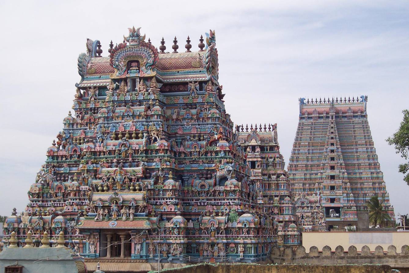
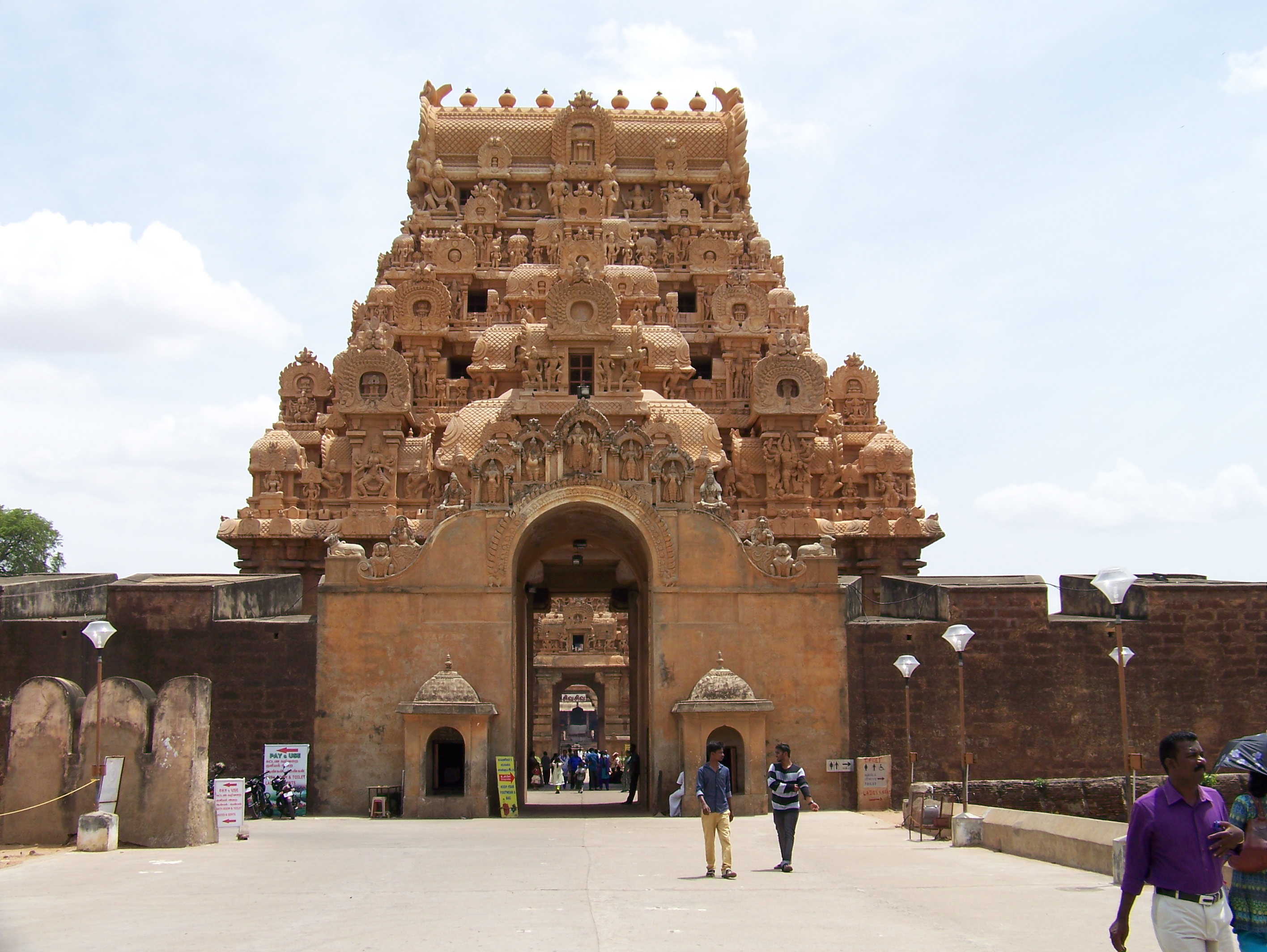
18. The Brihadeeshwara temple at Gangaikondacholapuram: We reached this yet another magnanimous temple after changing two buses (A change of bus at Kork road / GK cross). The biggest (of the three great living Chola temples enlisted by UNESCO), this structure stood right adjacent to the national highway, enchanting every tourist with all its might. The 3 living temples are together called so because the prayers, festivities followed thousands of years ago, during the Chola period, are still being followed religiously to date and have stood as true testimony of time and Tamil culture.

From here, we continued our backpacking into another territory within Tamil Nadu. From the Tanjavur district, we were then heading towards Chidambaram via Pichavaram. Backpacking trips and road trips always carry elements of surprise, and they are supposed to be like that. They can never be planned precisely. These trips always carry scope for making impromptu changes in the itinerary and taking on new adventures. That’s what was awaiting us on the next leg of this weeklong trip, far away in the southernmost state of India. Click here to read more about my journey to Chidambaram.