Category Archives: Nature & Wildlife

Meeting the farmers of the forests at Dandeli

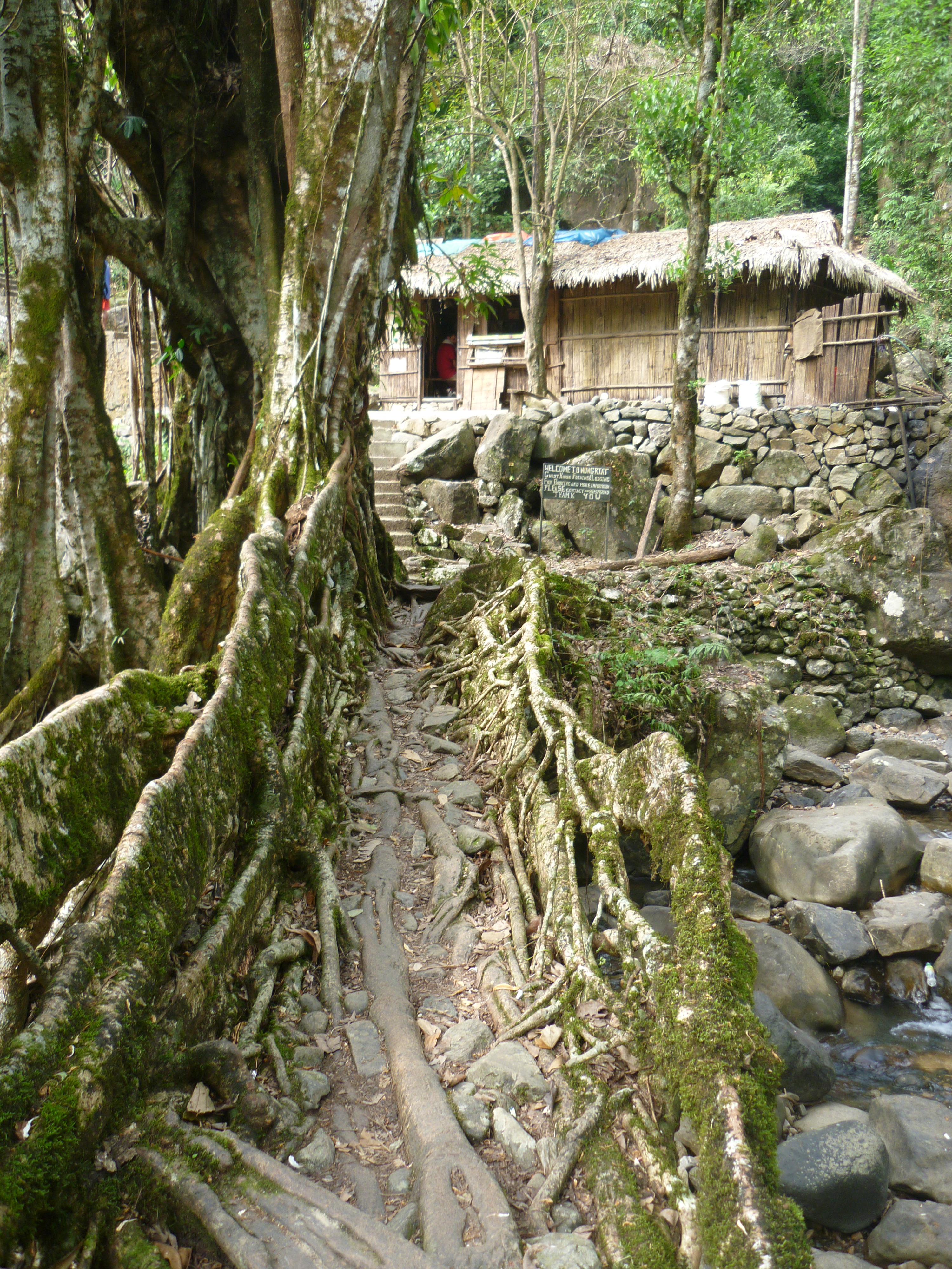
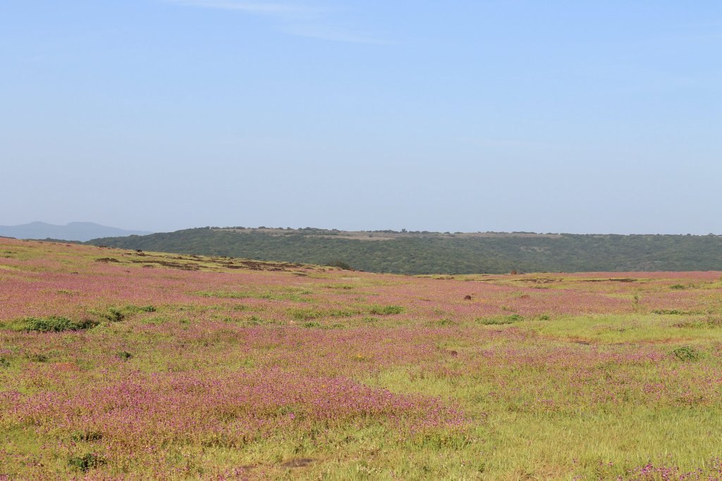
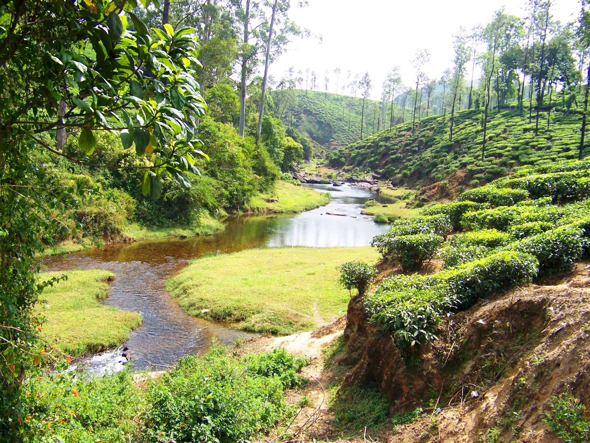
Being one of the first hotspots of the elusive black panthers and a place known as the ‘Rishikesh of the South’ for its river rafting in the waters of River Kali weren’t reasons enough for me to grab-in when opportunity struck! A Solo trip that was long due, finally happened one weekend. I packed my backpack and hit the road in an overnight bus to reach Dandeli. This trip was part of an invitation to review a resort and a homestay at Dandeli, arranged by www.dandeli.com However, the reviews of the places are in separate posts and this one is something else, worth your reading time. Or so, I believe.

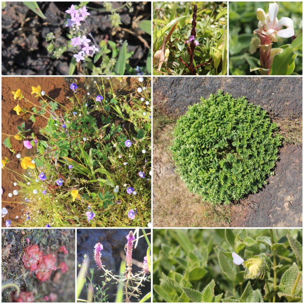
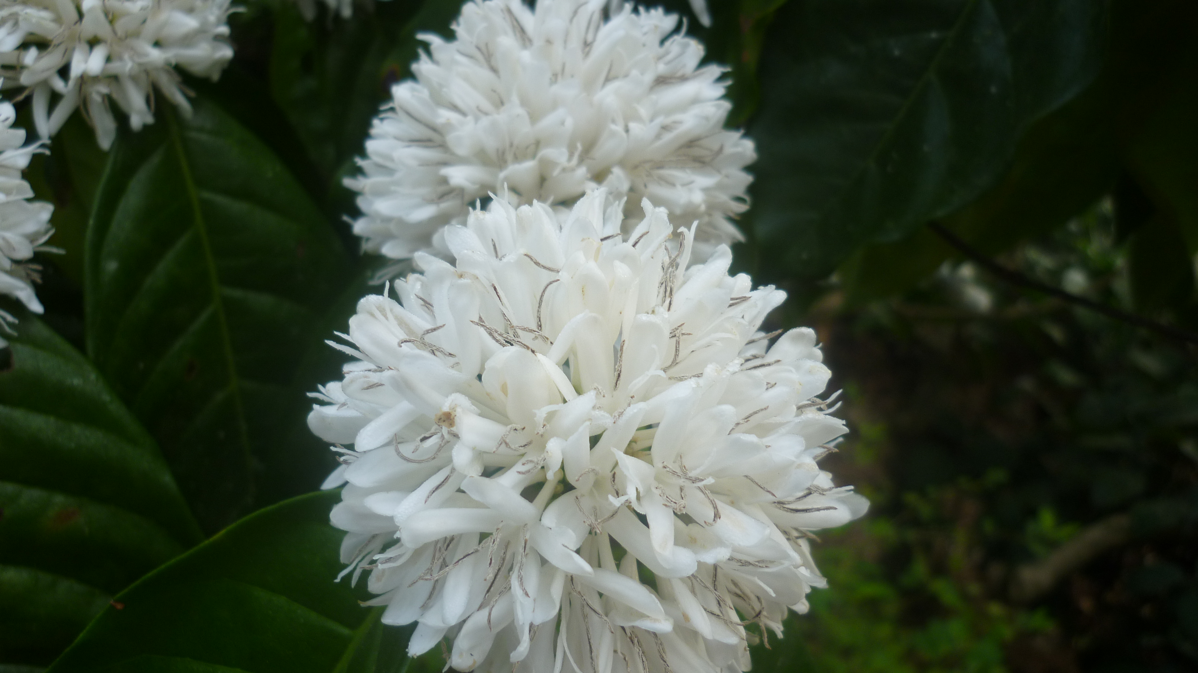
Apart from the cool and wonderful green cover that Dandeli has, I had a surprise awaiting me on the second day of my trip. It added yet another perspective to my travels- “Bird-watching”. If you have been following my blogs for a while, then you must already be aware that I have always been interested in wildlife and its conservation. But I neither did I have an opportunity to meet someone closely involved in such form of travel nor did I have any close acquaintances who was good at bird or animal tracking. Here, at Dandeli I met a person who has dedicated time and money in tracking and documenting the birds of the region. The entire experience of birdwatching with this person is something that I will cherish for long time.

As a part of the trip package by the homestay, I was asked to be ready by 6.00.a.m. and was taken to the Dandeli timber depot. I was introduced to Ms. Rajani, a government schoolteacher by profession and an avid nature keeper by passion. She was assigned to take me on a bird watching tour around the depot where over 150 bird species could be spotted on any given day- A true haven for the bird watchers!

Dandeli timber depot

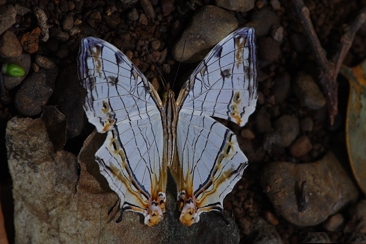
Among several species that she went on showing me around and shedding light on facts about them, the one that opened my eyes to an all new perspective of seeing avian life were the ‘Hornbills’. The hornbill is one species that is referred to Lord Ram and Sita for the couple bonding that they share. These birds have a very unique way of finding their mates and if ever happened that one bird dies anytime, the other remains single all life without finding another mate which is unique to hornbills. The reproduction cycle of these birds is once in 5 years and hence, the male bird is extremely protective about the female and the chick. The male bestows his beloved with berries of her choice from faraway places during this period. While it carries around 40-50 berries in its beak to feed its family, a few fruits may fall down during its flight, thus contributing to afforestation- The hornbills are the farmers of the forests in true sense and live a life of awe and inspiration to mankind. Another interesting fact is among the 54 species of hornbill across the world, 9 are found in India. Out of these, the world’s largest species- The great Indian hornbill and world’s smallest- the Malabar Grey hornbill with Malabar pied and Indian Grey, 4 species can be found in Dandeli alone. And I was fortunate to see all 4 of these during my 3 days of stay at Dandeli, an experience that cannot be explained but only be felt.

Another unique sighting was of the jungle babbler or the ‘seven sister birds’. With enormous untold stories, the tour ended rather quickly as we both lost track of time.

My enthusiastic guide visits this place every morning and evening which she describes as her day being incomplete without talking to the woods and strengthening her nature connect. She ensures she talks about them to her pupils at school as well. That’s a novel way to inculcate the habit and awareness about nature conservation among children from a very young age itself. I gave her a tight hug for the wonderful ways of teaching her students in school about conservation of natural resources and I bid farewell.

Bonus tip for birdwatching at Dandeli: Watch the hornbills mud-bathing on the riverbank near Ganeshgudi (sometime around winter)

Visit my detailed posts below, for itineraries if you are planning your trip to Dandeli.
Option 1: With sightseeing and stay at ‘Old Magazine House’, a Jungle Lodges venture
Option 2: With sightseeing and stay at ‘Dandeli jungle camp’, an offbeat homestay.

Climbing the highest waterfall in Andhra Pradesh- Talakona

It is needless to elaborate on the names Tirumala and Tirupathi! Famous as the richest temple in the world, the seat of Swamy Venkateshwara- the lord of seven hills. What goes beyond just this RICH temple is its geographical location. For someone who has been there and used the 11km long stairs to get to the top, I’m sure he must have enjoyed the multiple pit stops and deviations off the course to see the ‘Papavinasanam’ and ‘Akasha Ganga’ waterfalls enroute. And then there is the magnificent Silathoranam, the natural arch bridge formed due to volcanic erosions several million years ago… As if these pit stops weren’t enough, one is bound to get enchanted by the stunning view of the entire range of hills surrounding the temple with the Nagari quartzite formations… Ever since I had been there, exploring these hills has always been on my bucket-list… And when I chanced upon an opportunity to do it over a weekend, I jumped in with excitement. Taking cue from a random couch-surfing meet-up, we had decided to hit the roads to explore the hill ranges of Eastern Ghats. So on a Saturday morning, we started from Bangalore before sunrise to see the highest waterfall in the state of Andhra Pradesh, nestled in the Venkateshwara National Park. While I slept for most of the way, I was awakened to a blurred view of a fiery-red sunrise seen through the dew-laden window glass of our car, cruising through misty roads with hazy paddy fields around. We stopped by at one of the several restaurants on the way for a nice south-Indian breakfast and coffee.

With good asphalted road all the way, we arrived at the forest check-post at Talakona. While our friend was getting the required permits / entry tickets into the national park, we got chatting with a fruit vendor who let us try the variety of fruits in his cane basket which all tasted as sweet as nectar. He then told us that he could be our guide (at a small cost) and show us some offbeat corners of the forest. We agreed upon the idea and promised to buy more fruits from him on our return to make up for his business. We then reached the eco-lodge, managed by the forest department and ordered for food which would be kept ready by the time we returned from our trek from the woods. We then drove up, till the Siddeshwara Swamy temple and parked our vehicle near the foothills of the waterfalls. Our guide took us off the course from there on through stone-laid stairs that seemed like we were walking into oblivion in the jungle that is notoriously famous for red-sandalwood smugglers and the elusive beasts- the Royal Bengal tigers. Our first stop was at this view point from where most of the green and brown stretch of alternating forest and quartzite was seen. After a short climb thereon, our guide made us cross a stream of water and took us to the edge of the rocky path. The stream now seemed like it was jumping down in a mad rush from the cliff we were standing upon, and we could hear the screaming of several tourists down beneath. That’s when our guide burst the bubble for us- We were standing right on top of the highest waterfall of the state. It was a nerve wracking experience to stand atop there and watch the water gush down under our feet and have a post-monsoon gorgeous view of the green ranges.

IMG_20171216_141757_HDR
The view of the ranges atop the waterfall

We were then guided through a canopy of lush green trees and hanging branches along the flowing water, at the end of where our feet stopped! Stopped in amusement… Amusement at what our eyes were seeing… A thick moss laden semi-circular rocky wall due to the flowing water over ages across whom several creepers hung and the water dropped down with all grace. This entire set-up of nature reflected in the mirror-like crystal clear water of the pond formed beneath where the golden fishes were enjoying their undisturbed swim. The rocks inside the pool made it appear rather shallow and was enticing us for a quick swim! With absolutely nobody else in the place- No exaggeration, it felt like we had found our long lost connection with nature right there! All unprepared for a swim, we put our legs into the freezing cold water to get a nice fish pedicure that de-stressed the city souls in us!

IMG_20171216_150524_HDR
The pool atop the Talakona waterfall

After getting our natural fish pedicure done, we headed back towards the base of the Talakona waterfall. But, it was a different route this time… It was a beautiful path with a canopy of trees, a deep gorge to our left and the massive rocky caves to our right accompanied by an eerie silence of the jungle… At the end was another waterfall. It was one of the levels of this multi-tiered waterfall which we had to cross through. For a look from the distance, we could not gauge the level of difficulty until we actually got on the rocky path to cross it. While each one of us mocked and took fun in laughing at why the other person couldn’t cross it with ease, we dreaded our own feat of the waterfall-crossing when we slipped, slid and even glided across the super slippery rock over which the algae had settled making it an armed to the teeth adventure. We had a friend who slid and landed right at the edge of the cliff, just an inch further would have taken him rolling down the multiple tiers of the highest waterfall of the state 😛 All said and done, with we being drenched to our bones, our jaws chattering with cold and an unexplainable feeling of accomplishment, we had reached the last part of our hike.

IMG_20171216_154525
The path across the caves

We then walked down to get a good look of the mighty Talakona waterfall from its base right-up, to understand where we had just arrived from… We then drove to the eco-lodge to dry ourselves, get some food and to call it a wrap for an eventful day that we concluded at twilight!

Tracking the Big Five at Kaziranga

The monsoon has caused the mighty Brahmaputra to take a toll on the North-eastern part of India causing innumerable and irreplaceable losses. I saw this one particular photo of a floating carcass of the striped beast, the National animal of India in the newspaper this morning and I was taken back in time when I visited Kaziranga last year, post monsoon.

This post is part of my fortnight long road trip across North-east India, specifically covering parts of Meghalaya – Assam – Arunachal Pradesh I had tagged along with two other travelers and drove around the places in a self-drive car hired at Guwahati. Our visit to Kaziranga had just one agenda, a safari in the Kaziranga National park and get a glimpse of at least one rhinocerous! Kazhiranga National Park is counted in the list of UNESCO’s world Heritage sites.

My Itinerary:

Day 1: Evening drive from Guwahati to Kaziranga (Kohora forest range)
Day 2: Early morning elephant safari & jeep safari in Kaziranga national park, Orchid research centre. Continue the journey onward to Jorhat.

The Details:

After a wonderful drive through the National highway from Guwahati, we reached Kaziranga on a night lit with Diwali lamps all around. Kaziranga national park is divided into four main areas: The Central range at Kohora, Western range at Bagori, Eastern range at Agaratoli and the Burapahar range at Ghorakhati. Here, the tourists can enjoy the elephant and jeep rides into the forest that are organized by either government or private parties. The park is closed during monsoon and we were lucky that the central zone at Kohora had opened just around our visit time. We had a nice meal and settled down at one of the numerous resorts that exist on the boundary of the National park in the Kohora range. Meanwhile, our resort guys helped us to get tickets for a safari ride scheduled for early next morning.

We woke up the next morning and headed towards the forest gates where the elephant ride was supposed to commence. The drive from the resort until the forest gate was so refreshing in itself. With the addictive smell of wet ground, kaccha roads passing through green paddy fields dotted with bamboo huts here and there, thick mist slowly clearing up with dew drops reflecting the rising sun: It was just wonderful all the way.

P1140268
Enroute to the forest gates

Kaziranga is synonymous with the one-horned rhinoceros. With about 2/3rd of the world’s population of these beauties found in just this area, it was no surprise that we began to spot them one after the other. Even before we started our ride, we spotted rhino families all around the watch tower we were standing at. We even found a few of them grazing in the fields on the sides of the highway. With that we realized, that Kaziranga was beyond rhinos. There are some other wild animals that are exclusive to the park and are collectively called as the ‘Big Five’, a must on the list of every wildlife enthusiast visiting the state of Assam.

Our elephant had arrived in a bit. We sat atop and started our ride into the haze of the misty green grasslands of Kazhiranga to track the ‘Big Five’ of the this land. The elephants that we were seated on, were walking through dense thickets of elephant grass: the grass that was taller even for elephants to walk through. Slowly, the mahout started to point out and show us the animal at far distance.

P1140264
The elephants marching into the forest

First, it was a wild elephant with its calf. We were told that rhino and elephant conflicts were common and that mother elephant was wounded just that morning in a bid to protect its new born calf. So, that meant we were not safe sitting on one either! We slowly moved out of tall grass to another area where a couple of rhinos were finishing their morning chores. It was very surprising for us to know that large rhino groups identify space where each rhino marks its own spot (making a private toilet space for itself) and does not let any other rhino enter the area.

Wow! We slowly passed that place and spotted herds of swamp deer. World’s largest population of these herbivores too is concentrated in these forests. Swamp deer are handsome animals.

Just as we were photographing them, we saw a herd of Asiatic wild water buffaloes marching out of a slush pool. Until our guide told us, we had no idea that over 57% of the world’s water buffaloes too were accommodated in the woods here!

Kazhiranga
Clockwise: The Single horned Rhino, Swamp deer, Wild water buffaloes and the Asiatic elephants

Another surprise information awaited us: Kazhiranga national park has the highest density of the Royal Bengal tigers in the world!!! Whoa!!!! That’s like……..something that was unknown to me, a person who hails from the land of Nagarhole, Bandipur & Bannerghatta. But as always, no luck with spotting the elusive beast. Seeing a tiger in the wild is a LONG dream, awaiting to be realised. (So much adventure to see a wild tiger, Click here to read more!)

So, we had checked off 4 out of the big 5 of the Kazhiranga before heading towards the exit gates- The One horned rhinos, Asiatic elephants, swamp deer and wild water buffaloes. Meanwhile, we realized that we still had time to make it for the morning batch of jeep ride. So, after enquiry and booking at the counter, we had a gypsy to take us into the forest again. Needless to mention, we were greeted by herds and herds of rhinos all along our path. Wild boars, barking deer etc. too were spotted in abundance. The highlight was however, the innumerable species of migratory birds that were spotted. Our driver cum guide mentioned several bird names, out of which only pelicans and spoon-billed storks were the ones that I have managed to remember.

On the other end of our drive into the forest, we were taken to a watch tower from where we could catch a very good view of hundreds of animals that had come to drink water from the flowing river. It was a very calm and a serene place to spend a while with nature. What caught our curiosity was some random years mentioned on the wall of the watch tower. So, here is a picture that may give an idea of the monsoon fury and severity of floods that affect this area year after year.

The tower itself is located at an elevation from the river. My friend in the below picture is a 6-footer. The water level of 2016 is marked above him… Can you imagine how impossible it is for the animals to escape out of the area??? It’s insane to think of and the image of the floating tiger’s carcass hovers around in my thoughts.

P1140350
Record of the flood water level of the Bramhaputra

The drive back to the resort, on the highway was an extremely nice one which had gone unnoticed during the hurried drive through misty roads in the morning. Tea plantations flanked the roads on both sides. The famous Assam tea grows in flat lands and under shade, totally contrary to what I had seen and grown up seeing in the hills in down South. We stopped by to sip on some hot brew and bought some processed tea leaves for our caffeine addicts back home. A quick visit to the Orchid research centre was an interesting place to drop by too.

P1140352
The Assam tea estate

Overall, our day was eventful at Kazhiranga with warm memories from the woods before heading to our next destination- Jorhat. Although a little disappointed for not being able to spot a tiger by the end of our safari ride, we were feeling content for having our long pending wish of visiting this heritage site come true!

Concluding remarks: For those of you planning to visit Kaziranga, I strongly recommend to try both ways of exploring the woods, on elephant back and by a four-wheel drive. Both are different experiences and the type of terrain and sightings are different. While an elephant will be able to take you through the tall grass, a 4-wheel automobile will be able to enter deeper areas of the forest. If you wish to spend more time with nature, I recommend you all to explore all the 4 ranges of the national park. Don’t go by recommendations of people of which range to go in… Each area is distinct with different types of vegetation, landscape, flora and fauna concentrations.

Hiking up Assam’s highest point- Hapeo peak

This post is part of my fortnight long road trip across North-east India, specifically covering parts of Meghalaya – Assam – Arunachal Pradesh I had tagged along with two other travelers and drove around the places in a self-drive car hired at Guwahati. We had arrived at Haflong, the only hill station in the state of Assam following a mis-adventurous trip. (Click here to know the details)

This trek to the highest point in Assam happened by chance, as a backup after the original plan for the day had failed. We were told that the hill isn’t yet popular in a typical tourist’s circuit. Apart from the local tribal folk who like to party atop the hill, hardly 4 to 5 trekkers come here from outside the district and the state to climb this hill each year. Having said that, we wanted to reach Hapeo peak, the highest point in the state of Assam for sunrise. However, due to the clouds that had hovered that morning, we decided to snooze for a little longer before going ahead with the plan.

There are totally 13 native tribes in Dima Hasao district of Assam state and each tribe has its own village. A local NGO called spectrum is working towards the empowerment of the local tribal communities through promotion of tourism in the district. They helped us in getting this event organized. We were driven in their 4WD vehicle from Haflong to a village called N.Liekung. N.Liekung village belonged to the Kuki tribes and the required permits from the village head was arranged by Spectrum. A local guide was assigned to take us through this off-beat wilderness to scale the highest point in Assam. I would like to present my trek in essentially three parts.

Part 1: The Ascent

After a small stop in front of the holy Cross at the prayer area of the Kukis, we began our ascent towards the peak. For the three of us, all seasoned trekkers doing this trip together, the climb to Hapeo peak wasn’t a very difficult one as compared to what we had done back in the Southern India. But what made it seem difficult was the high grass that had grown tall enough to cover the entire stretch. Since the trek is not frequented with people, the grass on the path is not worn out as much as in the popular trekking trails. Hence, the way up was something through which we had to FIND the trekking trail. Based on the ease of finding the trail, I would split the trail into three portions:

  • A well traceable path with steps laid. However, at some places, the stairs have been lost amid the thickets. We had to cut the grass and bushes in order to find our way. The stretch was full of high grass with occasionally placed animal traps which our guide who walked ahead, would carefully move aside and make way for us.
  • This was the only flat area with some grassland vegetation for a stretch of around 500mts.This was the only place apart from the highway, from where we could actually see the peak that we were apparently scaling up!
  • The last part passes through thick jungle, with a canopy of trees that allowed very less sunlight to penetrate. Varieties of innocent looking wild mushrooms had bloomed at several patches, but we were warned not to pick any of them as they could actually be lethal with allergens or venom. We were accompanied by strange sounds and cries of migratory birds around.
p1140545
The only grassland in Hapeo trek

As we climbed up while chatting up with our Kuki guide, he enlightened us with their tribal customs, culture and showed us a few videos on his phone of their traditional dances, festivals ceremonies and the like. Our guide jokingly told us how his fellow folks are named in the tribe. The names may not mean anything and just anything random that sounds nice goes as a name. He was thus randomly called after a ‘Song that was Sung’ (I’m sorry, I don’t want to give out his name). But the tradition is, that the maternal grandfather selects a name for the granddaughter and the paternal grandmother picks a name for the grandson and vice-versa. It is a patrilineal system of inheritance.

Part 2: Reaching the Top

Suddenly, the darkness of the jungle had turned into snow white of the clouds. Before we could realise, we had reached the top already and we had barely taken us two hours. We were told that one could see the entire district of Dima Hasao from up there. But, we were greeted with thick fog and clouds upon arrival. We spent some time soaking in nature’s beauty and waited for the clouds to clear so that we could catch a glimpse of the beautiful view.

For the benefit of potential trekkers, there is just one small shelter with a bench atop the hill and nothing apart from yourself there! Our guide mentioned to us about a patch of land measuring about 2×2 feet, right behind the bench where a natural and strong magnetic force is believed to exist, due to which none of the mobile phones work in that spot. Yes, we tested the phenomenon too. Although all our phones had FULL network, we were unable to place any calls. But none of us had any scientific reasoning for what he told.

p1140551
A view of Dima Hasao district from Hapeo peak

In the next fifteen minutes, the clouds had slowly started to clear. We spotted the railway bridge at Lumding onto the right side of the horizon. This rail line is the longest and highest in the Silchar route. Our guide pointed towards another hill onto our left, through which the longest railway tunnel (around 3.5kms long) in the North-east passes. The Silchar-Lumding railway route has been featured in several tourism websites and has been one of the scenic stretches in the country. As the weather slowly worsened and began to drizzle, we decided to start our descent.

Part 3: The Descent

When we had just started to climb down and we received a call from the NGO. We were told to return to the base of the hill ASAP as an alert for a cyclone had been issued by the meterological department and heavy rains were expected in this region in the next few hours. But, it had started to pour cats and dogs within no time. The fastest pace we could catch was by rolling down the hill. With all the rain, thick grass covered path and steep gradient, just a steady walk itself was a struggle as we descended on the slippery trail. There was nothing enroute to take shelter from the rain. But, waiting at any place made no sense because the pounding rains would continue for the entire day or even two. It made more sense to simply continue to walk down as we were already drenched till our bones.

We were back at the base by 11.00.a.m. and thus ended our trek to the highest point in the state of Assam. We were invited over to our guide’s house to dry ourselves up and have a cup of hot tea. We thanked him much and bid adieu with a warm heart to this lesser known corner of the world!

Treading the living root bridges- Nongriat

As kids, we always imagined fairies with wings flying amidst colourful gardens, rope like creepers hanging across the forest thickets, rainbows emerging on the tranquil sky. Do you agree when I say this is how most of the animated movies depict fairy tales ? Nestled deep in the rich forests of Meghalaya; with NO exaggeration, that’s how I would describe this village called Nongriat!

This post is part of my fortnight long road trip across North-east India, specifically covering parts of Meghalaya – Assam – Arunachal Pradesh I had tagged along with two other travelers and drove around the state of Meghalaya visiting Shillong – Smit – Cherrapunjee – Mawlynnong – Dawki – Ribhoi- Shillong.

A pleasant drive through the breathtakingly beautiful valleys and naturally formed creepy high limestone walls brought us to a village called Tyrna in Cherrapunjee. That’s where the tarmac ends and our car had to be parked. Further, we trekked down to the Nongriat village: where the ‘Umshiang bridge’ or popularly called ‘the double decker root bridge’ exists. One needs to climb over 2500 steps each way, so that this piece of marvel can be seen at close quarters. Root bridges are created by inter-weaving the roots of the rubber tree by the tribal folks who live in the deep forests of Meghalaya for their local commute across the bloated rivers during monsoon. A bridge fit for usage can take a minimum of a couple of decades and it only gets stronger with age. There are several such living root bridges across Meghalaya and most of them continue to be untouched by the tourists due to their remoteness. We were here, to tread on some of the most popular living root-bridges of Meghalaya.

p1130958
The route to Tyrna village

Although, there is a well laid out path of stairs all the way, we thought it was wiser to have a localite who would enrich us with the facts and figures that we wouldn’t get to learn otherwise. At Tyrna, we met a Khasi villager from Nongriat who agreed upon to guide us through our trek. We passed through several sacred groves and areca farms belonging to the villagers. After decending about 1000 steps, a small deviation to the right indicated the way to Nongthymmai village. We took this deviation to reach the ‘Ritymmen root bridge’ a single bridge and another old one next to it which has taken its toll due to the negligence by the localites. Our hearts were jumping with joy at the first experience of treading on a living root bridge, that we had only read about until then… I decided to throw my shoes away for a while and enjoy the feeling of walking barefoot on the bridge.

p1130974
The Rythimmen bridge at Nongthymmai village

After spending some time, we decided to continue the trek and our new friend cum guide, continued to enlighten us about the rich traditions and culture of the Khasis. We stopped by for a quick breakfast at a straw hut selling 2-minute noodles and lemon tea. Further, a short climb of stairs continued only to be awestruck by the marvel of indigenous engineering: The double decker root bridge, the main motivation for us to trek this far. It was like fantasy out of a fairytale: creepers hanging across a little waterfall, fed by a pristine river in the middle of nowhere! It was tempting to get our feet wet as we watched a few tourists who had stayed in the Khasi homes around the root-bridge over the previous night and enjoying their swim in the cold waters. However, spending some time admiring this piece of absolute marvel, we decided to move ahead, towards our next mission: Rainbow falls!

p1140003
Entry bridge to Nongriat village

Nature’s best kept secrets are those which are untouched due to their remoteness. Rainbow waterfalls being one of those. The small number of tourists who make it till the double decker bridge seemed to have had disappeared there onwards. The tiring path ahead was going to be tiring, we were told. But, nothing comes easy.

I was doing this trip post monsoon (October to be precise) and that’s when the caterpillar larvae take wings! Like winged fairies, we were greeted and accompanied by butterflies of all colours, shapes and sizes all along the stretch from Umshiang bridge (the local name for the double-decker bridge) till the rainbow falls. We had to be extremely cautious while walking, clear the way for ourselves with a stick, lest accidentally step on these little winged beauties. The path was so full of butterflies, that it cannot be expressed with words and the joy can only be experienced. Truly, in every sense: I was Alice, walking in wonderland!

p1140026
Another root bridge enroute to Rainbow falls

It was a walk of nearly 2hours through the thickets of the sacred forests and crossing at least 5 other root bridges and a couple of metal rope bridges that were laid across the deep river that flowed down with its seductive clear blue waters. After the brisk climb, we had finally arrived at the place where a hidden jewel of nature unfolded itself, from amid the greens…

We stood there in AWE….. the green trees and bushes had opened up to display a canvas with milky white waters gracefully tumbling down into a pool of turquoise blue and a hundred fairies flying around us. A dozen spectrums added to this heavenly scenery! On a clear sunny day, there could be 50-100 spectrums around the waterfall, giving the place its name: Rainbow falls! We enjoyed a couple of hours in calm just by sitting beside the naturally formed swimming pool as we were the only people in this fairyland and restoring our lost bond with nature that was shared long ago.

p1140039
The Rainbow falls

As described by our guide, camping at the Mawsmai caves (2hours trek further) and climbing up the hill to be greeted by the Nohkalikai waterfalls, the highest waterfall in India would have been a complete story! Unfortunately, we hadn’t known much about the enchanting beauty of this trek before embarking on it and had no preparations now, to have it extended further. So now, it was well past afternoon and distance that required to be walked back was long. The sun sets early in this part of India and that meant that we had very less time of daylight left. During our return, we stopped by at another hut near the Umshiang bridge for a late lunch where we relished a simple Khasi meal of rice and bitter lime curry.

p1130990
A metal rope bridge near Rainbow falls

The walk back from there onwards was taxing and it is a very steep climb up the 2500 odd stairs.. I stopped several times at the little homes and stalls put up by the villagers on the way to keep myself hydrated with the local energy drinks and fruit juices. I cannot forget the way our guide cum friend Denzil kept motivating me to complete the stretch. He kept reducing the count of steps by hundreds so that I would climb faster with the intention of reaching the top ASAP. Finally, I was back at Tyrna, even while there was sufficient sunlight for us to drive back to Cherrapunjee.

A small deviation from Tyrna will lead one to ‘Ummunoi root bridge’ in the Laitkynsew village, one of the oldest bridges in the viscinity. It has been truly a very refreshing way to explore ‘the abode of the clouds- Meghalaya’.

Conclusion remarks:

  • For all trekking enthusiasts, a two day trek covering Laitkynsew, Nongriat, Mawsmai and Nohkalikai is highly recommended.
  • Although, we missed to trek up to the Nohkalikai falls, we made sure that we camped overnight at a spot facing this waterfall and caught the view of the sun rising over the Nohkalikai waterfalls!

Tracing the abode of celestial congregation- Kollur

While I was flipping through old photos of my college days, I was taken back in time to this so-called ‘Industrial trip’. This class trip consisted of trekking, pilgrimage, beaching and lastly, not to forget our industrial visit (only If time permitted, that was!). Basically, it was less of industries and more of place hopping. So here goes the first part of the so called ‘Not-so-Industrial-Trip’.

Although I had walked for miles to reach places during my school days, this was my first ‘Official’ trek! A trek in the ‘Kodachadri hills’ in Malnad region of the western ghats.. After a really long bus journey, we alighted at the Nittoor forest checkpost late in the evening. We got the permits at the forest checkpost for the night’s camping ahead, at the old forest guesthouse. We parked our bus there and got into the 4WD jeeps that were waiting for us since early evening. There is NO road from Nittor to the guest house and is only a muddy pathway. And in monsoon, it makes way for a deep trench kinda massive slush pool. This stretch can be covered by various modes based on each person’s interest. You can walk up or drive or ride.. The more adventurous people choose the latter; cycling comes with the greatest challenge. We chose the safest- The 4WD. But, driving through such terrain calls for great skill of steering control, lest have at least 7-8 people thrown off the road. That said, it was a crazy drive up the hill, until we reached the guesthouse in the darkness of 10~11.00.p.m.

After reaching the guesthouse, we could barely stand because of the strong winds. So, you can only imagine our next task of pitching tents.. We called off the idea of camping under the moonlight as we struggled to even hold the tents firmly in our hands. The winds were so strong. That’s when we had to camp indoors, at the guesthouse 😛 We had only a roof above us and no mats or sleeping bags. So we decided to pitch the tents inside the guesthouse hall for the rest of the night.

We woke up early next morning and started our hike up the Kodachadri hill. Our hike mainly consisted of two target activities- one was to reach the Shankaracharya mantapa at the peak, for sunrise and the second was to take a shower in the Hidlumane waterfall. We did not hire a guide as the organisers claimed their familiarity with the route. The sight all the way till the mantapa was beautiful and the sunrise and the Arabian Sea at the distant horizon just added up to the view! The climb was great, giving us an eyeful of the valley that was in all bloom with colourful wild flowers. After a brief walk, we reached the Mantapa. After spending some time at the peak, we readied ourselves for the descent.

bye-bye-6
The Kodachadri hills- Overlooking the Arabian sea

The descend was towards the waterfall. With the descending gradient, we slipped, jumped down, clung onto wild creepers in the event of finding our way to the waterfall amidst the thicket of the forest. Somewhere, we had already started to realize that we were lost in the forest. The thumb rule of finding the way out of a forest is to follow a flowing water body. The organisers followed the sound of flowing water and we followed the organisers. We stopped by at a small cave like structure enroute, where someone had installed an idol of Lord Ganesha and offered some flowers. We prayed for our safe exit out of the forest and continued with our pursuit of the waterfall. So we finally reached at the source of the flowing water!

Sure it was a waterfall.. But ain’t the mighty one that we had thought it would be. It was a stream that was directed to a storage tank by the localites and the tank was overflowing forming a waterfall!! Neither the organisers nor the others knew how to react at our misadventurous pursuit. But we were all happy that we had found some pure water where we could fill our water bottles and ease ourselves out of the tiring hike that we had been through so far! We were now sure that the tank was there for a purpose and the pipe attached would lead us back to base point. And the descent continued, along the same stream to the base.

There is a small temple dedicated to Mookambika Devi at the base. It is believed to be the original temple that is tagged to the legend of Shankaracharya’s installation of the idol at Kollur. We reached the priest’s house near the temple where we had a simple-wholesome breakfast. After packing our stuffs from the guesthouse, it was time for us to head out to our next destination: Kollur.

morning-trek-34

A view of the Arabian sea from the Kodachadri peak

People who prefer to trek further, can cover the Agnitheertham waterfalls enroute to Kollur Mookambika temple. But, having had enough in the quest of a waterfall, we decided to take the bus route. The bumpy drive continued until we reached Kollur, the small temple town known for the Mookambika temple, one of the Shakti peethas. This temple is said to have been developed by the Keladi rulers later in time so that pilgrims don’t have to trek up the overlooking Kodachadri hills to worship the goddess. Another legend has it that Lord Shiva appeared before Sage Kola and agreed to be present there in the form of Linga with his consort Devi. Along with Shiva and Parvathi, all other gods and goddesses are believed to be residing in a non-form in the Linga. Hence, Kollur is referred as ‘an abode of the entire celestial congregation’. We took a little time to offer our prayers and admire this beautiful little temple built in the typical Kerala style of architecture. Post that, we proceeded to the forest guest house where we had our stay booked for the night.

7th-morning-6
The forest guesthouse

The forest guest house is located in a serene location in the middle of the ‘Mookambika wildlife sanctuary’ and on the banks of river Sowparnika. With banks I mean, just a couple of steps lie in between the guesthouse and the river. This river is frequented by spotted deers & leopards to drink water. And we were told that just the previous morning, a tiger was spotted on the same steps that we were standing on, at that time! The river flowed gracefully with the crystal clear water and the school of fishes enjoying their swim in between the tree roots that grew beneath. It was a SPECIAL place to go back again indeed! We cherished every moment of our stay there while being in harmony with nature in its purest form.

mookambika-temple-8
The Idol of Mookambika being taken out as a part of the daily ritual

Soon, the dawn broke the next morning awakening us to another day reminding us of our journey to the next destination- Bhadravathi. It was the last day of our tour and that meant we had to do the most important part of this trip ‘Our Industrial visit’! That’s for another story altogether…

The silent whine of a valley at Khas Pattar

“Thank you very much for online registration to Visit Kas Plateau.” Read the auto-response mail from the Satara divison forest office. Our slot for the much anticipated trip to the South India’s very own valley of flowers was confirmed.

We reached Khas plateau by hiring a cab from Satara town as early as sunrise. One reason was to get good shots of the valley with different hues of sunrise; second was to enjoy the oneness with nature, undisturbed by the senseless, rather ruthless people who would pour in later during the day in the name of tourism. Recognised among the world’s 39 natural heritage sites by the UNESCO in 2012, Khas has over 350 flower species including orchids, insectivorous plants and other herbaceous plants. There are plants whose flowers change their sex each year too..!! Atleast 20 species of plants are endemic to the Khas valley alone. Someone rightly called it the “Nature’s very own laboratory”. Since Khas is a part of the Koyna Sanctuary, the place is often frequented by animals like the barking deers, bears etc. in search of water. It is nature’s treasure in every sense.

The flowers of Khas plateau- Part 1

Life is not a bed of roses, but at Khas- it is a bed of balsams.. Oops.. Bad one, I know..!! But that’s what came into my mind when I was finally there..!! The complete valley looked as if painted in pink with an endless stretch of balsam flowers, dotted here and there with small ponds like a bindi on a beautiful lass’s forehead that would complete her looks. These ponds dual as watering holes to the wild animals that visit here occasionally. A narrow stream flows silently on the other side over black basalt rocks until it plummets down into the Khas lake. Beauty of the Western ghats is beyond expression when one stands here at the edge of the Sahyadri ranges overlooking the Sajjangad fort and the Kanher dam.

The Pink balsam carpet at Khas valley

It is a pitiful plight of the place when several plants are smashed under the reckless visitors who pour in there in thousands during the peak months of blossom. A well laid asphalt road cuts right through this protected land until the Khas lake. No entry tolls, no parking fees, no written commitments to gain entry- but just a nominal registration fee of 10Rs. per head is all it takes to get to this colourful patch of nature. It is just a place to hangout for the majority without actually knowing the ecological importance of the place. NO… It doesn’t have any restaurants, playgrounds, toy-trains for you to lunch over with your family and kids. And definitely, NOT a photo studio for you have NO rights to sleep over the flower bed to get those sexy hot babe-kinda photoshoots done. Be educated before heading there that this place is ONLY for the people who respect nature’s gifts. Infact, none-of us even have the rights to walk through the laid walkpaths for there is always a possibility that one can step on an endangered plant and therefore kill it. So think about visiting there ONLY if you’re genuinely into research or in quest of knowledge- NOT for anything else.

The flowers of Khas plateau- Part 2

Be reminded, the acknowledgement mail from the forest dept. also read the following:

Please note that, Kas a plateau of flowers is a divine gift. Please observe carefully, enjoy the beauty of these tiny tots and convey others also but not to hurt.”

Here’s a request to the authorities: Taking a cue from a protected island called ‘Kurusudai’ in Tamil Nadu, It is really the need of the hour to treat Khas at such level. My suggestions are:

  • Do-NOT make the valley accessible to public and make the entry STRICTLY based on requirement from education/research institutions.
  • Please increase the entry fees. A HEFTY fee (possibly in thousands) will make it possible to filter out only genuinely interested people visiting there for whom money does not matter against knowledge.

My visit to the Panchgani tableland also reflected a similar letdown. The vegetation at the tableland is very fragile & similar to that of the Khas. However, onslaught of exploitative tourism has left it in a state of pity. If the flow of tourists continues the same way at Khas, it won’t take more than just a couple of years to lose this treasure FOREVER.

Mission accomplished- Kumara Parvatha

This trek was planned to celebrate the 1st anniversary of Sam’s farewell trek (Click here for details).. on the same day, exactly a year ago..

Let me get you going directly from where this trek to Kumara parvatha or KP peak is actually supposed to start. We reached Kukke Sri kshetra and checked into the lodge(a meagre 100Rs. Per day) run by the temple trust, freshened up and feasted on some sumptuous Mangalorean food for breakfast. Without wasting much time, we started the much hyped- one of the toughest treks in South India.. to the Kumara parvatha peak in the Pushpagiri wildlife zone.

The original plan was to start from the base by 7.00.a.m and camp at Bhatru mane. Then, leave Bhatru mane by 3.00.a.m the next morning and reach the peak to witness the sunrise, what is supposedly one of the best.

As planned, we entered the trekking trail.. It starts off with thick forest around and steep climbs uphill.. There was NO water sources along the way (We didn’t know that there was a perennial stream, with a small deviation after 2.5km) and a possibility of occasional encounters with elephants. We took frequent stops before taking a longer halt at Bhima’s rock. This stretch of 3km had oozed the fluid out of us..

 A view from Bhima's rock
A view from Bhima’s rock

Once this 3kms stretch was covered, we got our first view of Kukke town.. The thick canopy of forests made way to the grasslands after walking 1km further from there.. It was well past noon and the sun shined at its hottest.. We were running out of water already.. We started to wonder if Bhatru mane really existed and literally pulled ourselves to reach there. Or rather say, we pushed ourselves to walk the small distance that seemed never ending.. Finally… we were overjoyed at the first glimpse of Bhatru mane…

The first glance of Bhatru mane

We ran down to his nestle amid a small piece of green land.. I find NO words to express the joy of finding water.. That too, clear and cold water from the stream that ran through his farm.. We had a simple, yet the tastiest lunch served by Bhatru and rested under the shades of his arecanut farm..

We then made a small change in the plan and decided to continue the trek until it was dark. We feared the pace at which we were climbing up and did not want to return late on the following day.. We halted at a view point along the way for some photographs, before reaching the forest checkpost. We continued our hike up after registering our names at the forest office.. We stopped again at yet another view point.. The sun was coming down by the time we reached kal-mantapa and hence we decided to pitch our tent near the stream that ran by..

The sunset from our tent

The sunset from our tent

I don’t remember which sane person in the group chose the place.. I agree that we got a place which became every other trekker’s envy.. The place was for sure, a top rated spot for sunset viewing.. But we girls, who stayed inside the tent know what we went through that night.. The tent was pitched on a slope, on the edge of a rocky cliff which seemed like the place where the earth ended.. It was soon dark and we ate the little food that we had carried and hit the bed (Read hit the rocks)..

The boys comforted themselves in their sleeping bags and threw the poor girls inside the tent.. The entire night went by like this: ‘Our respective backpacks were used as pillows inside our tent. We all would slide down with our bags inside the tent.. again we would push back everything and move up.. Slide down.. Slide up.. Phew..!!’ And a while into midnight.. The intensity of the wind also increased.. The cover of the tent started to fly.. We hoped for it to be 3.00.a.m soon so that we all could start our ascend.. But another surprise was awaiting us.. Madhu heard the cracking sound of the tent support and scared all the girls inside to vacate the tent. We carried our luggage from inside and jumped out of the tent, one by one.. The last girl just came out and the tent crashed down to a flat.. The guys woke up and one of them attempted to slowly remove the pegs.. One peg was removed and then… The tent flew.. away from our reach.. off the cliff.. down the valley.. We had borrowed the tent, on hire.

Everyone woke up and sat wondering why this had to happen. It was still dark at 4.00.a.m. and with the wind that continued to blow ruthlessly, our ascend to the peak seemed impossible.. We stayed back until sunrise 😦 We decided to compromise on one of the main agenda of our trek- Watching the sunrise at KP peak.

After there was dawn,one of the boys dared to go down the cliff. He had a thrilling feat with adventure and managed to bring back the tent that had settled on a boulder in the middle of a water body, down below in the valley.. More than getting excited about finding the tent, we were all celebrating his safe return.. It was around 7.00.a.m by the time we started our ascent.

Inspite of missing the sunrise, the views post that period were equally spectacular, all along the way. The climb was pretty smooth. It was around 11.00.a.m. by the time we reached the first peak/ false peak- Shesha parvatha.

Post sunrise

The view from the base of Shesha Parvatha

After just a few photo moments, we decided to continue our journey.. We descended the steep rock and waded through super cool, thick jungles.. And then, climbed up another steep rock. This rockclimbing with bare hands and legs reminded me of our monkey ancestors.!! A small walk further up took us to the actual end of the earth. Right there, we had conquered our destination- Kumara Parvatha..!!

Shiva temple atop Pushpagiri hill

Shiva temple atop Kumara parvatha

Thanking the diety with a small bow in the temple on the peak, we set our return journey.. Getting down the rocky slope of KP seemed tricky with one of my friends ending up with torn trousers when he decided to sit and slide down on his butt 😉

The descend from Shesha Psrvatha was no easy task either. The loose gravel all along the trail made walking difficult without slipping. It was 4.00.p.m by the time we reached Bhatru mane.. We realised that we had covered only half the distance and had very less time left with sunlight.. We had to complete the remaining distance before it got dark because that was the toughest stretch with thick forests and wild animals. We had a quick lunch at Bhatru mane and got some rest in fast forward mode and started our descend by 5.00.p.m..

We knew we had very less time in hand and a LONG way to go.. We all walked as fast as we could. Our legs had given up already.. I was preparing my mind to stay back in the forest and make a feast of myself to some wild animal at night.. I ran down the slope at times.. My knees seemed like they would part away from my thighs.. We saw the sun coming down.. We continued to walk fast.. We saw the sun going down the horizon.. We paced up.. Suddenly we all halted.. There was pin drop silence.. We realised that some wild animal(mostly elephant) was somewhere around.. It took us a few minutes to feel the sound move away from us.. Then, we resumed our walk. We saw the bright day fade into darkness and every shade in this process. The toughest and the last stretch was almost coming to an end.. We had FINALLY reached the KP gate… And the last ray of light too waned into darkness.. Thus came an end to the KP trek- a mission….. accomplished..!!

We all then freshened up at the same lodge and did a quick visit to the Kukke temple before hitting the roads on our return journey.

NOTE: The above story is written based on my trek back in 2013 when there was no restriction on camping in the entire trail. As on 2019, camping is allowed only around the forest checkpost and Bhatru mane. So, it is wiser to plan the distance, hiking time and camping accordingly.

Must do things/ Highlights of Kumara parvatha trek:

  • Bhatru mane is the ONLY place you will find food and it is an experience in itself to get your turn in the queue to have your meal served. The same basic rice and sambar is served for all 3 meals and nobody complains. Not tasty, but finding food after a long day is LUXURY here. Bhatru has a fixed time for serving food and very punctual. The crowd is huge especially on weekends and the wait for your meal can take longer if you dont have your own plate.
  • The sunset from the view point enroute forest checkpost or Kal-Mantapa
  • To watch the Sunrise from Kumara parvatha is like going to a different world. Try to make it there in time.
  • The sky is in its clearest form and star gazing at night is a whole different experience. You see so many stars, bright and clear that it feels as if the sky has moved closer to earth. We got lucky as it was also a night of a meteor shower, so we saw many shooting stars.
  • Drinking water from the stream felt like nectar. So clean and tasty. You can fill your bottles at 4 places along the way. First after 3kms, near the Bhimas rock. Second, at Bhatru mane. Third, at the forest checkpost. Fourth, at a stream just before kal-mantapa.

Of pre-monsoon showers and coffee blossoms

It is that time of the year when the entire hill station awakens with the fragrance of the blossoms.. On the ninth day after the 1st pre-monsoon showers, the coffee plants around the hills of Kodagu will be in bloom..

P1000890

It is an annual spectacle of nature whose occurance is unpredictable and is wholely dependent on the pre-monsoon showers. If the rain fails, it creates some sort of panic among the growers who then resort to artificial sprinkling sytems.. Be it rain showers or irrigation, in either case, what follows is something that one must experience atleast once in a lifetime..

White bunches of coffee blossoms adorn the trees as if some one has strewn cotton all over the hills.. And these flowers last for a maximum of 24 hrs which makes it even more special.. And like the saying goes.. You HAVE to be at the right place at the right TIME to see the right thing happen..

Have you experienced the fragrance of coffee flowers?

Explore the Best of Valparai on a Weekend

My friends and I had heard sufficiently about the rich wildlife of the region surrounding Pollachi, its beautiful sceneries and perfectly trimmed tea estates. Valparai is a lesser known hill station in the Indira Gandhi Wildlife Sanctuary (earlier known as Annamalai Wildlife Sanctuary). Kollywood stars and burnt out urbanites frequent this place to de-stress themselves and savor a slice of nature. Here, as one ambles past mud walled, thatched roof dwellings, granaries of farmers and tea estates fringed plateau, don’t be surprised if you happen to hear someone screaming ‘start camera’, ‘action’. This is a hot spot for movie makers with over 1500 movies and commercials having been shot here. And we too got lucky when we happened to visit the sets and share our homestay with the crew of the movie- ‘Madras cafe’ during this trip of ours.

A weekend itinerary was primarily planned by one of my friends and a few must-see items were pushed into the plan by me. Since this place falls on the border of Kerala and Tamil Nadu, we decided to make it a three states’ drive including Karnataka. Accordingly, five of us started from Bangalore on a Friday night. Since it is also a bio-diversity hotspot, I had listed 5 animals on my ‘to-spot’ list while at Valparai. Valparai is the end destination after driving through 32 hairpin bends. Being a hill station, Valparai weather is specifically delightful with a cool climate throughout the year. It is usually the road leading to Valparai that is enjoyable with scenic vistas and photo-points. I had enlisted them with day 1 in the Tamil Nadu side of the sanctuary and then spending the second day on the Kerala side of the forested land.

Itinerary:

Day 0: Leave from Bangalore by night (Own car)
Day 1: Reach Pollachi before sunrise. Backwaters of the Aliyar dam, monkey falls, Loam’s viewpoint, Carver Marsh viewpoint, Congreve falls, Vinayagar temple, Birla falls, Balaji temple, Iraichalparai falls, Nallamudi Pooncholai viewpoint, ChinnarKallar hanging bridge trek, Sholaiyar backwaters (night stay at a homestay in Chalakudy)
Day 2: Athirapally falls, Vazachal falls and return to Bengaluru via Ooty.

The details:

Part 1: Tamil Nadu

During the night journey, I had dozed away on the rear seat of the car. When I opened my eyes to the misty morning dawn, our car was greeted by beautiful countryside with tree-lined roads, emerald fields of paddy, whispering palms and coconut plantations in the backdrop of the towering Western Ghats. We had reached Pollachi in Tamil Nadu. We waited near Aliyar park until 06.00.a.m. for the forest check post to open.

a. We registered our entry into the wildlife sanctuary there and proceeded on our journey. Our drive further towards Valparai, was an ascent along the winding road by the backwaters of the Aliyar irrigation dam.

View of the Aliyar backwaters

b. Four kilometers further from the forest check post, we reached the monkey falls. The waterfall is aptly named due to the many troublesome monkeys here. One even entered our car and happily carried away a bag full of fruits from the rear seat. Our drive continued…

c. Just as we approached the 9th curve (the Loam’s viewpoint), we were greeted by this gentleman who was calmly grazing on the edge of the steep rocks.
We scored off the first member on our list of top 5 wildlife to see- ‘The Nilgiri Tahr’.

Nilgiri Tahr – Photo credits: Samson Joseph

d. Continuing our drive, we stopped at Carver Marsh viewpoint adjoining the Kavarkal estate. On a clear day, we were told that one can see the Sholayar reservoir (2nd deepest dam in Asia) from there.

e. We then cruised past the Tiger valley from where we caught a good view of the upper Aliyar reservoir.

At the entrance to Sholayar / Kallyar estates

f. We covered Congreve falls (located in the Nadumalai estate), Vinayagar temple (Jayashree estate) & Birla falls along the way up. We got good view of the Manopally forest and the grass hills of the sanctuary.

g. Ox-bow lakes situated inside the protected area is supposedly the highlight of this region for those who can manage to get permission from the forest authorities. We failed at it since we didn’t have insufficient information on the channels for the permits.

h. We visited the Balaji temple and the nearby Iraichalparai falls along way.

Just along our way, it was time to score off no.2: groups of ‘Lion tailed Macaque’ were walking all over the road and around. Even before we realized, we had reached the hilltop.

Lion Tailed Macaque- Valparai

i. We stopped by and trekked through the tea estates to reach the ‘Seen god shrine’ at the Nallamudi Pooncholai viewpoint. An old man, who claims to have seen god, blessed us with some prayers and turned out to be an encyclopedia of knowledge about the local culture and history. He explained to us about the various tribal settlements in these hills… pointing out at colonies, he would tell- Kadars, Muthuvars and Malai Malasars. They are estimated to have 190 households in 8 settlements in the sanctuary.

While we walked towards our car, the women picking tea shoots warned us not to proceed further. She pointed at a herd of 8-9 elephants feasting around at a distance, thus scoring off no.3 on my list.

j. We then drove to ChinnarKallar for the hanging bridge trek. In spite of driving all the way, we refrained from shelling out 250 Rs. per head just for the entry which sounded to us more like a bribe at the forest check post. This place is among the highest rainfall receiving areas in India. No doubt that the Valparai weather is pleasant all through the year and is an upcoming weekend destination among the urban crowd of the nearby metro cities.

We put our car in reverse and just then… no.4: The giant flying squirrel (a young one and wasn’t flying though) crossed our road. We were excited…!!

k. After covering places in the Tamil Nadu part of the sanctuary, we headed towards the Kerala border. We saw a calm stretch of the Koolangal river and decided to spend some time there. We could not compel ourselves from not taking a sip of its crystal-clear waters.

And right there. we saw this little creature on no.5: ‘The common map butterfly

The Common map butterfly

Part 2: Kerala

We registered at the border check post and prepared to enter the Kerala land. Thick rainforests on both sides accompanied us all the way till our destination. We happened to drive through what I think is one of the dangerous roads I have been through. With the Sholaiyar backwaters on one side and a valley on the other side, only one vehicle can pass at a time. Beautiful views for most of the stretch kept us in an awe. Tunnels have been bored through the mountains to supply water to Parambikulam reserve from the Nirar dam.

We reached Athirapally reserve just after sunset. We got a quick glance of the beautiful waters cascading down to join the Chalakudy river. It was soon dark, and we checked into Maria cottage (a local homestay) where we were made us feel at home and served some sumptuous Mallu food.

Next morning, we walked past the palm plantations to reach the Chalakudy river to freshen up. This place is frequented by elephants at all times, but we did not care. We enjoyed the clear but rapids of the water there. We took a refreshing dip before returning to our homestay. We checked out of the place after having a good filling Malayalee breakfast.

Post this, we went back to the Athirapally waterfalls. We walked down to the base of the waterfalls and spent good time there. We had to then continue our drive, as our target was to reach Bangalore by night. After a quick stop at the Vazachal waterfalls (it is more like water flowing down a steep rock than a waterfall), we decided to say goodbye to Kerala.

Athirapally waterfalls

Part 3: Karnataka

The original plan was to drive through the route covering Ooty-Bandipur-Mysore to reach Bangalore. But, since we were behind schedule, we could not reach Bandipur before the forest gates closed (the forest gates are open only between 06.00a.m. to 06.p.m.). So, we decided to drive back through the curvy stretch of Pollachi road again.

We further drove through Udumalpet which happens to be one of the windiest places in Southern India. Thousands of windmills dot the stretch on either side which is a sight to behold. It was dark in no time and we had to zip ASAP to reach our offices on the following morning.

Thus, ended our 50 hours’ drive, covering 1000 kms across 3 states!