All posts by thelostlander

Experiences from the Indian roads

Endurance testing of a car- A road trip across Assam

I have been involved in testing of new cars that belonged to my company. But, all that are with SOPs and defined patterns. This time, it was about driving a competitor in the extreme road conditions just for the joy of driving and fun of travelling. No SOPs and we were our own bosses… The India unique driving conditions… With money spent from our own pockets… So this is what it was all about.

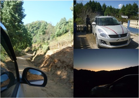
Part 1: We meet our new friend from the showroom- Maruthi Swift Petrol
The car was delivered from the showroom just 30 minutes before our arrival. It had the ribbon on its hood and a TC plate for registration indicating us that we were the first people to drive it. After all the formalities, the experimental trip kicked off in a traditional Indian way- Getting ourselves photographed in front of our brand new car with the self-drive company owner handing over the keys to us. The road ahead is supposedly beautiful with greenery all the way with paddy fields, hills and tea plantations. It was past sunset and hence, it was just a cruise from Guwahati to Kaziranga highway. We checked into the resort by 10.00.p.m which we had booked at Kohra range of Kaziranga National park.

kazhiranga
The National Highway passing through Kazhiranga

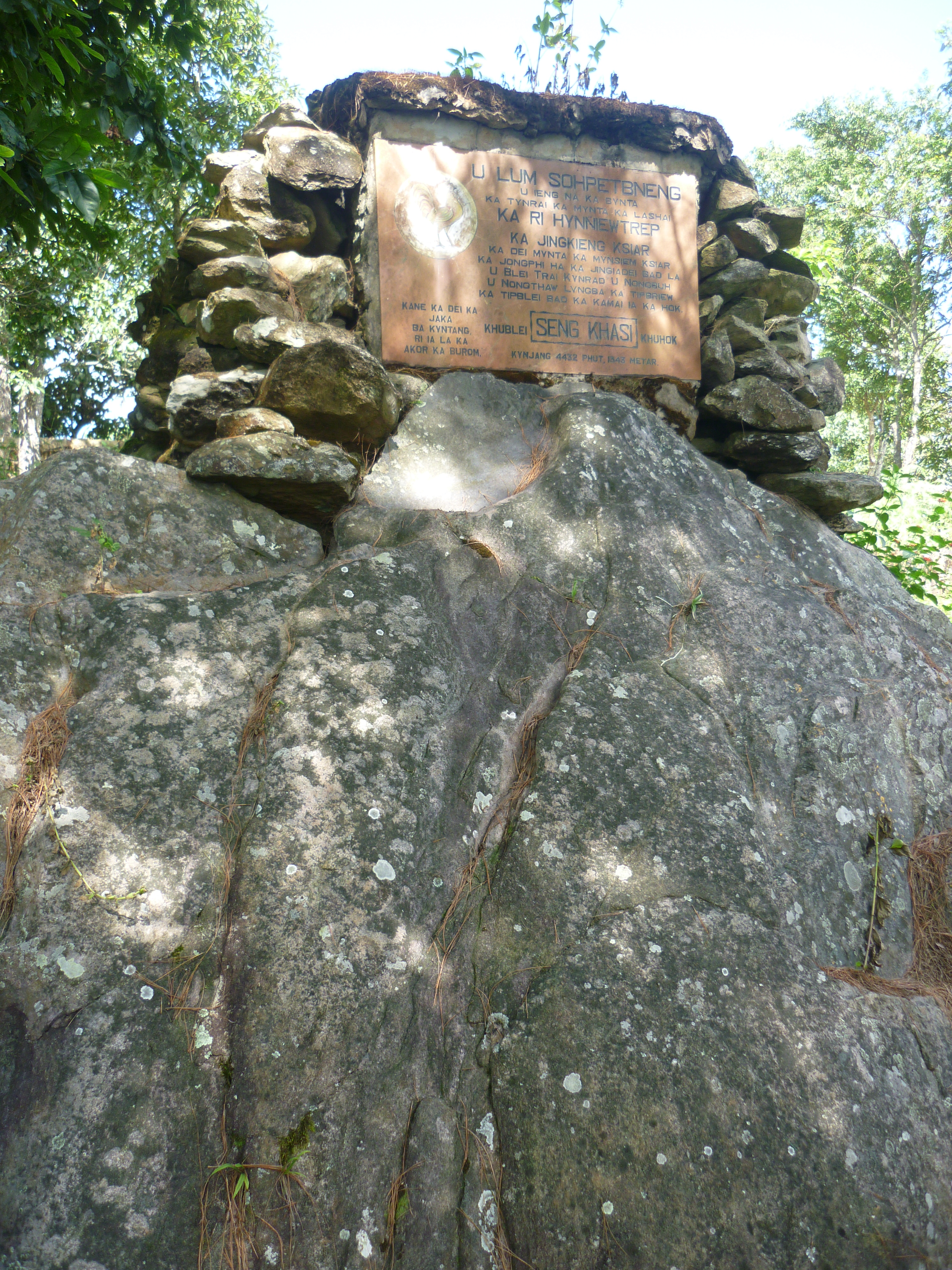
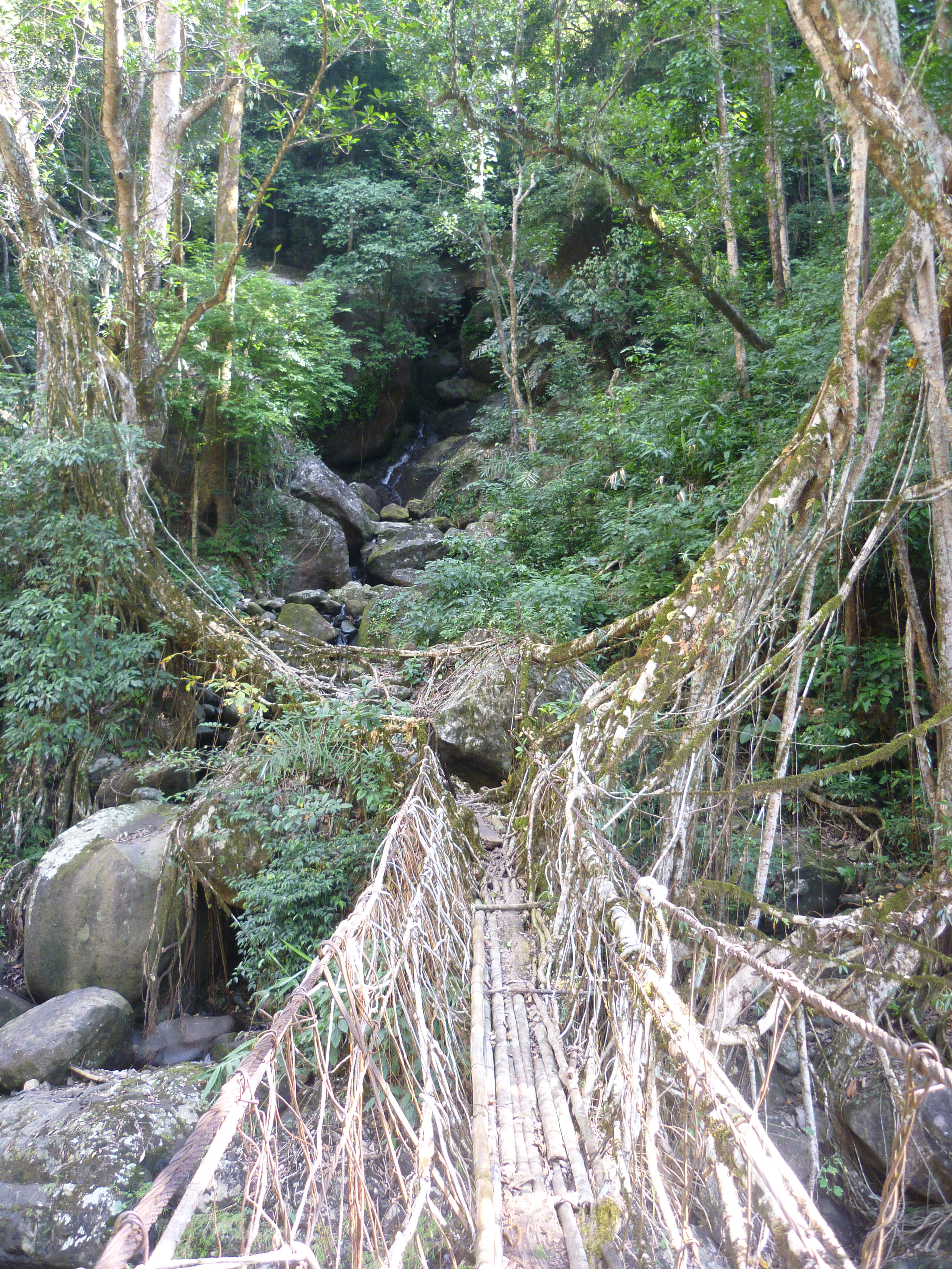
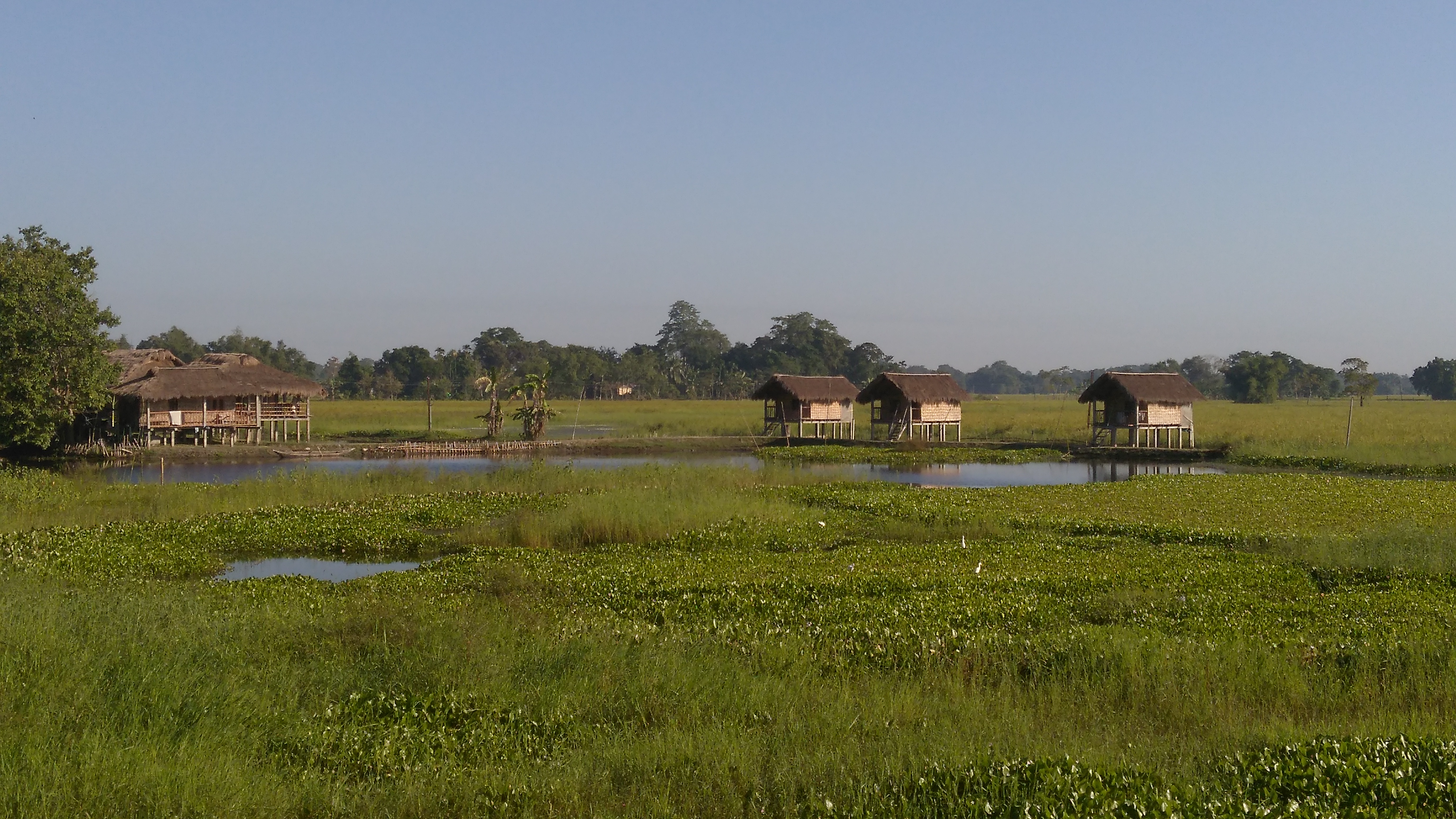
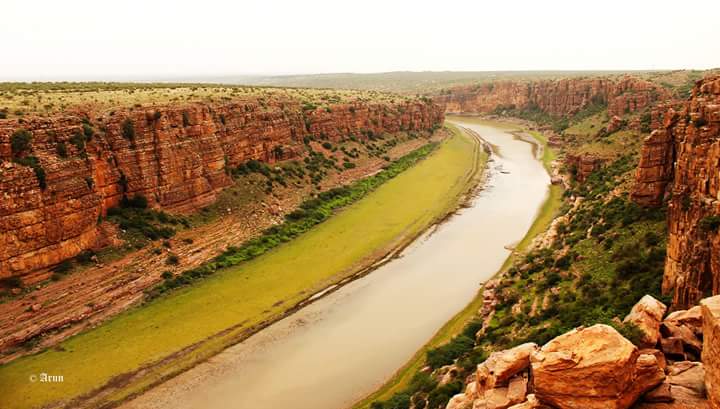
The next morning, we drove through the rustic areas of Kohra to reach the elephant Safari area. It was a splendid view with lush green paddy fields hovered over with mist and mud smeared huts dotting the entire stretch which set a positive tone for the day. We even spotted a couple of rhinos by the roadside itself 😀 An elaborate story of Kaziranga is another post altogether and hence, I will drive you across from here to reach Neemati ghat as the last ferry would leave for Majuli by 04.00.p.m. The car too sped similar to the drive you’ve just been through the post from Kohra to Neemati ghat- HIGH SPEED! Majuli is yet another post in my blog and that comes with Diwali lights, fireworks and a lot of pulling and pushing of the car in the dusty terrain of the countryside. A drive to be truly remembered!

majuli
The kaccha roads of Majuli

Part 2: Driving on the National Highway no.13- A sneak-peak to Arunachal Pradesh
It was complete off-road driving (Read it flying) all along the banks of Brahmaputra from Dhunaguri Ghat of Assam. We had covered a stretch of 165 kms/4hrs via North-Lakhimpur in merely an hour through a shortcut via Parbatipur. We had met a cop from Arunachal Pradesh who had asked us to follow him and we did that although skeptical about his real motives 😛 We heaved a sigh only when we saw some people around and that’s when we realized we were right in front of Arunachal gate at Banderdewa check post. Having sorted out the issues of inner-line permits for us and our swift car with no number plate (We had a temporary registration), a grueling drive into the state of Arunachal had begun along NH.13. It was pitch dark at 6.p.m. in the evening and not a soul on the road san us. We braved a couple of landslides and waterfalls- both plunging right onto the road that we were driving through. It was 12.00.a.m. when we reached Hapoli market in Ziro town of the lower Subansiri district. The three of us were trying to get in touch with the homestay owner for directions from 5 different mobile network providers and yet unable to make a call. All the mobile phone networks were apparently down since evening and felt like the entire valley was paralyzed without communication. And, we were kind of stranded in the middle of a freaking cold night at nowhere!!

There were no civilians on the road but hundreds of cops walking around with balaclava and guns keeping vigil in the place prone to surprise social turbulence. Meanwhile, we were confronted by a CRPF cop as to what we were doing there at that time and we explained our plight to him and sought help. He offered to help us telling BSNL lines were up and he could call our homestay from his mobile- unfortunately, our homestay guy was still not reachable, thanks to his Airtel connection! By that time, we had decided to spend the night on the road with our shorts and loafers to help us bare the zero temperature at Ziro town. But in a while’s time, a miracle happened. Our homestay owner had realized the issue with the mobile networks and come down to Ziro searching for us. He found us! But rightly then, his Maruthi 800 refused to crank… He pushed it aside until next morning, got into our car and took us to safe harbor- his homestay at Siiro!

ziro
The National Highway at Ziro

After all the sightseeing and lifetime experiences at Ziro, we had to now drive back to our next destination- Jatinga. It was the same highway down until Banderdewa, but this time during daytime. So we had ample vistas to soothe our eyes all the way… Deep valley with clear waters and occasional rapids of the Subansiri on one side and thick jungle on the other kept up the motivation for the drive on that Roadless NH road! Occasional Apathani women folk hitch hiking a drop to different villages enroute to Potan and frequent photo stops added to the tempo. Further down, while the sunset added colour, the grazing Mithuns along the valley added charm to the drive. Mithuns are shy animals belonging to the cattle family. They resemble bisons from Nagarhole in their features but are in shades of white colour. They are handsome creatures! In such bad tarmac, we were still able to keep the good condition of our new car with just the rear mudguards hanging down. We crossed the Banderdewa by 06.00.p.m. and thus the next sojourn into Assam happened.

Part 3: Driving on the Asian Highway no.1 to Haflong.
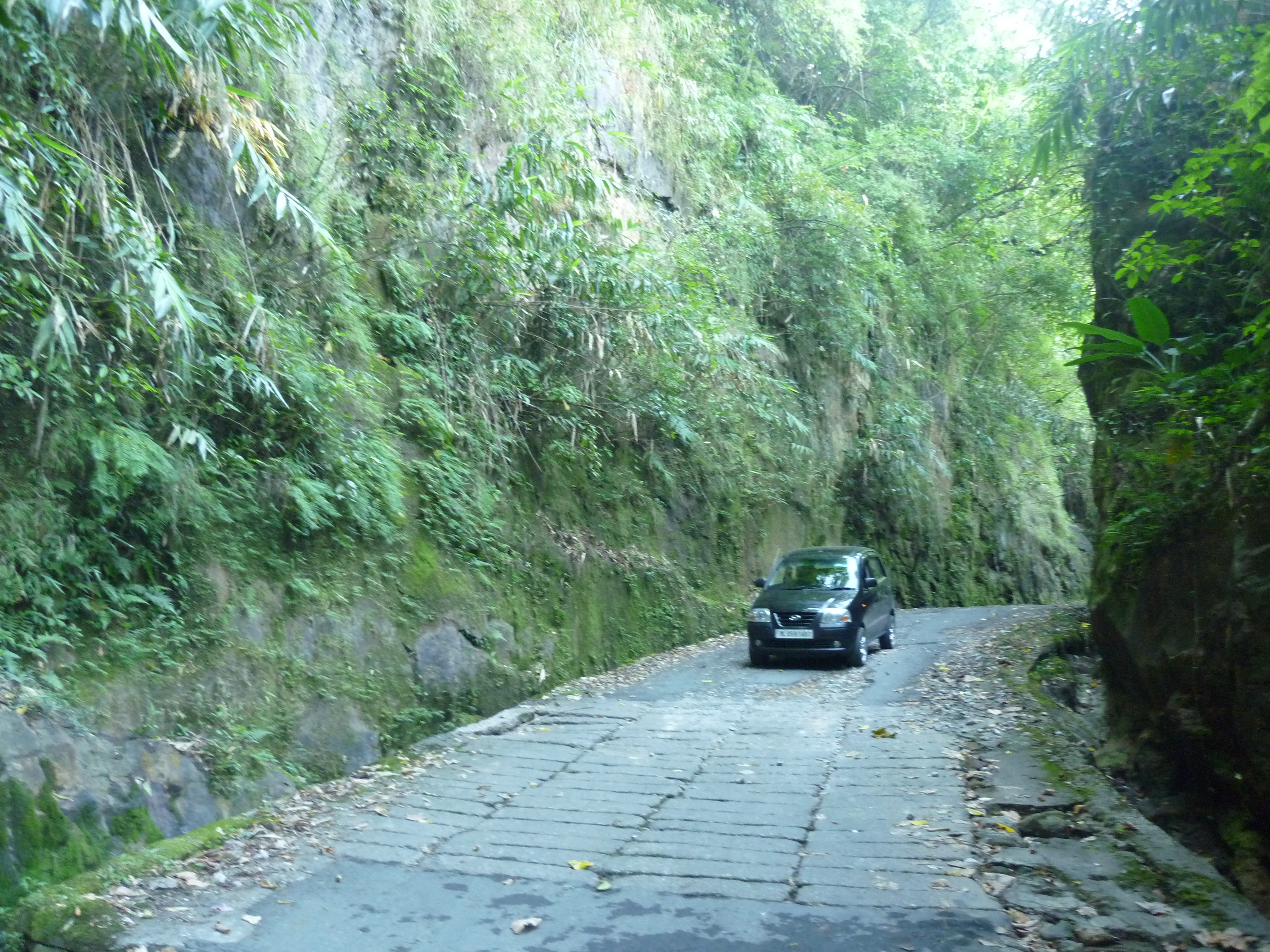
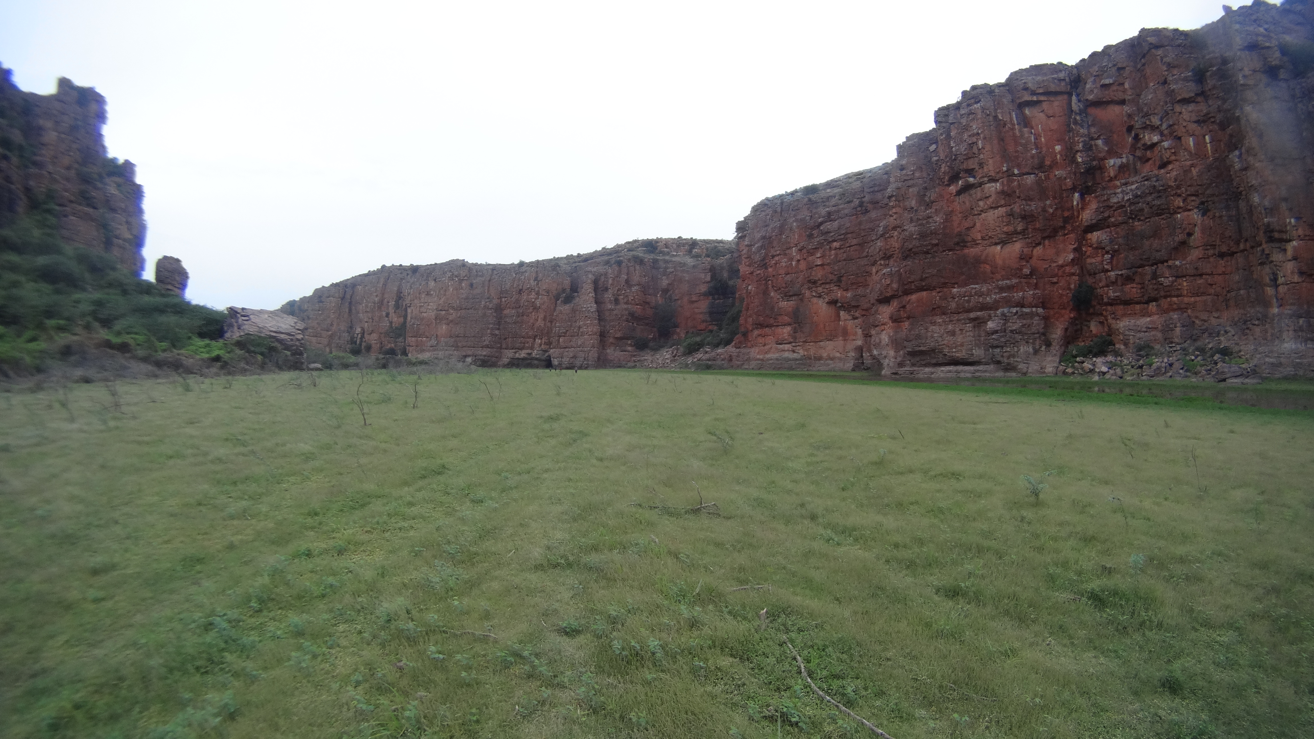
After a short tea break and for dinner, we drove until Tezpur where we decided to stay for the night. After seeing no roads in Arunachal, the new tarmac in Assam seemed more like a speedway in NFS. We were cruising through the NH passes over the 3kms+ long Kolia Bhomora Bridge across the Brahmaputra and cuts through tea plantations and paddy fields in most stretch and was a delight to drive. But, we were watchful at the same time as the beautiful stretch was also known for anti-social elements like militants, Maoists etc. The next morning, we started early towards Dima Hasao district so that we had sufficient time to explore Haflong and make it to Jatinga to watch the famous birds’ mass suicide phenomenon. We were blindly following our dear friend- google maps and cruising on the AH, that is being newly developed in the stretch that we were supposed to drive till Haflong. We were thoroughly enjoying our drive through the newly asphalted 4-lane road passing through the forest reserve area. However, we did not want to risk ourselves by stopping anywhere even for a nature’s call as the entire stretch is known to be socially intolerant and infested with militants. It was only us and no one else amid virgin forests on both sides for as long as our eyes could reach. The map was indicating only ONE road right until Haflong without any crossroads and hence, it was an easy way to go…

We had just passed through the tunnel near Mahur junction and suddenly the road disappeared. The front wheels of our car were stuck inside a deep pool of slush. It was 01.00.p.m. and our enjoyable drive had halted. The map on all our phones continued to indicate the road ahead. We opened the doors to get out and push the car- we were amused by the knee deep water that we had just got ourselves into. There was a huge rock exactly under the front cross-bar which meant we couldn’t push it forward. Meanwhile, we noticed that the water level was rising due to a continuously flowing stream which posed a risk of the water entering the engine. While 2 of us took to task of digging a water-way for the stream to flow out, the other friend walked back until the tunnel where we hoped to find some help. There were a couple of cars who had lost their way too and drove to the place where we were stuck, but they were quick enough to shift to the reverse gear and drive back. Remember… The place is infested with militants?? Our poor friend near the tunnel- was trying to stop every single vehicle that passed by and no one cared! By 03.00.p.m. he somehow managed to walk back with 3 local boys who came down with a couple of posts to lift the car out of the slush. The ground clearance was bad which at the first place had got us down to where we were. The front bumper seemed fragile to come out if we tried to lift up with it. There were no side skirts or reinforcements that could help us to hold the car up. And then there was a huge dent & a bump on the Rear door while my friend was trying to support his shoulder in between. We together tried all possible tricks and ideas to get the car out but all in vain. The sun had begun to set by then which meant we had very little time left with daylight lest spend the night inside the car in the middle of nowhere with highest possibility of getting mugged at gunpoint and worse- become a meal to some hungry wild animal. It was 04.00.p.m. and we were still stranded.

While we had given up and were thinking about the way forward, a Mizoram bound family arrived in a XUV-500. Seeing a girl, they took pity on us and offered to help us by waiting until we arranged for a rope. Fortunately, another truck arrived on a lost route within the next 10 minutes. The truck driver obliged to open a compartment in his truck which was located deep under and was never touched since the time he had owned the truck. He finally pulled out a big chain which was then attached to the XUV and towed the swift out of the ditch. It was a moment of celebration… not only to us, but to so many people who had gathered during the course. With some navigation help from the locals, we took a small deviation to avoid the landslide that had actually caused the entire episode of getting our car towed. The highway ahead right until Jatinga was under construction with just heavy dust all around. There was a spot where our car was in the middle of like ten JCBs around- Like a scene from the transformers. Wow! A wonderful experience in a no-man’s world…

dima-hasao
The Asian Highway through Dima Hasao

Part 4: Swift gets a face wash
We found a local garage at Haflong who vacuum cleaned the interiors and did a high pressure wash for the exteriors and underbody. Our car looked as new as it was when we took delivery. Only change point was that it had a big bump on the rear door and functionally, the power steering would suddenly get harder than its manual version due to the leaking power steering oil, the brakes took a longer distance to stop and the entire electrical system would suddenly go off during the drive due to the excessive electrolyte spillage in the battery and of course- the wheel alignment had gone for a complete toss. We drove back to Guwahati braving the deadly combination of multiple malfunction Indication Lamps on and horrible road sense of the people on the newly laid highways. We returned the car at Guwahati and the rest is better left untold…

Summary: Sorry for the poor car on it’s first road-trip.. It was driven in extreme conditions for what it is not designed.. Inspite of all that we put it through, it got us back safe to our harbour:)

What was your most memorable road-trip? Let me know!

Gateway to the abode of clouds- RiBhoi

This post is part of my fortnight long road trip across North-east India, specifically covering parts of Meghalaya – Assam – Arunachal Pradesh I had tagged along with two other travelers and drove around the state of Meghalaya visiting Shillong – Smit – Cherrapunjee – Mawlynnong – Dawki – Ribhoi- Shillong.

A long winding highway up the hill from Guwahati leads to Meghalaya: Abode of the clouds. And up there, one will be greeted by blue waters of a calm lake flanking the road on the right with no sign boards indicating the arrival at Ri Bhoi district. With no major landmark to explore for a typical tourist, this small distrct is full of fables and legends. If you’re someone interested in fairy tales, I highly recommend you to take a local person with you and follow my trail.

p1140244
The Umiam lake from NH40

The Umiam Lake or Barapani has been gracefully present there in a serene backdrop of green hills of the state. There is no passerby who doesn’t stop for at least a minute to capture the beauty of this place! This is a man-made lake formed due to the construction of a reservoir across the Umiam river. Today, this reservoir is one of the main sources of potable water to Shillong. For people looking for a leisure trip, one can go for boat rides in the clear waters of the lake. It is also called as the ‘water of tears’ named after a legend which talks about two sisters who were travelling to heaven. It is beleived that one of the sisters slipped from the hills and died, the other sister cried out of grief and her tears are said to have trickled down and formed the lake!

We had read about this place called ‘Lum Sohpetbneng’ close to Umiam and asked our driver if he could take us there. Although he himself had never been there earlier, he readily agreed to take us there. ‘Lum Sohpetbneng’ is a sacred grove of pine trees where a golden ladder is believed to have existed which connected Heaven and Earth. Although there is a motorable road, the place looked eerily deserted with absolutely NO ONE until the peak. We kind of got lost with several deviations in the route but since we were in the middle of the forest, we decided to reach the destination before we gave up. We wanted to know how the ladder looked like that connected God and Man. Finally, we arrived there… Only a dilapidated structure what appeared like some prayer hall and an under-construction structure was there, which our driver told us was a place where an annual fair is held with a large congregation of Hindus.

p1140248
An epitaph at Lum Sohpetbneng

A few steps away from the concrete structure, our driver took us to a neglected patch of land under an old withering tree. He pointed at a rock and told us, “See, these massive footprints here? It is of the humans who tried to climb heaven. Back in the days, humans used to be massive in size. One day, God realized that heaven was getting full and so he cut-off the ladder which laid right here, where this tree is now growing.” Although the shape of a feet with heels and toes were demarked clearly in the footprints, it is interesting to know how we grow up with fables without understanding the scientific logic behind.

There isn’t much to do on the peak apart from a good view of the Umiam Lake on one side and the Jaintia hills, Shillong airport, the Asian highway on the other. We drove back to Shillong.

p1140251
A view of Umiam lake from Lum Sohpetbneng

I personally would not recommend this trip if you are on a packed schedule. But if you are an explorer, interested in studying religion and culture, I would advise you to go there with a person familiar and knowledgeable about the place. A deviation from Umiam Lake can help one to explore the Diengiei Peak, where a crater formed by an extinct volcano exists. Dwarksuid is yet another place we gave a miss on the Umroi Bhoilymbong road where a rocky lake exists and is believed to be ‘Devil’s doorway’ because of the dark colored rocks surrounding the lake.

Closing remarks: Being the first scenic spot while entering Meghalaya through NH40, Umiam Lake is a good stop-over to watch the sunset and chill with friends on the banks. There, you can flip your arms open and let Meghalaya breathe some life into you before you head over for a wonderful trip ahead!

Treading the living root bridges- Nongriat

As kids, we always imagined fairies with wings flying amidst colourful gardens, rope like creepers hanging across the forest thickets, rainbows emerging on the tranquil sky. Do you agree when I say this is how most of the animated movies depict fairy tales ? Nestled deep in the rich forests of Meghalaya; with NO exaggeration, that’s how I would describe this village called Nongriat!

This post is part of my fortnight long road trip across North-east India, specifically covering parts of Meghalaya – Assam – Arunachal Pradesh I had tagged along with two other travelers and drove around the state of Meghalaya visiting Shillong – Smit – Cherrapunjee – Mawlynnong – Dawki – Ribhoi- Shillong.

A pleasant drive through the breathtakingly beautiful valleys and naturally formed creepy high limestone walls brought us to a village called Tyrna in Cherrapunjee. That’s where the tarmac ends and our car had to be parked. Further, we trekked down to the Nongriat village: where the ‘Umshiang bridge’ or popularly called ‘the double decker root bridge’ exists. One needs to climb over 2500 steps each way, so that this piece of marvel can be seen at close quarters. Root bridges are created by inter-weaving the roots of the rubber tree by the tribal folks who live in the deep forests of Meghalaya for their local commute across the bloated rivers during monsoon. A bridge fit for usage can take a minimum of a couple of decades and it only gets stronger with age. There are several such living root bridges across Meghalaya and most of them continue to be untouched by the tourists due to their remoteness. We were here, to tread on some of the most popular living root-bridges of Meghalaya.

p1130958
The route to Tyrna village

Although, there is a well laid out path of stairs all the way, we thought it was wiser to have a localite who would enrich us with the facts and figures that we wouldn’t get to learn otherwise. At Tyrna, we met a Khasi villager from Nongriat who agreed upon to guide us through our trek. We passed through several sacred groves and areca farms belonging to the villagers. After decending about 1000 steps, a small deviation to the right indicated the way to Nongthymmai village. We took this deviation to reach the ‘Ritymmen root bridge’ a single bridge and another old one next to it which has taken its toll due to the negligence by the localites. Our hearts were jumping with joy at the first experience of treading on a living root bridge, that we had only read about until then… I decided to throw my shoes away for a while and enjoy the feeling of walking barefoot on the bridge.

p1130974
The Rythimmen bridge at Nongthymmai village

After spending some time, we decided to continue the trek and our new friend cum guide, continued to enlighten us about the rich traditions and culture of the Khasis. We stopped by for a quick breakfast at a straw hut selling 2-minute noodles and lemon tea. Further, a short climb of stairs continued only to be awestruck by the marvel of indigenous engineering: The double decker root bridge, the main motivation for us to trek this far. It was like fantasy out of a fairytale: creepers hanging across a little waterfall, fed by a pristine river in the middle of nowhere! It was tempting to get our feet wet as we watched a few tourists who had stayed in the Khasi homes around the root-bridge over the previous night and enjoying their swim in the cold waters. However, spending some time admiring this piece of absolute marvel, we decided to move ahead, towards our next mission: Rainbow falls!

p1140003
Entry bridge to Nongriat village

Nature’s best kept secrets are those which are untouched due to their remoteness. Rainbow waterfalls being one of those. The small number of tourists who make it till the double decker bridge seemed to have had disappeared there onwards. The tiring path ahead was going to be tiring, we were told. But, nothing comes easy.

I was doing this trip post monsoon (October to be precise) and that’s when the caterpillar larvae take wings! Like winged fairies, we were greeted and accompanied by butterflies of all colours, shapes and sizes all along the stretch from Umshiang bridge (the local name for the double-decker bridge) till the rainbow falls. We had to be extremely cautious while walking, clear the way for ourselves with a stick, lest accidentally step on these little winged beauties. The path was so full of butterflies, that it cannot be expressed with words and the joy can only be experienced. Truly, in every sense: I was Alice, walking in wonderland!

p1140026
Another root bridge enroute to Rainbow falls

It was a walk of nearly 2hours through the thickets of the sacred forests and crossing at least 5 other root bridges and a couple of metal rope bridges that were laid across the deep river that flowed down with its seductive clear blue waters. After the brisk climb, we had finally arrived at the place where a hidden jewel of nature unfolded itself, from amid the greens…

We stood there in AWE….. the green trees and bushes had opened up to display a canvas with milky white waters gracefully tumbling down into a pool of turquoise blue and a hundred fairies flying around us. A dozen spectrums added to this heavenly scenery! On a clear sunny day, there could be 50-100 spectrums around the waterfall, giving the place its name: Rainbow falls! We enjoyed a couple of hours in calm just by sitting beside the naturally formed swimming pool as we were the only people in this fairyland and restoring our lost bond with nature that was shared long ago.

p1140039
The Rainbow falls

As described by our guide, camping at the Mawsmai caves (2hours trek further) and climbing up the hill to be greeted by the Nohkalikai waterfalls, the highest waterfall in India would have been a complete story! Unfortunately, we hadn’t known much about the enchanting beauty of this trek before embarking on it and had no preparations now, to have it extended further. So now, it was well past afternoon and distance that required to be walked back was long. The sun sets early in this part of India and that meant that we had very less time of daylight left. During our return, we stopped by at another hut near the Umshiang bridge for a late lunch where we relished a simple Khasi meal of rice and bitter lime curry.

p1130990
A metal rope bridge near Rainbow falls

The walk back from there onwards was taxing and it is a very steep climb up the 2500 odd stairs.. I stopped several times at the little homes and stalls put up by the villagers on the way to keep myself hydrated with the local energy drinks and fruit juices. I cannot forget the way our guide cum friend Denzil kept motivating me to complete the stretch. He kept reducing the count of steps by hundreds so that I would climb faster with the intention of reaching the top ASAP. Finally, I was back at Tyrna, even while there was sufficient sunlight for us to drive back to Cherrapunjee.

A small deviation from Tyrna will lead one to ‘Ummunoi root bridge’ in the Laitkynsew village, one of the oldest bridges in the viscinity. It has been truly a very refreshing way to explore ‘the abode of the clouds- Meghalaya’.

Conclusion remarks:

  • For all trekking enthusiasts, a two day trek covering Laitkynsew, Nongriat, Mawsmai and Nohkalikai is highly recommended.
  • Although, we missed to trek up to the Nohkalikai falls, we made sure that we camped overnight at a spot facing this waterfall and caught the view of the sun rising over the Nohkalikai waterfalls!

Celebrating Diwali in the island of Satras- Majuli

This post is part of my fortnight long road trip across North-east India, specifically covering parts of Meghalaya – Assam – Arunachal Pradesh

A good photo can tell a story… But a camera can never capture what the real eyes see’. This expression explains my feeling when my drive to Majuli started.

After our wildlife safari at Kaziranga National Park, we drove down towards Neemati Ghat from where we had to get our car onboard a ferry… Although the ferry sailed away from the banks, we saw ourselves taking a detour and approaching the same bank within 15minutes. A person who had alighted at Neemati Ghat had created a ruckus for having lost his bag of crackers in the ferry. So, he made the entire ferry return to the bank to find his bag back. Oh yes… Diwali with no fireworks?? After all the drama, our ferry took sail on its final trip of the day… It was approximately an hour’s journey across the mighty Brahmaputra towards Kamalabari ghat on the other end that had conveniently faded into the horizon. On the other end of our journey was Majuli, the largest river island in the World.

Places covered:
• Natun Samaguri Satra (known for mask making)
• Uttar Kamalabari Satra (known for the origin of Sattriya dance)
• Kamalabari Satra (known for boat making)
• Aouniati Satra (the largest Satra)
• Dakhinpat Satra (The oldest Satra in Assam)

The Details:
We were sailing in the middle of the widest of the Indian rivers which seemed no less than a sea… In no time, it was sunset in the sky!! We saw the gold of daylight changing into molten red merging with the darkness of the sea to call it a day! Each fraction of a second was a spectacle to the eye while the universe around us was changing into hues of red. And at the distant horizon, the dark sky was being lit up with fireworks as if the world’s largest river island was set for our grand welcome. With last drop of the set-sun, our ferry reached Majuli Island. The welcome was more than what we had imagined while in the waters… The streetlights in the entire island were switched off and it was like time travel to the history books of ancient days when all towns and villages used to be lit by lamps with oil soaked wicks… All villages, all streets, all houses & shops, every courtyard and like every damned place in the island was lit up with diyas of Diwali reminding us the exact purpose of the festival- Celebration of the grand return of Lord Ram, Sita & Lakshman at Ayodhya..!! The distinct rural ambience with lamp lit bamboo huts reflecting in the swamp waters just added to the amusement we had.

p1140385
Lamps being lit at one of the huts at the Missing village

After getting directions from our homestay owner, we drove through stretches of Gurmur only to be guided with lamps that marked the boundary between the road and the bamboo forests on a moon-less night… A neatly done-up bamboo cottage was awaiting our arrival in that bamboo island… After freshening up in our cottage, we took a stroll in that magical village in search of some local food for dinner. We had to satiate our hunger at a small but pleasant hotel with a simple Assamese Thali.

The rest of the night was spent star gazing in a clear moon-less sky outside our bamboo hut, with moist dew-kissed grass underneath and sipping apong- the local rice-beer… Right there, I found what I wanted from my trip- A piece of peaceful life… It was BLISS..!!

The next morning, we woke up leisurely and took a stroll around the village enjoying the rustic countryside… As it was start of the winter, we witnessed several endemic & endangered bird species including migratory birds that had come to nest in this extensive wetland. After breakfast, we decided to explore the cultural diversity offered by the island. Although I would any day choose to cycle around this vast district, my friend wanted to drive around instead and so we did…

img_20161031_073505_1
The bamboo huts/ houses in the Mising village

Majuli has always been the cultural headquarters of Assam. It is known for its ancient monasteries which have been practicing various forms of art for over 500years now. These monasteries are called Satras. There were over 660 Satras in the island which has reduced to a handful of practicing schools now. We were hence keen on exploring a few of them. The drive around the bamboo groves alternately opened up to the swamp waters of the island making the drive very enjoyable. And every household had a loom placed outside under the shade of the hut with several women folk weaving the famous textile of Majuli. Several others were busy with the preparations for ‘RaasLeela’ the biggest cultural festival of the island flocked with people from across the world due for a few weeks ahead.

Firstly, we visited the ‘NatunSamaguri Satra’- known for mask making. The humble person Mr. Hem Goswami was patiently explaining the process of mask making to every visitor who dropped by. Since, the preparations were on for RaasLeela, most of the masks available were those of characters from Ramayana. We were amused with the way Mr. Goswami got into the skin of the character of the mask that he wore each time. Be it the aggression of King Vali or the gracefulness of seditious Mohini- He adorned them all with ease… We then drove across the island visiting various Satras scattered across the village. Lastly, at Dakhinpat Satra, we greeted the monks or Bramhacharis as they are called were all occupied in the practice of hymns for the Raas night!

p1140393
The masks at the Samaguri satra

The island is inhabited by the Mising, Deori & Sonowal Kachari tribes in separate villages in this bamboo district. And hence, the indigenous culture of the tribal folk is another attraction in addition to all the cultural and bio-diversity that the island has to offer. After all this exploration of the island district, we headed towards Dhunaguri Ghat from where a 3hour drive would get us to the gates of Arunachal Pradesh.

img_20161031_152130
The ferry and the under construction bamboo bridge at Dhunaguri ghat

Firstly, we need to cross a small swamp with a ferry which is available at any point in time, so one needs to just hop in and get rowed across. There is a bamboo bridge being constructed by the local tribes parallely which I think is eligible to be called world’s longest bamboo bridge. The amount of engineering and effort the locals have been putting in is noteworthy. Next was a short drive through the tribal settlements to catch another ferry that runs on a fixed time. But, this drive was again like an emotional farewell to us by this beautiful island… The oblique rays of the setting sun laid a golden tone for the entire backdrop. With the bamboo huts onto our right, the view to our left was a visual treat! Grey waters of the Brahmaputra, green paddy fields, blue Himalayas at a distance with the golden sunset- all in one sight looked like layers of colors and terrain merging into one another forming as if a dream was frozen on canvas.

We waited at the banks for a long time and captured various silhouettes in the backdrop of a dreamy sunset until our ferry arrived. We boarded our car onto the launch and bid a final goodbye to the beautiful island and its people…

Summary:
Majuli is THE place for a traveler who wants to break through some offbeat destination with multiple touch points- Cultural, traditional, geographical, eco and biological diversity all at one place!

Must do:
• Take a cycle tour exploring the Satras around the island.
• Attend the annual cultural festival- RaasLeela in 3rd week of November.

A day out at the Khasi cultural centre- Smit

This post is part of my fortnight long road trip across North-east India, specifically covering parts of Meghalaya – Assam – Arunachal Pradesh I had planned to visit Shillong – Smit – Cherrapunjee – Mawlynnong – Dawki – Ribhoi- Shillong during my weeklong stay in Meghalaya.

I had decided to explore some places all by myself and Smit happens to be one of them. After seeing some spellbinding photos on the internet, I wanted to visit the Laitlum valley as well. Although there are public buses from Shillong to Smit, the connectivity further to Laitlum isn’t great. This is where one needs to have a travel arrangemtn of their own, or in my case: to hitch a ride to reach Laitlum. Since it was my first day in the state, I did not want to get too adventurous for being alone. That’s why, I hired a taxi from Police bazaar (in Shillong) to Laitlum.

This drive was very refreshing for me, whose mind was cluttered by all the madness of traffic, pollution and work tension back in the metropolis (Bengaluru). I was requesting my driver to stop the car after every other kilometer to capture the seducing beauty of the place with my not-so-good camera. The bamboo trees and terrace lands with potato farms, all added charm to the landscape that was very beautiful even otherwise. To add to the pleasure of the drive, I was having a good conversation with the driver as well. Althiugh I had hired a personal taxi, I did not mind to let a few locals into the car when the driver asked me if I could allow them. Given the remoteness of places and the scarce connectivity through transposration, I had absolutely no problem with offering a ride. The next thing I experienced was that there were atleast 50 passengers hopping on and off at every stretch for their ride. And would you know what was exciting for me? All locals who boarded the car used to get overly excited about meeting a foreigner (Yeah… That’s what they called me!).

Smit is an old rustic town and the cultural centre of the East Khasi hills, but there isn’t much in this town apart from the Siam’s house. A road flanked with well groomed pine trees lead to the Khasi Raja’s palace. The Raja or the head of the clan is called ‘Siam’ and he lives in the same premises. However, the wooden palace is used only on special occasions when there will be large tribal congregations, like the Nongkrem festival for example. This typical Khasi styled wooden house is said to have been constructed with zero iron nails and only wood for all joints. Although I met the Siam, he did not seem to be a photo friendly person when I asked for permission to photograph his little children.

p1130680
The Siam’s house at Smit

We then drove to Laitlum valley, located at about 5kms ahead of Smit. It was an offbeat drive through the rarest stretches of countryside. We passed by a lot of school kids who were on their way to school. Few were happy waving at me while a few were busy pranking at their pals as they walked. Having been born and raised in a small town myself, it was a flashback of typical childhood days in a rural setup. There were a couple of school teachers in my backseat, chatting happily with me and patiently waiting in the car while I would get down to take photos. Overall, it was a very pleasant drive until we reached the Laitlum gate. While the driver wanted to sit back in the car, he asked me to enjoy the view and return.

I was the only person amid the green scintillating valley until I walked down and saw 2 local boys cleaning the pristine place. They had already parked aside 4-5 sacks full of waste. When I spoke to them, they told me that they came there every morning before leaving for school, to pick up plastics left behind by the previous day’s tourists. While it was a heartfelt respect for these boys for doing their bit to save earth without having any expectations of monetary gain, it was a subtle slap on my face because I too represented the tourists who unmindfully damage the same earth in the name of travel and enjoyment.

P1130730.JPG
The Laitlum valley

I walked down to the cliff and stood in amazement at the beauty that the place beheld. While I was standing on the brink on a large flat rock, it felt like I was the only person in the whole wide beautiful world. The gentle winds kissed my cheeks and the chirping bird was a welcome guest. There were several waterfalls flowing down the valley gracefully at a distance… Then there were a few villagers who appeared to be popping out of the deep valley beneath. They seemed to be friendly and told me that their village was located far down the valley and they had to climb up each time to meet their basic life requirements, trade their farm products etc.

There is a cable car made of bamboo which will be dropped down and pulled up for old people and goods, but their daily commutation is by foot most of the time. I grew curious and my feet dragged me down the stones that were laid on the path to the village. The beauty of the 360 degree greenery and the fresh air had already cleansed my mind off half my worries and tension by the time I clocked the distance to the village. There is a small stream, a church and a few huts in this little fairy tale village nestled deep down the valley. And the villagers I met on my way enriched me with the simplicity and contentment in life. After a good walk down the beautiful valley of Mawkeynrew, my tummy had started to call out for me. I savoured the plantains offered to me by the villagers and unwillingly decided to climb back.

p1130853
The bamboo cable car and the village below

Once I reached the top, I finally sat down at a small hut like stall at the valley gate that had opened by that time. It was run by a lady who couldn’t understand what I was trying to communicate in English. her little son helped me with a cup of lemon tea in English before running to school. The lady there could not understand anything other than Khasi language and I didn’t know that. In spite of the language barrier, we both soon became friends and managed to communicate with hand signs. She cooked maggi noodles and Jadoh with chicken curry for breakfast while I was eagerly waiting for my first Khasi meal. Jadoh is a traditional Khasi meal where rice is cooked with chicken blood instead of water. It was one of the most relishing and sumptuous maggi noodles I had eaten before! What made the meal so special was not that I found it in a no-man’s land or at an extremely low price. It was something that I would travel back again all the way for the humility and dollops of warmth with which the meal was served to me.

She cut a pomello fruit and mixed it with chilly powder and packed it for my road.. With a heart full of gratitude, I bid goodbye to this new Khasi friend of mine!

Kublei Shiboon,
Hitha.

Tripping in Scotland of the east- Shillong

This post is part of my fortnight long backpacking across North-east India, specifically covering parts of Meghalaya – Assam – Arunachal Pradesh I had planned to visit Shillong – Smit – Cherrapunjee – Mawlynnong – Dawki – Ribhoi- Shillong during my weeklong stay in Meghalaya.

The planned solo trip started when I boarded the BLR- GAU bound flight to Guwahati. An argument over having to pay an additional Rs.50 per head for turning the A/C on for 1 passenger’s need in a shared taxi from Guwahati airport ended when the drive uphill pulled-off at Police Bazaar in Shillong at 3.00.p.m. While the streets were bustling with the weekenders finding their way out of the hill state, an acquaintance who had offered to let me stay at her place was waiting for my arrival. Thus started my weeklong backpacking trip at Meghalaya and my first day at the capital town, Shillong.

On my first ever solo trip, it being my first day in an unknown city and having very little time with daylight left (The sun sets early in the North-eastern part of India), I decided not to move too far from my friend’s house and eventually cause trouble to people in finding me. I dumped my luggage at the house and started to explore the city by foot.

My Itinerary for Shillong:

Day 1: Arrive at Shillong by 03.00.p.m., Walk around the residential lanes, Shopping at Police Bazaar
Day 2: Golf course, drive to the outskirts (Laitlung valley), local city tour, Elephant falls, Shillong peak & Sweet falls
Day 3: Proceed with the next day’s itinerary

The Details:

The first day went pretty well where I tagged along with another solo-traveler and together we were able to explore the markets, street food and have a fine conversation about travel & music- we kind of struck similar chords. We shopped for woolens, thermals and shoes at dirt cheap prices on the streets of police bazaar. We tasted a lot of local fruits and even picked up some ‘Bhoot Jhalokias, world’s spiciest chilly as mementoes to our relatives.

While we were walking through the narrow residential lanes of the city, we learned about the architecture of the buildings here. Shillong falls under the red belt for earthquakes. Hence, the houses are constructed with light-weight roofs- usually a combination of hay and metal sheet. Also, the houses are usually constructed a few feet above the ground with insulating materials to keep them warm during the winters. Although, a few buildings seemed to have been constructed of concrete, I was told that the walls were mud smeared and if a hole was made with a slightly large nail, the sand from within would ooze out and eventually collapse the wall. This was to protect the people from earthquake & chilly winters together. Pork forms a major part of Khasi cuisine and that made us eat a lot of it (chops, barbequed, fried etc.) since pork goes into almost all dishes. All in all, my landing on the first day in the North-eastern India as a solo traveler went rather well without seeming so lost!

Day 2 can be broadly divided into 3 parts:

  1. Taxi ride to the outskirts (Smit & Laitlung valley)
  2. Walk around the city
  3. Taxi ride to the cantonment area (Shillong peak & Sweet falls)

An early morning walk down the road from my friend’s house lead to the Golf course- The largest, oldest, wettest and the toughest to play in Asia. Green pastures have been scientifically proven to have a soothing effect on human mind and it was nothing different to expect from this golf course. I walked back up to the Police Bazaar and hired a taxi thereon to Smit.

Part 1: Taxi ride to the outskirts (Smit & Laitlung valley)

The drive of 25kms was refreshing as I passed through potato farms and scenic Khasi villages on the way. After a small stopover, we drove to Laitlung valley- about 5kms further. The beauty of the valley with 360 degree greenery and fresh air cleansed my mind off half my worries and tension. The villagers I met on my way enriched me with the simplicity and content of life. After a good walk down and up the beautiful valley of Mawkeynrew, my tummy had started to call out for me. I savoured the plantains offered to me by the villagers and sat down with a few school kids who were excited to catch up for a conversation with a foreigner in English! I managed to get breakfast at one of the stalls where a simple plate of noodles was served with a heavy dose of warmth and humility. (Click here to read more on this visit to Laitlung valley)

Part 2: Local city tour

After reaching back to Shillong, I enquired with a few taxis to show me around local sightseeing places. For a backpacking budget that I had, the taxi charges seemed to be expensive. Hence, I decided to explore the city by foot with support from my best friend: Google maps. With a little bit of browsing, I listed down many places, all located within a radius of 5 kilometers. Depending on what one’s interest lies in, it is possible to find something for everyone in this little hillstation.

P1130784.JPG
The Ward’s lake at Shillong

Things to see in Shillong include:

• For the museum bums: Air force museum (at Upper Shillong), Forest museum (Inside Lady Hydari park), Rhino heritage museum, Zoological museum, Anthropological museum (at Mawsbuit/ahead of Happy Valley), Botanical museum, Arunachal museum, State museum, Don-Bosco centre of culture (At Mawlai).
• For the water & nature lovers: Shillong peak, the Wards lake, Bishop Beadon falls, Spread eagle falls (also called as Sati or Umkaliar falls), Crinoline falls and Elephant falls.
• For the spirituality seekers: There are a large number of Cathedrals and churches where you can attend the Sunday mass with hymns melodiously sung in the Khasi language.

Part 3: Taxi ride to the cantonment area (Shillong peak & Sweet falls)

By sunset time, I realized that I had done several rounds of the same roads and had checked off very few places. And that’s when I decided to take a taxi and visit the farthest of the city’s sightseeing landmark. I was heading towards the highest point of the hill station: Shillong peak. However, the road taken towards the peak was blocked by the Indian air-force staff due to security reasons. So, that’s when my driver offered an alternate plan for me to spend the remaining evening. I nodded to his idea and sat back as he drove through the ‘Happy Valley’ and the army cantonment area at Mawsbuit to show me the most beautiful of all places around Shillong: the Sweet falls.

P1130811.JPG
Sweet falls

Being tucked away from the city crowd and having limited access to people due to the army area, this place was very serene, clean and beautiful. However, apart from a couple of riders who had dropped over for a drink, the place seemed to be very secluded. Since this was my “first” solo backpacking trip, I wasn’t feeling great about being in a less-crowded place like this one. So, I went back to the taxi and decided to be driven back to the city area.

Just then, I had a surprise waiting for me inside my taxi. My driver fallen sick and seemed to be partially unconscious. He was struggling to respond when I tried to talk to him. I suspected that his sugar levels had dropped and quickly gave him some toffees from my bag. After letting him rest in the car for a while, he seemed to come back to normalcy (at least enough conscious to be able to drive the car out of the deserted area). He then dropped me back to the city and bid me farewell.

After a short shopping break at the Police bazaar market, I headed to MTDC (Meghalaya Tourism Development Corporation) office where I thought I would be able to plan my next day’s itinerary… and what happened next is history.!!

Closing Remarks:

• It’s a safe and a friendly city for the solo travelers.
• Time required for covering all places in the city- 1.5 days

Must dos:

  • For the music buffs: Attend the Shillong Weekender NH7 music festival
  • For the cultural buffs: Attend the Nongkrehm festival of the Khasi tribes at Smit
  • For the foodies: Try Khasi cuisine at the many restaurants and give it a try for street food post 6.00.p.m across the city.
  • For the shopaholics: lots of amazing winter wears, shoes and boots at dirt cheap prices across the city!

Tracing the abode of celestial congregation- Kollur

While I was flipping through old photos of my college days, I was taken back in time to this so-called ‘Industrial trip’. This class trip consisted of trekking, pilgrimage, beaching and lastly, not to forget our industrial visit (only If time permitted, that was!). Basically, it was less of industries and more of place hopping. So here goes the first part of the so called ‘Not-so-Industrial-Trip’.

Although I had walked for miles to reach places during my school days, this was my first ‘Official’ trek! A trek in the ‘Kodachadri hills’ in Malnad region of the western ghats.. After a really long bus journey, we alighted at the Nittoor forest checkpost late in the evening. We got the permits at the forest checkpost for the night’s camping ahead, at the old forest guesthouse. We parked our bus there and got into the 4WD jeeps that were waiting for us since early evening. There is NO road from Nittor to the guest house and is only a muddy pathway. And in monsoon, it makes way for a deep trench kinda massive slush pool. This stretch can be covered by various modes based on each person’s interest. You can walk up or drive or ride.. The more adventurous people choose the latter; cycling comes with the greatest challenge. We chose the safest- The 4WD. But, driving through such terrain calls for great skill of steering control, lest have at least 7-8 people thrown off the road. That said, it was a crazy drive up the hill, until we reached the guesthouse in the darkness of 10~11.00.p.m.

After reaching the guesthouse, we could barely stand because of the strong winds. So, you can only imagine our next task of pitching tents.. We called off the idea of camping under the moonlight as we struggled to even hold the tents firmly in our hands. The winds were so strong. That’s when we had to camp indoors, at the guesthouse 😛 We had only a roof above us and no mats or sleeping bags. So we decided to pitch the tents inside the guesthouse hall for the rest of the night.

We woke up early next morning and started our hike up the Kodachadri hill. Our hike mainly consisted of two target activities- one was to reach the Shankaracharya mantapa at the peak, for sunrise and the second was to take a shower in the Hidlumane waterfall. We did not hire a guide as the organisers claimed their familiarity with the route. The sight all the way till the mantapa was beautiful and the sunrise and the Arabian Sea at the distant horizon just added up to the view! The climb was great, giving us an eyeful of the valley that was in all bloom with colourful wild flowers. After a brief walk, we reached the Mantapa. After spending some time at the peak, we readied ourselves for the descent.

bye-bye-6
The Kodachadri hills- Overlooking the Arabian sea

The descend was towards the waterfall. With the descending gradient, we slipped, jumped down, clung onto wild creepers in the event of finding our way to the waterfall amidst the thicket of the forest. Somewhere, we had already started to realize that we were lost in the forest. The thumb rule of finding the way out of a forest is to follow a flowing water body. The organisers followed the sound of flowing water and we followed the organisers. We stopped by at a small cave like structure enroute, where someone had installed an idol of Lord Ganesha and offered some flowers. We prayed for our safe exit out of the forest and continued with our pursuit of the waterfall. So we finally reached at the source of the flowing water!

Sure it was a waterfall.. But ain’t the mighty one that we had thought it would be. It was a stream that was directed to a storage tank by the localites and the tank was overflowing forming a waterfall!! Neither the organisers nor the others knew how to react at our misadventurous pursuit. But we were all happy that we had found some pure water where we could fill our water bottles and ease ourselves out of the tiring hike that we had been through so far! We were now sure that the tank was there for a purpose and the pipe attached would lead us back to base point. And the descent continued, along the same stream to the base.

There is a small temple dedicated to Mookambika Devi at the base. It is believed to be the original temple that is tagged to the legend of Shankaracharya’s installation of the idol at Kollur. We reached the priest’s house near the temple where we had a simple-wholesome breakfast. After packing our stuffs from the guesthouse, it was time for us to head out to our next destination: Kollur.

morning-trek-34

A view of the Arabian sea from the Kodachadri peak

People who prefer to trek further, can cover the Agnitheertham waterfalls enroute to Kollur Mookambika temple. But, having had enough in the quest of a waterfall, we decided to take the bus route. The bumpy drive continued until we reached Kollur, the small temple town known for the Mookambika temple, one of the Shakti peethas. This temple is said to have been developed by the Keladi rulers later in time so that pilgrims don’t have to trek up the overlooking Kodachadri hills to worship the goddess. Another legend has it that Lord Shiva appeared before Sage Kola and agreed to be present there in the form of Linga with his consort Devi. Along with Shiva and Parvathi, all other gods and goddesses are believed to be residing in a non-form in the Linga. Hence, Kollur is referred as ‘an abode of the entire celestial congregation’. We took a little time to offer our prayers and admire this beautiful little temple built in the typical Kerala style of architecture. Post that, we proceeded to the forest guest house where we had our stay booked for the night.

7th-morning-6
The forest guesthouse

The forest guest house is located in a serene location in the middle of the ‘Mookambika wildlife sanctuary’ and on the banks of river Sowparnika. With banks I mean, just a couple of steps lie in between the guesthouse and the river. This river is frequented by spotted deers & leopards to drink water. And we were told that just the previous morning, a tiger was spotted on the same steps that we were standing on, at that time! The river flowed gracefully with the crystal clear water and the school of fishes enjoying their swim in between the tree roots that grew beneath. It was a SPECIAL place to go back again indeed! We cherished every moment of our stay there while being in harmony with nature in its purest form.

mookambika-temple-8
The Idol of Mookambika being taken out as a part of the daily ritual

Soon, the dawn broke the next morning awakening us to another day reminding us of our journey to the next destination- Bhadravathi. It was the last day of our tour and that meant we had to do the most important part of this trip ‘Our Industrial visit’! That’s for another story altogether…

Marvel at Caves and Crannies- Kurnool

A trip that was pending since over two years, finally took wings last weekend. The places covered were an unusual combination of natural and contrived elements that created beauty. Had the both not been there, the existence of these places would have a lesser value than what it is today.

Our Itinerary:
Friday night: Drive from Bangalore
Saturday: Yaganti group of temples, Banaganapally Nawab’s bungalow, Owk reservoir, Belum caves, Sunset and night’s stay at Gandikota.
Sunday: Explore Jammalamadugu fort & Gandikota, Lakshminarayanaswamy temple in Kadiri town, Lepakshi and reach Bangalore by late evening.

The details:
An overnight drive was aimed at starting our trip from Bethamcherla- a town in the Kurnool district of Andhra Pradesh. A couple of articles on the internet had caught our interest to visit this place which is a treasure trove for archaeological studies. Invaluable Pleistocene remains have been excavated from several caves that are scattered around this region. We wanted to explore the Yerrajala & BillaSurgam caves in particular after being impressed by the photos online. However, even after talking to several localites, we failed miserably to get anywhere close to the places we were looking for. Language was a BIG concern there and for any small enquiries too, the curious people would throng in large numbers and stare at us while we were trying to communicate with our hand signs. Luckily, we had a Telugu-ite in our group who would do most of the talking throughout the trip. So without really finding the place, the day started somewhat on a low note.

As per the plan, the first day was a long one with target being to reach Gandikota for sunset. In quest of the place, we had already lost 3 hours doing nothing. So, we decided to skip Yerrajala and proceed to accomplish the rest of the itinerary. The winding roads of Tadipatri are carved out of the rocky hills. These hills are rich sources of the infamous Kadapa stones used in constructions. Its sedimentary rocks formed over years can be seen in layers, which make driving along this stretch a delight! We stopped at several spots to photograph the beautiful landscape as we drove through, to reach our next destination- Yaganti.

This is an ancient cave temple patronized by the rulers of the Sangam dynasty. ‘Keep left’ is the rule one needs to bear in mind in order to cover all the caves located around. Here, every cave has a special story to tell. Just keep taking the stairs whenever & wherever you spot them, so that you don’t miss out on any cave. At a point, a flight of steep stairs takes you to Agastya Cave where Lord Shiva is worshipped. And yet another chamber leads you to Lord Venkateshwara. Although, the lord is otherwise known for all the wealth, the minimal deco and the dimly lit chamber here, has some positive energy that emanates out of the place. We needed a little more time than what we had initially thought we would need to observe this place, where art, history & mythology co-exist.

PICT_20160709_094820
The temple pond at Yaganti- amidst a backdrop of several caves

On our return, we halted at Banaganapally village, in front of a mansion that stands magnificently atop a small hillock, by the road side. An old rusted name board read- ‘Nawab’s bungalow’. Though the exteriors have stood the ravages of time, the interiors of this imposing structure built of wood and rock, is crumbling. In spite of being featured in several movies, nobody really knows who the Nawab who owns this bungalow is.

Further into the drive, we stopped by for a quick group photo at the Owk reservoir. We were ‘literally stopped’ while we were trying to capture a photo with the serene backdrop of the dam. The wind blew so hard that we were struggling to move against the strong currents and felt stationary most of the times. It was my first time experience, of ‘fighting’ the wind. I really wonder how strong a ‘storm’ could be..!!

Having found NO hotels for breakfast, it was a hungry drive down until Belum village. After wandering around, we settled down to have lunch at the only A/C- restaurant in the region (with no electricity for A/C service) on a recommendation by a localite. Not like we had an option either..!! After a quick lunch, we drove over to Belum caves.

As expected, the weekend crowd was insane. But, the weather was in our favor on that breezy afternoon! On a flat/potent fertile land that seemed fit for cultivation, there appears a deep well like opening in the land. A steep flight of stairs takes one by surprise, as he enters the infamous caves. The magnificent stalactites & stalagmites formations of limestone make Belum caves the longest and the 2nd largest complex in the country. Several ancient remnants of pre-historic human dwellings and relics of the Buddhist era have been discovered, marking the caves on the map of archaeologically and culturally important places. Due to the crowd, high humidity levels and low level of oxygen inside, most of us had a severe headache by the time we walked out of the place to sunlight. But whatever the hardship, it was totally worth every drop of sweat.

DSC02269
Inside the Belum caves

We were running behind schedule and we had to zip, zap, zoom… to reach the sunset point… After a 2-3 hrs drive, we were excited to spot the windmills dotting the distant horizon. The long wall of the Jammalamadagu fortress stood spread across, bordering the land’s end. It was an indication that we were approaching our destination- Gandikota.

But the sunset..??? Hell yeah! We did make it in time, but the clouds played spoilt sport! Never mind, we still had chores to accomplish before it was dark. We wanted to trust the roads and go where they took us. That’s why, we hadn’t booked our stay. In worst case of not finding a hotel, we had carried tents and sleeping bags as backup. The trip had been good so far and we hoped that all went fine till the end… As expected, the rooms were all occupied at Haritha- The only stay option around, for miles (A resort run by the AP tourism). We negotiated with the caretakers to let us use the washrooms and dining facility.

We struck a deal with a couple of villagers and then hiked down the steep gorge to pitch our tents for the night. It was really dark and well past 9.00.p.m. when we started our descent down to the river ridge. The descent seemed longer than expected, with the luggage and the total darkness of the night adding to our woes. A few loose stones rolled down our feet as we paved our way down carefully. Once we reached the bottom, it was immense silence that had engulfed the calm environment and our ‘cubicle bred minds’. The fresh cool air filled our souls. It had been a windy day throughout, and the night by the river side could’nt be any different. We managed to pitch one tent with great difficulty and the rest of us decided to just cuddle inside their sleeping bags. The weather wasn’t harsh and the cool temperature remained pleasant, right till dawn. The only thing we were hoping for was, that no dam gates were opened for that night and that we all don’t get washed away in the dark 😉

DSC02312
That’s the view from our tent- from the Pennar river bed

We all were awakened by the first rays of dawn and opened our eyes to a dream… We all knew we were camping on the ridge of river Pennar all night. But only with sunlight, we realized that we were actually sleeping on the ‘river bed’!! No wonder that, the soil felt moist and loose while we were struggling to pitch our tents last night!! With the mighty gorge standing all around us, our hearts skipped more than a few beats at the splendid view of the painterly beauty. We strolled across the river bed till both ends of the fort wall, taking in sufficient clean air into our lungs through the billowing winds and the burnt yellow-green grass. We returned to our tent, cooked maggi and ate bread-jam for breakfast. Soon, we had to undesiringly call it ‘Pack-up’, lest face the brunt of the burning sun while climbing back with the entire load.

Once on top, we explored the view point, the old mosque, the fort remnants, the granary and the temples in the village. The entire village exists within the fort walls. It was a beautiful place to bid good bye!

The Pennar gorge at Gandikota Photo credits: Arun Kumar B.R.

For a pious traveler, a visit to the Lakshminarayanaswamy temple in Kadiri town and the Madhvarayaswamy temple at Gorantla is recommended. Both from the Vijayanagara era, would complete their religious trip. Half a day could be well spent at the Lepakshi complex too, if opted for on the way back to Bangalore. We opted out of these temple visits and drove back to Bangalore through the bypass road. In this route, we travelled mostly through protected forest reserve area which was another highlight of our journey. The Rollapadu bird sanctuary, the only habitat in Andhra for the largest flying bird in the world, the endangered – ‘Great Indian Bustard’, lays just a small deviation away. The mighty rocks balancing on each other and the greenery all along just made every bit of the trip so joyful.

We had to reach Bangalore to drop a friend at the airport for her late evening flight! Thus ended a quick weekend… like zip, zap zoom…!!!

Chettinad Part 1: Exploring Karaikudi- The Land of Palatial Mansions and Piquant Cuisine

Under the influence of watching Tamil movies, my friend and I had sufficiently heard about the mansions of Chettinad. Further, our curiosity was piqued when we heard stories about how rich a land this region had been around a century ago, how the native people were involved in a lot of trade between Chettinad and Burma (present Myanmar). There is a Tamil settlement in modern day Myanmar consisting mainly Chettiars who decided to settle there. Burma Teak is still a word that is abundantly used for those familiar with timber and carpentry, primarily adorning these mansions of Chettinad. With that, we wanted to visit this region over a weekend and worked on our google research to set our travel plan.

The native community inhabiting Chettinad are the Chettiars. Well-educated, affluent, entrepreneurial are some adjectives that are synonymous with the Chettiars. The region comprises of 73 villages and spans over two districts of Shivagangai and Pudukkottai. Since we couldn’t be driving down, our usual resort for commutation was public transportation. Given that we had only a weekend’s time in hand, we wanted to plan our itinerary well and be able to make the most use of whatever time and resources we had.

The stay options on the other hand were limited to just a couple of Chettinad houses that have been converted to luxury resorts or heritage homestays. Although we wished that we could stay at one of those palatial mansions, we were restricted with our budget (we had just started to work after graduation from college). There were no budget stays anywhere in the region. So that was something we wanted to figure out after reaching there. In the worst case, we wanted to find at least a floor space where we could lay our sleeping bags.

This article is a first of the two part story about my trip to Chettinad. This post has been featured on BlogAdda’s ‘Spicy Saturday’s Picks’ column.

Our Itinerary:

Day 0: Leave from Bengaluru (Overnight bus to Karaikudi)
Day 1: Explore Karaikudi- Koviloor, Devakottai & Pallathur (Night’s stay at Kaanadukathan)
Day 2: Explore Kaanadukathan- Aathangudi (Return to Bengaluru by overnight bus from Trichy)

The Details:

Upon reaching Karaikudi on Saturday morning, we freshened up at a nearby hotel. Our day started with a delicious south-Indian breakfast with aromatic ghee roast masala dosa and idiyappams served with coconut milk sweetened to perfection. A piping hot cuppa filter coffee topped it up. Meanwhile, we worked out our options of commutation as we got taking with a very friendly waiter at the hotel. We figured out that hiring an autorickshaw was the best way if we had to get to the remote villages and unexplored lanes of Chettinad. The local bus or even a self-driven car wouldn’t be of much help as it needed someone familiar with the streets to wade through and the hot summer sun would just add up to our woes. After finishing our breakfast, we struck a good deal with an autorickshaw guy who would show us around and help us do a bit of mansion hopping.

Part 1: Exploring Karaikudi

Ariyakudi Perumal temple: Following the plan on our list, we decided to visit the temple first as the temples in South India close by 11.00.a.m. The history of this temple mentions it as an alternative Tirupati. Unfortunately, the temple remained shut at the time of our arrival due to the demise of the temple priest that morning. We spent some time photographing random things around the temple before heading to our next destination, to see the Chettinad houses in Karaikudi.

Ayiram jannal: This was our first tryst with the palatial residential structures of Chettinad. The name that literally translates to “mansion with 1000 windows”, this Chettinad house in Karaikudi is a common shoot location for those familiar with South Indian cinema. Much to our disappointment, tourists do not have access to the inside of this house as the people still live in this house.

IMG-20160607-WA0005
The Inner courtyard of one of the mansions in Devakottai

Meenakshi-Sundareswaran temple: We were surprised to see the assembly of 108 idols of lord Ganesha at this temple. He is seen in rare avatars and seated on vahana that are usually considered as the others. We had visited this temple on the outskirts of Karaikudi, while on our way to Devakottai. It was a bumpy auto ride with the stiff tarmac having been withered off at several places and a lot of dust entering our ears, eyes and nose.

Koviloor Shiva temple: This beautiful little temple is set in a very pleasant location and is surrounded with mansions. We had gotten busy clicking photos.

Koviloor antique museum: Excitement was at its peak when our entry into the first stately house happened. It was a strong structure built of granite blocks facing the temple. One part of it has been converted into a museum of antiques that were used by the Chettiars, one part has been converted to a government office while another part is used by some self-help groups for basket weaving, coconut de-husking etc. A few localites had gathered for the afternoon prayers in the two temples housed inside the mansion -one dedicated to Shiva & Parvathi each which had served as personal prayer rooms for the family in the yester years. We envied the people who lived there a century ago thinking of how peacefully they could decorate their own temple with flowers and lamps and celebrate the festivals without the interference of random people in their way of offering prayers.

One of the warehouses at Koviloor

Memorials built for the famous Tamil poets: Since we weren’t keen on visiting memorials, we gave it a miss to visiting the Kamban Mani mandapam & Kaviarasu Kannadasan Mani Mandapam.

Nagara Shivan temple: This temple stop happened by chance as our auto-driver cum guide stopped for a break at a random place after a short ride. We walked into this temple where a sumptuous lunch was served as part of donations from the devotees and that kept us full for the rest of the day.

Devakottai: We had read that this village has some of the well-kept mansions in the region. By now, our driver had a good understanding of our interests in exploring the region. Over the course of the day, he was very accommodative and stopped at several mansions thereby letting us admire and awe at the vast and artistic dwelling places. He even spoke to a dozen of localites to permit us inside their houses as this would help our studies (We never mentioned we were architecture students though!!) Although a couple of mansion owners were kind enough to entertain strangers like us to have a look at their magnificent mansions, we got shooed away at the gate by several others.

IMG-20160607-WA0002
The Mansion filled streets of Devakottai

There was one such incident where the proud caretakers gave us a guided tour of the entire house and we were even greeted by a colony of bats flying past our heads when one of the most unused parts of that mansion was opened just for our academic purpose! We climbed up the guano filled wooden stairs leading to an attic where hundreds of bats roosted. We ducked down as we further walked across a wooden bridge opening out into the terrace to be treated with an amazing view of the overstretching lanes of Devakottai filled with mansions.

Kandadevi temple: We stopped at this temple on our way back to Karaikudi from Devakottai. The temple pond is spread across 2 acres and is believed to be the largest in Chettinad.

Alagappa University & the Annavar memorial: Originally, these were not in our list. But we visited these places as our enthusiastic auto-driver wanted us to see these landmarks named after prominent personalities who have contributed in the development of this region.

The making of Athangudi tiles

After an exhausting day exploring the streets crammed with Chettinad houses in Karaikudi, we were dropped at the bus stand to board the local bus to our next destination. The bus snaked through the narrow lanes and we craned our necks out of the window to stare at a few bungalows along the road at Pallathur before we finally alighted at ‘THE’ destination of our tour- Kaanadukathan.

Click here to continue reading Part 2.

Must do’s in Chettinad:

  • Take a walk in the Muneeshwaran Koil street or the antique market in Karaikudi
  • Shop for a colorful palm basket- The local handicraft that has gained a GI tag
  • Treat your palette with Chettinad cuisine (I definitely mean Non-Veg)
  • Take a bicycle / walk tour around the streets of Kaanadukathan

Journey to the edge of India- Kanyakumari

Abstract: This was a family backpacking trip on a long weekend. The target destination was the southernmost tip of mainland India- Kanyakumari. We took a train on both ways. Hence, we had planned our route in such a way that we didn’t repeat the trail and could explore new places on both ways. Here’s a glimpse of the itinerary before I narrate the details:

Overnight train: Bangalore to Nagercoil by the ‘Nagercoil Express’
Day 1: The green stretch of Nagercoil comprising Padmanabhapuram palace, Udayagiri fort, Mathur aqueduct, Thiruvatturu Adi Perumal temple, enter the east coast and drive to Kanyakumari for sunset
Day 2: Catch the sunrise at Kanyakumari, a ferry ride to Vivekananda Rock, Vatakottai fort, Suchindran temple and board the night train at Nagercoil.

The details:
How can the thought of standing on the edge of land be expressed? As a kid, I always wondered how we stood steadily on a round globe… My curiosity grew further, when I was handed a world map for the first time. On it, the round globe looked flat. And on the world that looked flat on a map, India took the center position. And when carefully observed, I noticed that there is nothing below India but only water. On a closer look of the Indian sub-continent, Kanyakumari pops out in the edge, as the southern-most tip of the Indian mainland. Then I made a wish- ‘to make a journey to that end of land’…

Our overnight train journey was very pleasant through the route that was lush green and beautiful, even in the peak of summer. As the train entered Tirunelveli district, the landscape took a different look. Thousands and thousands of windmills seemed like they were strewn around, until the horizon. Our train slowly chugged past the hills only to later reach its destination- ‘Nagercoil junction’, the next morning.

Day 1:
We freshened up at the station and hired a taxi for the rest of the day. I managed to explain our itinerary to the driver with my broken Tamil and he managed to understand the jist: ‘To cover all the places listed down and ensure we make it to the Sunset point at Kanyakumari in time..!!’ That said, our sightseeing started in the order given below:

  1. The Nagaraja temple– The temple that gives its name to the city.
  2. We spent a good couple of hours photographing the BEAUTIFUL Padmanabhapuram palace in Thuckalay. It is by far, one of the beautiful palaces in South India. You don’t regret paying the entry fees as there is so much effort that has gone into the maintenance of this wooden palace. A surprising fact I discovered was that, although this palace is located in the state of Tamil-Nadu, it is maintained and controlled completely by the Kerala Government.
Padmanabhapuram palace (97)
The wooden facade of the Padmanabhapuram palace

3. Next was the Udayagiri fort. It wasn’t a great place as a traveler, but maybe a paradise for the bird watchers. It is converted into a mini zoo and houses the memorial of Commander De Lannoy- of the Dutch east India company.

4. The hanging trough / aqueduct at Mathur– The longest in Asia, is set amid a very beautiful surrounding of lush green cashew, coconut and rubber plantations.

5. Adi Perumal temple at Thiruvatturu- adorned with intricate sculptures (of the Cheras period probably). It was strange to know that the people of the Muslim community do not and cannot live in a radius of 6kms around this temple due to a curse by one of the rulers in history. Tippu Sultan had tried to steal the main idol with the help of the Nawab of Arcot. Also, this is probably the only temple where a grave of a ruler is seen next to the main idol of the temple.

Mathoor aqueduct (4)
Mathoor aqueduct

6. Jadeshwara temple and Mariamman temple are at a walkable distance from Perumal temple. It is here, Lord Vishnu had come to seek support of his sister- Parvathi to convince Goddess Lakshmi when the latter suspected Vishnu of being involved in an extra-marital affair while he had gone hunting in realty.. Strange legends!!

7. Chittaral jain temple at Vellomcode- is a part of the rocky hills. It is small but a nice place for the history buffs and the pilgrims alike.

8. Thiraparappu Mahadeva temple– This place was a turn off with very less to NO water in the waterfalls and being overly crowded with tourists(NOT pilgrims!!). I suppose it will be worth the while only if it is monsoon and when the river flows with all its might down the gorge forming the beautiful waterfalls and the temple at the backdrop.

9. Pechiparai dam– We gave this one a miss anticipating disappointment with no water in the dam.

For this trip, the drive was the highlight and not the places visited. The main road would have traffic and that would waste our time. Trying to ensure that we could cover all the places, our driver took us through the remote roads of Nagercoil. These narrow and winding roads flanked by coconut trees on either sides were probably least exploited by a normal tourist and hence we could have a feel of the rustic part of an otherwise pilgrim city. The cool and pleasant weather was another surprise. What was more surprising was that the weather in Nagercoil supported the spices plantations, in an otherwise hot and humid climate that Tamil Nadu is recognized with.

It was the southern-most part of the western coast of India, that we were planning to drive through, to reach the end of land. Suddenly, the weather changed and the dark clouds hovered over us. As we were approaching the seashore, the clouds broke hell. As we watched the rain batter, we had lost an hour doing nothing. This meant that if we had to arrive at the Sunset point on time, we could only drive through without stopping anywhere. We drove past the Thengapattinam beach, Colachel port (it has a victory pillar to commemorate the victory of the Travancore king over the Dutch army), Mandaikadu temple, Muttom beach, Tekkurichi beach, Sanguthurai beach, Sothavilai beach and Manarkudi. When we finally reach our destination, what awaited us was sheer disappointment. There were clouds, clouds and more clouds..!!! We spent some time with the waves and headed to the hotel in the city where we had booked our stay.

Day 2:
We saw ourselves seated amid thousands of people who had gathered there for the same reason as us. The famous ‘SUNRISE of Kanyakumari’. We watched the sea change its colour from pitch black to different hues of the spectrum until dawn’s break. But, again our woes with badluck continued on day 2 as well. A nebule of cloud sat adamantly blocking the rising sun.. adding much to all our disappointment from the previous evening.

Kanyakumari (16)
The post sunrise visuals of the Vivekananda rock

We visited the ‘Kanyakumari Amman temple’ and the confluence point of the three oceans along with the other touristy places in the city (There is enough written about the places to see in the internet- I don’t want to repeat the same stuff again!) The wait in the queue that was at least 3 furlongs, under the hot sun was a big turn off. My expectations of finding the calm I was told about across the waters (Read it- the Vivekananda Rock) was let down by the galling tourists who had thronged there in thousands on that weekend. We left Kanyakumari in the afternoon, all disheartened by the way things turned out on a much anticipated trip.

We did a quick visit to Vatakottai fort- a small but a calm place away from the vexing crowd. We then stopped at Suchindran temple that stood grand with its majestic tower, but remained closed when we arrived there. We spent some time sitting by the temple pond and feeding the fishes with puffed rice.. And we finally left back to Nagercoil to board our evening train back to Namma Bengaluru.

Summary:
Kanyakumari, being the edge of land is more of an emotion that every Indian grows up listening to. So, this is one of those places in every Indian’s bucket list. Mine was an ideal itinerary covering a lot of places. But the rain gods didn’t seem to be in our favour. But I would like to mention the highlights that SHOULD go into the list of anyone visiting Kanyakumari:

  • When you go to this particular spot at Kanyakumari- You can feel the waves touching your feet from 3 directions- left, right and center.. quite literally..!! That’s when you sense that you are standing in the end of land where the three seas meet- The Bay of Bengal, The Arabian Sea and the Indian Ocean. The feeling can only be experienced and not expressed.
  • The ruby nose stud adorned by the chief deity- Goddess Parvathi is believed to be shining so bright that history has it that many ships had been misguided due to its light. And that’s also the reason why the sea facing door on the eastern side of the temple is always kept closed, except for a few special occasions.
  • Lot of shopping… Shell crafts..!!