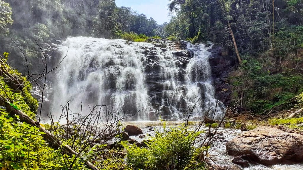
Abbi falls is one of the most popular landmarks in Kodagu, located in ‘Kalakeri Nidugane village’ on the outskirts of Madikeri. This is where the Lostlander was stung by the travel bug, much before she was born! History speaks about Columbus and Vasco-da-Gama, but the lostlander grew up listening to the stories of her grandfather’s adventures of discovering Abbi falls. Those are the very stories that sowed the seeds of seeking adventure and finding her own life path for the Lostlander.
The memories associated with Abbi falls is an endless list, so this post is going to be a photo tour with some old photos of the Lostlander with her grandfather at Abbi falls estate.
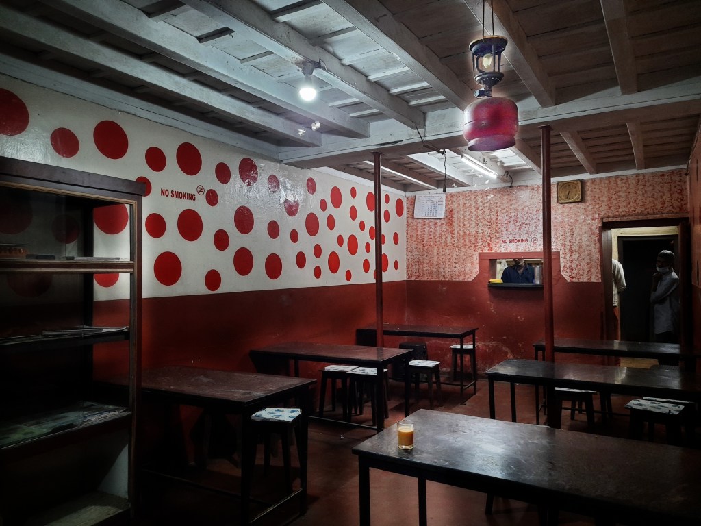
Abbi falls, Madikeri
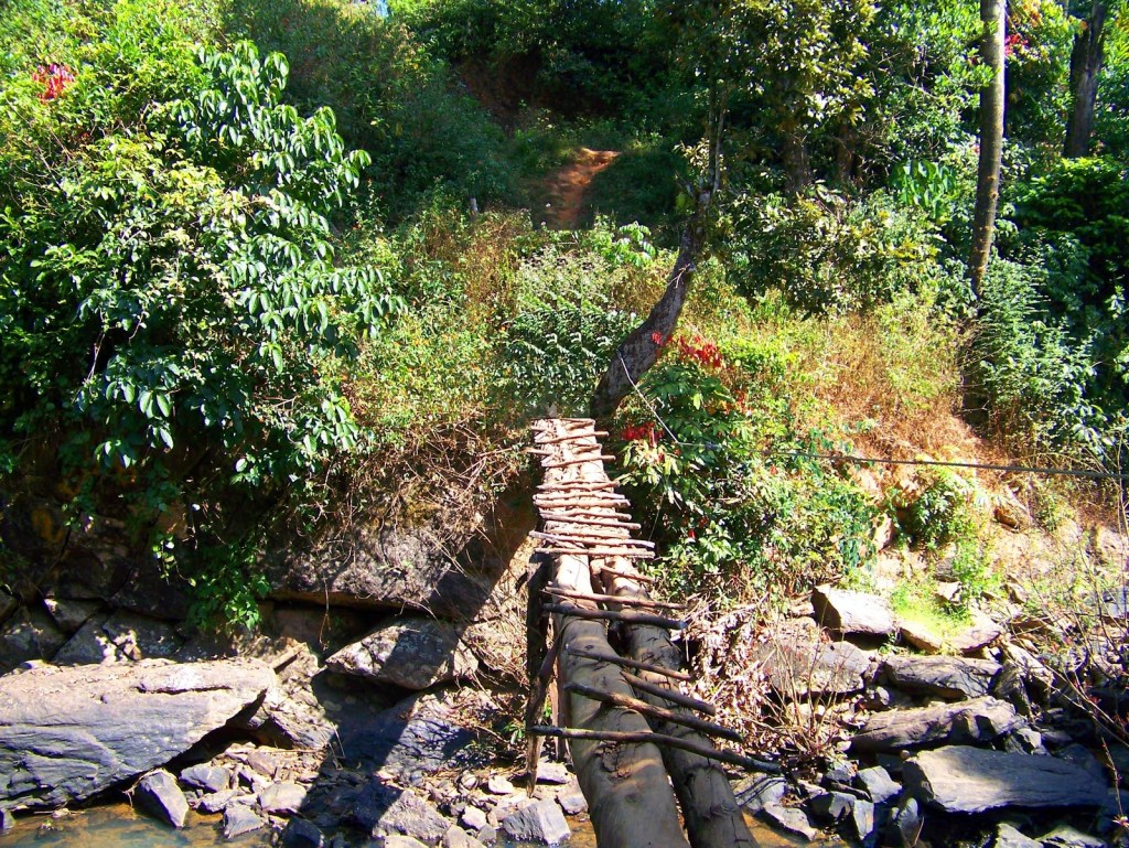
This is a brook built by my grandfather to provide accessibility to the surrounding villagers to get across the river, on the upstream of Abbi waterfalls during the monsoons. It has been replaced by a concrete bridge only in yr.2021, several decades after it was originally requested for. (Click here to read further)
The wooden bridge, upstream at Abbi falls
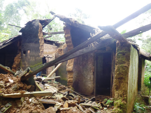
Only memories remain of a house that once served as the heart of the family’s life. (Click here to read further)
The Abbi Villa- Now
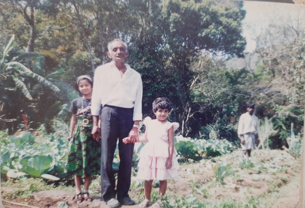
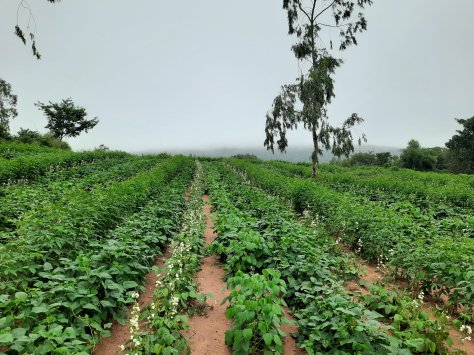
In this photo, the lost lander is lost in the vegetable garden, set in the middle of the coffee plantations, overlooked by the beautiful hills of the Pushpagiri ranges. Gravity fed sprinkler jets sprayed water from the stream that was fed by the larger waterfall. (Click here to read further about the LostLander’s love for honeybees).
The author with her grandfather (center) and cousin in the vegetable garden at Abbi falls
I wish to compile a book someday, comprising of all these stories from the life of “My grandfather”. Do share in all your thoughts and any personal stories associated with this place that I will be glad to add them in my book with due credits.
Sadashivanagar is a locality in North Bengaluru, widely comprising of the upper and the lower orchards. For those unfamiliar with Bangalore’s demography, Sadashivanagar is rather known as a VIP and VVIP haven and a high security residential area. For the non-VIPs living around here for too long, the periphery extends beyond. It covers Vyalikaval, Malleswaram, RMV extension and Yeswantapur. Having spent a significant number of years and the most youthful days of my life here in the early 2000s, a large part of my heart belongs to Sadashivanagar. Here are some of the best memories from the years spent here.
Sankey tank, in Sadashivanagar
Having lived at a proximity to Sankey tank, it was my ‘go-to’ place for all the years that I lived in North Bengaluru. You can say, ‘Sankey tank was to me as Chamundi Betta is to a Mysorean’. I would go there when I was sad, when I was happy and when I felt nothing. I went there every day! Simply walking there and watching the ducks and the several fish-consuming birds that nested in the middle of this waterbody rejuvenated my senses. However, I hated the months that followed the festival of Ganesh Chaturthi when large number of Bangalore’s population came here for the immersion of the idol and the water would smell bad for several more months until the concerned authorities cleaned it.
The garden around Sri Ramana Maharshi’s meditation center and Kempegowda tower at Mekhri circle, the single screen cinema at Cauvery theater, late night ice-creams at Baskin Robbins were some of my favorite peace places around this locality.
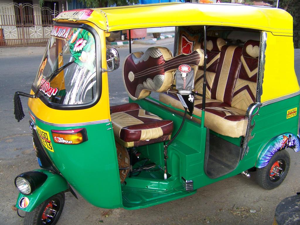
A decked-up autorickshaw at Sadashivanagar
Again, proximity to Mekhri circle and Palace grounds added another dimension to my interests- Music! Back in those days, Palace grounds was synonymous with hosting the BIG concerts of Bengaluru. Iron Maiden, Aerosmith, Megadeth, Metallica, Bryan Adams, Deep Purple ’em all… If you hear me having a flair for the western music, along while I’m humming the songs of Sonu Nigam, Sunidhi Chauhan and several other traditional musicians, Sadashivanagar is probably the place that has influenced me! Even on days that I couldn’t make it to the concert arena, the blaring sound would rock the glasses and doors of our house wanting me to be a part of the cheering crowd!
‘Ontiangadi’ literally translates to The Only Shop’ in Kannada, and it is the name of a village in South Kodagu, where my paternal lineage hails from. Now, this village has grown beyond just one shop, into a tiny township.
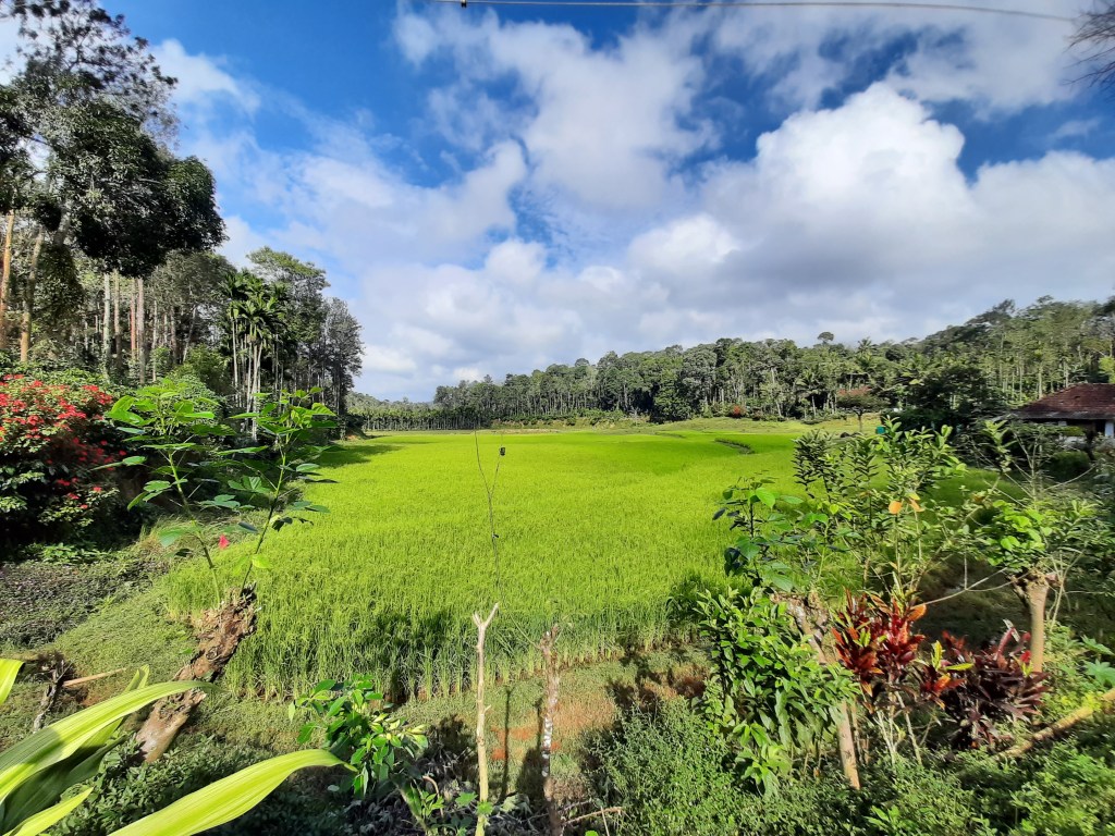
As a child, I would come here on those weekends, when my parents came down from Bangalore. But whenever I came here, there has always been a calm of a different kind. There are two ancestral houses located within the large premises: one nearly 200 years old which is now used as a warehouse and the other, around 50+ years old that is currently being resided at by our family. The latter is surrounded with coffee plants, paddy fields, overflowing ponds and streams, an open well at a walkable distance to fetch potable water. This place has always seemed magical to me, then and now!
View of the farm from our ancestral home in Kodagu
While the green paddy fields have been a treat to the eyes, the offseason is when I have lived some of my best holidays. The paddy field would turn into a playground when my cousins, other kids from the village and their cousins, would all congregate here for a game or two of football. Not with a foot-BALL, but with hollow balls of pomelo skin (grapefruit).
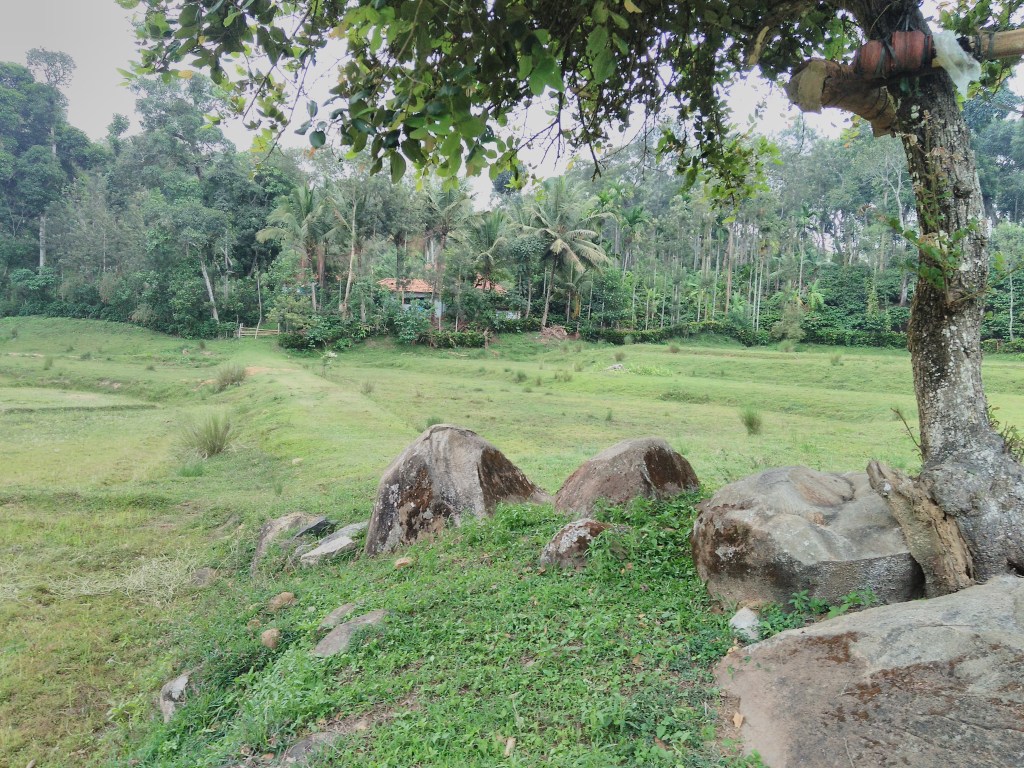
And then, came the first monsoons: we ran to the large wild-mango tree and fought a mango war. Who won or lost the battle would be decided by how much mango juice we were soaked in and who got the maximum scolding from our elders!
The farm and the mango tree, on the drier days in Ontiangadi
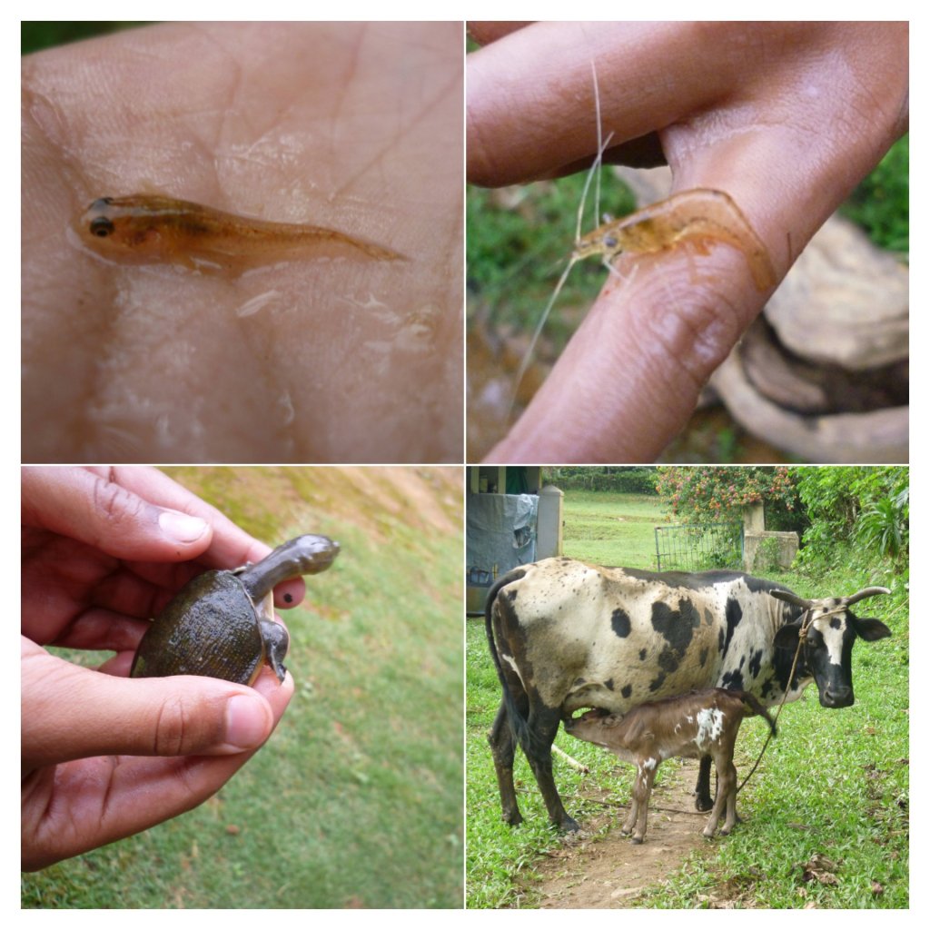
Wait for a few more days to pass by and the monsoon will peak. Then, the streams would overflow and bring that time of the year for our prized catches: Laying bamboo traps to collect fresh water eels and Koile meen (a local fish in Kodagu), fishing out mud-crabs from crevices along the downstream were normal. On (un)Lucky days, one or two smushy crabs would turn out to be snakes after being grabbed out 😀
Once, the workers had brought home several soft shelled turtles which they had found while working in the paddy field. It was timed well with my then recent experience of volunteering for a sea turtle conservation project in Chennai. With all excitement and inspiration, I had written to so many organizations about my new discovery in the western Ghats 😀 Aaah, what memories!
Clockwise from top left: 1. Koile meen, 2. Freshwater shrimp, 3. Cattle, 4. A soft shelled turtle
Apart from this, the ‘Subramanya temple’ at Byrambada and the ‘Palli Swamy Dargah’ (Pulkimaad dargah) have been important landmarks in and closer to Ontiangadi. A nice warm day even now, is often concluded with a hot plate of palam pori and a cup of kattan chai from ‘Ganesh hotel’ at Ontiangadi.
‘Ganesh hotel’ at Ontiangadi, Kodagu
I borrow my surname from this village and so, definitely a part of me belongs here 😀
The original plan for this short family outing was to make an early morning visit to Sanjeevaraya Swamy temple in Channapatna Taluk of Ramanagara district and return. But, since my workplace is located along the same route, I expressed my disinterest in traveling that way. I pitched in the idea to have a change of route at least for one-way. Hence, I added a couple of other landmarks, picked up an offbeat village road and created a circuit with aid from google maps.
For those of you who are not familiar with the geography of Karnataka, Ramanagara is popularly known for its Sholay hills that was featured as the village- ‘Ramgarh’ in the Bollywood movie Sholay. Channapatna is popular for its cottage industries of wooden toys. I am not going to write about any of these places, the search engines are already flooded enough! I am going to take you around some lesser known places in Channapatna, for a half a day’s trip from Bengaluru.
We set out on a Saturday morning and decided to have our breakfast on the way. Sri.Renukamba tatte idly (translates to ‘Plate idli’ in Kannada) needs no introduction for the Bengalureans. So, after a filling plate of tatte idly at Bidadi, we proceeded towards our intended destination for the day. To reach there, we had to pass through Kengal, a village popular for yet another Hanuman temple. Moving ahead from there along a small deviation, we arrived at our first major destination: Sanjeevaraya Swamy temple at Devarahosahalli village. This is a small stone structure dedicated to Lord Hanuman and dates back to the Vijayanagar era. The deity is believed to be powerful and hence, we were there to offer or prayers following the recommendations of some well-wishers.
After spending some time there, we continued onward to our next destination, a little cave temple located atop of a hill. The drive, the scenery, the canopy of the majestic trees along the highway was a pleasant one. We stopped by to do some bird watching at the Neelasandra lake as well. We could see Pelicans flocking in large numbers.
Our next major stop came as a rather surprise to us. Gavi Ranganatha Swamy temple was a random destination included in our day based on an internet search result. The drive, the location of the temple, the valley, the village view from the temple porch and the overall scenery was just so stunning and unexpected. There was just no one else in the temple apart from our family and a few local kids playing in the hill, atop which this temple is located. You can watch the video of our visit to Gavi Ranganatha Swamy temple below:
Drive to Gavirangana betta
By this time, the sun was already up and beaming bright. So, we decided to drive back, of course through a different route. We descended the Gavi Ranganatha Swamy hill and took the route that connected to Kanakapura. On the way, we stopped at this beautiful location where the highway passes through green farms on one side, a large lake on the other side and the entire scenery was being overlooked by the temple hill.
Vittalenahalli highway and lake
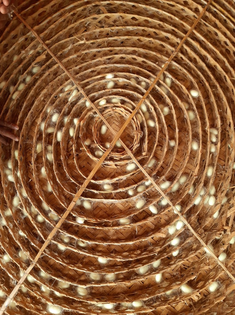
Our drive from there continued through large stretches of rocky hillocks, mango orchards, paddy fields, coconut groves and mulberry farms. Ramanagara is also known for sericulture. Several households in the villages here are involved in silkworm rearing. As we passed through, we noticed that families were sitting out in the verandahs of their traditional houses and collecting the fully grown cocoons from the bamboo trays. We stopped by and walked over to one of the houses on our way and learnt a thing or two about sericulture from them.
Silk Cocoon trays
In a short while, we reached the Kanakapura main road where we had our lunch. Well, it was a late evening lunch before continuing towards home and thus ending a quick trip to the Bengaluru outskirts.
If you are someone who has been following my blogs for some time now, you would know that most of our family trips are on weekends and to random destinations located around the Bangalore outskirts. We leave home with random reasons to drive out and then pick up equally random roads and follow-it till the road reaches a dead-end. We have thus far explored several villages like this. This weekend too was a similar one. And the reason to drive out, you may be curious to know, right?
My dad had long heard of a pig farm located somewhere around Kanakapura road. We had first stopped for lunch at a hotel on Kanakapura road. There, my dad enquired with the hotelier if they knew of any pig-farm around. They informed us that the kitchen waste from their hotel too was collected by someone who runs a pig farm but was unsure of its location. He gave us the possible location of the place with rough directions. After lunch, we headed out in that direction, a deviation before Kaggalipura.
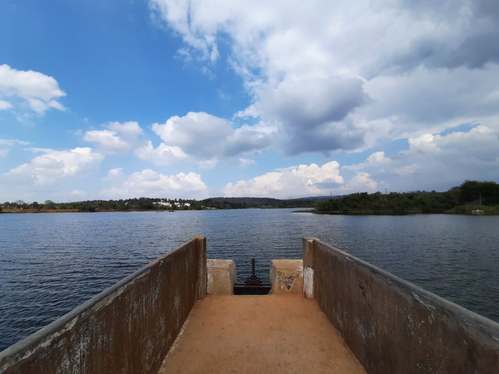
Our drive to Gulakamale lake
With just the deviation, there was a sudden and a contrasting change in the scenery to drive through as compared to the super congested Kanakapura highway. For a moment I felt as if I were driving through some remote lanes of Coastal Karnataka or the Malnad region. There were stretches of areca and banana plantations on either side creating abundant greenery and change in the ambience. Since there were barely any people on the road, we continued to drive till we found some village ahead. By this time, we had covered a good distance and passed through several types of fruit and vegetable farms.
After reaching the village, we stopped by to enquire a villager on the roadside about the farm, he guided us to a pig-farm located next to his farm. But after reaching there, we realized that it was a different one that my dad had heard of and we had no entry into the place where we had now reached. So, we continued our drive further and reached a junction where we had to pick a direction to turn, the left or the right. Instead, we chose to stop the car in a side and walk up a large wall in front of us that looked like a high-rise wall of a reservoir or something. Indeed, it was a lake up there and surrounded by farms and distant hills of Bannerghatta on the other side. A flock of migratory birds too seemed to be resting in a small islet in the middle of the lake. I checked the location on google maps and I learnt that the place was called as ‘Gulakamale lake’.
Gulakamale lake
The water looked so good and we sat there for some time, enjoying the cool breeze even on a hot and humid afternoon. It was just my family in the entire place until we noticed some local kids who arrived there. They removed their clothes and jumped into the lake one after the other, enjoying their fair share of fun time. They took all of us back to our childhood days and it was a pleasure to watch them enjoy it that way.
After a while, we decided to move further on the road. This time, we chose to take the road to our left and continued at it. We passed through millet farms, taking a round about of the same lake, papaya farms and other vegetable farms before arriving at a village called ‘Nallakkanadoddi’. It was a small settlement with nothing noteworthy to see or do. Hence, we went ahead as we saw that the road was newly laid and in good condition.
The road reached a dead-end and that was the parking lot of ‘Tottikallu falls’ commonly known as TK falls among the urban crowd of Bangalore. This was the second time for me that I had reached the entrance of TK falls, both times an unplanned drive had taken me there. Again, I decided not to go there on both occassions given the large crowd that had come down over the weekend. More so, given the Covid-19 situation and the crazy crowd this time, we didn’t even dare to step out of our car. So, TK falls has to wait until next time. From here, we decided to head back home and not stop anywhere on the way. Thanks to the weekend rush on Kanakapura road, we would need good number of hours to make our way back through the traffic.
The standard itinerary with PTU: Day 1: Depart from Bangalore (Leave HSR layout) by 08.00.p.m. Day 2: Reach homestay by 06.00.a.m., freshen up and start the hike by 09.00.a.m.; Return to the homestay by evening Day 3: Visit Nagara fort enroute home, reach Bengaluru by evening.
The story of my weekend: A total of 16 people including two trek leaders were supposed to board the bus at various pickup points across Bangalore. While HSR layout was the first pickup point, the last and the biggest bunch of people were supposed to board at Mekhri circle. When the driver cranked the engine to leave HSR, the last member boarding the bus noticed that a rear tyre had a flat. So, it needed to be changed and the punctured tyre required to be fixed before proceeding for the long journey. After about an hour, the stepney was replaced and the bus arrived at the second stop.
People boarded and the Bus… did not start. This time, the battery had drained, completely! A mechanic arrived in a while and told that it could not be topped up and needed a replacement. Well, it was another good couple of hours until the bus finally left…. With an assurance from the ‘travels company’ assuring that there won’t be any more breakdowns.
Meanwhile, I had taken an autorickshaw to reach Mekhri circle to hold up all the people who had arrived there. The co-leader managed the people who had already boarded the PTU bus. Most of them being first timers on their solo travel, their growing anxiety with the extending delay in the tour was quite a challenge to clarify all their doubts and questions. It was 00.30.a.m. by the time the bus finally arrived at Mekhri circle instead of the scheduled 09.30.p.m. We quickly wrapped up the initial welcome and introduction that usually takes a while on normal trips. Everyone needed some sleep before climbing up the Kodachadri trail.
It was approximately 01.30~02.00. a.m. and the bus had reached somewhere around Sira town. Then suddenly, everyone in the bus woke up for a LOUUUD thud noise. The driver stopped the bus. I walked to his cabin and got down with the driver with a torch light to check what the issue was. The driver found a broken bolt under the bus, near the engine room. The radiator had started to leak profusely, and the engine belt had ripped off. The driver informed me that there was no way that the bus could move. Trying to find a mechanic in the middle of the night would only be futile. The options we had was to find one back in Nelamangala (this would take a good few hours) or wait in the bus until morning, find a mechanic in Sira, find spares, get the bus fixed and then proceed. Proceed further to Kodachadri or return to Bangalore. In either case, Saturday would be gone. We pushed the bus to the side of the highway and decided to take time to figure out the next POA (Plan of Action).
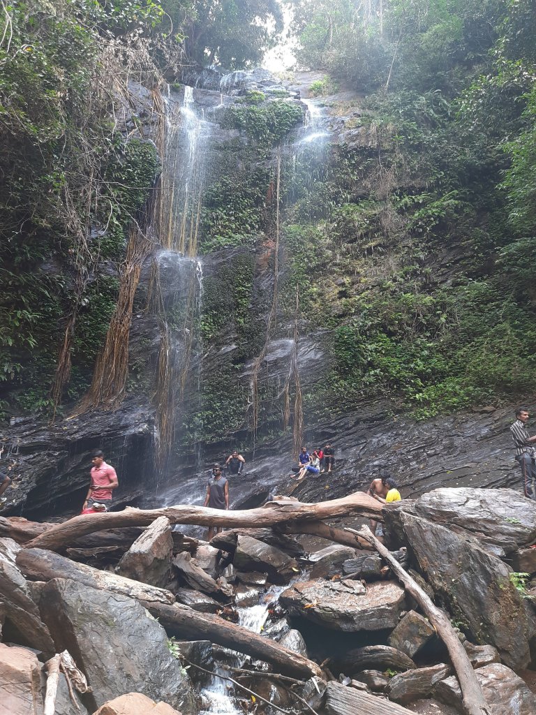
Hidlumane falls
I called up the PTU organizers and informed them of the situation. We were fortunate to find a chaiwala (petty Angadi), the ONLY place with light and people movement in the drop-dead night. The people in the bus got down and occupied themselves with their dose of mid-night chai and smokes until we figured out an alternative. None of them would settle for a full refund and wanted PTU to ensure that they got what they had signed up for.
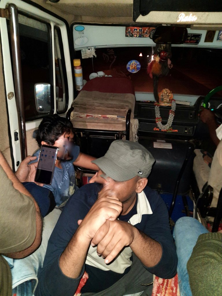
It was a weekend. It wasn’t going to be easy to find an alternate bus or a TT (Tempo Traveler). While my co-lead was waving at every other bus that came on the highway (both KSRTC and private buses) to check if there were empty seats, I was calling up every random travel company listed on google and checking for availability of buses. Either they were all booked for the weekend or people would just abuse me for waking them up in the middle of the night and hang up. To add to it, I was the ONLY person in the entire bus who could speak Kannada. So yeah, I literally had to manage the show and all the translations, communications and co-ordinations. Finally, one KSRTC bus stopped! They had sufficient seats to accommodate all of us as well. But we had a new challenge. The travellers with us had ganged up and would not agree to board a red bus (Karnataka Sarige bus). All requests to convince seemed futile and we let go off the KSRTC bus. After a total of about an hour, the chaiwala managed to find us a localite who had agreed to come with us for a per kilometer charge that was double the normal price. PTU organizers agreed. The TT arrived. Next challenge? It was a 12-seater TT, we were 16 in total. We, the leaders convinced ourselves to sit on the floor of the ramp between the two rows of seats and another 2 travelers volunteered to fill the already crammed space. Ensuring that everyone else got a comfortable space, the journey continued. Fortunately, we had no more surprises and we reached the homestay by 09.30.a.m.
That’s how we rolled, in our TT (Faces intentionally blurred)
We took time to freshen up, have breakfast, get the forest permits for the trek and finally started our ascend by 11.00.a.m. All went fine, by god’s grace. This was my first PROPER trek in Kodachadri, the previous one was another adventure worth a read. We climbed up the Hidlumane waterfall, arrived at a local house enroute to have a surprise Majjige (buttermilk) stop, crossed paddy fields, areca and banana plantations, Mookambika temple and finally arrived at the peak marked by the Shankaracharya Mantapa. The landscape and the entire path were unrecognizable for me from what I had seen on my previous visit. It was now exploited and overdone by tourists. There were a few hikers who felt exhausted and wanted to give-up halfway. But as a trek leader, it was my personal obligation to ensure that EVERYONE completed what they had signed up for and no one stayed back without some safe company. Finally, everyone made it to the peak, and it was now mission accomplished. Well, only partially!
The real deal was in the descend. We had a 4×4 ride awaiting us for our return. It is one that is BEYOND explanation and you only hold on to the roof bars hoping that you don’t have a few broken bones or dislocated joints by the time it ends. There is NO road, only a slide down a ditchy/bumpy gradient path. This 4×4 jeep ride alone supports the livelihood of several people around the area. Hence, the localites aren’t letting a road happen even if the government wants to develop this important site of tourism (we were told so by one of them). So, if this ride is considered as an adventure and a source of employment, then you can imagine how memorable this experience must be, right?
The view after reaching the keep trail
Well, in spite of all the delays and breakdowns, it gave me a sense of achievement by the end of the day for having met the itinerary. Though we paid late exit fine at the gates, this was a PTU experience in its true sense. More adventures to come, until then- Keep tripping…. Plan the Unplanned!
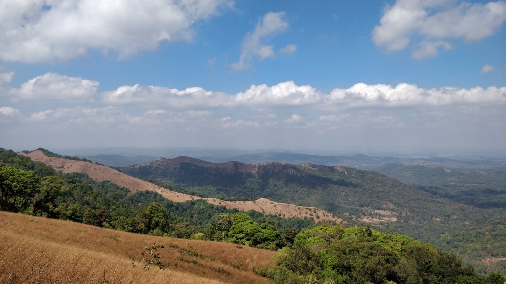
With a closed group of family and friends, about 10 of us planned this weekend trek to this lesser known hill, a little away from Bangalore. We started from Bangalore at 05.00.a.m. with an intention to finish the hike back down before the sun goes up. It was dawn by the time we drove towards Kanakapura and reached a village called Kanchanahalli, in Malavalli Taluk of Ramanagara district. The Kaccha road thereafter till the base of the hike, passes through fine landscape and traditional village of ‘Mysore Karnataka’ region. The hill is a part of the ‘Kabbala Forest reserve’ area. The early morning rays added extra charm to the cloud kissed peak of the ‘BheemanaKindi hill’ at the distant end and the fog covered coconut groves and vibrant green farms on either side of the road. What else? Picture this: A dozen peacocks dancing in the middle of the road! Well, a pleasant welcome; I must say 😊
The Drive and trek to Bheemanakindi
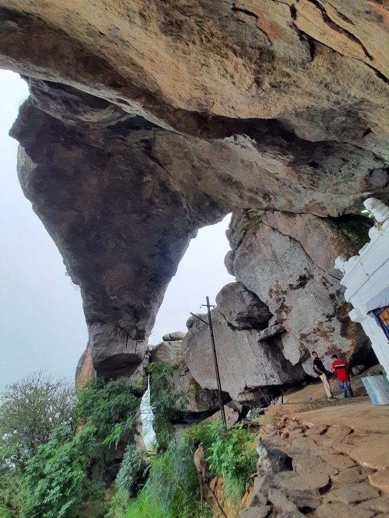
We finally arrived at the base of the hill, parked our cars and started the ascend. It starts at a small godown sort of a structure from where, is a well laid out stone path through the forest, right till the destination. Well, let me clarify that unlike most of the common treks around the city that promise you a breathtaking view after a good climb, this one has a MASSIVE stone arch at the end. With this large arch, goes the legend from Ramayana. ‘Bheema’ hit the large rocky monolith with his ‘Gadhe’ and thus resulted this Natural arch, locally called as ‘Kindi’. The smaller pieces scattered are believed to be the ones which appear to have been arranged one on-top-of the other in the adjoining smaller hillocks by the consecutive civilizations, over a period of time.
The difficulty level of the climb is moderate, but the gradient is steep. Since I hadn’t eaten anything since the previous afternoon, acidity was taking a toll on me. I was feeling nauseous and tired and trailing everyone on this trek. (That’s also the reason I didn’t take many photos of our ascent and the video attached below includes more visuals from the descent). I somehow made it to the top, all worthwhile the effort. A small temple dedicated to Nandi sits in a corner underneath the massive rock arch overlooking the dense forest cover below. Apart from a few squawking peacocks and chirping birds, we thought we were the earliest mammals to arrive there. But not until we saw some freshly laid elephant poop at the peak…!
A portion of the Stone arch and temple at Bheemanakindi
I had some biscuits and relaxed there for a bit until I felt fine. From a few known localites, we had heard that there exists a perennial pond somewhere close by. We walked behind the boulders that overlooks the millet farms beneath. We climbed up the hill further and we ventured out in pursuit of the pond. Mind you, the trek path ends at the temple and we were venturing out beyond, into the forest (Do not try this adventure). The sloppy path didn’t have a proper trail and we followed each other and stayed together so that we wouldn’t get lost. We walked further, a few broken trees (Bamboo, Indian Gooseberry, hog-plums etc.) perhaps warned us from going further, the pachyderms had just crossed the path. From there, we arrived at a small opening in the green cover- a large boulder. As the mist had engulfed the entire view, we sat there for a while hoping for it to clear out and get some good view of the valley below. But no luck and we decided to walk back.
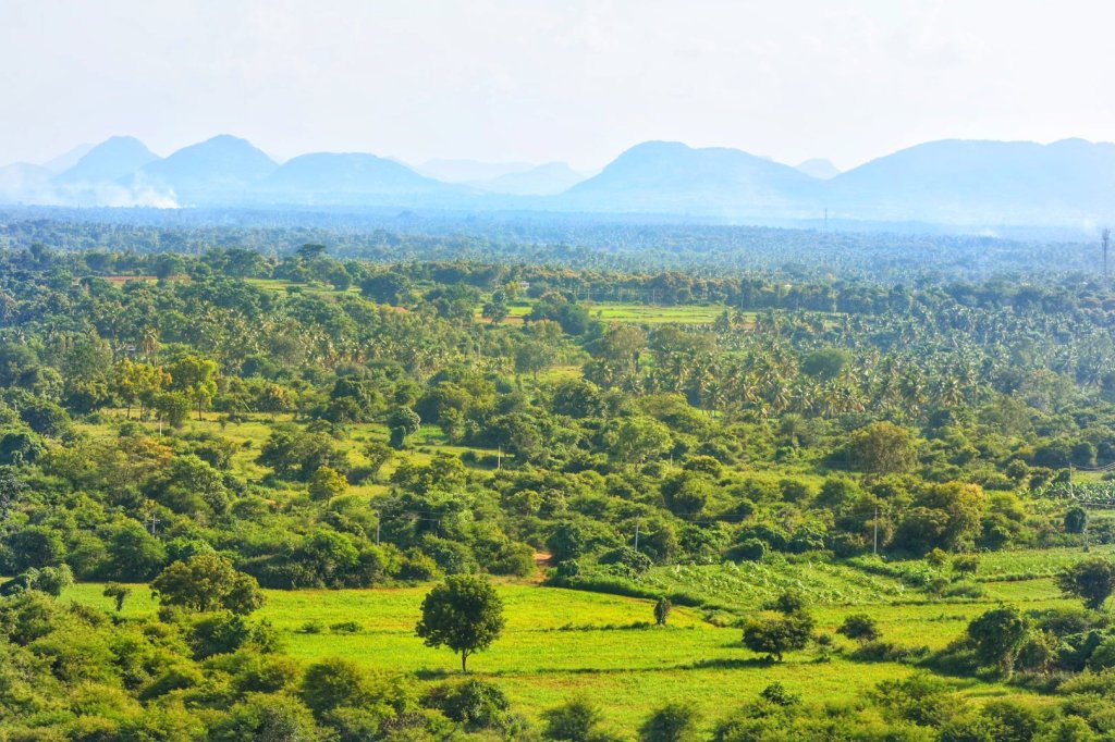
Our stomachs were grumbling for food by the time we reached back to the base by 10.00.a.m. One of the members in our group had a relative in Kanchanahalli and hence, we were invited for brunch at their house. We drove to their house, passing through my FAVOURITE views of Karnataka: The rural hamlets of ‘Mysore Karnataka’ region. Traditional houses with wide porticos on raised platforms, red-oxide floors, clay tiled roofs supported by wooden pillars are a delight, I tell you!! Sometimes, cattle sheds on one side and a bicycle on the porch too is a common sight, so very typical to this region and so warm and old world. I have always gaped at those tiny streets in awe. So, today was my first opportunity to see the interiors of one such house, all that I had only seen in Kannada movies till date. Picture this: they are locally called ‘Thotti mane’ and the central living room has a central area which opens to the sky. Talk about natural ventilation and lighting, it has been part of our ancestral architecture from time immemorial. It also serves as an area to wash our feet and hands when we enter home, before we touch anything else. (Connect it with self-sanitizing during Covid times, after you come home from outside??)
A street at Kanchanahalli, overlooking the Bheemanakindi hill
Well, a pleasant happy day for me and a nice, happy, simple, warm meal for the tummy 😊 We head back to the city…. Hoping for another warm weekend to arrive soon….
This post is of my family’s random “target destination-less” drive during the Covid unlock period. We set out in three different directions on three separate weekends but reached a place from where we got the view of the same hill, every time. By the shape of the solo hill, we would know that it was the ‘Ragihalli Betta’, located on the fringes of Bannerghatta National park. So, here are the details.
Direction 1: Kanakapura road; Destination explored: Gullahatti Kaval; View: Ragihalli Betta The aimless drive culminated at a beautiful spot at the backwaters of the Muninagara reservoir in a village called as Gullahatti Kaval (Click here to read the detailed post). The route was mainly through millet and Banana farms dotted by small hamlets.
The road leading to Yogavana Betta, from Kanakapura road
Direction 2: Bannerghatta road; Destination explored: Koratagere Doddi; View: Ragihalli Betta An offroading drive through Ragihalli state forest, stream crossing, forest trail and then culminating at a viewpoint- was a very welcome drive (Click here to read the detailed post).
View from Yogavana Betta
Direction 3: Mysore road; Destination explored: Yogavana Betta; View: Ragihalli Betta After passing through small hamlets, an art school and a road with a foresty canopy leading to an ashram called as ‘Yogavana Betta’. We skipped the ashram visit and walked up the hill and climbed up a meditation hall, apparently called ‘Anubhav Mantapa’ to get a 360deg view of the surrounding. One of the views from atop was the Ragihalli Betta. Apart from a casual walk in the green neighborhood, there was nothing specific to do here. But it is a DEFINITE recommendation for those seeking a good ‘Sunset View’ point. Watch the below video of this place and the view surrounding this place.
This is yet another of my family’s random drive day, thanks to Corona unlock weekends… This time, our random pick was in the direction of Bannerghatta forest. We drove past Jigani marble market towards Ragihalli state forest. We drove around randomly and stopped wherever we thought we had a good vantage point. The place being around the fringes of a national park and in the fertile stretch of countryside, there was lots and lots of greenery all along. We stopped by at the IIM-B new campus plot near Mahanthalingapura from where we got a distant view of the ‘Ragihalli Betta’. (Remember our drive to Gullahatti Kaval? We had the view of the hill from a different direction- Click here to read the complete article) The cloudy and cool weather here made everything perfectly amazing, with a great combination of bright green and dull grey. With permission of a millet farm owner present there, we sat in his farm overlooking the green valley for a while, with some packed food and water.
After resuming our drive and on recommendation of a friend, we deviated from the main road leading to the Ragihalli state forest. It was quite an offbeat surprise for our ageing hatchback, but he performed smoothly compared to any youthful 4×4 SUV. A random deviation got our hatchback into an overflowing stream (with water level almost up to the doors). We didn’t know the way ahead, but our driver(my brother) didn’t switch off in the middle of the stream. Another car in the opposite direction directed us to the correct road from where, it was an unpaved gravel laid forest path for a few more kilometers, before passing through a couple of laidback villages. After the tree laden trail was over, small rocky hillocks appeared to our left and a vast stretch of farmland flanked the valley to our right. Apart from a few villagers transporting their goods on two wheelers, we were the only people in this stretch for most distance. We continued an uphill drive until there appeared a junction with a temple at the top. Watch the video of our drive below:
The drive to Koratagere Doddi
A milestone at the junction read that it was ‘Koratagere Doddi’. Thanks to the lockdown and social distancing norms, it had been several months since I had been to a temple and I was excited at the sight of it. From the architecture of it, the structure seemed to be a Sun temple. But google says it is a ‘Paanchala Kshetra’ that was closed at that time. However, the place seemed to be beautiful and we decided to park our car and take a stroll. We walked a few yards to our right and believe me when I say, it looked BEAUTIFUL! We were at a flat rocky tabletop cliff from where we could see a good stretch of the city outskirts. We decided to sit there for an hour at least and enjoy the strong breeze that kissed our faces hard. But yeah, the time was cut short by the rain gods who manifested themselves from the distant dark clouds to a sudden pounding of rain.
The misty Ragihalli forest viewed from a farm
We had no choice but run to our car for shelter. But wow, what a wonderful setting it was: Green grass, grey sky, hill on one side, valley on the other and a lonely temple ahead of us. We saw no signs of the rain stopping as we waited in our car and decided to continue our drive, back home but in the direction of the road ahead of us. Thanks to the rain, we did nothing specific to stop-by and take note of. But yeah, the Ragihalli Betta now appeared closer and COMPLETELY mist / cloud laden, a view not everyone gets lucky with.
Overall, a wonderful day out with family to a place where I belong: to Nature 😊
As the lockdown is easing out and the Covid positive cases in India are on a rise, many people are opting DIY (Do it Yourself) day trips and hikes over organized group trips. Either with just family members or a closed knit of friends is what seems to be an option for some time more to come. Quite a few of them have been asking me to give them suggestions of where they can go for short drives or hikes. One such suggestion is ‘Kunti Betta’. Although I had done this hike with an organized itinerary by ‘Plan the Unplanned’, one can try this by themselves. However, a hike in daylight is suggested over our pre-dawn adventure.
We started from Bangalore at midnight as we wanted to reach the peak before sunrise. It was still dark, cold and windy when our minibus reached the parking lot of ‘Sri Shankarananda Bharati Vidyapeeth’ school at Kachenahalli village in Mandya district. We climbed a small flight of stairs, walked past a temple pond (we couldn’t see but only were told by our guide) and continued to walk in a single line following each other’s torchlights. While a couple of them tripped over small stones on their path, a few others got their shoes wet by stepping into water puddles in the dark. With torchlight, our guide navigated the path through thick shrubs, tall grasses and large boulders enroute. We reached the peak in a couple of hours.
The view from the Kunti Betta peak: Before dawn, at dawn break and after sunrise
It was dark when we reached the top and it was unexpectedly cold. I hadn’t gone with enough warmers but that didn’t stop me from sleeping on the cold rock until dawn. I watched the stars in the clear sky and didn’t realise that I had surrendered to the sleep gods. I was awakened by a fellow hiker at dawn. The view of the distant lake and sugarcane farms looked nice from the top. Also, several other rocky hillocks dotted our view. The one we were standing at was named after Kunti, the mother of the Pandavas. History has it that the hill was earlier called as the ‘French Rocks’, named by the French army in the pre-independence era. Although it was partially cloudy by the time the dawn broke, we still got lucky to get a glimpse of the sun that morning. After taking enough photos, we started our descent.
The Kunti Betta hike route
Since there are lot of loose rocks, there were possibilities of slip. Only during descent, we got a sense of the terrain and the view which we had missed while climbing up. We soon reached the temple pond at the base beside which there is a large monolithic rock. The localites use this as a giant slide. I too climbed up this rock and the kid in me had fun sliding down from this version of the desi slide.
The temple pond at the base of Kunti betta
Our stomachs were grumbling by that time and there was no food around. With permission, we could use the washroom at the school. We then commenced our return to Bangalore with a breakfast stop at ‘Maddur Tiffanys’ for their signature dish- Maddur vadas with Masala dosa and filter coffee. The landscape was beautiful with green sugarcane farms extending on both sides of the countryside roads before we hit the highway.
A word of advice though:
Since there are too many hillocks in a cluster, having a guide would be better to find the right peak.
Since we hiked before dawn, there was also the fear of confronting wild animals like bears and leopards. Although, we didn’t see any, this was told by someone in the group.
Although we did only the early morning hike, you can make it a full day activity. These are a few things you can include in your itinerary:
Since Mandya is the ‘Sugar Bowl’ of Karnataka, you can visit any of the small sugar/jaggery making setups on the farms enroute and savor freshly made jaggery.
A lot of people visit the Tonnur lake (about 10kms away) from Kunti Betta and take a dip there. Alternatively, you can visit Manchinabele dam or Kanva reservoir. We skipped it as we were told that the soil on the banks was marshy at the time we visited.
You can visit Ranganathittu Birds sanctuary and take a ferry ride in the river.
You can also visit ‘Janapada Loka’ to get an overview of the folk-culture from across Karnataka.