Tag Archives: travel

Experiencing the warmth of Khasi hospitality in Cherrapunjee

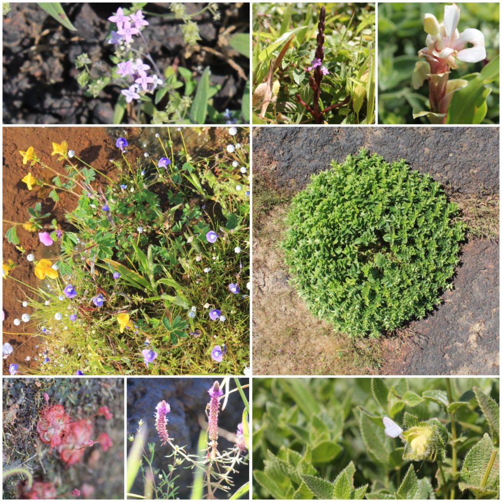
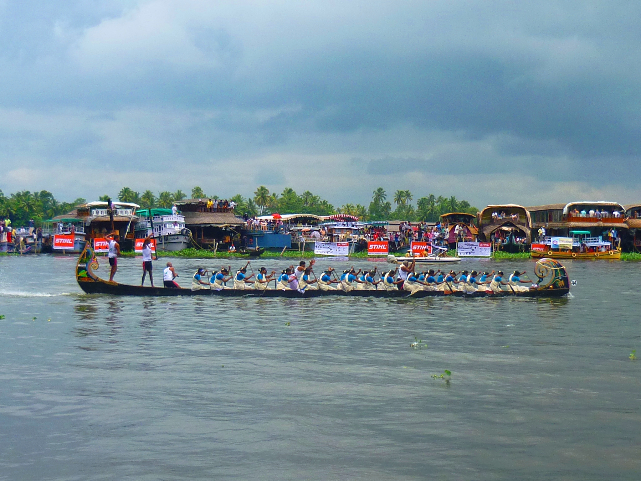
I could not express better than these lines picked up from a website, “If the Raindrops elevate your mood, clouds stir your senses and rainbow brings out childlike pleasure in you, then don’t hold yourself back. We are taking you to the abode of clouds-Meghalaya; where rain weaves a magical spell, spellbinding beauty haunts your senses and you witness nature at its best. Witness the monsoon magic, majestic waterfalls, live root bridges and more…” and one can go to no better place than Sohra fondly called Cherrapunjee to experience all of that Meghalaya has to offer in a small place.

This post is part of my fortnight long road trip across North-east India, specifically covering parts of Meghalaya – Assam – Arunachal Pradesh I had tagged along with two other travelers and drove around the state of Meghalaya in a self-drive car hired at Shillong. The places visited in Meghalaya include Shillong – Smit – Cherrapunjee – Mawlynnong – Dawki – Ribhoi- Shillong.

Our Itinerary:

Day 1: Arrive from Shillong / Smit; Wahkabah waterfall, Arwah or Lumshynna caves, Nohkalikai waterfalls, seven sister / Nongsthiang falls (Night’s stay at a local homestay)
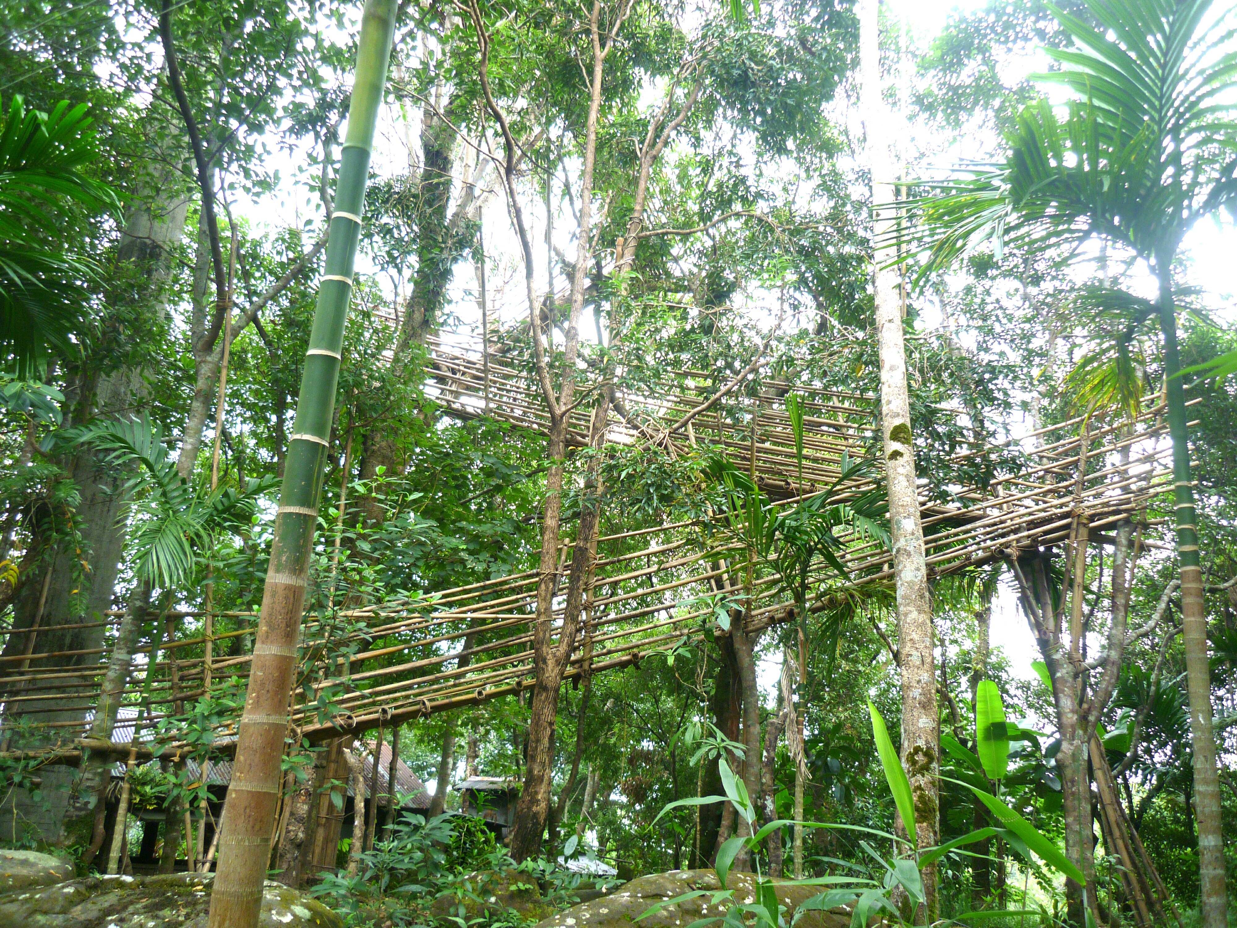
Day 2: Tyrna village, Nongriat trek (Double decker rootbridge & Rainbow falls), Mawsmai cave/Krem Phyllut, Ummunoi root bridge at Laitkynsew village (Night camping at Nohkalikai)
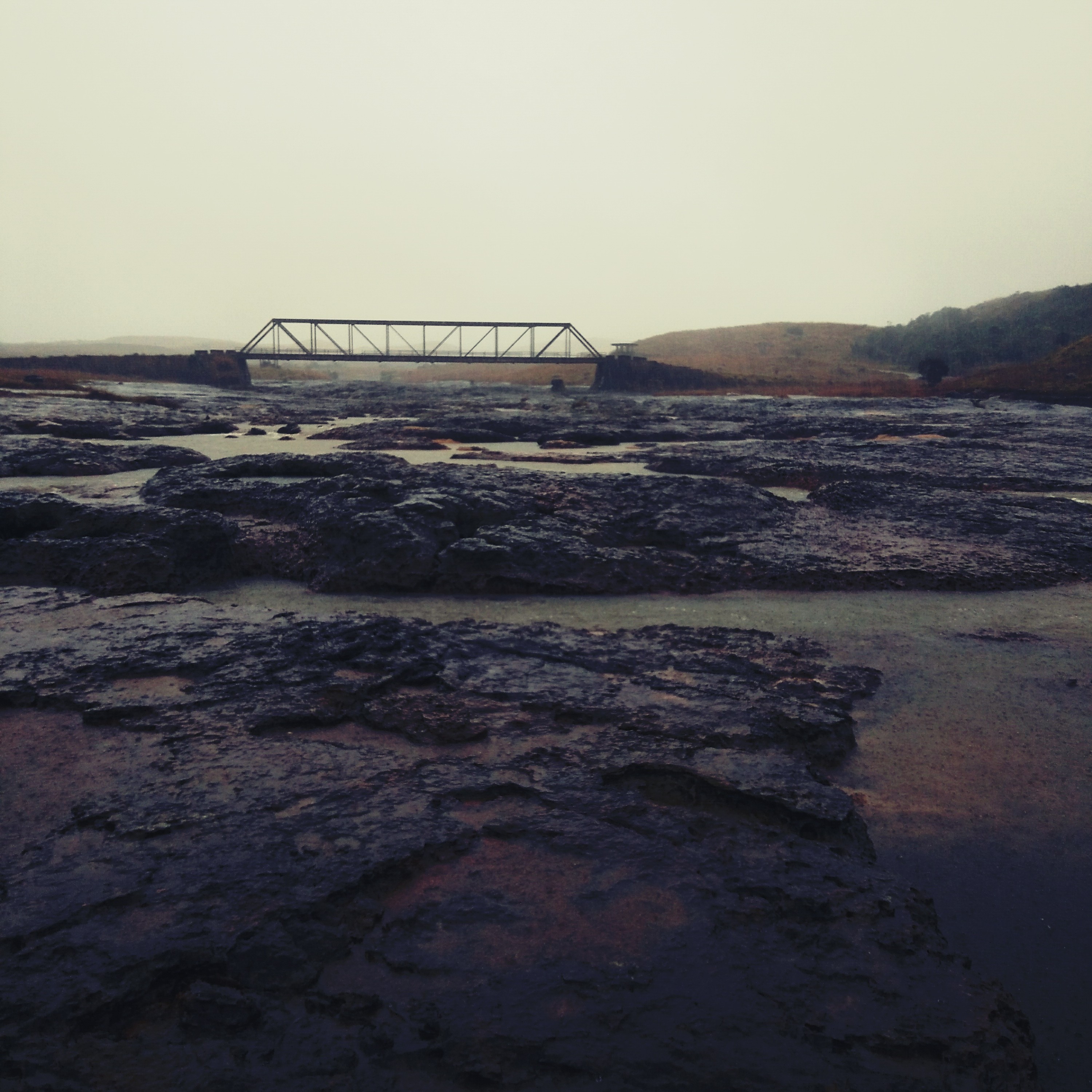
Day 3: Dianthlen waterfall trek, Sohra market, Ramakrishna mission, Mawkdok valley, Thangkharang park, Moktrop rock; journey towards Mawlynnong.

The Details:

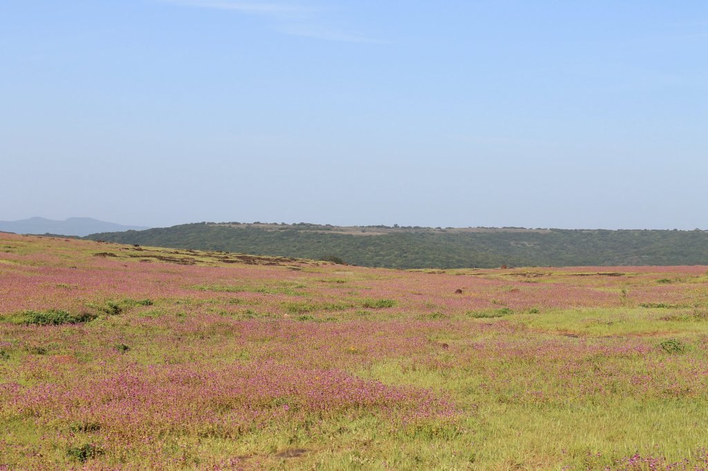
Like most tourists, we started our day early from Shillong via Smit. To differ from the rest, we had a self-drive car at our disposal so that we had the liberty to stop whenever and wherever we wanted. The drive route was mostly untouched and its rustic charm kept us excited all through as this route is less treaden by the tourists. Pine plantations, lesser explored waterfalls nestled away from the main road, well groomed vegetable farms, hay shacks were a common thing for us while we had stopped atleast 100 times for photos.

p1130875
A reservoir enroute to Cherrapunjee

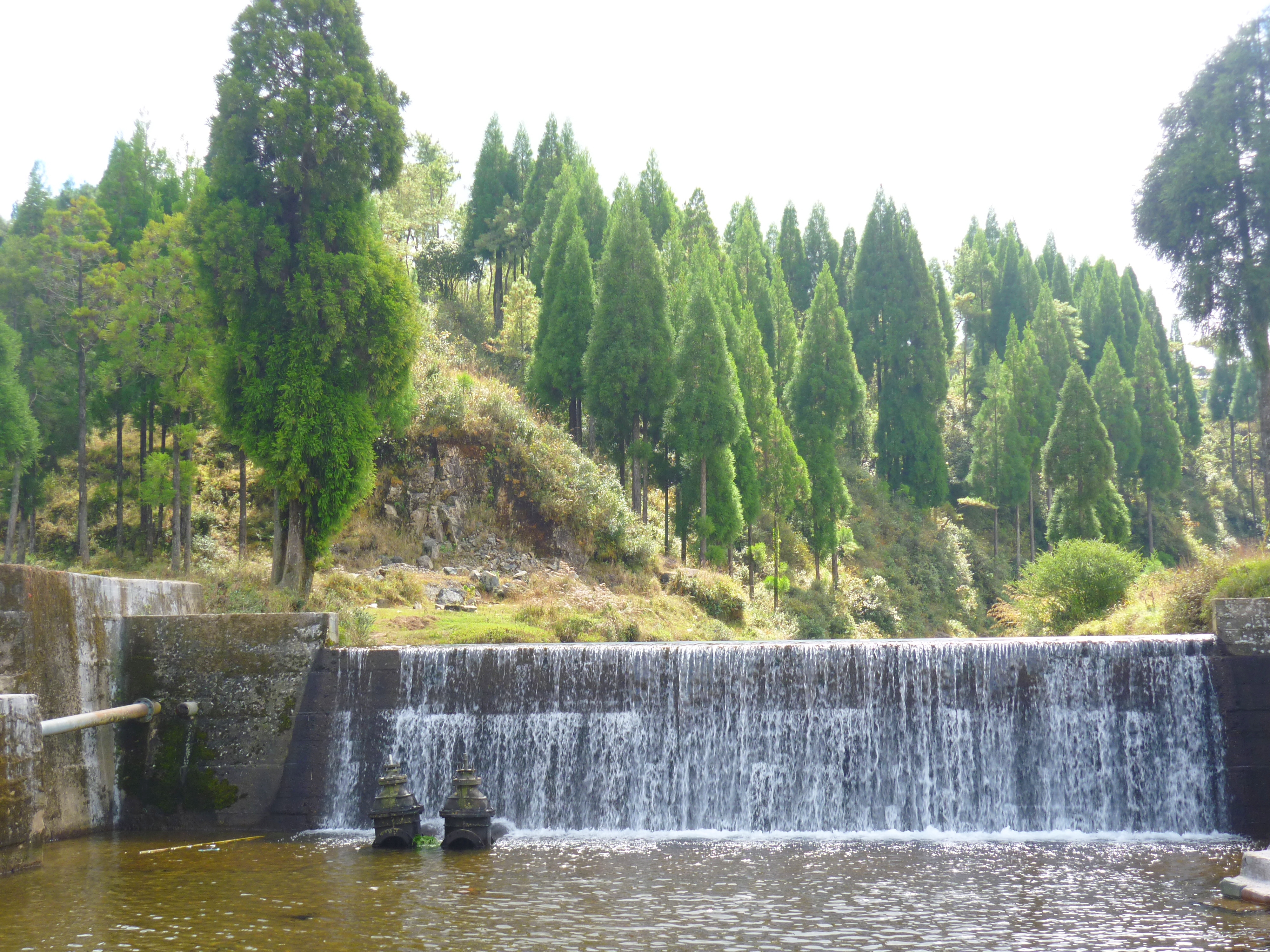
As we approached Sohra, we stopped at several view points, Wahkabah waterfall being one among them. India’s longest cave and the most numbers of limestone caves in one place happens to be in Meghalaya and hence Meghalaya is a haven for cave explorers. Our first stop at Sohra was at the Arwah or Lumshynna caves. Relatively smaller compared to the other caves in the viscinity, but is tucked away in a gorgeous location overlooking the deep valley with the Nongsthiang waterfalls.

After a brief visit, we headed towards our next stop: Plunging down from a height of over 1100 feet, Nohkalikai is the highest waterfall in India. We trekked down the steps and a little beyond into the bushes and enjoyed the rare views of the waterfall away from the reaches of normal tourist. There is an option to camp at the Eco park, over the seven sister / Nongsthiang falls. But we decided against it as the place is filled with backpackers and would’ve been too clumsy for us, we were someone who wanted a peaceful place away from the crowd.

dsc02827
The Nohkalikai falls

Pitching a tent in Sohra requires prior permission from 4 different authorities: the land owner, the Siam of the village, the local government body and the police. In search of a nice place to pitch our tents, we took help of one of a local Khasi friend. With the local connect, our quest to find a piece of land to pitch a tent ended up more like an exploration of Sohra. We could go to some of the untouched places and sunset views that was completely out-of-reach from typical travellers. We were taken to remote places like banks of a small river, a cliff off-a-small hillock, plains overlooking massive gorges, cement factory backyards among other places. With the sun-going down early in this part of the world, we had very little time in hand and insufficient preparation for the night’s camping.

We finally ended up staying with a Khasi family in a local homestay located amid a serene location. The stay however was the highlight of our day: the warm hospitality of the Khasis is something that will never let one regret their choice of stay. Our host at the homestay, accompanied us for dinner and for a drink as we got discussing everything from Khasi culture, ceremonies, politics, sports, tourism et all under the sky, a clear night’s sky. With no pollution in the atmosphere, my friend helped me to identify several constellations from the place that was brilliant for star gazing. It was an unforgettable night for us with the Khasi family.

p1130943
The village settlements around our homestay

Next day, we drove to places around Cherrapunjee including the villages of Tyrna, Nongriat, Mawsmai cave/Krem Phyllut, Laitsynkew to explore the living root bridges which was an activity from dawn to dusk! We got in touch with a local guide ‘Mr.Paradise’, who then arranged for our camping in the Nohkalikai village for the night. It was yet another wonderful night spent with new Khasi friends, as we enjoyed Khasi music, the enriching conversation with Paradise and his friends about the Khasi culture. We gained insights about their customs, religious practices, respect for people, nature’s love among many other things. It was a long night under the starry sky with only my friends, Paradise’s friends, myself and the campfire! Suddenly, while the last bit of the firewood was being lit and just before the night broke into dawn, the skies of Meghalaya had shown their power. It poured cats and dogs for the rest of the night, with thunder storm and lightning. We sheltered ourselves inside our tents while I continued to shiver with cold.

At dawn’s break on the following morning, the skies had seemed to have mellowed down and we stepped out of our tents only to be awed by the beautiful sun rising over India’s highest waterfall! Yeah, Meghalaya has been wonderful to us all this while and this was another new day in this ‘land of clouds’. While we had planned a short trek across the Dianthlen falls, the rain gods continued to lash throughout the day.
Cherrapunjee is the wettest part of the world. So, what’s the whole point if one doesn’t experience the rains here, right? We walked in the places around Dianthlen falls and enjoyed the rains for some wild fun but getting drenched till our bones.

Momentous 100%
One of the suspension bridges on the way to Dianthlen falls

It was already noon and we couldn’t cover the other few places as planned in Cherrapunjee because of the poor visibility due to heavy rains. Anyway, speculating no possibilities for any improvement in the weather conditions, we decided to drive to our next destination- the Jaintia hills district.

Shine 100%
The rain fed roads of Cherrapunjee

While the warmth of the very hospitable Khasis has still left me in awe and amusement, I’d like to end this note here with these lines:

Even then, goodbye dear Cherra, and your rain goodbye.
For my life is yonder, though my love is here.”

-Karavan, Stokholm, Sweden

A walk in God’s own garden- Mawlynnong

“The Soul of India is in its villages”.

-Gandhiji

Sometimes, it is not about the place.. It is about the people that brings you closer.. And that’s precisely my take on this little quaint village called Mawlynnong.. After a refreshing drive through some breathtaking views and best roads of India, we had alighted at ‘God’s Own garden’ nestled deep in the East Khasi hills of Meghalaya. Although it is being largely promoted by the Meghalaya Tourism Department(MTD) as Asia’s cleanest village after being awarded so by the ‘Discover India Magazine’ in 2003, I feel it holds a different charm in it with the warmest people I have met so far!

This post is part of my fortnight long road trip across North-east India, specifically covering parts of Meghalaya – Assam – Arunachal Pradesh I had tagged along with two other travelers and drove around the state of Meghalaya visiting Shillong – Smit – Cherrapunjee – Mawlynnong – Dawki – Ribhoi- Shillong.

Tourists flock to this place in large numbers just because they have heard about it in MTD handouts. These senseless creatures litter the place extensively with chocolate wrappers, chips sachets etc. all strewn around this supposedly cleanest village they have come to see.. But, the humble villagers watch on with a smile and pick up these wastes themselves and put them in the cane trash bins places visibly infront of every household in the village, thus keeping up to its reputation of being clean!

Things to see in Mawlynnong:

• Inside Mawlynnong village: The old church, floating stone, the water shed and the Bangladesh view point.
• 1 kilometer away: Riwai village (Living root-bridge)

The Details:

I walked around the laid back lanes of the village exploring the old church, the floating stone and the water shed maintained by the villagers. The flowers lining the fences of each household added myriad hues to the green village and grey of the cloudy sky.. I climbed up the skywalk laid up with bamboo and cane that threw up a nice view overlooking the plains of Bangladesh.

The Bangladesh view point at Mawlynnong
The Skyview bridge at Mawlynnong

Finally, I settled down at a locally run restaurant for a cup of chai to beat the chills of the cloudy weather. I caught up on a conversation with a pretty Khasi lady draped in her Asiangyake (the traditional dress of the Khasi women also called Dhara). While she helped me to memorise a few words in her dialect, I learnt about the Khasi culture and customs. Being a matrilineal society, women are respected and are given the preference to choose her husband-to-be. It is considered a bad omen, if a man proposes to a woman.

While she was attending to other customers at the restaurant, I called out for ‘Oikong’ (Khasi alternative for addressing ‘Didi’ in other parts of northern India) to help me with some Soh (Khasi for fruit). “Ohhhh” A voice filled with humility came in response… She then sat down with me and prepared a plate of pineapple seasoned with salt and flakes of the ‘Bhut Jholokias’ (the spiciest chilli in the world). It was one of the best snack I had in years!

I then walked down to the playground where some local kids were playing. They seemed excited to meet me, talk in English and pose for a few candid photos. It was a warm and a very pleasant evening for me. There is nothing in particular in this village to see or do.. Yet, the nomad in me strongly intended to stay there for an extra day. There are homestays that are available where the warmth of the Khasi hospitality can be experienced.

Kids playing on the lanes of Mawlynnong

I would recommend an early morning walk to Riwai village that helps you avoid the chaotic tourists who flock in later during the day. At a distance of about 1km before Mawlynnong, is the most easily accessible living root bridge and hence, a lot of visitors throng down. So after a nice walk, savouring a nice Khasi breakfast and lemon tea, it was time to pack bags to head out to my next destination- Dawki: the last village of Meghalaya on the Indian border!

The church at Mawlynnong

Request to tourists:

Please remember that the sole reason that you are at Mawlynnong is to see how ‘Asia’s cleanest village’ looks like. How on earth will you ever feel like littering such a place? Do you want to see if you can take off the ‘Cleanest’ tag from the place? Or do you want to just prove that you are only an uncultured educated rich person who could afford enough money to tour the North-east India? Ask yourself… Be sensible and responsible!

A day out at the Khasi cultural centre- Smit

This post is part of my fortnight long road trip across North-east India, specifically covering parts of Meghalaya – Assam – Arunachal Pradesh I had planned to visit Shillong – Smit – Cherrapunjee – Mawlynnong – Dawki – Ribhoi- Shillong during my weeklong stay in Meghalaya.

I had decided to explore some places all by myself and Smit happens to be one of them. After seeing some spellbinding photos on the internet, I wanted to visit the Laitlum valley as well. Although there are public buses from Shillong to Smit, the connectivity further to Laitlum isn’t great. This is where one needs to have a travel arrangemtn of their own, or in my case: to hitch a ride to reach Laitlum. Since it was my first day in the state, I did not want to get too adventurous for being alone. That’s why, I hired a taxi from Police bazaar (in Shillong) to Laitlum.

This drive was very refreshing for me, whose mind was cluttered by all the madness of traffic, pollution and work tension back in the metropolis (Bengaluru). I was requesting my driver to stop the car after every other kilometer to capture the seducing beauty of the place with my not-so-good camera. The bamboo trees and terrace lands with potato farms, all added charm to the landscape that was very beautiful even otherwise. To add to the pleasure of the drive, I was having a good conversation with the driver as well. Althiugh I had hired a personal taxi, I did not mind to let a few locals into the car when the driver asked me if I could allow them. Given the remoteness of places and the scarce connectivity through transposration, I had absolutely no problem with offering a ride. The next thing I experienced was that there were atleast 50 passengers hopping on and off at every stretch for their ride. And would you know what was exciting for me? All locals who boarded the car used to get overly excited about meeting a foreigner (Yeah… That’s what they called me!).

Smit is an old rustic town and the cultural centre of the East Khasi hills, but there isn’t much in this town apart from the Siam’s house. A road flanked with well groomed pine trees lead to the Khasi Raja’s palace. The Raja or the head of the clan is called ‘Siam’ and he lives in the same premises. However, the wooden palace is used only on special occasions when there will be large tribal congregations, like the Nongkrem festival for example. This typical Khasi styled wooden house is said to have been constructed with zero iron nails and only wood for all joints. Although I met the Siam, he did not seem to be a photo friendly person when I asked for permission to photograph his little children.

p1130680
The Siam’s house at Smit

We then drove to Laitlum valley, located at about 5kms ahead of Smit. It was an offbeat drive through the rarest stretches of countryside. We passed by a lot of school kids who were on their way to school. Few were happy waving at me while a few were busy pranking at their pals as they walked. Having been born and raised in a small town myself, it was a flashback of typical childhood days in a rural setup. There were a couple of school teachers in my backseat, chatting happily with me and patiently waiting in the car while I would get down to take photos. Overall, it was a very pleasant drive until we reached the Laitlum gate. While the driver wanted to sit back in the car, he asked me to enjoy the view and return.

I was the only person amid the green scintillating valley until I walked down and saw 2 local boys cleaning the pristine place. They had already parked aside 4-5 sacks full of waste. When I spoke to them, they told me that they came there every morning before leaving for school, to pick up plastics left behind by the previous day’s tourists. While it was a heartfelt respect for these boys for doing their bit to save earth without having any expectations of monetary gain, it was a subtle slap on my face because I too represented the tourists who unmindfully damage the same earth in the name of travel and enjoyment.

P1130730.JPG
The Laitlum valley

I walked down to the cliff and stood in amazement at the beauty that the place beheld. While I was standing on the brink on a large flat rock, it felt like I was the only person in the whole wide beautiful world. The gentle winds kissed my cheeks and the chirping bird was a welcome guest. There were several waterfalls flowing down the valley gracefully at a distance… Then there were a few villagers who appeared to be popping out of the deep valley beneath. They seemed to be friendly and told me that their village was located far down the valley and they had to climb up each time to meet their basic life requirements, trade their farm products etc.

There is a cable car made of bamboo which will be dropped down and pulled up for old people and goods, but their daily commutation is by foot most of the time. I grew curious and my feet dragged me down the stones that were laid on the path to the village. The beauty of the 360 degree greenery and the fresh air had already cleansed my mind off half my worries and tension by the time I clocked the distance to the village. There is a small stream, a church and a few huts in this little fairy tale village nestled deep down the valley. And the villagers I met on my way enriched me with the simplicity and contentment in life. After a good walk down the beautiful valley of Mawkeynrew, my tummy had started to call out for me. I savoured the plantains offered to me by the villagers and unwillingly decided to climb back.

p1130853
The bamboo cable car and the village below

Once I reached the top, I finally sat down at a small hut like stall at the valley gate that had opened by that time. It was run by a lady who couldn’t understand what I was trying to communicate in English. her little son helped me with a cup of lemon tea in English before running to school. The lady there could not understand anything other than Khasi language and I didn’t know that. In spite of the language barrier, we both soon became friends and managed to communicate with hand signs. She cooked maggi noodles and Jadoh with chicken curry for breakfast while I was eagerly waiting for my first Khasi meal. Jadoh is a traditional Khasi meal where rice is cooked with chicken blood instead of water. It was one of the most relishing and sumptuous maggi noodles I had eaten before! What made the meal so special was not that I found it in a no-man’s land or at an extremely low price. It was something that I would travel back again all the way for the humility and dollops of warmth with which the meal was served to me.

She cut a pomello fruit and mixed it with chilly powder and packed it for my road.. With a heart full of gratitude, I bid goodbye to this new Khasi friend of mine!

Kublei Shiboon,
Hitha.

Tracing the abode of celestial congregation- Kollur

While I was flipping through old photos of my college days, I was taken back in time to this so-called ‘Industrial trip’. This class trip consisted of trekking, pilgrimage, beaching and lastly, not to forget our industrial visit (only If time permitted, that was!). Basically, it was less of industries and more of place hopping. So here goes the first part of the so called ‘Not-so-Industrial-Trip’.

Although I had walked for miles to reach places during my school days, this was my first ‘Official’ trek! A trek in the ‘Kodachadri hills’ in Malnad region of the western ghats.. After a really long bus journey, we alighted at the Nittoor forest checkpost late in the evening. We got the permits at the forest checkpost for the night’s camping ahead, at the old forest guesthouse. We parked our bus there and got into the 4WD jeeps that were waiting for us since early evening. There is NO road from Nittor to the guest house and is only a muddy pathway. And in monsoon, it makes way for a deep trench kinda massive slush pool. This stretch can be covered by various modes based on each person’s interest. You can walk up or drive or ride.. The more adventurous people choose the latter; cycling comes with the greatest challenge. We chose the safest- The 4WD. But, driving through such terrain calls for great skill of steering control, lest have at least 7-8 people thrown off the road. That said, it was a crazy drive up the hill, until we reached the guesthouse in the darkness of 10~11.00.p.m.

After reaching the guesthouse, we could barely stand because of the strong winds. So, you can only imagine our next task of pitching tents.. We called off the idea of camping under the moonlight as we struggled to even hold the tents firmly in our hands. The winds were so strong. That’s when we had to camp indoors, at the guesthouse 😛 We had only a roof above us and no mats or sleeping bags. So we decided to pitch the tents inside the guesthouse hall for the rest of the night.

We woke up early next morning and started our hike up the Kodachadri hill. Our hike mainly consisted of two target activities- one was to reach the Shankaracharya mantapa at the peak, for sunrise and the second was to take a shower in the Hidlumane waterfall. We did not hire a guide as the organisers claimed their familiarity with the route. The sight all the way till the mantapa was beautiful and the sunrise and the Arabian Sea at the distant horizon just added up to the view! The climb was great, giving us an eyeful of the valley that was in all bloom with colourful wild flowers. After a brief walk, we reached the Mantapa. After spending some time at the peak, we readied ourselves for the descent.

bye-bye-6
The Kodachadri hills- Overlooking the Arabian sea

The descend was towards the waterfall. With the descending gradient, we slipped, jumped down, clung onto wild creepers in the event of finding our way to the waterfall amidst the thicket of the forest. Somewhere, we had already started to realize that we were lost in the forest. The thumb rule of finding the way out of a forest is to follow a flowing water body. The organisers followed the sound of flowing water and we followed the organisers. We stopped by at a small cave like structure enroute, where someone had installed an idol of Lord Ganesha and offered some flowers. We prayed for our safe exit out of the forest and continued with our pursuit of the waterfall. So we finally reached at the source of the flowing water!

Sure it was a waterfall.. But ain’t the mighty one that we had thought it would be. It was a stream that was directed to a storage tank by the localites and the tank was overflowing forming a waterfall!! Neither the organisers nor the others knew how to react at our misadventurous pursuit. But we were all happy that we had found some pure water where we could fill our water bottles and ease ourselves out of the tiring hike that we had been through so far! We were now sure that the tank was there for a purpose and the pipe attached would lead us back to base point. And the descent continued, along the same stream to the base.

There is a small temple dedicated to Mookambika Devi at the base. It is believed to be the original temple that is tagged to the legend of Shankaracharya’s installation of the idol at Kollur. We reached the priest’s house near the temple where we had a simple-wholesome breakfast. After packing our stuffs from the guesthouse, it was time for us to head out to our next destination: Kollur.

morning-trek-34

A view of the Arabian sea from the Kodachadri peak

People who prefer to trek further, can cover the Agnitheertham waterfalls enroute to Kollur Mookambika temple. But, having had enough in the quest of a waterfall, we decided to take the bus route. The bumpy drive continued until we reached Kollur, the small temple town known for the Mookambika temple, one of the Shakti peethas. This temple is said to have been developed by the Keladi rulers later in time so that pilgrims don’t have to trek up the overlooking Kodachadri hills to worship the goddess. Another legend has it that Lord Shiva appeared before Sage Kola and agreed to be present there in the form of Linga with his consort Devi. Along with Shiva and Parvathi, all other gods and goddesses are believed to be residing in a non-form in the Linga. Hence, Kollur is referred as ‘an abode of the entire celestial congregation’. We took a little time to offer our prayers and admire this beautiful little temple built in the typical Kerala style of architecture. Post that, we proceeded to the forest guest house where we had our stay booked for the night.

7th-morning-6
The forest guesthouse

The forest guest house is located in a serene location in the middle of the ‘Mookambika wildlife sanctuary’ and on the banks of river Sowparnika. With banks I mean, just a couple of steps lie in between the guesthouse and the river. This river is frequented by spotted deers & leopards to drink water. And we were told that just the previous morning, a tiger was spotted on the same steps that we were standing on, at that time! The river flowed gracefully with the crystal clear water and the school of fishes enjoying their swim in between the tree roots that grew beneath. It was a SPECIAL place to go back again indeed! We cherished every moment of our stay there while being in harmony with nature in its purest form.

mookambika-temple-8
The Idol of Mookambika being taken out as a part of the daily ritual

Soon, the dawn broke the next morning awakening us to another day reminding us of our journey to the next destination- Bhadravathi. It was the last day of our tour and that meant we had to do the most important part of this trip ‘Our Industrial visit’! That’s for another story altogether…

A Buffalo Valentine at Kambala

14-Feb-2016

The air painted red with romance and roses, the atmosphere illuminated with candles and balloons.. Couples holding hands out on dates- both young and old…. That’s the scene in rest of the world on that day.. But for me, Valentine’s day was an unusual form of celebration amid the Tulu-Naadu people. It was a celebration of folk culture and a celebration of earth’s gifts. While in some parts, it is the celebration post harvest, yet in other parts it is a celebration to commence the sowing season for the next crop. The Dakshina Kannada region, fondly called ‘Tulu-Nadu’ was a place where love and war co-existed on that day.. LOVE for a sport of thousands of passionate spectators and a WAR of prestige for hundreds of participating landlords. And amid all pomp and pride, a buffalo soldier fights it out in glory thus emerging as the showstopper..!!

A rickshaw ride from the Mangalore city centre traversed through some Kuccha roads, then across a highway and completely off-road to reach the banks of river Nethravati. Coconut tree lined mud road flanked with dozens of anchored fishing boats on the river bank ended straight at the arena where the big-event was set to take place. As I stood amid thousands of spectators in the gallery, the air felt heavy with anxiety. The show-stealers of the day walked down the ramp(Read it the slush pool) one-by-one to take their places and get set for their D-day. A day where all the effort and hard-work of hundreds of buffalo owners will be put to test. It was time to score off ‘Kambala’ from my bucket list when I decided to spend my weekend at ‘Joppinamogaru Kambala-2016’ in the coastal stretches of Mangalore.

The ‘Raging bull’, the ’Buffalo skinned’ are idioms that we commonly refer to humans as expressions of exasperation. But when all the action brings forth the literal sense of these words- The event happens to be ‘Kambala’. Kambala is a sport where He-buffaloes are made to run on a mud filled slush track to reach the ‘Nishana’ or the finishing post. In the modern races, there are usually two tracks running parallel and thus called ‘Jodu Kare’ or ‘pair of tracks’. Each track is given a name so that it becomes easy to communicate in events where both the tracks are being used. In Joppinamogaru, the tracks are called Jaya kare and Vijaya kare. A coin is tossed for the team to choose the track. As loud drums beats and hoot sound of the timekeeper goes out, the whip lash of the runner crackles in the air before it hits the buffalo and the action finally takes off… The soldiers begin the battle..

There are different forms of kambala. Firstly, the Negilu category- Here, a representation of a plough is attached to the buffaloes which has evolved over period of modernisation. This is a race mostly for the younger buffaloes. Usually two pairs of buffaloes are made to run at a time and the fastest of the two is considered for the consecutive rounds.

IMG_3172
Negilu Kambala

Hagga kambala- This form is similar to the Negilu kambala, only difference being that the negilu or the plough is replaced by a hagga or a rope. Both these forms of the sport requires a great deal of stamina for the runner as he too is expected to run as fast as the buffaloes.

IMG_3236
Hagga Kambala

Adda halage kambala- This is a category mainly for the senior buffaloes(decided by age). A cross wooden plank is attached to the buffaloes on which the driver stands firmly and controls the speed and direction of the buffaloes to reach the Nishana. This is mostly a time based event where one pair runs at a time and the fastest pair is awarded.

IMG_3261
A pair of buffaloes getting ready to run the Adda Halage Kambala

Kane halage kambala- In this form, a round wooden plank with two holes is tied to the buffalo pair and the driver stands on it to control them. Two strips of white cloth are tied across the track which are used for measurement of the height of water spurt. One cloth is tied at a height of 7.5kolu(9.37mts) and the other at 6.5kolu(8.125mts). Faster the pair runs, higher the water spurts out of the holes on the plank. Here, one pair runs at a time and is specific to the senior buffalo category. It is very difficult to run at the expected speed and hence every team that spurts high enough to wet the cloth is awarded unlike the other forms.

IMG_3265
Kane Halage Kambala

With a history of over 500years, the event is a treat to watch the enthusiasm and the energy of the participants and the spectators. However, it is heart wrenching at the same time to see the welts and the swollen bruises on the buffaloes as a result of continuous whip lashing. For this reason, Kambala has been in the radar of seeing a ban for a while now as demanded by several animal rights activists. We don’t know what the future beholds, but one MUST experience the vibrance of India’s rich folk culture in all forms before its name joins the pages of history..

A Not so Blissful Trip to the City of Eternal Bliss- Chidambaram

This trip was part of a backpacking by my brother and me with an original itinerary to cover Bangalore- Kumbakonam – Gangaikondacholapuram – Chidambaram – Pichavaram – Pondicherry – Tiruvannamalai – Bangalore

As per this, we left Bangalore on a Sunday night in a bus and decided to explore further at our own pace, using public transport and staying at places with bookings made on the go. Plan was all set. But well, with a small glitch. We assumed that the monsoon season was the same in the entire southern India. But what we hadn’t taken into consideration was the fact that Tamil Nadu doesn’t come under the south-western monsoon. Hence, the monsoon peaks (with north-east winds) after the season ends in its neighboring states. So, we were now on an exploration of Tamil Nadu in October, during the peak of its monsoon season! Anyway, with its share of travel miseries, poor planning gave us the benefit of experiencing a different kind of backpacking.

Firstly, we explored Kumbakonam, a place which is often spoken less about on a typical tourist’s circuit. It was a wonderful experience to explore a place that is soaked in history and RICH architectural heritage, mostly from the Chola era. (This is elaborated in a separate post, click here to read). From Kumbakonam, our next planned destination for a major halt was the place that’s is often referred as ‘a city of eternal bliss’. But our experience was as unblissful as it could get, even as we wished to get a glimpse of the deity of a temple whose manifestation is revered to be as one of the five elements of life- ‘Space’. I would like to elaborate this trip for my readers to get a wholesome idea of our visit to this city was like for us!

With incessant rains, our mobile-phone network had been patchy. On day 2 at Kumbakonam, we received a call from our parents who had been trying to get in touch with us since the previous night. They informed us about the alert issued by the Met. Department. We checked online and confirmed the news about the weather forecast of cyclone- Roanu and a deep depression in the Bay of Bengal. We were asked not to venture near the seacoast. Our intended trip itself was supposed to be along the Coromandel coast- including Cuddalore and Pondicherry. Since the day was bright, we did not take our Met.dept. seriously and decided to take a chance by continuing with the plan from Kumbakonam.

With a visit to the Brihadeeshwara temple at Gangaikondacholapuram (another of the three living Chola temples), we boarded a bus to Mannarkudi. From Mannarkudi, we were supposed to take another bus towards our next planned destination: Chidambaram. However, the conductor informed us that the road beyond Mannarkudi was blocked since the previous night due to an uprooted tree. Although the tree was cleared, he wasn’t sure if the route was worthy for us to go. Without really understanding the seriousness of his advice, we boarded an overly priced private bus which ferried us to Chidambaram. Our road was flanked by the Kollidam until most stretch. Last time we had seen this part of the state was with our family, during our quest to see the end of river Kaveri. The dam was empty and dry back then. Today, she was flowing in full spate and the Grand Anicut was filled till its maximum limit. Kaveri looked beautiful with her brown waters reflecting back the sun rays that sneaked from amid the thick grey clouds. That was the point from where, the real saga of our road trip started.

As we covered a little distance ahead of the dam, the river began to touch the road around the corners at most turns. Gradually, the river started to spill over the road at some stretches. Instead of plying on the road, it seemed like our bus was driving over the river at these junctions. Further into the journey, the water level increased. Several stretches (in kilometers) of the road was submerged by the river. Our driver was a real super star- who could figure out exactly where the road laid in the ground in spite of the water being above the tire height. Even a slight slip in the road only meant death and nothing less. The entire bus with about 25-30 passengers could have been washed away by the currents of the spiteful river. I had only seen such things in the news. Now I was right there, experiencing a flood scene, firsthand.

The flooded villages enroute to Chidambaram

Stretches of villages laid submerged ahead. At some places, the thatched roofs and the hay huts had given away. We could see utensils floating around on the road, helpless villagers wading across the (once existent) streets, even as the flood water stayed above their waist level. Their plight was heart rendering to see, even as the rest of us inside the bus continued to wonder if we were going to see a safe arrival at our destination at all. The rain of just one night had wreaked so much havoc across the state of Tamil Nadu. However, our driver remained focused and drove us across to reach the safe harbor at Chidambaram by around 03.00.p.m.

My brother and I decided to drop the luggage at the hotel which we had booked online and find some food for ourselves. We hadn’t eaten anything since that morning. On arrival at the hotel, we were a little perplexed to see our room. The bedsheets looked extremely old, torn and dirty. The bathroom was a disaster. The toilet floor was covered with a thick layer of algae, slush and mud, all that had accumulated over years without washing it. The flush lever was broken, the taps rusted and a crazy layer of deposits on the bucket and the mug. The nasty smell of alcohol hit our noses from outside through the opened door even as we continued to feel suffocated inside that room. My brother and I looked at each other’s face- and both of us knew what was running in each other’s mind. In spite of being exhausted and hungry, we decided to leave the place and find some other place to stay. Just when we started to descend the stairs and as if the injury (of finding a bad room online) wasn’t enough, I happened to step on a large mess of barf, thrown up by some drunkard on the stairs and slip down a couple of steps.

Until this moment of our day, I had managed to keep my calm, but my brother gave up. He wanted to end the trip right there and return to Bangalore. While he found no buses that would leave Chidambaram immediately to Bangalore, I managed to convince him to stay calm until we boarded a night bus at least. I found a place near the ‘Nataraja temple’ where I could clean myself and headed to get the darshan of the lord. The visit was peaceful, maybe I will write about in another post someday.

The Bharatanatyam postures sculpted on the walls of the west-tower of the temple

After finishing the evening prayers, my brother booked our tickets to Bangalore for the same night. Since my holidays were still not over, somewhere deep in my mind, I still wanted to complete my trip. I didn’t want one bad experience of the day ruin the entire holiday for us. But, given the weather condition further ahead in our planned route, I couldn’t rule out my apprehensions of getting stranded in the cyclone at Pondicherry as well.

But right now, our priority was different. We had been starving since morning and had to find something to fill our stomach. In spite of walking the WHOLE of Chidambaram town, we couldn’t locate a single place where we could find food. Thanks to the day of Deepawali festival- there were absolutely NO eateries open! Also, the entire town was SOO DIRTY with garbage littered everywhere. After a long search, we finally found ONE supermarket in the entire town. And what did we get to eat there? Just a cup of sweet corn to sate our hungry bodies.

Our city woes did not end after eating the steamed corn. It was still 07.00.p.m and we had three hours more to kill. On enquiring with a few locals, we were told that we would find a decent restaurant near the bus stand. And so as per the recommendations of the local people, we found this AC luxury restaurant called ‘Vandayar- Southern Spice’.

When we arrived there, the waiter informed us that they served only fried rice for the day. The waiter came to our table thrice to take our order (for the only dish available) and after two hours of waiting for food, there arrived a convoy of VIP customers at the restaurant. Bonus for waiting: A feast was set for this VIP family that comprised of all dishes from the menu. Even while all the tables were occupied with middle-class customers including my brother and me, there was no one from the restaurant that cared for our existence that day. Wondering if we were waiting for any free food to be served at 09.00.p.m. several customers grew furious and started to walk out of the restaurant. It was also time for us to board our bus. As we too walked out of this VIP restaurant, there was power cut in the town.

In a dark and dingy bus-stand, we spotted the only stall that served tea and some biscuits. The little candlelight was just enough for the tea-stall guy to reach out to things in his kiosk. We were essentially scared of stamping some more muck that could’ve been laid in the littered path. As we dunked the last biscuit into our chai, we had yet another surprise for us. Our bus to Bangalore was delayed by 2 hrs.!!! As we waited there in the dark platform of the bus stand, some drunk men started to throw glass bottles at the crowd there. Luckily no one was injured, but the downpour of bottles and splatter of glass pieces continued for a while. Our bus arrived after a while and we boarded at 10.00.p.m.

With all the crazy stuff that happened that day, we fell asleep quickly… Only to be woken up at sunrise. That’s when the rain was battering outside, and our bus had broken down on the highway. Although we were given an alternate bus in a while, our anxiety continued until we reached home.

The temple Gopuram at Chidambaram Nataraja temple

Conclusion Remarks: The people on the east coast are god’s chosen ones to have a grand celebration of festivals. Tsunami for Christmas. Cyclones for Diwali…!! One cannot sit in a place, hear stories and imagine of places and people. You need to move yourself to places to experience and explore. This trip was one such experiences where I got a first had experience of braving a flood and starvation of food. Also, this is a trip where I managed to find a place in India that I wouldn’t want to return.

The silent whine of a valley at Khas Pattar

“Thank you very much for online registration to Visit Kas Plateau.” Read the auto-response mail from the Satara divison forest office. Our slot for the much anticipated trip to the South India’s very own valley of flowers was confirmed.

We reached Khas plateau by hiring a cab from Satara town as early as sunrise. One reason was to get good shots of the valley with different hues of sunrise; second was to enjoy the oneness with nature, undisturbed by the senseless, rather ruthless people who would pour in later during the day in the name of tourism. Recognised among the world’s 39 natural heritage sites by the UNESCO in 2012, Khas has over 350 flower species including orchids, insectivorous plants and other herbaceous plants. There are plants whose flowers change their sex each year too..!! Atleast 20 species of plants are endemic to the Khas valley alone. Someone rightly called it the “Nature’s very own laboratory”. Since Khas is a part of the Koyna Sanctuary, the place is often frequented by animals like the barking deers, bears etc. in search of water. It is nature’s treasure in every sense.

The flowers of Khas plateau- Part 1

Life is not a bed of roses, but at Khas- it is a bed of balsams.. Oops.. Bad one, I know..!! But that’s what came into my mind when I was finally there..!! The complete valley looked as if painted in pink with an endless stretch of balsam flowers, dotted here and there with small ponds like a bindi on a beautiful lass’s forehead that would complete her looks. These ponds dual as watering holes to the wild animals that visit here occasionally. A narrow stream flows silently on the other side over black basalt rocks until it plummets down into the Khas lake. Beauty of the Western ghats is beyond expression when one stands here at the edge of the Sahyadri ranges overlooking the Sajjangad fort and the Kanher dam.

The Pink balsam carpet at Khas valley

It is a pitiful plight of the place when several plants are smashed under the reckless visitors who pour in there in thousands during the peak months of blossom. A well laid asphalt road cuts right through this protected land until the Khas lake. No entry tolls, no parking fees, no written commitments to gain entry- but just a nominal registration fee of 10Rs. per head is all it takes to get to this colourful patch of nature. It is just a place to hangout for the majority without actually knowing the ecological importance of the place. NO… It doesn’t have any restaurants, playgrounds, toy-trains for you to lunch over with your family and kids. And definitely, NOT a photo studio for you have NO rights to sleep over the flower bed to get those sexy hot babe-kinda photoshoots done. Be educated before heading there that this place is ONLY for the people who respect nature’s gifts. Infact, none-of us even have the rights to walk through the laid walkpaths for there is always a possibility that one can step on an endangered plant and therefore kill it. So think about visiting there ONLY if you’re genuinely into research or in quest of knowledge- NOT for anything else.

The flowers of Khas plateau- Part 2

Be reminded, the acknowledgement mail from the forest dept. also read the following:

Please note that, Kas a plateau of flowers is a divine gift. Please observe carefully, enjoy the beauty of these tiny tots and convey others also but not to hurt.”

Here’s a request to the authorities: Taking a cue from a protected island called ‘Kurusudai’ in Tamil Nadu, It is really the need of the hour to treat Khas at such level. My suggestions are:

  • Do-NOT make the valley accessible to public and make the entry STRICTLY based on requirement from education/research institutions.
  • Please increase the entry fees. A HEFTY fee (possibly in thousands) will make it possible to filter out only genuinely interested people visiting there for whom money does not matter against knowledge.

My visit to the Panchgani tableland also reflected a similar letdown. The vegetation at the tableland is very fragile & similar to that of the Khas. However, onslaught of exploitative tourism has left it in a state of pity. If the flow of tourists continues the same way at Khas, it won’t take more than just a couple of years to lose this treasure FOREVER.

Backwaters and boat races at Alleppey

It was the 2nd Friday of August 2012, a day before the Biiigg sporting event of South India: “The Nehru trophy boat race”. After a long haul of planning, two of my friends and I had alighted at our destination- Allapuzha, a popular little town on a tourist circuit in Kerala. Fondly known as Alleppey, we were there to experience the festivities of ‘The Olympics of Kuttanad’- Vallamkali or the boat race. The Nehru trophy boat race is an annual event held in the Vembanad lake, in the Kuttanad region of Kerala. Vembanad lake is the longest lake in India and spans across several districts of Kerala. Depending on the region, the lake is known by different names. It is called as the Punnamada Lake here in Kuttana, of which Alleppey is a part. Along with the boat race, we wanted to explore the backwaters that’s a popular haunt of the tourists in this region.

My Itinerary:

Day 0: Leave from Bangalore to Kochi (Overnight train);
Day 1: Kochi to Alleppey (local train), Shikara ride in the Vembanad lake, Sunset at Alleppey beach.
Day 2: Nehru trophy boat race, Champakulam St. Mary Forane Church, Kalloorkkadu Angadi (local & oldest market in the region), Latin church. Return from Alleyppey to Bengaluru (Overnight Train)

Other Places of Interest:
• Karumadi Thodu- famous for the black granite idol of lord Buddha
• Ambalapuzha Sree Krishna temple- known for the ‘Palpayasam’ or the milk porridge offered as prasad to the deity.
• Kokkothamangalam church- This is one of the seven churches founded by St.Thomas, one of the twelve disciples of Jesus Christ.
• Ayyappan temple in Mukkal vattam (near Muhamma)- known for the Kalari from which Lord Ayyappa is believed to have learnt his skills in martial arts. The hermitage where Ayyappan lived during the training period has been preserved in its original form by successive generations of the Cheerappanchira family.

The Details:

Day 1:

It was noon by the time we checked into our hotel room. We freshened up quickly and set out to explore Alleppey. We walked around a little bit and reached at a small boat jetty. We hired a ‘Shikhara’, a local motorboat to cruise around the narrow canals, passing through several fishing hamlets. While the womenfolk were washing clothes, the men were spiralling their fishing nets into the water and a few kids were diving into the waters for a refreshing swim. It was a nice experience of seeing local lifestyle of the people for whom, the backwaters are a lifeline. Along our ride, we picked up some fresh lobsters and pomfret at a local market and got them cooked in the local style at a fisherman’s house.

The Shikara cruise in the narrow canals of Alleppey

Further, we were oared across to the end of the canal which opened into the wide Vembanad lake where all the teams were practising for the boat race and the venue was getting set for the ‘Big’ event. The energy and enthusiasm in the atmosphere was no less than that of the main event itself. Though we wanted to stay there till sunset, the government deadline for all activities in the waters forced us to return to the jetty before 06.00.p.m.

On returning to the mainland, we meandered through the lanes of Alleppey town searching for a dose of Kerala chai and palam-pori (Banana fritters). We then decided to settle down by the beach until dark. While finding our way to the beach, we walked past the coir industries that Alleppey was once known for, and now remained shut and non-functional.

A stationed shikara enroute to the Alleppey beach

While walking back to the town area from the beach, we happened to see a hoarding of a concert happening at a nearby stadium. Post sunset on normal days, most towns in Kerala sleep to silence after 7.00.p.m. and there will be not many options to see or do after that. Since we did not want to waste the remaining evening by sitting inside our hotel room, we decided to head to the stadium to kill the rest of our evening. ‘Music never disappoints’, all the three of us had the same thought. Upon arrival at the stadium, we enjoyed the on-going performance of ‘Theyyam’, one of the colourful, traditional & spiritual dances of the state. But after some time in the audience gallery, is when we experienced a surprise on the stage. A MIND-BLOWING show by the violin maestro- Balabaskaran and team.. It was there that we were LOST in dreamland..!!

Day 2:

The next morning, we had to reach the racing venue as early as 08.00.a.m. to ensure that we had a place to sit. (Read about the madness of the event). The snake boats are the world’s biggest water vessel used for sports. One by one, they arrived for assembly. Locally called as the Chundan Vallam (Beaked boats), these 100~120 feet long wooden canoes carry 90- 110 rowers and move like snakes through the channels. And soon, the races started under different categories. Every single soul in the arena was singing songs of cheer. All through the event, only one thing echoed in the atmosphere: Vanchipattu or the Boat song. It was a once in a lifetime experience to be a part of that enthusiastic crowd.

The oarsmen '"Women"
The oarsmen ‘”Women”

Post the event, we still had time to explore the town and hence boarded a bus to Champakulam. As we passed through the waterlogged villages of Kuttanad, we were reminded that the region we were passing through was the ‘granary of Kerala’ or the rice bowl of Kerala. It is one of the few places in the world where farming is done below sea level.

Soon, we reached the St. Mary Forane Church. Since it was a Sunday, we were lucky to take part in the mass. Built in 427A.D., this riverside church is a testimony of time with its finely maintained beautiful mural paintings. From there, we took a boat to reach the other end of the river: the oldest market in the region known as Kalloorkkadu angadi.

Champakulam St. Marys church

With a local bus ride from there, back to the town, we then took a walk to the Latin church in the town. The entire town of Alleppey can be viewed from the terrace of this church (permitted only during visiting hours). What particularly caught our interest was the cemetery where all members of a family were buried in the same pit. Hundreds of such graves laid within the church premises.

The premises of the Latin Church

We then checked out our lodge and headed to the railway station for our return, scheduled for the night. It was time for us to depart with a mind filled with beautiful memories of sailing afloat on a boat in the backwaters of land that is called ‘God’s own country’ and hope to return soon.

Must dos: Experience the madness of the Snake boat race
Must eat: Freshly caught and cooked seafood while on a backwater cruise tour

A mind numbing winter experience in Ladakh

So well, thank you for dropping by. This post is an elaborate impromptu itinerary we came up with when we were stranded in Leh, sometime before Ladakh became a separate Union territory. If you’d are interested in planning an itinerary, stick around this post. But, if you’re keen to know the fun story behind our plan going haywire, I recommend you to also read my brother/ co-traveller’s perspective. (Click here to read his story)

Stick around a little more, to know my side of the same story. Then tell me what you liked 🙂

Here’s mine!

What was supposed to be an once in a lifetime experience of trekking on a frozen river- ‘The chadar trek’, rather turned out to be a wonderful experience in its own way.. Thanks to a landslide on the Zanskar, a natural dam had been formed stocking up water for over 5 kms. If incase this natural dam collapsed due to the built up pressure, the stored water would wash away the nearby areas causing flash floods. Hence, citing safety reasons, the goverment had issued ‘section 144 – Shoot at sight’ to anyone attempting to go anywhere close to the river.

We decided to break away from the trek organiser and explore Ladakh on our own.. Oh yeah, before I forget to mention- None of our phones were working(No connectivity via phone or internet)- Thanks to all our pre-paid connections. Only postpaid connections work in this part of the country due to security reasons (given its proximity to disputed border areas). Thus started our lifetime experience of the mind-numbing winters in Ladakh.

Day 1: It was noon by the time our early morning flight took off from Delhi airport, thanks to bad weather conditions. Just 20minutes after take off, a small but prominent layer of cloud seemed to appear at the horizon.. But within no time, we realised that we were approaching the Himalayas. In just few minutes, the GPS indicated Shimla on the map in the TV infront of our seats. A never-ending stretch of deep gorges, ravines, formed the beautiful landscape below. Few minutes further up.. Yes..!!! we couldn’t contain our excitement of flying over the snow covered mighty Himalayan peaks, we were jumping for a spot at the windows taking turns.. It was the first time we were seeing snow! Click click click…. The cameras went on and on… It was as if we were in an enclosure which was floating up in heaven.. It was absolute FEAST to the senses.. all the way… till touch down🙂

You are flying over the Himalayas...
You are flying over the Himalayas…

Inspite of the glaring bright sun, it was 6 below zero degrees when our flight landed at Leh- one of the highest airstrips in the world. We took a cab to the hotel that we were informed by the trek organiser.

The day went by just making an alternative plan for the trek that could not happen. Also, it was necessary to get acclimatized to a scary combo of High altitude + low temperature(It went upto -25deg on some days of our trip). So we just had to stay bummed to our rooms(without heaters..!!) and warmup ourselves 😛 We shopped for a lot of thermals in Leh market (we got cheap & good quality stuff..)

Day 2: It was the last day of the Gustor festival – the annual fair at the Spituk monastery– Enroute we visited the ‘Hall of fame‘- the war museum. We happened to be there at the right time when an Indian airforce carrier was about to land. With the Sham valley & other mountain ranges all around the airstrip, it called for the exact photo that had inspired me to visit Ladakh more than a year ago.. We later headed to the monastery where the day long festivities and mask dance was going on.. We walked up the stairs to the holy abode of Kali(which is open for public viewing only during Gustor festival) before we comforted ourselves by finding a seat amid the chaotic crowd that had assembled. After the event, we did a bit of souvenir shopping at the mela that was put up and a lot of binging on Ladakhi food. We took a cab to Shanti Stupa which is best for sunset viewing. After the sun was down, we took the stairs down which we were told was a shortcut to reach Leh town by foot.

Mask dance at the Gustor festival - the annual fair at the Spituk monastary
Mask dance at the Gustor festival – the annual fair at the Spituk monastery

Day 3: Drive through Changla pass(the 3rd highest pass in the world) at a nerve freezing temperature: Get a quick grab of food at Karu town. Here one needs to get the Inner Line Permit to proceed towards Pangong Tso- the controversial border between India & China. The lake was partially frozen- where we could drive over most part of it and experience the chadar partially 😛 If one has an extra day, they could head to Tso Moriri, a salt water lake and camp there overnight before returning to Leh. But, we took back the same route so we could cover the Shey Palace, Thikse monastery & got a glimpse of the Rancho school of the ‘3 Idiots’ fame. Hemis monastery- the wealthiest monastery in India remained unreachable by road since it was winter.

A milestone at the Pangong tso

Day 4: It was a lonng day.. A wonderful drive on a roadless route which seemed to have been carved all out of ice and sprinkled with snow.. A small slip of tyre could get deadly as beautiful as the valley seemed to appear. We couldn’t ask for more when it began to snow just when we alighted at the end of the highest motorable road in the world- the Khardungla pass. Continue on the road that leads to the cold desert of Ladakh- The Nubra valley. With minimal vegetation, and sand dunes all around, you should not be missing out the ride on the Bactrian camels which are endemic to this region and is a critically endangered species. Visit the Diskit monastary- where a 32 feet statue of Maitreya Buddha looks upon Pakistan. Towards the end of the valley is the Siachen glacier- the highest battleground in the world and the glacier forms the source to the biggest irrigation system in the world-The Indus. Catch a good night’s sleep at a traditional homestay there and experience authentic Ladakhi hospitality.

View from a monastary
View from a monastery

Day 5: Start early cuz the day will be short with too many places to cover on a single stretch from Leh. We took the Kargil road- a drive through Sham valley. First stop was at Nimmoo where we filled our fasting tummies. The next quick stopover was at Pattar Sahib Gurudwara. The straight stretch of road looked as if it was peircing right through the horizon. We were driving through the magnetic hill. The road which is believed to have defied gravity where a car with ignition off and neutral gear moves uphill- against gravity..!! We were not quite convinced with our experience though, which made us agree to the scientific explanation of it being an optical illusion. We arrived at Chilling- The confluence of the Indus and Zanskar. The partially frozen stretch was intimidating to walk over.. But we were warned by a cop not to go near the banks.. all thanks to section 144 😛

The confluence of the Indus and the Zanskar

We continued our journey through rustic Ladakhi villages, monasteries dotting the distant hillocks, frozen waterfalls, bare poplar trees, narrow truss bridges, army barracks, hot water springs, ice hockey fields, etc. We came across wild deers, yaks, pashmina sheep, wild horses and other fauna endemic to this high altitude region.. Likir monastery was beautiful with the Buddha statue smiling in between the snow clad mountains all around. Our last destination was Lamayuru monastery– The start point for many treks in this region.

Unfortunately, we did not have the luxury of a few more hours and safe conditions at the border to go further upto the Kargil border. We wanted to drive back through Drass valley- The coldest inhabited place in India and the second coldest in the world. Again, If I had an additional day in hand, I would have loved to get an inner line permit to spend a day at DhaHanu valley: home to the endangered community of the Dard people. I would love to go back ASAP atleast to document their customs, traditions, photograph their intricate jewellery and costumes before their numbers further deplete. Had I been blessed with a couple more days, I would want to do the Markha valley trek andand experience the tribal life in its raw & purest form.. And spot a snow leopard in its natural habitat at the Hemis national park- the largest national park in India and the highest national park in the world.

During winters, most of the town is shut for the season. The few places that are up, open after 11.00.a.m and close by 5~6.p.m. We missed out on some fine shopping of souvenirs, local handicrafts and dry fruits.. Probably, some form of connectivity of phone or internet could have helped us to cover more places and organise our trip in possibly a better way.. But, NO REGRETS..!! We’ve still done what most people don’t dare to- Experience the bitter winter of Ladakh. That’s all the time we had for.. We had to pack our bags with a super heavy heart to carry back home..

Day 6: It was a rare phenomenon that we had woken up with that day, early at 6.a.m. It was snowing in Leh. There usually is no snowfall at Leh town… But that day I guess the town had started to miss us… the sky was crying heavily.. We reached the airport by 07.30.a.m. The security measures are very stringent for those leaving Leh which easily needs about 2hrs. 2 rounds of passengers’ frisking and 2 rounds of baggage screening. And then, you have to individually identify your baggage until which it will not be loaded to the flight..!! Quite a strenuous task for the security personnel… While it is considered as a fun trip for the touristy people like us.. It’s a salute to the bravehearts : The Indian army.. Who bare all odds like extreme climatic conditions and unpredictable threats to their lives, strive day and night to ensure that we are safe.. The flight took off over the mountainthat said ‘Touch the sky with glory’.. in the true sense…

I will come back ASAP for more..

Julley Leh..!!

Places to Visit in Trichy in a day

This visit to Trichy was a part of our family’s backpacking trip, mainly conceptualized to cover a portion of the Coromandel coast during this trip. Our itinerary for this trip was Bangalore – Mayiladuthurai – Poompuhar – Tarangambadi – Karaikal – Nagapattinam – Velankanni – Tanjavur – Trichy – Bangalore.

After a long day exploring Tanjavur, we boarded an evening bus to Tiruchirappalli. Trichy is a name given by the British, perhaps the shortened version of the original used for the ease of pronunciation. After reaching the town, we checked into a lodge in front of the central bus stand, had a sumptuous meal and retired early.

  • It was day 3 of our backpacking. The places covered in our Trichy day trip were:
    • The island town of Srirangam
    • Thiruvannaikaval
    • St. Lourdes’s church
    • Rock Fort

The visit in detail:

Since this was not the first visit to Trichy for my parents, this plan was just a Trichy day trip. They wanted to just go around the major landmarks that are typically frequented on a traveler’s circuit. But Trichy is beyond just pilgrimage and ours is a family of explorers. So, in spite of covering these popular landmarks, we still added a few elements of history and architectural explorations into it to make it more meaningful than just going around these places. In fact, as someone who views places from a historian’s perspective, places are usually recognized by a specific dynasty that had an influence in its overall culture. For example, Mahabalipuram is associated with the Pallavas, Tanjavur or Kumbakonam is a major territory of the Cholas, Madurai with the Pandya and so on. But, when it comes to Trichy, this town was never a capital of one particular kingdom. However, it has remained a very important place throughout history and across timelines, thereby picking up influences of all major dynasties that ruled over this region. Hence, it is safe to say that Trichy represents a confluence of all south-Indian architectural styles.
I would like to elaborate on the places we visited to give my readers a brief idea of these places when they plan their trip to Trichy.

Landmark 1: Srirangam

We got ready early next morning and boarded a local bus to Srirangam- the abode of Sri Antya Ranganatha Swamy. This is the Tamilian counterpart of AdiRanga at Srirangapatna and MadhyaRanga in Shivana Samudra (All three are island towns formed by river Kaveri). Srirangam is an important place of worship for the Vaishnava sect of Brahmins or the followers of Lord Vishnu. When we arrive there, there was a long queue and we managed to get a glimpse of the historic idol of Sri Ranganatha sleeping on a serpent after a long wait in the queue. (There is a long history of how this idol came into being, worth a read).

But pilgrimage aside, we were there to enjoy the architectural marvels of the city. If you are someone who loves to walk and explore a place by foot, it would take a good 2-3 hours to simply walk around the main temple complex. Although the main gopuram or the outermost tower is the latest among all the towers in this temple complex, it is the largest temple tower in the world. With a spread of 156 acres, the temple complex itself is believed to be the largest functional temple premises in the world.

The complex consists seven rounds of walls/fortifications before you reach the sanctum sanctorum. Each wall was added by the successive dynasties that reigned in this town including the Pandya, Cholas, Hoysala, Vijayanagar, Pallavas and the others. The art specific to each of these eras can be noticed in the complex. The entire complex has 21 temple gopurams where one could easily get lost in the vastness of the complex if attempting to see each of them individually. After entering the main complex, a ticket of Rs.10 per head took us through narrow stairs leading to the roof of the temple. This is called the temple viewpoint, from where all 21 temple towers could be seen from a single spot. There is also a 1000 pillar hall which was earlier used as a venue to host dance events, now remained locked. We admired the fine sculptures on these pillars through the bars of the closed gates and continued our walk further.

The Antya Ranganathar swamy temple at Srirangam

The banks of river Kaveri is just behind the temple, which can be accessed by walking through the rear door of the temple. With blazing sun even at 10.00.a.m, the sand and the asphalt road were already heated up. Hence, our barefooted attempt to walk to the riverbank was less a walk and more a run. Hailing from a place where the holy river originates and flows gracefully with water all through the year, it was unexpected and disappointing and to see her riverbed running TOTALLY dry in this part of her journey. But after talking to the localites, I cheered up a bit as they were looking forward for a good monsoon in the coming month. We were told that the river would flow almost in spate during the monsoons (Even submerging the very place that I was standing at). We came back to the temple again, had some fresh fruit juice from one of the stalls outside, wore our footwear and took a walk around the temple.

Big houses, with very small entrance, compactly built next to each other, allowing no or very less ventilation inside was the trademark style of Srirangam. These streets take pride in being home to one of the highly educated communities of the country- the Iyengar Brahmins.

Oh yeah…!! It was BURNING hot and I was pretty sure I’d go back home like a grilled chicken after this walk. But then, we wanted to make the most of the visit because life is uncertain, and no one knows for sure when we would be visiting again.

Landmark 2: Thiruvannaikaval

Though the population of Srirangam mainly comprises the Iyengar (the followers of Vaishnavism), the then rulers have also built temples for the Iyers (the followers of Shaivism). Hence, our next destination was to see the temple built for Lord Shiva. We boarded a bus to Thiruvannaikaval. This temple is as beautiful as the Ranganatha temple, however, the history behind the latter has made it more prominent. Though many people visiting this city give a miss to this temple, it should be noted that this is one among the five temples built for Shiva representing the five elements of life. This one represents water or Jala Linga. One of the residents in the complex noticed our interest in exploration and suggested us to visit the Amma or Parvathi temple, another beautiful ancient temple usually missed by visitors. It is located right behind the Shiva temple.

The entrance to Thiruvannaikaval Shiva temple

Landmark 3: St. Lourdes’s church

From the temple, we had a nice south Indian meal at a nearby hotel after which we headed back to Trichy town. We visited the St. Lourdes’s church in the city. The Gallo-Catholic design of the church architecture and the neo-Gothic spires are beautiful in this early 2 centuries old heritage structure.

St. Lourde's church
St. Lourde’s church

We did a bit of shopping in the by lanes and the Trichy market around the Teppakulam (Temple tank) before we started our ascend to our next destination.

Landmark 4: Rock Fort

This single projection of land in an otherwise low/Flat Trichy town dates back to the pre-historic era. It is beyond words to describe how in those days, could someone has created such beautiful structures out of a hard monolith. What appears to be just a random protrusion of earth from outside, is in fact a haven for the art lovers in the inside. There are stairs, numerous temples, artistic pillars and idols carved out of the same rock all the way up. There is a Ganesha temple at the summit from where one can enjoy the view of the entire Trichy town, the Kaveri river flowing around Srirangam, the temple gopuram, the rail lines traveling in and outside the city. The fun was doubled by the cool but strong winds that blew taking away all the tiredness from our minds.

The view of river Kaveri from the summit of Rockfort
The view of Srirangam and the river bed from the summit of Rockfort

As we decided to descend down, we realized that a door that had remained closed during our ascent was now wide open. There were some beautiful paintings peeking out of the door intimidating us to go inside and see what was there. We stepped inside and it was amusement that followed. It was a vast hall carved out inside the same rock with beautifully sculptured pillars and amazing paintings adorning the walls. A priest noticed our interest and started explaining the story depicted by each painting. He then told us to hurry up and walk inside through another door. There, the maha mangalaarthi (the last pooja of the day.!!) for goddess Parvathi was just about to begin. Just as we reached there, they unveiled the curtains for us to get an eyeful of the beautifully decorated goddess.

Just while we were sipping the holy water, we were again asked to rush through another door, cross a narrow chamber that led to the Shiva temple. The deity was getting ready for the final pooja of the day. Prayers are offered only thrice a day: During sunrise, at noon and before sunset. And we were lucky for being there for one of these (the last one). The curtains were parted from the deity and the huge idol was being bathed in the pancha-Amrutha. Then, he was neatly dressed in dhoti, decorated with fresh flowers and the pooja culminating with Arathi. The curtains were back signaling us that the god would then go to sleep. We felt truly BLESSED…!! by the end of this, I could see my mom weeping in joy for being lucky to witness this Pooja. We had witnessed an event that was so unexpected.

At the exit of the Cave temple / Rockfort

Again, the presence and strong hold of almost all major south Indian dynasties could be felt there with the exquisite designs present in the art there. We thanked the priest and took leave to descend the stairs leading us down to the market.

Landmark 5: GR restaurant

A final destination to our tour: a local recommendation for an evening chai. GR restaurant is housed in an old building in the heart of the city (enroute to Rock fort). The Valli appam is a must try here. The interiors of the hotel are commendable which has rock pillars, structures & collectibles that reminds one of the grandeurs of temple architecture that this region is renowned for. A cup of piping hot filter coffee was a grand ending to our Trichy day trip!
There are many lesser known temples around Trichy and equally beautiful with rich artwork which takes up another full day. But one day was all the time we had with us before wrapping up trip in Trichy to Bangalore. So, I shall come back soon.