Category Archives: Statewise Travel

Journey away from Bangalore that includes night journey and an overnight stay… Especially ones planned on long weekends with Saturday and Sunday off :)

A roadtrip in the coffee land- Karnataka

There’s a proverb in Kannada, “Hitlu gida maddalla” meaning ‘We don’t recognize the medicinal value of plant that’s lying in our backyard’. True to this, I have been traveling and writing about beautiful places from across the country.. And suddenly I felt that I had left out to explore places in my home state itself..!! We just wanted to have a rough theme before we hit the road. What was fitting well in the time available was the coffee tour!

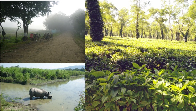
Karnataka produces about 51% of India’s coffee and it is all on the southern stretch of the Malnad region. The coffee grown here is highly priced in the international market owing to its better flavor as it is grown under the shade. That’s it, my brother and I pulled out dad’s bike from our cellar and decided to hit the road for a long weekend covering the entire stretch of coffee belt in Karnataka. Unlike cars, we won’t have the luxury of having a spare wheel in a 2-wheeler. Inorder to get our 125CC, 4-stoke, single cylinder, 10 year old boy running smoothly, it was necessary to give him a fine pair of CEAT tyres that could sustain our long ride on different terrain. So finally, here we go.. Our road trip along the coffee belt on the western ghats.

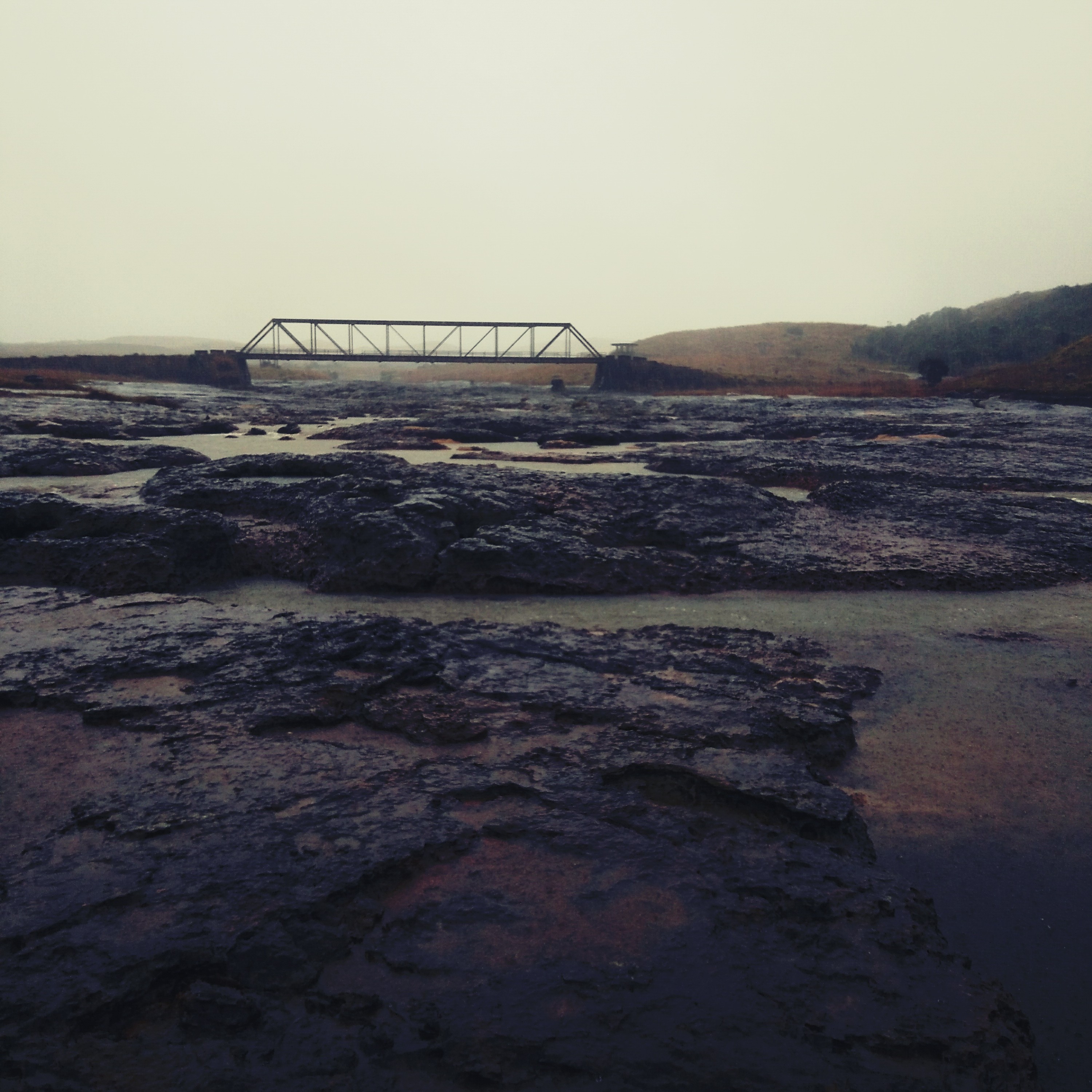
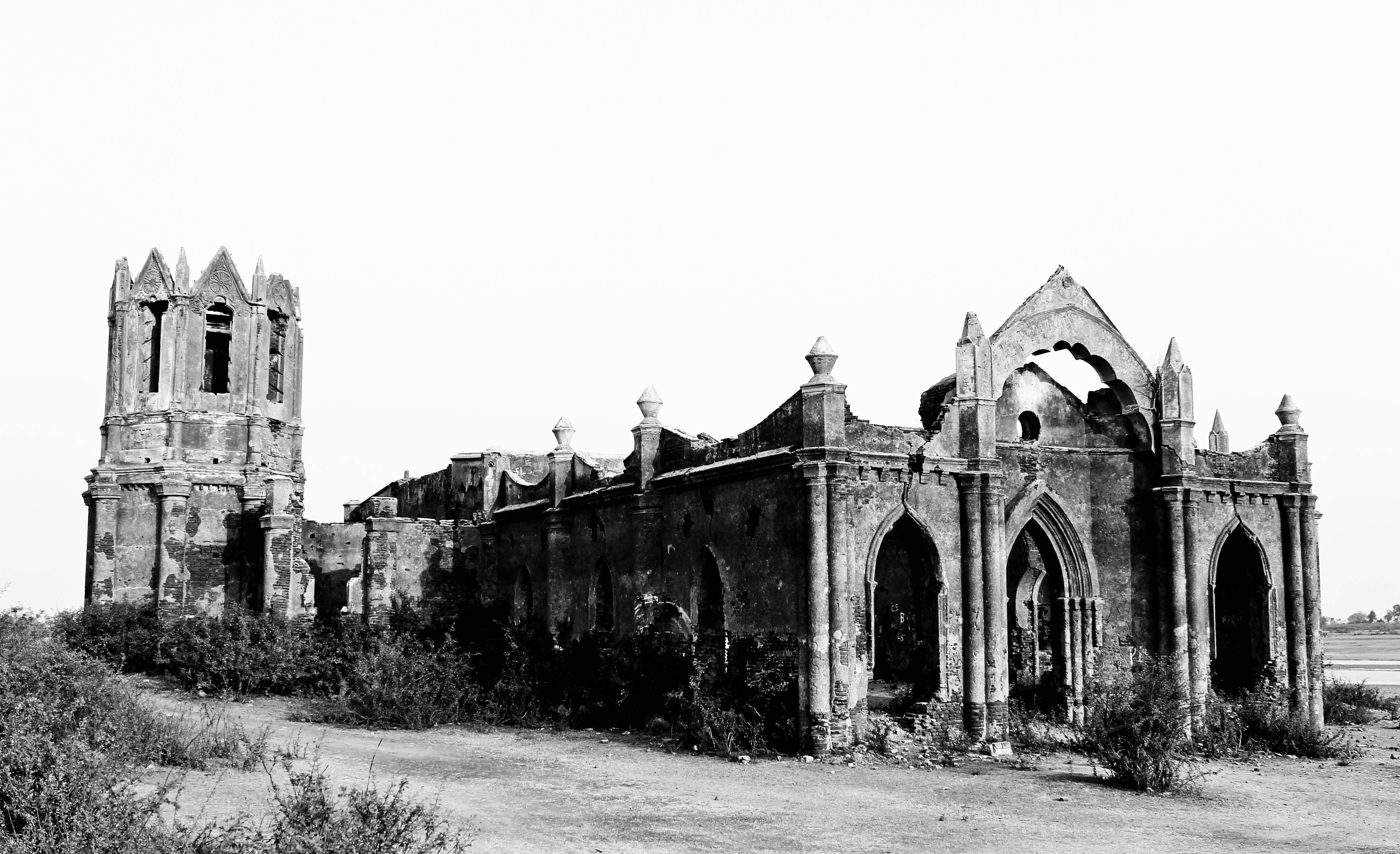
On a January weekend, we rode through the finely maintained NH- through Nelmangala and Kunigal. Our first coffee stop was to sip on some caffeine from the Hassan plantations. A simple hot cuppa at a petty shop before a deviation to Shettyhalli was all that we wanted. At a distance of about 20kms from Hassan, the Rosary church at Shettyhalli stood testimony to time and silently narrated a story of a painful past. This church emerges out when the water levels in river Hemavathi recede as if playing a game of hide and seek. We spent some time admiring this architectural beauty and trying to reconstruct it’s glorious past through our imagination. We left Hassan after a sumptuous lunch at a friend’s house located in the middle of a coffee estate.

IMG_0087-2
The Rosary church at Shettyhalli. Clicking credits: Samson Joseph

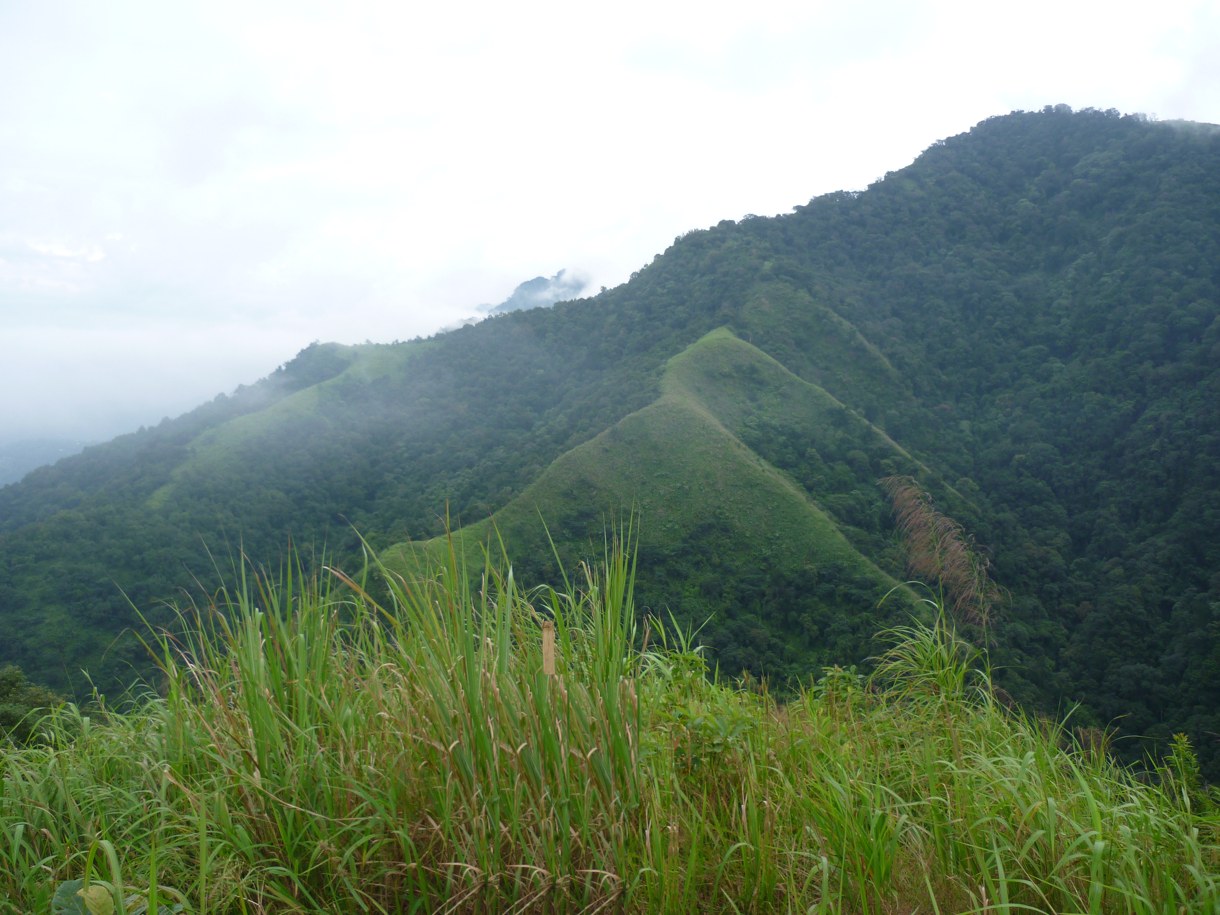
As we passed through the winding roads of Chickmagalur, we were reminded that the hillstation is the birthplace of Indian coffee. Bababudangiri range is the place where coffee was first brought to India and the plantations flourished. Mullayangiri, the highest peak in Karnataka is a hotspot among trekkers. Also, being the native of the famous chain- Café Coffee day, we couldn’t help but stop over for a cup of cappuccino.. After having our dose of caffeine, we continued on the road for our night’s stay at Sringeri.

IMG-20170424-WA0010
Enroute to Chickmagalur

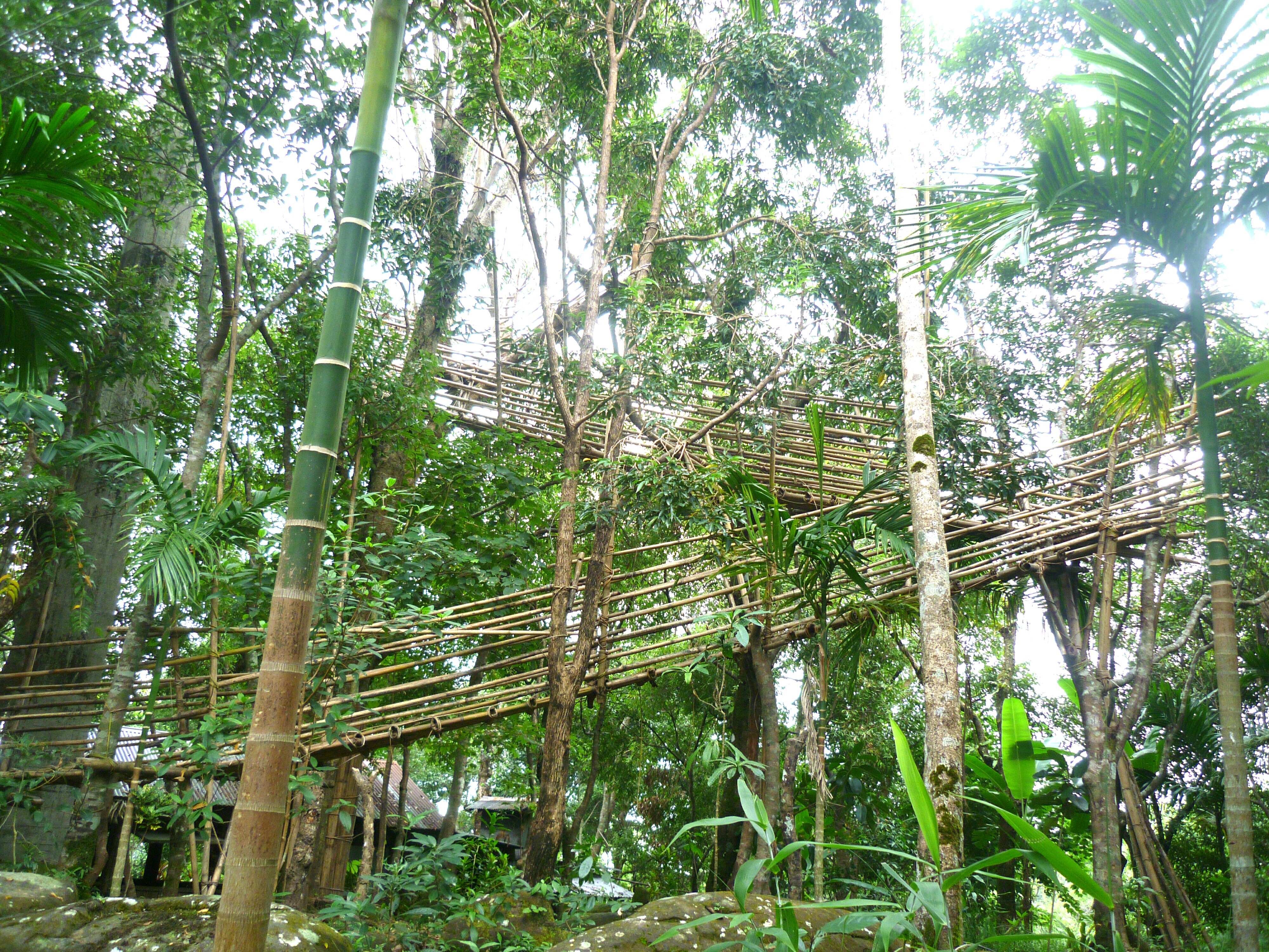
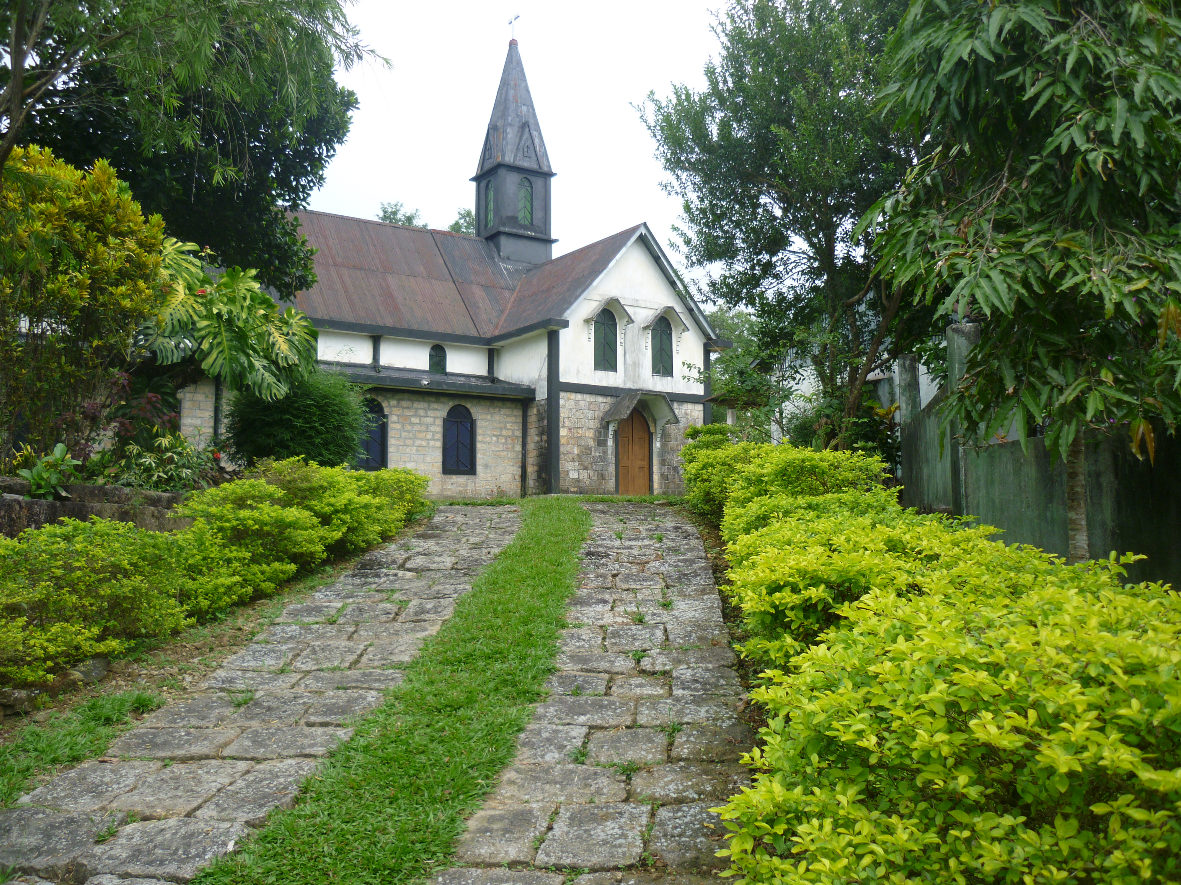
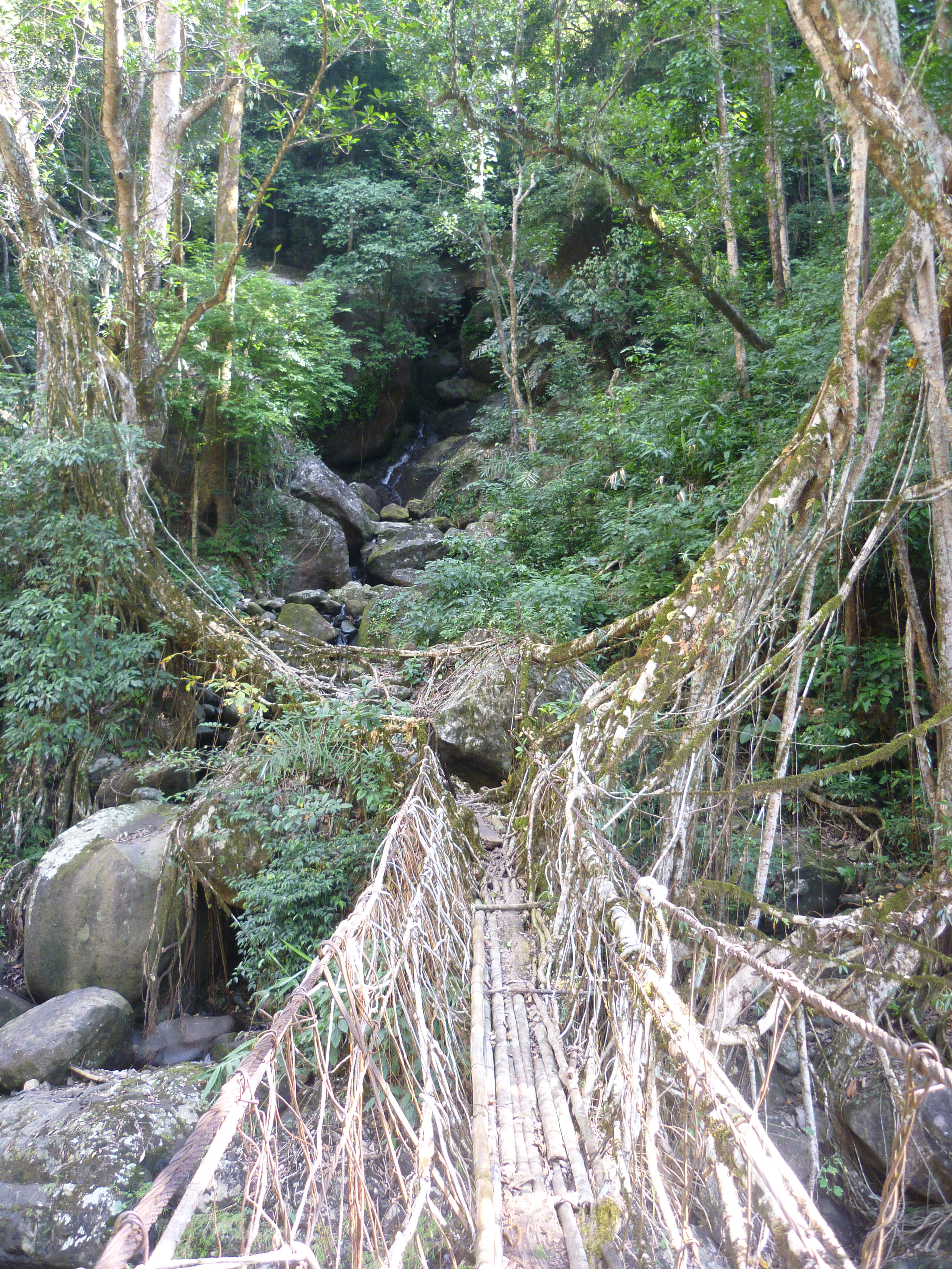
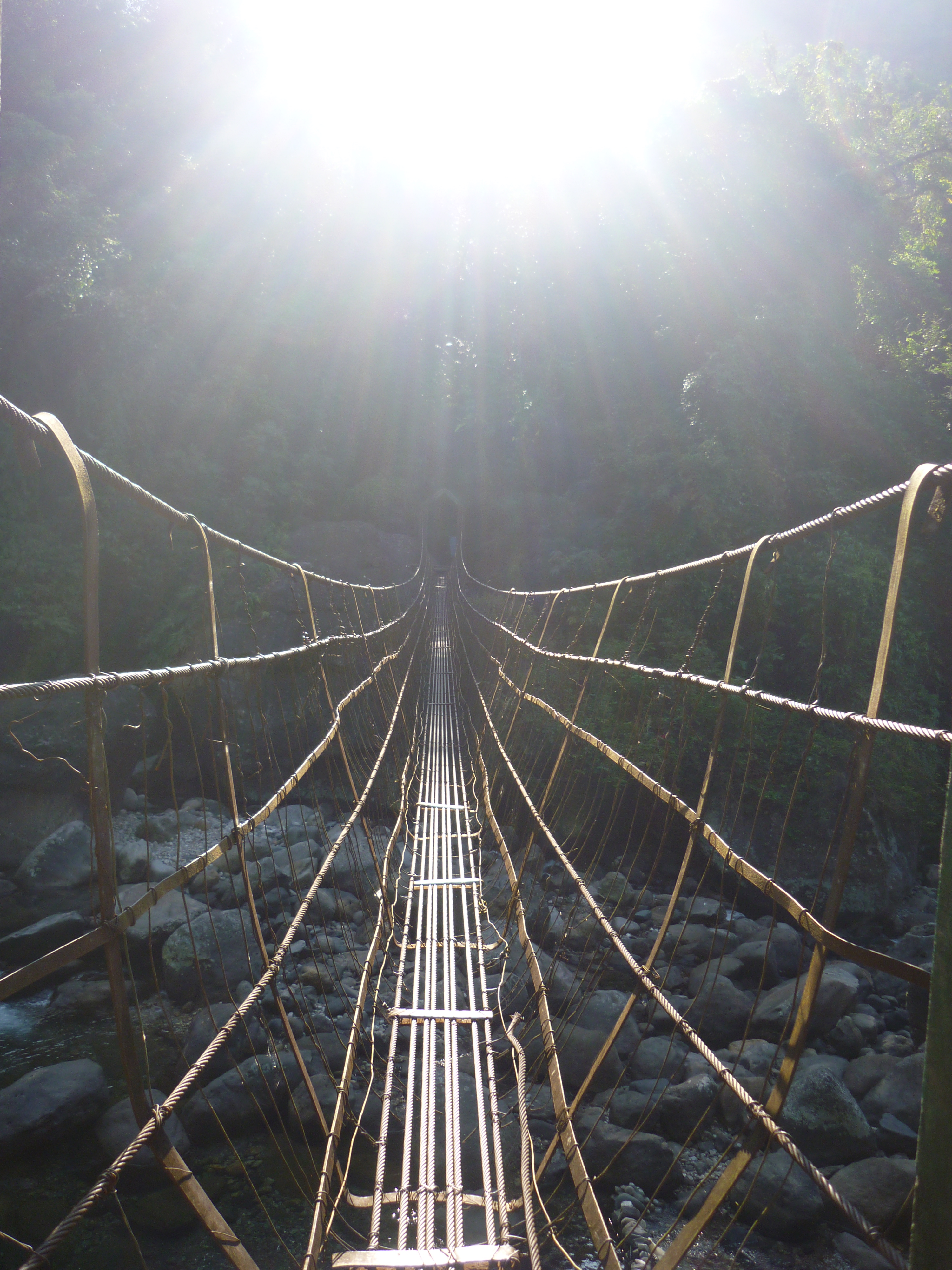
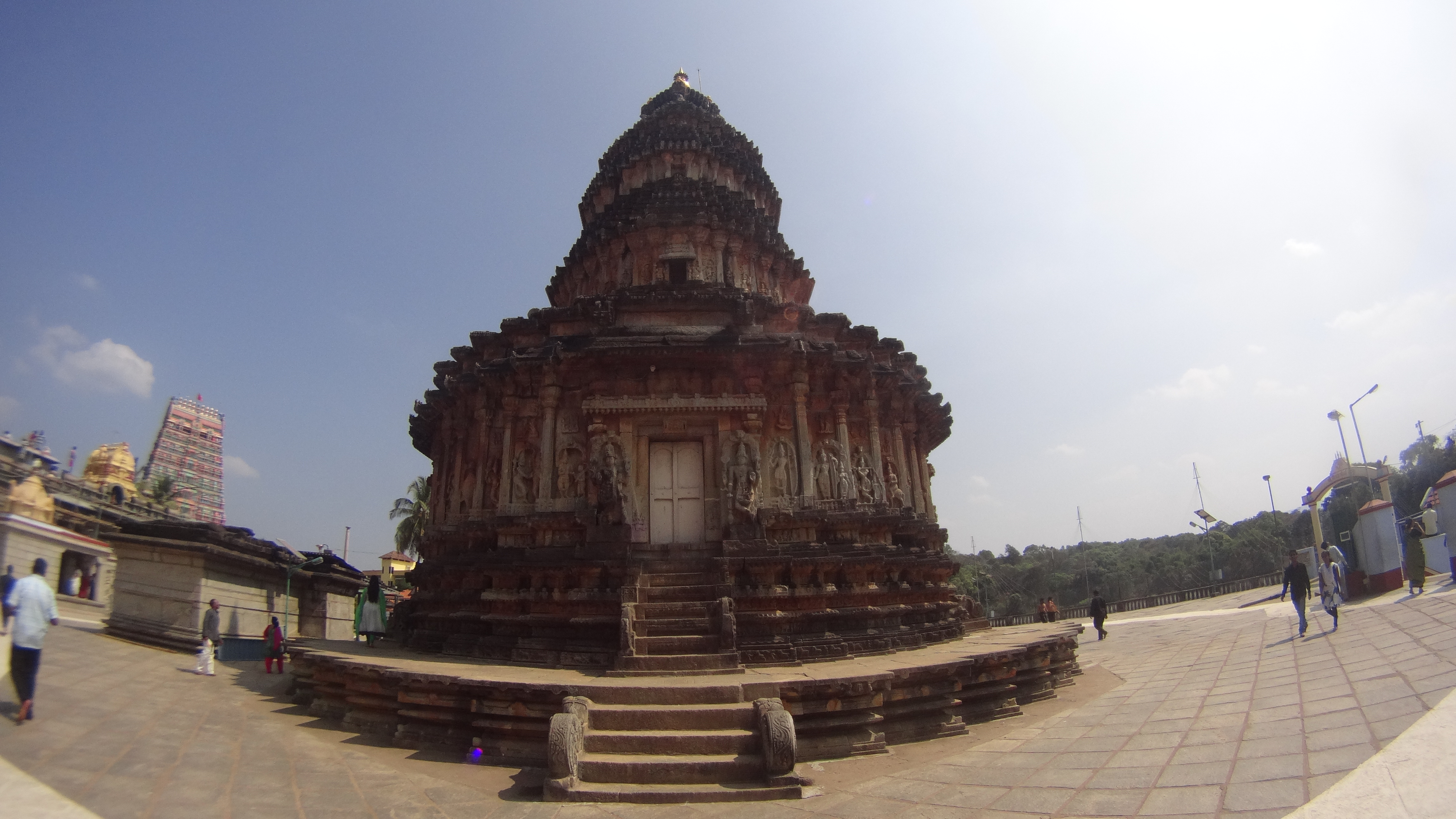
Next day, we set out to explore the pilgrim town of Sringeri. The Sharadamba temple is one among the 4 main Mutts established by Sri.Adi Shankaracharya. The Vidhyashankara temple on the same premises is a beautiful structure built in a combination of Hoysala and Vijayanagara style of architecture. After a small ride, we stopped by at Sri Rushyashrungeshwara swamy temple in Kigga, locally called as the God of rains. The route to our next destination- Sirimane waterfalls was a pleasant one passing through thick jungle on either sides, once notoriously famous as a haven of dacoits. Narasimha Parvata and Meghebaile waterfalls are other places of interest for the forest bums. However, we decided to spend the remaining time whiling away on the banks of river Thunga feeding the school of fishes with puffed rice.

210
The Vidhyashankara temple at Sringeri

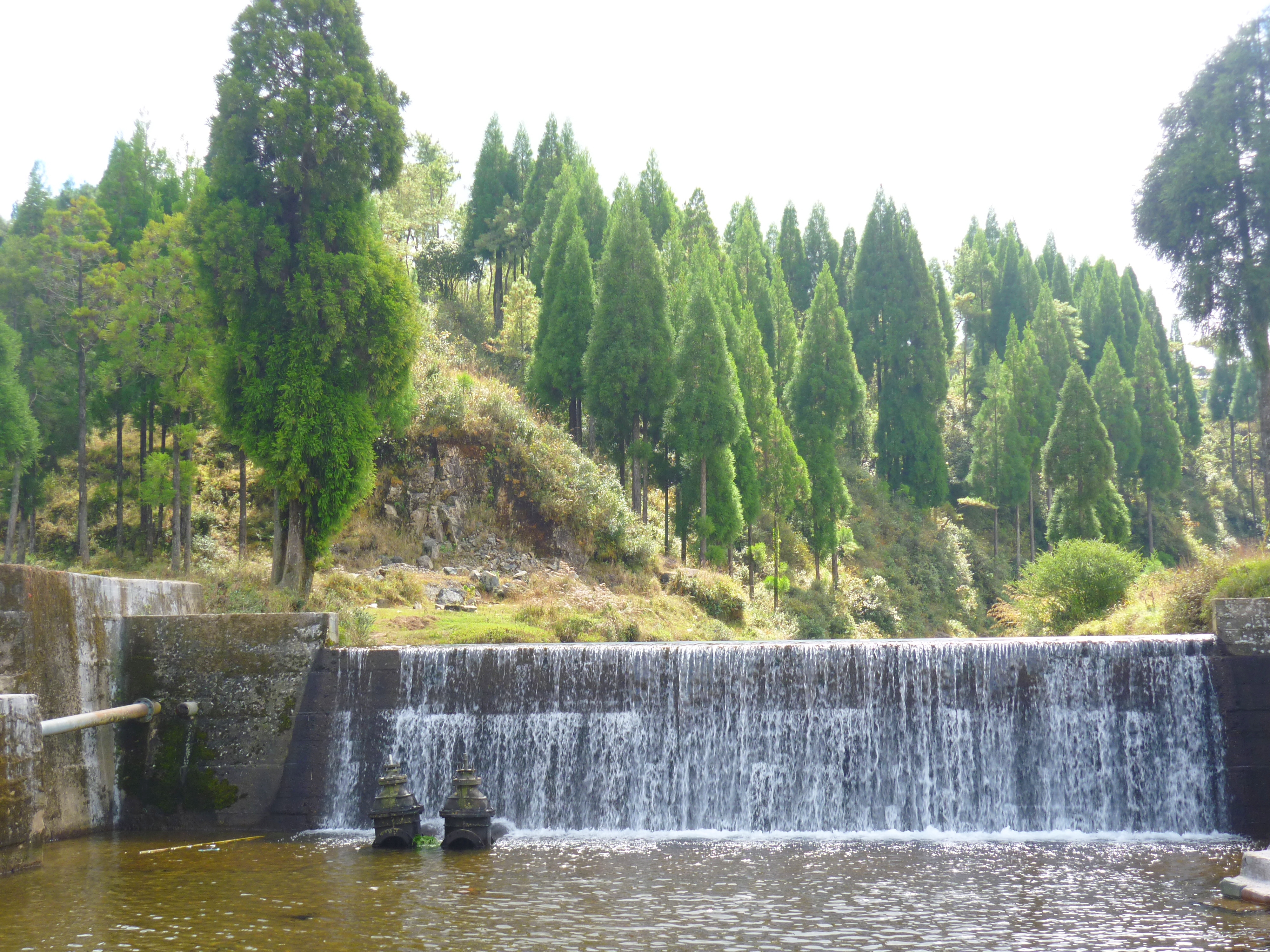
We started early the following day as we had a long route to cover and the BEST stretch of our roadtrip. We arrived early at the Kalaseshwara temple and enjoyed the serenity and oneness with nature that Kalasa town had to offer. The Breakfast served at the Annapurna temple happens to be one of the best prasadams and there was no way we were going to miss it. So we had to speed our way towards Horanadu, before the food counter closed. We then had to do a small off-roading which took us to a place of Ultra Calm- Javali in Mudigere Taluk, the birthplace of river Hemavathi.

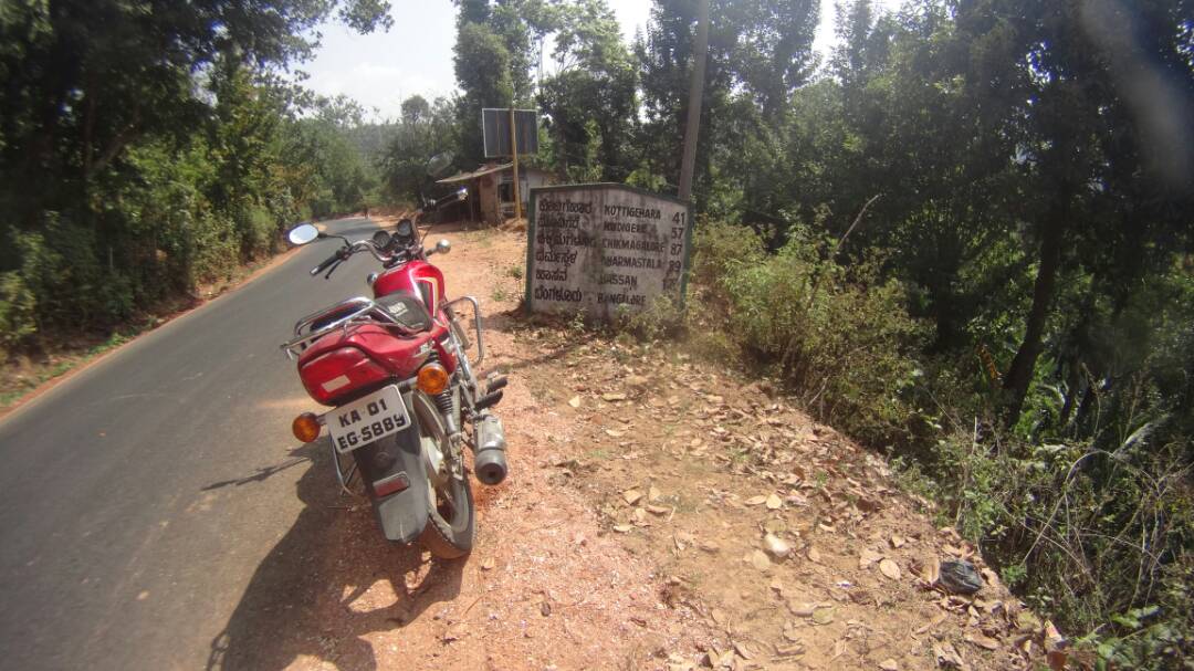
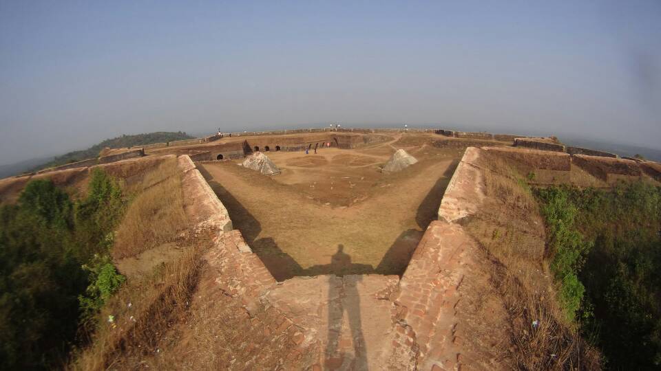
After a refreshing break, we headed towards the next coffee hotspot. It had been an awesome ride so far and time to get our caffeine fix. We parked our bike at one of the stalls put up with a bare table and a stove serving banana fritters and our dose of Sakleshpur coffee. We then climbed up the stairs to reach the beautifully located and strategically built Armory of Tipu Sultan- Manjarabad fort. It is a multi-walled star shaped fortress and worth photographing for an aerial view. Having Shiradi ghat and Bisle ghat in the vicinity, the view from the fort is amazing!

IMG-20170424-WA0005
The Manjarabad fort

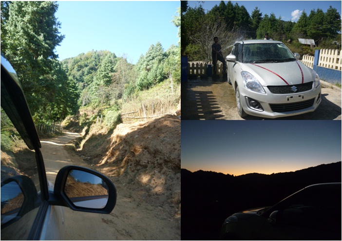
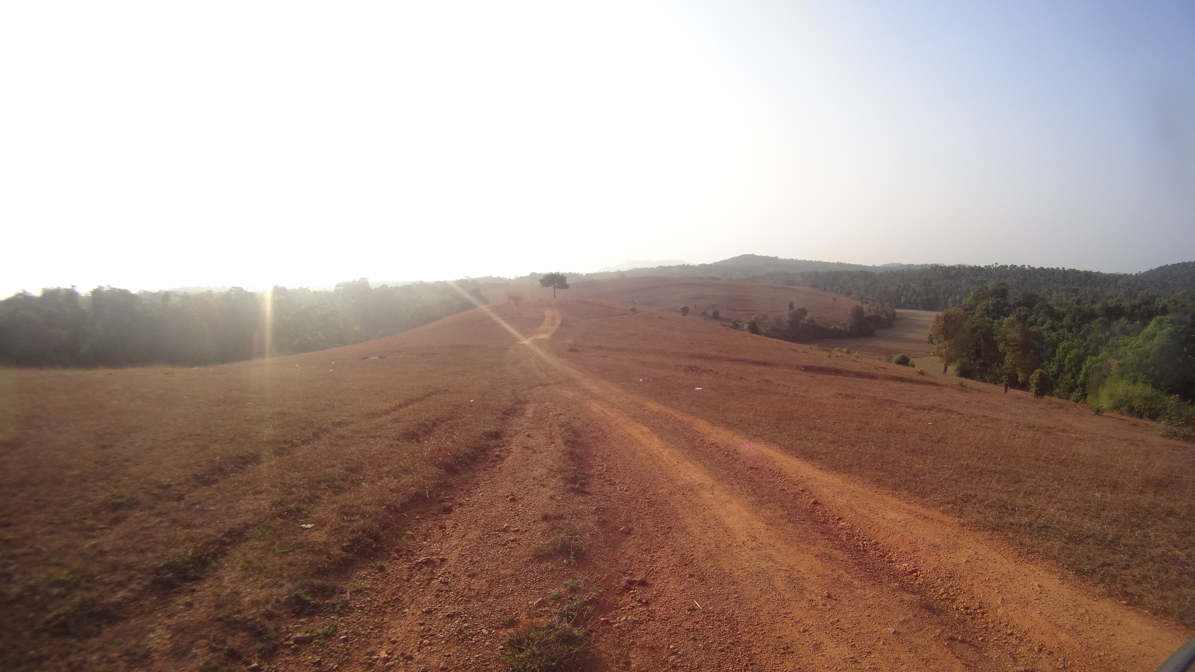
The ride has been brilliant so far and we stopped by for a picture of this solo tree standing in a serene place.

671

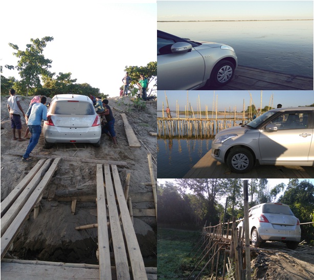
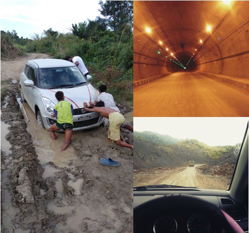
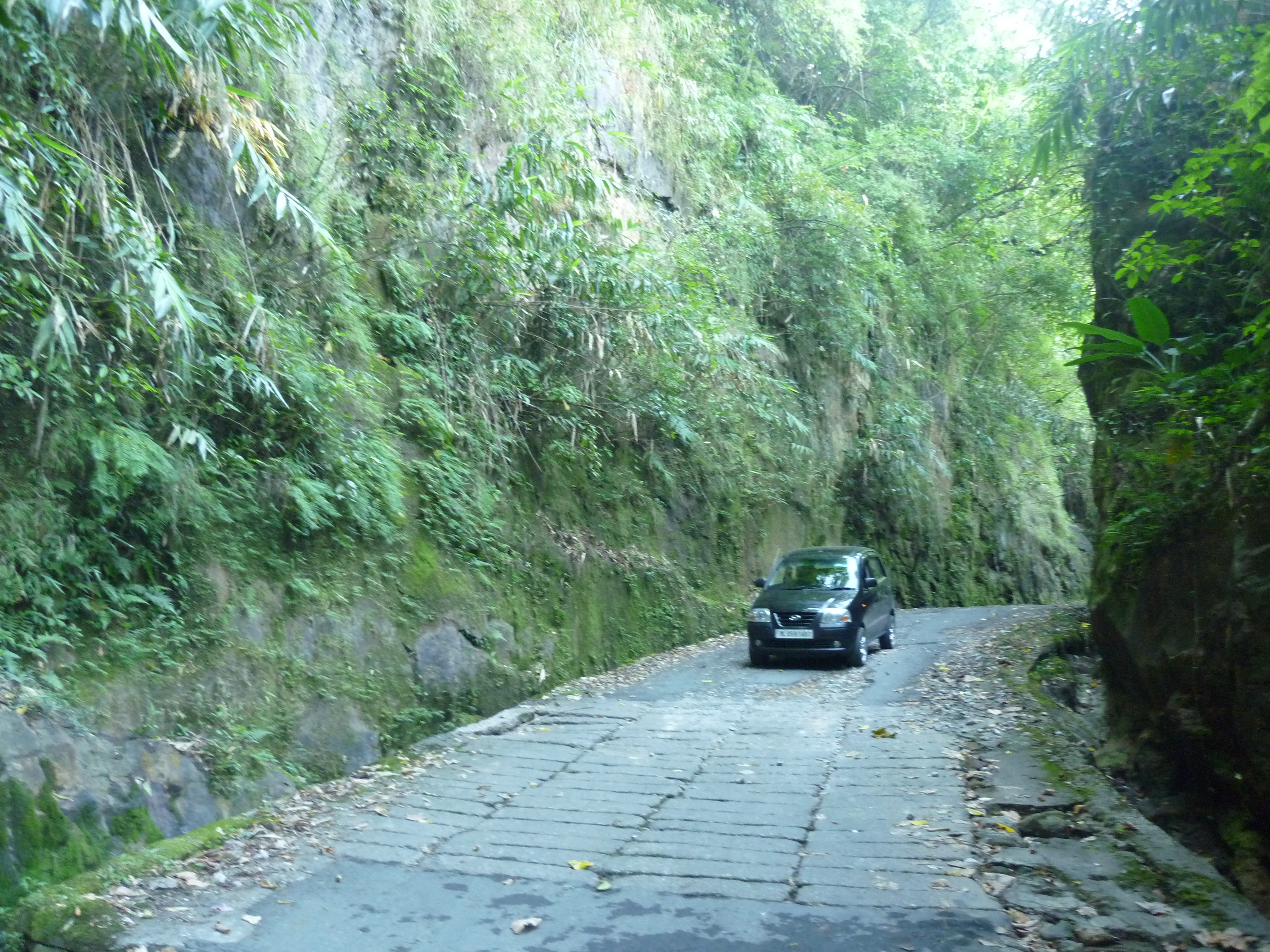
As we continued to enjoy our ride further, god decided to add in a tinge of adventure. We lost our way and we missed a deviation.. So that’s when our CEAT tyres were put into real test. We were scared of having lost our way and running on low battery on our mobile phones during our off-roading tryst. However, we were fortunate to reach the main road that ran parallel to our wrong road. Astonishingly, we later got to know that the official name of that road was ‘Kundu-Rasthe’ which literally means ‘Pot-hole road’ in Kannada.

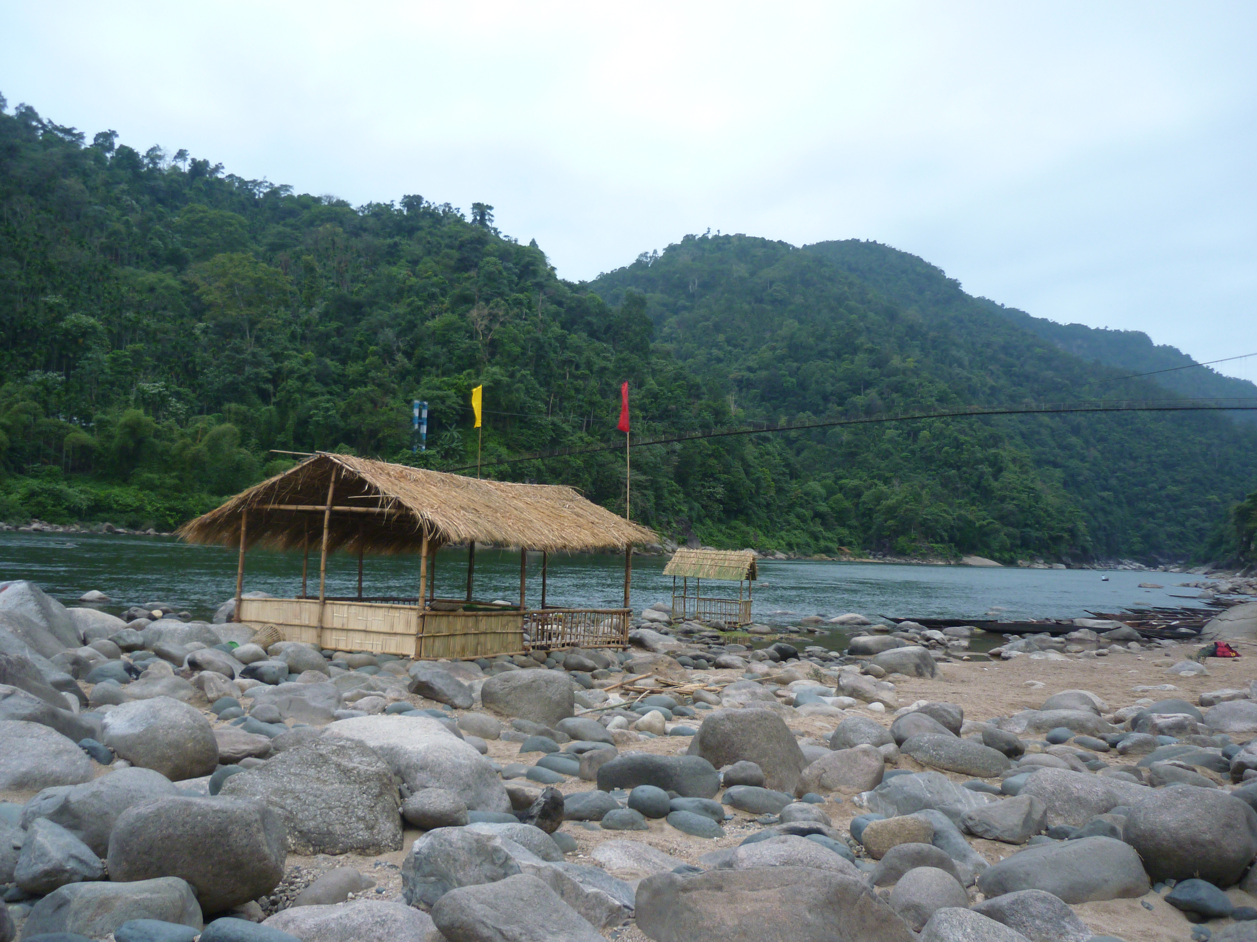
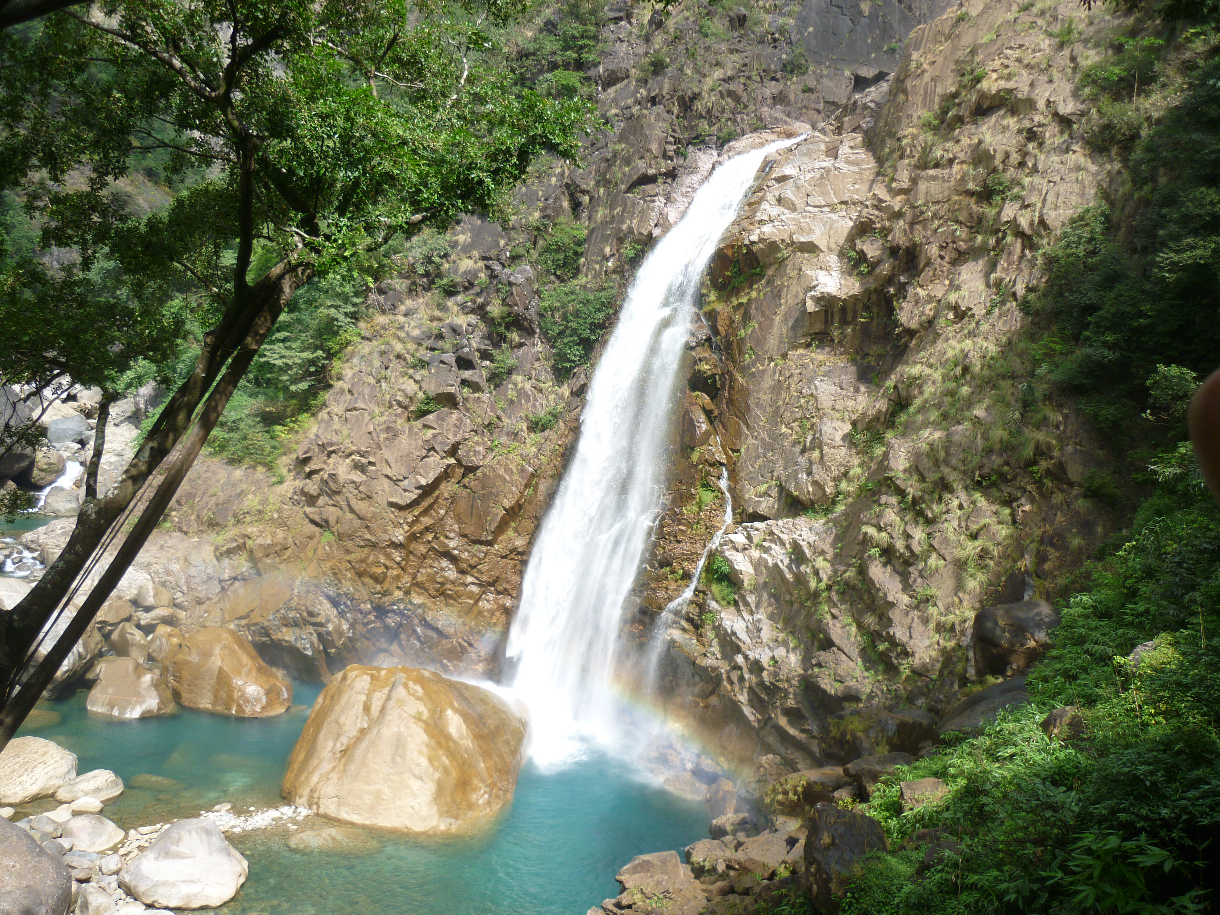
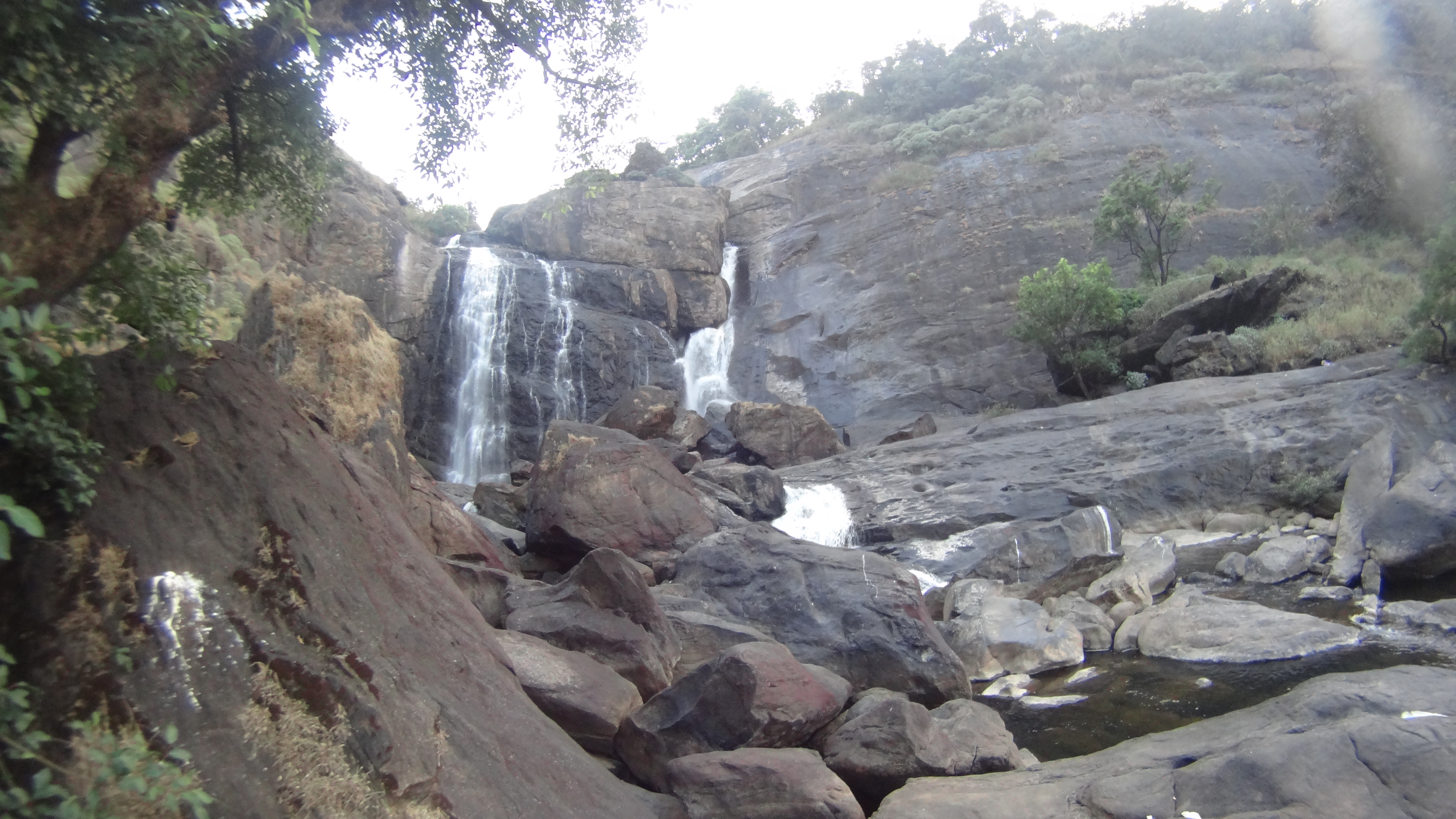
The sun was already setting and we were the last and the only people in the middle of no-where, walking down the stairs towards Mallalli waterfalls. The place was drop-dead deserted by the time we reached there. We hurriedly clicked some photographs and rode for a short coffee break at the last part of our coffee trip, entrance to Coorg or Kodagu district. Interestingly, we passed through several small towns named after the days of the week when the weekly shandy is held. Shukravarapete, ShanivaraSanthe and Somwarpet were among them.

706
The Mallalli falls

So it was past 07.00.p.m. when we finally reached our ancestral home at Madikeri town. And there was no better way to be greeted at home and end the long trip than having a sinful brew of Bella kaapi of Coorg. That said, our ride on the coffee belt had come to an end.. We rode on excellent national highways, state highways and stretches with no roads.. I must mention that coffee kept us awake and the tyres kept us on track and it was a wonderful experience.

Summary:

It is not an expensive car / bike you need for a wonderful trip. An efficient engine and a pair of reliable tyres is all that is required if you have a zeal to conquer the roads.. Bring it on and enjoy the ride!

Request to all riding & driving enthusiasts:

I myself work for an automobile manufacturer and my roles include attending to quality issues of seats & airbags. I have seen tests performed on dummys for evaluation. Trust me, it is insane to imagine the impact of not wearing seat belts.

  1. Seat belts alone can reduces the risk by 60% in case of a collision. In most cars, the airbags don’t deploy unless the seatbelts are worn as they are inter-connected for the electrical system to identify the seat occupancy. So buckle up and ensure all your co-passengers too have!
  2. Helmets on the other hand reduce fatal accidents by up to 60% avoiding severe head injuries. So, please invest on a quality assured helmet and strap it properly for your own safety and DO NOT look out for any cash savings by picking the one’s sold on roadside.

You may be a safe rider/driver. But you don’t know that stranger on the road.. Remember, someone is waiting back at home for your return. Please follow safety rules for their happiness. This is the least you can do!

The journey through Uttar Pradesh State Elections- 2017

This post is part of my fortnight long backpacking in the typical pilgrimage circuit of Uttar Pradesh covering Lucknow- Ayodhya-Faizabad- Varanasi – Saranath- Allahabad- Agra- Mathura- Brindavan– Fathehpur Sikri– Delhi

I’m not a political person and I don’t prefer blogging about something that can spark a political row with my writings.. But, this one goes here because I want to narrate the election campaign as seen through my eyes as a traveler traversing through a state where the election fever had hit hard! One of the most awaited elections of the country and an important one for the current ruling party of the state to prove their influence.. Uttar Pradesh State assembly elections!

Firstly, we were roaming the streets of the state capital- Lucknow. One fellow told us, “There were elephants standing at all corners and across all streets, then the cycle lanes were laid. Neither the elephants nor the cycles did any good to the city. Unemployment is an evil left over by the previous governments. Ours kids are struggling in the slush. Let us give a chance for the lotus to bloom.”

Moving ahead, we were temple hopping at Ayodhya. A local boy offered to be our guide. We were amused with the stringent security checks and the big political drama directed by man in the name of God. Just as we were talking among ourselves, our guide blatantly told- “Don’t worry, you will not have to go through all this when you are here next time. ModiJi aayenge tho sab theek hojayega! (ModiJi will resolve everything)”

The following day we were at Varanasi, the Lok Sabha constituency of Modiji himself! It was election day when we arrived there. The security was tight and with very less traffic, the spiritual city was a sight. That said, we went for a boat ride along the Ghats of the Ganges.. Explaining the history and significance of each ghat, our boatman rowed the vessel forward. In between he said- “Do you see that structure up there? Modiji aayenge tho uss Masjid ka samasya ka hal mil jayega (The issue around that mosque will be solved if Modiji wins), pointing at a mosque that is a subject of historical controversy.

It was 11th March: The D-day.. We were travelling to our next destination- Allahabad. The counting of votes was in progress and the poll trend was being aired by all news channels.. The customers in shops and hotels were glued to their TV screens.. Our fellow passengers were lost with news updates on their smartphones.. The driver and conductor of our bus caught up every now and then to get updates on the running poll trend.. Clearly, curiosity and anxiety were the only things in the air.. Everybody was discussing about who or which party would win the elections. We caught up with a conversation with our oarsman while being rowed to the confluence. He was casually talking about how he had left home to find a better job but later returned back to his family with the grace of mother Ganges et all.. And in the event, he told us that, “Mother Ganges gets more polluted on her journey forward through Banaras. But, Let us give a chance to Modiji, Ganga Zaroor Saaf hojaayegi! (Ganga will definitely become clean)”.

It is a very tough deal to commit for something as big as this, given the various religious, cultural and sentimental dimensions linked to everything that requires a change. These were not just hopes, It was an assurance given by the BJP.. It made me realize how just one man has changed the way common man looks at politics.. At any situation, we must stick to the basic morals of being an Indian- Secularism is the beauty of India! Exhibit ‘Unity in Diversity’ because the nation needs us.

And in between all the frenzy, we were waiting at Faizabad junction for our night train to Varanasi.. A train with no display board thugged slowly on Platform no.1. In the next few minutes, we were amused by looking at the platform. It was crowded with the men in uniform till as far as our eyes could reach on both ends. We saw arms and ammunitions being stacked up on the pavement and dedicated men with rifles guarding them. In a time where the entire nation was celebrating Holi, it was a strange but an overwhelming event to watch so many personnel from the armed forces who were there on duty. I hold very high regard for the defence personnel who guard us regardless of time and place. I had goose-bumps for having been in the midst of all this action. I couldn’t contain my anxiety and spoke to one of the men, while a couple of others joined in. We were told that they were from the Border Security Force (BSF) and had travelled down from Srinagar for security reasons during the state elections. That gave us an idea of how massive and sensitive the event of elections in UP is for whom, things are a lot peaceful and easy back in our home state- Karnataka.

Coming back to politics, declaring the party leader / Ministerial candidate before elections is a normal way to attract votes from the public based on various other parameters. In contrary to this style, having fielded no chief ministerial candidate; the BJP (Bharatiya Janata Party) has managed to win the great battle with just the name of one man- ModiJi! A sweeping victory of 325 /403 votes that has pushed the entire nation into amazement. Now, that the lotus has bloomed, whether the fragrance of the flower or the stench of the drainage would spread is left for the citizen to watch..

The last Indian village on the Meghalaya border- Dawki

We were bowled over by the beautiful plains of Bangladesh, the view of our neighbouring country from the rest of Meghalaya! So, the thought of driving over to actually see another country from close quarters made us very excited. The innumerous blogs about the crystal clear waters of the Umngot river and the boat ride with the emerald green backdrop kept us on toes until we were finally there.. Dawki is the last village on the Indian border and Tamabil on the Bangladesh end. This is a friendly stretch and an important trade route between the two countries with limestone being majorly exported across borders. We were driving there from Cherrapunjee. Dawki is located in the Jaintia hill district of Meghalaya. During our interactions with the locals, the cultural difference of the Jaintia tribes was clearly felt by us who had spent many days in the Khasi hills previously.

This post is part of my fortnight long road trip across North-east India, specifically covering parts of Meghalaya – Assam – Arunachal Pradesh I had tagged along with two other travelers and drove around the state of Meghalaya in a self-drive car hired at Shillong. The places visited in Meghalaya include Shillong – Smit – Cherrapunjee – Mawlynnong – Dawki – Ribhoi- Shillong.

The details of our trip:

A mesmerising stretch of green mountains on one side and a deep valley with thick fog settled hills, accompanied us all the way till our destination. Based on a friend’s recommendation, we stopped by on the way to find a small board that guided us to Byrdaw falls. The road got narrower and isolated as we drove further. After passing through very thick forest, the road ended abruptly. Although we were a little apprehensive of the route ahead, I forced my friends to walk down. We continued to walk through what looked like some poorly maintained plantations and seemed more like a forest infested with some bandits where we could be held for a ransom. There were no signs of any water source or a stream that would eventually lead to a waterfall. But, I insisted to continue to follow a flight of well laid stairs that finally led us to a view that has us awestruck. It was a magical view, to define nature’s beauty that was infront of us! There stood a 3-tiered waterfalls, through which we could walk through enjoying the serene location from the waterfall’s point of view, quite literally! My friends thanked me for having them got there!

p1140144
Byrdaw waterfall

We then drove over to where we were destined to reach for the day.. It was a slow route thereon, with several loaded trucks heading towards Tamabil. Suddenly, the blue waters of the Umngot river appeared from amid the trees with the rays of the setting sun reflecting back at us. We were overjoyed at the sight! To get to the other side of the river, we had to cross the narrow steel bridge, that is declared weak and over which only one vehicle is allowed at a time. There were at least 50 trucks ahead of us in the queue and so, we patiently awaited for our turn.

It was dark by the time we met our guide ‘Mr.Bright Star’ at Dawki town and followed him to where we were supposed to camp for the night. Bright Star drove his car ahead of us and guided us through the eerie looking terrain carved though mountainous limestone. There was no asphalt and no streetlights, with only thick creepers hanging down the high rise limestone walls. It was more like an offbeat off-civilisation drive for over 5kilometers into nowhere, until we braked at our destination: Shnongpdeng.

With our backpacks and camping essentials, we walked down a small valley with torchlights. We then pitched our tents which we were told was on the river bank. The night was spent in absolute peace under the clear starry sky and some burning wood by the side that kept us warm through the night. Apart from the three of us, it was just the rustle of the flowing water and our guide’s dog for our company.

I was awakened early on the following morning and I unzipped my tent with the first ray of the breaking dawn. That’s where my heart skipped a beat with what I was seeing! That’s when I actually realized that we had stayed on the river bed all night. The swiftly flowing river, the rich never-ending stretch of green forest cover, rounded rocks of different colours strewn all over the place seemed to have put up a piece of heaven right infront of our tents. A couple of bamboo shacks and a long suspension bridge added to the beauty of the setup.. We then met Mr.Mickey, our oarsman who rowed the boat along the rapids of the river. We wanted to catch the sunrise from the popular view point and get back to our camp before the tourist crowd poured in.

p1140153
The view from my tent

Although the beautiful landscape kept us motivated, the ride was rather taxing. We would board the boat and sail in it along the calmer stretch and then get off the boat and walk when we there were rapids. This on-and-off continued in multiple cycles. But then, it was all worth it at the end.. We could enjoy the pristine beauty of the place right up, close and personal.

Momentous 100%
Our boat being pulled in the rapids

After a filling breakfast, we packed our stuffs and continued to travel towards Jowai with a stop-over at the Tamabil checkpost.

Concluding remarks: Dawki is a very laidback place blessed with natural beauty. It is very disheartening to see tourists flocking in thousands everyday which will not surprise me if in just five years down the line, Umngot river would be nothing more than a stinking slushy pool of water left back as a memory of abusive tourism.

A piazza of paintings- ChitraSanthe

It has been a while since I did the local rounds as I have been tad busy on weekends with lot of get-togethers with family and friends. So to start the year 2017, I did not think twice to go solo shopping in the market. Typically, the one stop campo where all villagers come-together to trade grains, vegetables, cattle, clothes etc. is called a ‘Santhe’ in Kannada. But this was a unique market that sold only paintings (Chithra) of various artists who gather from around the country.

It is an annual event organized by the Karnataka Chitrakala Parishath on the first Sunday of January every year and is all about art in the form of paintings. Canvas, glass, paper, fabric, wood, plastic, beer bottles- you name them and you can find beautiful paintings on them being sold at this fair with products strewn on both sides of an entire road. KumaraKrupa main road and it’s cross roads would be choc-o-block from dawn to dusk with art enthusiasts pouring in large numbers.

From very modern styles of mass-media art to traditional Madurai and Mysore royal paintings, artwork of school going kids to Octogenarians to handicapped artists, celebrity portraits, wildlife, architecture, conceptual paintings- art lovers will be spoilt for choices. Although the artistic skill cannot be gauged with a price tag, things range from 50Rs. to 1lakh Rs. Per painting depending on the material used and time spent.

img_20170125_111012
Wildlife paintings

This is not an event for the trippers who want to take a selfie and post on social media but a wonderful event for talented artists to get some genuine investors. A must go for the artist in you…

Finally, here is a life sized painting that I loved the most- An expecting mother playing with her unborn baby in the real world. Everything in the real world- the mother, the door and the toys have their shadow except the imaginary baby. The clarity in the artist’s thoughts about his subject has been represented with every detail in this picture looking so real.

img_20170125_111109

PS: Do not reproduce any images as there is a lot of effort that has gone into every piece of art. #Respect

Have you been to ChitraSanthe? What kind of art do you like? What other art festival have you been to? Do let me know what was your favourite part of the visit to this annual market of art in the comments below.

Experiencing the warmth of Khasi hospitality in Cherrapunjee

I could not express better than these lines picked up from a website, “If the Raindrops elevate your mood, clouds stir your senses and rainbow brings out childlike pleasure in you, then don’t hold yourself back. We are taking you to the abode of clouds-Meghalaya; where rain weaves a magical spell, spellbinding beauty haunts your senses and you witness nature at its best. Witness the monsoon magic, majestic waterfalls, live root bridges and more…” and one can go to no better place than Sohra fondly called Cherrapunjee to experience all of that Meghalaya has to offer in a small place.

This post is part of my fortnight long road trip across North-east India, specifically covering parts of Meghalaya – Assam – Arunachal Pradesh I had tagged along with two other travelers and drove around the state of Meghalaya in a self-drive car hired at Shillong. The places visited in Meghalaya include Shillong – Smit – Cherrapunjee – Mawlynnong – Dawki – Ribhoi- Shillong.

Our Itinerary:

Day 1: Arrive from Shillong / Smit; Wahkabah waterfall, Arwah or Lumshynna caves, Nohkalikai waterfalls, seven sister / Nongsthiang falls (Night’s stay at a local homestay)
Day 2: Tyrna village, Nongriat trek (Double decker rootbridge & Rainbow falls), Mawsmai cave/Krem Phyllut, Ummunoi root bridge at Laitkynsew village (Night camping at Nohkalikai)
Day 3: Dianthlen waterfall trek, Sohra market, Ramakrishna mission, Mawkdok valley, Thangkharang park, Moktrop rock; journey towards Mawlynnong.

The Details:

Like most tourists, we started our day early from Shillong via Smit. To differ from the rest, we had a self-drive car at our disposal so that we had the liberty to stop whenever and wherever we wanted. The drive route was mostly untouched and its rustic charm kept us excited all through as this route is less treaden by the tourists. Pine plantations, lesser explored waterfalls nestled away from the main road, well groomed vegetable farms, hay shacks were a common thing for us while we had stopped atleast 100 times for photos.

p1130875
A reservoir enroute to Cherrapunjee

As we approached Sohra, we stopped at several view points, Wahkabah waterfall being one among them. India’s longest cave and the most numbers of limestone caves in one place happens to be in Meghalaya and hence Meghalaya is a haven for cave explorers. Our first stop at Sohra was at the Arwah or Lumshynna caves. Relatively smaller compared to the other caves in the viscinity, but is tucked away in a gorgeous location overlooking the deep valley with the Nongsthiang waterfalls.

After a brief visit, we headed towards our next stop: Plunging down from a height of over 1100 feet, Nohkalikai is the highest waterfall in India. We trekked down the steps and a little beyond into the bushes and enjoyed the rare views of the waterfall away from the reaches of normal tourist. There is an option to camp at the Eco park, over the seven sister / Nongsthiang falls. But we decided against it as the place is filled with backpackers and would’ve been too clumsy for us, we were someone who wanted a peaceful place away from the crowd.

dsc02827
The Nohkalikai falls

Pitching a tent in Sohra requires prior permission from 4 different authorities: the land owner, the Siam of the village, the local government body and the police. In search of a nice place to pitch our tents, we took help of one of a local Khasi friend. With the local connect, our quest to find a piece of land to pitch a tent ended up more like an exploration of Sohra. We could go to some of the untouched places and sunset views that was completely out-of-reach from typical travellers. We were taken to remote places like banks of a small river, a cliff off-a-small hillock, plains overlooking massive gorges, cement factory backyards among other places. With the sun-going down early in this part of the world, we had very little time in hand and insufficient preparation for the night’s camping.

We finally ended up staying with a Khasi family in a local homestay located amid a serene location. The stay however was the highlight of our day: the warm hospitality of the Khasis is something that will never let one regret their choice of stay. Our host at the homestay, accompanied us for dinner and for a drink as we got discussing everything from Khasi culture, ceremonies, politics, sports, tourism et all under the sky, a clear night’s sky. With no pollution in the atmosphere, my friend helped me to identify several constellations from the place that was brilliant for star gazing. It was an unforgettable night for us with the Khasi family.

p1130943
The village settlements around our homestay

Next day, we drove to places around Cherrapunjee including the villages of Tyrna, Nongriat, Mawsmai cave/Krem Phyllut, Laitsynkew to explore the living root bridges which was an activity from dawn to dusk! We got in touch with a local guide ‘Mr.Paradise’, who then arranged for our camping in the Nohkalikai village for the night. It was yet another wonderful night spent with new Khasi friends, as we enjoyed Khasi music, the enriching conversation with Paradise and his friends about the Khasi culture. We gained insights about their customs, religious practices, respect for people, nature’s love among many other things. It was a long night under the starry sky with only my friends, Paradise’s friends, myself and the campfire! Suddenly, while the last bit of the firewood was being lit and just before the night broke into dawn, the skies of Meghalaya had shown their power. It poured cats and dogs for the rest of the night, with thunder storm and lightning. We sheltered ourselves inside our tents while I continued to shiver with cold.

At dawn’s break on the following morning, the skies had seemed to have mellowed down and we stepped out of our tents only to be awed by the beautiful sun rising over India’s highest waterfall! Yeah, Meghalaya has been wonderful to us all this while and this was another new day in this ‘land of clouds’. While we had planned a short trek across the Dianthlen falls, the rain gods continued to lash throughout the day.
Cherrapunjee is the wettest part of the world. So, what’s the whole point if one doesn’t experience the rains here, right? We walked in the places around Dianthlen falls and enjoyed the rains for some wild fun but getting drenched till our bones.

Momentous 100%
One of the suspension bridges on the way to Dianthlen falls

It was already noon and we couldn’t cover the other few places as planned in Cherrapunjee because of the poor visibility due to heavy rains. Anyway, speculating no possibilities for any improvement in the weather conditions, we decided to drive to our next destination- the Jaintia hills district.

Shine 100%
The rain fed roads of Cherrapunjee

While the warmth of the very hospitable Khasis has still left me in awe and amusement, I’d like to end this note here with these lines:

Even then, goodbye dear Cherra, and your rain goodbye.
For my life is yonder, though my love is here.”

-Karavan, Stokholm, Sweden

Hiking up Assam’s highest point- Hapeo peak

This post is part of my fortnight long road trip across North-east India, specifically covering parts of Meghalaya – Assam – Arunachal Pradesh I had tagged along with two other travelers and drove around the places in a self-drive car hired at Guwahati. We had arrived at Haflong, the only hill station in the state of Assam following a mis-adventurous trip. (Click here to know the details)

This trek to the highest point in Assam happened by chance, as a backup after the original plan for the day had failed. We were told that the hill isn’t yet popular in a typical tourist’s circuit. Apart from the local tribal folk who like to party atop the hill, hardly 4 to 5 trekkers come here from outside the district and the state to climb this hill each year. Having said that, we wanted to reach Hapeo peak, the highest point in the state of Assam for sunrise. However, due to the clouds that had hovered that morning, we decided to snooze for a little longer before going ahead with the plan.

There are totally 13 native tribes in Dima Hasao district of Assam state and each tribe has its own village. A local NGO called spectrum is working towards the empowerment of the local tribal communities through promotion of tourism in the district. They helped us in getting this event organized. We were driven in their 4WD vehicle from Haflong to a village called N.Liekung. N.Liekung village belonged to the Kuki tribes and the required permits from the village head was arranged by Spectrum. A local guide was assigned to take us through this off-beat wilderness to scale the highest point in Assam. I would like to present my trek in essentially three parts.

Part 1: The Ascent

After a small stop in front of the holy Cross at the prayer area of the Kukis, we began our ascent towards the peak. For the three of us, all seasoned trekkers doing this trip together, the climb to Hapeo peak wasn’t a very difficult one as compared to what we had done back in the Southern India. But what made it seem difficult was the high grass that had grown tall enough to cover the entire stretch. Since the trek is not frequented with people, the grass on the path is not worn out as much as in the popular trekking trails. Hence, the way up was something through which we had to FIND the trekking trail. Based on the ease of finding the trail, I would split the trail into three portions:

  • A well traceable path with steps laid. However, at some places, the stairs have been lost amid the thickets. We had to cut the grass and bushes in order to find our way. The stretch was full of high grass with occasionally placed animal traps which our guide who walked ahead, would carefully move aside and make way for us.
  • This was the only flat area with some grassland vegetation for a stretch of around 500mts.This was the only place apart from the highway, from where we could actually see the peak that we were apparently scaling up!
  • The last part passes through thick jungle, with a canopy of trees that allowed very less sunlight to penetrate. Varieties of innocent looking wild mushrooms had bloomed at several patches, but we were warned not to pick any of them as they could actually be lethal with allergens or venom. We were accompanied by strange sounds and cries of migratory birds around.
p1140545
The only grassland in Hapeo trek

As we climbed up while chatting up with our Kuki guide, he enlightened us with their tribal customs, culture and showed us a few videos on his phone of their traditional dances, festivals ceremonies and the like. Our guide jokingly told us how his fellow folks are named in the tribe. The names may not mean anything and just anything random that sounds nice goes as a name. He was thus randomly called after a ‘Song that was Sung’ (I’m sorry, I don’t want to give out his name). But the tradition is, that the maternal grandfather selects a name for the granddaughter and the paternal grandmother picks a name for the grandson and vice-versa. It is a patrilineal system of inheritance.

Part 2: Reaching the Top

Suddenly, the darkness of the jungle had turned into snow white of the clouds. Before we could realise, we had reached the top already and we had barely taken us two hours. We were told that one could see the entire district of Dima Hasao from up there. But, we were greeted with thick fog and clouds upon arrival. We spent some time soaking in nature’s beauty and waited for the clouds to clear so that we could catch a glimpse of the beautiful view.

For the benefit of potential trekkers, there is just one small shelter with a bench atop the hill and nothing apart from yourself there! Our guide mentioned to us about a patch of land measuring about 2×2 feet, right behind the bench where a natural and strong magnetic force is believed to exist, due to which none of the mobile phones work in that spot. Yes, we tested the phenomenon too. Although all our phones had FULL network, we were unable to place any calls. But none of us had any scientific reasoning for what he told.

p1140551
A view of Dima Hasao district from Hapeo peak

In the next fifteen minutes, the clouds had slowly started to clear. We spotted the railway bridge at Lumding onto the right side of the horizon. This rail line is the longest and highest in the Silchar route. Our guide pointed towards another hill onto our left, through which the longest railway tunnel (around 3.5kms long) in the North-east passes. The Silchar-Lumding railway route has been featured in several tourism websites and has been one of the scenic stretches in the country. As the weather slowly worsened and began to drizzle, we decided to start our descent.

Part 3: The Descent

When we had just started to climb down and we received a call from the NGO. We were told to return to the base of the hill ASAP as an alert for a cyclone had been issued by the meterological department and heavy rains were expected in this region in the next few hours. But, it had started to pour cats and dogs within no time. The fastest pace we could catch was by rolling down the hill. With all the rain, thick grass covered path and steep gradient, just a steady walk itself was a struggle as we descended on the slippery trail. There was nothing enroute to take shelter from the rain. But, waiting at any place made no sense because the pounding rains would continue for the entire day or even two. It made more sense to simply continue to walk down as we were already drenched till our bones.

We were back at the base by 11.00.a.m. and thus ended our trek to the highest point in the state of Assam. We were invited over to our guide’s house to dry ourselves up and have a cup of hot tea. We thanked him much and bid adieu with a warm heart to this lesser known corner of the world!

A walk in God’s own garden- Mawlynnong

“The Soul of India is in its villages”.

-Gandhiji

Sometimes, it is not about the place.. It is about the people that brings you closer.. And that’s precisely my take on this little quaint village called Mawlynnong.. After a refreshing drive through some breathtaking views and best roads of India, we had alighted at ‘God’s Own garden’ nestled deep in the East Khasi hills of Meghalaya. Although it is being largely promoted by the Meghalaya Tourism Department(MTD) as Asia’s cleanest village after being awarded so by the ‘Discover India Magazine’ in 2003, I feel it holds a different charm in it with the warmest people I have met so far!

This post is part of my fortnight long road trip across North-east India, specifically covering parts of Meghalaya – Assam – Arunachal Pradesh I had tagged along with two other travelers and drove around the state of Meghalaya visiting Shillong – Smit – Cherrapunjee – Mawlynnong – Dawki – Ribhoi- Shillong.

Tourists flock to this place in large numbers just because they have heard about it in MTD handouts. These senseless creatures litter the place extensively with chocolate wrappers, chips sachets etc. all strewn around this supposedly cleanest village they have come to see.. But, the humble villagers watch on with a smile and pick up these wastes themselves and put them in the cane trash bins places visibly infront of every household in the village, thus keeping up to its reputation of being clean!

Things to see in Mawlynnong:

• Inside Mawlynnong village: The old church, floating stone, the water shed and the Bangladesh view point.
• 1 kilometer away: Riwai village (Living root-bridge)

The Details:

I walked around the laid back lanes of the village exploring the old church, the floating stone and the water shed maintained by the villagers. The flowers lining the fences of each household added myriad hues to the green village and grey of the cloudy sky.. I climbed up the skywalk laid up with bamboo and cane that threw up a nice view overlooking the plains of Bangladesh.

The Bangladesh view point at Mawlynnong
The Skyview bridge at Mawlynnong

Finally, I settled down at a locally run restaurant for a cup of chai to beat the chills of the cloudy weather. I caught up on a conversation with a pretty Khasi lady draped in her Asiangyake (the traditional dress of the Khasi women also called Dhara). While she helped me to memorise a few words in her dialect, I learnt about the Khasi culture and customs. Being a matrilineal society, women are respected and are given the preference to choose her husband-to-be. It is considered a bad omen, if a man proposes to a woman.

While she was attending to other customers at the restaurant, I called out for ‘Oikong’ (Khasi alternative for addressing ‘Didi’ in other parts of northern India) to help me with some Soh (Khasi for fruit). “Ohhhh” A voice filled with humility came in response… She then sat down with me and prepared a plate of pineapple seasoned with salt and flakes of the ‘Bhut Jholokias’ (the spiciest chilli in the world). It was one of the best snack I had in years!

I then walked down to the playground where some local kids were playing. They seemed excited to meet me, talk in English and pose for a few candid photos. It was a warm and a very pleasant evening for me. There is nothing in particular in this village to see or do.. Yet, the nomad in me strongly intended to stay there for an extra day. There are homestays that are available where the warmth of the Khasi hospitality can be experienced.

Kids playing on the lanes of Mawlynnong

I would recommend an early morning walk to Riwai village that helps you avoid the chaotic tourists who flock in later during the day. At a distance of about 1km before Mawlynnong, is the most easily accessible living root bridge and hence, a lot of visitors throng down. So after a nice walk, savouring a nice Khasi breakfast and lemon tea, it was time to pack bags to head out to my next destination- Dawki: the last village of Meghalaya on the Indian border!

The church at Mawlynnong

Request to tourists:

Please remember that the sole reason that you are at Mawlynnong is to see how ‘Asia’s cleanest village’ looks like. How on earth will you ever feel like littering such a place? Do you want to see if you can take off the ‘Cleanest’ tag from the place? Or do you want to just prove that you are only an uncultured educated rich person who could afford enough money to tour the North-east India? Ask yourself… Be sensible and responsible!

Endurance testing of a car- A road trip across Assam

I have been involved in testing of new cars that belonged to my company. But, all that are with SOPs and defined patterns. This time, it was about driving a competitor in the extreme road conditions just for the joy of driving and fun of travelling. No SOPs and we were our own bosses… The India unique driving conditions… With money spent from our own pockets… So this is what it was all about.

Part 1: We meet our new friend from the showroom- Maruthi Swift Petrol
The car was delivered from the showroom just 30 minutes before our arrival. It had the ribbon on its hood and a TC plate for registration indicating us that we were the first people to drive it. After all the formalities, the experimental trip kicked off in a traditional Indian way- Getting ourselves photographed in front of our brand new car with the self-drive company owner handing over the keys to us. The road ahead is supposedly beautiful with greenery all the way with paddy fields, hills and tea plantations. It was past sunset and hence, it was just a cruise from Guwahati to Kaziranga highway. We checked into the resort by 10.00.p.m which we had booked at Kohra range of Kaziranga National park.

kazhiranga
The National Highway passing through Kazhiranga

The next morning, we drove through the rustic areas of Kohra to reach the elephant Safari area. It was a splendid view with lush green paddy fields hovered over with mist and mud smeared huts dotting the entire stretch which set a positive tone for the day. We even spotted a couple of rhinos by the roadside itself 😀 An elaborate story of Kaziranga is another post altogether and hence, I will drive you across from here to reach Neemati ghat as the last ferry would leave for Majuli by 04.00.p.m. The car too sped similar to the drive you’ve just been through the post from Kohra to Neemati ghat- HIGH SPEED! Majuli is yet another post in my blog and that comes with Diwali lights, fireworks and a lot of pulling and pushing of the car in the dusty terrain of the countryside. A drive to be truly remembered!

majuli
The kaccha roads of Majuli

Part 2: Driving on the National Highway no.13- A sneak-peak to Arunachal Pradesh
It was complete off-road driving (Read it flying) all along the banks of Brahmaputra from Dhunaguri Ghat of Assam. We had covered a stretch of 165 kms/4hrs via North-Lakhimpur in merely an hour through a shortcut via Parbatipur. We had met a cop from Arunachal Pradesh who had asked us to follow him and we did that although skeptical about his real motives 😛 We heaved a sigh only when we saw some people around and that’s when we realized we were right in front of Arunachal gate at Banderdewa check post. Having sorted out the issues of inner-line permits for us and our swift car with no number plate (We had a temporary registration), a grueling drive into the state of Arunachal had begun along NH.13. It was pitch dark at 6.p.m. in the evening and not a soul on the road san us. We braved a couple of landslides and waterfalls- both plunging right onto the road that we were driving through. It was 12.00.a.m. when we reached Hapoli market in Ziro town of the lower Subansiri district. The three of us were trying to get in touch with the homestay owner for directions from 5 different mobile network providers and yet unable to make a call. All the mobile phone networks were apparently down since evening and felt like the entire valley was paralyzed without communication. And, we were kind of stranded in the middle of a freaking cold night at nowhere!!

There were no civilians on the road but hundreds of cops walking around with balaclava and guns keeping vigil in the place prone to surprise social turbulence. Meanwhile, we were confronted by a CRPF cop as to what we were doing there at that time and we explained our plight to him and sought help. He offered to help us telling BSNL lines were up and he could call our homestay from his mobile- unfortunately, our homestay guy was still not reachable, thanks to his Airtel connection! By that time, we had decided to spend the night on the road with our shorts and loafers to help us bare the zero temperature at Ziro town. But in a while’s time, a miracle happened. Our homestay owner had realized the issue with the mobile networks and come down to Ziro searching for us. He found us! But rightly then, his Maruthi 800 refused to crank… He pushed it aside until next morning, got into our car and took us to safe harbor- his homestay at Siiro!

ziro
The National Highway at Ziro

After all the sightseeing and lifetime experiences at Ziro, we had to now drive back to our next destination- Jatinga. It was the same highway down until Banderdewa, but this time during daytime. So we had ample vistas to soothe our eyes all the way… Deep valley with clear waters and occasional rapids of the Subansiri on one side and thick jungle on the other kept up the motivation for the drive on that Roadless NH road! Occasional Apathani women folk hitch hiking a drop to different villages enroute to Potan and frequent photo stops added to the tempo. Further down, while the sunset added colour, the grazing Mithuns along the valley added charm to the drive. Mithuns are shy animals belonging to the cattle family. They resemble bisons from Nagarhole in their features but are in shades of white colour. They are handsome creatures! In such bad tarmac, we were still able to keep the good condition of our new car with just the rear mudguards hanging down. We crossed the Banderdewa by 06.00.p.m. and thus the next sojourn into Assam happened.

Part 3: Driving on the Asian Highway no.1 to Haflong.
After a short tea break and for dinner, we drove until Tezpur where we decided to stay for the night. After seeing no roads in Arunachal, the new tarmac in Assam seemed more like a speedway in NFS. We were cruising through the NH passes over the 3kms+ long Kolia Bhomora Bridge across the Brahmaputra and cuts through tea plantations and paddy fields in most stretch and was a delight to drive. But, we were watchful at the same time as the beautiful stretch was also known for anti-social elements like militants, Maoists etc. The next morning, we started early towards Dima Hasao district so that we had sufficient time to explore Haflong and make it to Jatinga to watch the famous birds’ mass suicide phenomenon. We were blindly following our dear friend- google maps and cruising on the AH, that is being newly developed in the stretch that we were supposed to drive till Haflong. We were thoroughly enjoying our drive through the newly asphalted 4-lane road passing through the forest reserve area. However, we did not want to risk ourselves by stopping anywhere even for a nature’s call as the entire stretch is known to be socially intolerant and infested with militants. It was only us and no one else amid virgin forests on both sides for as long as our eyes could reach. The map was indicating only ONE road right until Haflong without any crossroads and hence, it was an easy way to go…

We had just passed through the tunnel near Mahur junction and suddenly the road disappeared. The front wheels of our car were stuck inside a deep pool of slush. It was 01.00.p.m. and our enjoyable drive had halted. The map on all our phones continued to indicate the road ahead. We opened the doors to get out and push the car- we were amused by the knee deep water that we had just got ourselves into. There was a huge rock exactly under the front cross-bar which meant we couldn’t push it forward. Meanwhile, we noticed that the water level was rising due to a continuously flowing stream which posed a risk of the water entering the engine. While 2 of us took to task of digging a water-way for the stream to flow out, the other friend walked back until the tunnel where we hoped to find some help. There were a couple of cars who had lost their way too and drove to the place where we were stuck, but they were quick enough to shift to the reverse gear and drive back. Remember… The place is infested with militants?? Our poor friend near the tunnel- was trying to stop every single vehicle that passed by and no one cared! By 03.00.p.m. he somehow managed to walk back with 3 local boys who came down with a couple of posts to lift the car out of the slush. The ground clearance was bad which at the first place had got us down to where we were. The front bumper seemed fragile to come out if we tried to lift up with it. There were no side skirts or reinforcements that could help us to hold the car up. And then there was a huge dent & a bump on the Rear door while my friend was trying to support his shoulder in between. We together tried all possible tricks and ideas to get the car out but all in vain. The sun had begun to set by then which meant we had very little time left with daylight lest spend the night inside the car in the middle of nowhere with highest possibility of getting mugged at gunpoint and worse- become a meal to some hungry wild animal. It was 04.00.p.m. and we were still stranded.

While we had given up and were thinking about the way forward, a Mizoram bound family arrived in a XUV-500. Seeing a girl, they took pity on us and offered to help us by waiting until we arranged for a rope. Fortunately, another truck arrived on a lost route within the next 10 minutes. The truck driver obliged to open a compartment in his truck which was located deep under and was never touched since the time he had owned the truck. He finally pulled out a big chain which was then attached to the XUV and towed the swift out of the ditch. It was a moment of celebration… not only to us, but to so many people who had gathered during the course. With some navigation help from the locals, we took a small deviation to avoid the landslide that had actually caused the entire episode of getting our car towed. The highway ahead right until Jatinga was under construction with just heavy dust all around. There was a spot where our car was in the middle of like ten JCBs around- Like a scene from the transformers. Wow! A wonderful experience in a no-man’s world…

dima-hasao
The Asian Highway through Dima Hasao

Part 4: Swift gets a face wash
We found a local garage at Haflong who vacuum cleaned the interiors and did a high pressure wash for the exteriors and underbody. Our car looked as new as it was when we took delivery. Only change point was that it had a big bump on the rear door and functionally, the power steering would suddenly get harder than its manual version due to the leaking power steering oil, the brakes took a longer distance to stop and the entire electrical system would suddenly go off during the drive due to the excessive electrolyte spillage in the battery and of course- the wheel alignment had gone for a complete toss. We drove back to Guwahati braving the deadly combination of multiple malfunction Indication Lamps on and horrible road sense of the people on the newly laid highways. We returned the car at Guwahati and the rest is better left untold…

Summary: Sorry for the poor car on it’s first road-trip.. It was driven in extreme conditions for what it is not designed.. Inspite of all that we put it through, it got us back safe to our harbour:)

What was your most memorable road-trip? Let me know!

Gateway to the abode of clouds- RiBhoi

This post is part of my fortnight long road trip across North-east India, specifically covering parts of Meghalaya – Assam – Arunachal Pradesh I had tagged along with two other travelers and drove around the state of Meghalaya visiting Shillong – Smit – Cherrapunjee – Mawlynnong – Dawki – Ribhoi- Shillong.

A long winding highway up the hill from Guwahati leads to Meghalaya: Abode of the clouds. And up there, one will be greeted by blue waters of a calm lake flanking the road on the right with no sign boards indicating the arrival at Ri Bhoi district. With no major landmark to explore for a typical tourist, this small distrct is full of fables and legends. If you’re someone interested in fairy tales, I highly recommend you to take a local person with you and follow my trail.

p1140244
The Umiam lake from NH40

The Umiam Lake or Barapani has been gracefully present there in a serene backdrop of green hills of the state. There is no passerby who doesn’t stop for at least a minute to capture the beauty of this place! This is a man-made lake formed due to the construction of a reservoir across the Umiam river. Today, this reservoir is one of the main sources of potable water to Shillong. For people looking for a leisure trip, one can go for boat rides in the clear waters of the lake. It is also called as the ‘water of tears’ named after a legend which talks about two sisters who were travelling to heaven. It is beleived that one of the sisters slipped from the hills and died, the other sister cried out of grief and her tears are said to have trickled down and formed the lake!

We had read about this place called ‘Lum Sohpetbneng’ close to Umiam and asked our driver if he could take us there. Although he himself had never been there earlier, he readily agreed to take us there. ‘Lum Sohpetbneng’ is a sacred grove of pine trees where a golden ladder is believed to have existed which connected Heaven and Earth. Although there is a motorable road, the place looked eerily deserted with absolutely NO ONE until the peak. We kind of got lost with several deviations in the route but since we were in the middle of the forest, we decided to reach the destination before we gave up. We wanted to know how the ladder looked like that connected God and Man. Finally, we arrived there… Only a dilapidated structure what appeared like some prayer hall and an under-construction structure was there, which our driver told us was a place where an annual fair is held with a large congregation of Hindus.

p1140248
An epitaph at Lum Sohpetbneng

A few steps away from the concrete structure, our driver took us to a neglected patch of land under an old withering tree. He pointed at a rock and told us, “See, these massive footprints here? It is of the humans who tried to climb heaven. Back in the days, humans used to be massive in size. One day, God realized that heaven was getting full and so he cut-off the ladder which laid right here, where this tree is now growing.” Although the shape of a feet with heels and toes were demarked clearly in the footprints, it is interesting to know how we grow up with fables without understanding the scientific logic behind.

There isn’t much to do on the peak apart from a good view of the Umiam Lake on one side and the Jaintia hills, Shillong airport, the Asian highway on the other. We drove back to Shillong.

p1140251
A view of Umiam lake from Lum Sohpetbneng

I personally would not recommend this trip if you are on a packed schedule. But if you are an explorer, interested in studying religion and culture, I would advise you to go there with a person familiar and knowledgeable about the place. A deviation from Umiam Lake can help one to explore the Diengiei Peak, where a crater formed by an extinct volcano exists. Dwarksuid is yet another place we gave a miss on the Umroi Bhoilymbong road where a rocky lake exists and is believed to be ‘Devil’s doorway’ because of the dark colored rocks surrounding the lake.

Closing remarks: Being the first scenic spot while entering Meghalaya through NH40, Umiam Lake is a good stop-over to watch the sunset and chill with friends on the banks. There, you can flip your arms open and let Meghalaya breathe some life into you before you head over for a wonderful trip ahead!

Treading the living root bridges- Nongriat

As kids, we always imagined fairies with wings flying amidst colourful gardens, rope like creepers hanging across the forest thickets, rainbows emerging on the tranquil sky. Do you agree when I say this is how most of the animated movies depict fairy tales ? Nestled deep in the rich forests of Meghalaya; with NO exaggeration, that’s how I would describe this village called Nongriat!

This post is part of my fortnight long road trip across North-east India, specifically covering parts of Meghalaya – Assam – Arunachal Pradesh I had tagged along with two other travelers and drove around the state of Meghalaya visiting Shillong – Smit – Cherrapunjee – Mawlynnong – Dawki – Ribhoi- Shillong.

A pleasant drive through the breathtakingly beautiful valleys and naturally formed creepy high limestone walls brought us to a village called Tyrna in Cherrapunjee. That’s where the tarmac ends and our car had to be parked. Further, we trekked down to the Nongriat village: where the ‘Umshiang bridge’ or popularly called ‘the double decker root bridge’ exists. One needs to climb over 2500 steps each way, so that this piece of marvel can be seen at close quarters. Root bridges are created by inter-weaving the roots of the rubber tree by the tribal folks who live in the deep forests of Meghalaya for their local commute across the bloated rivers during monsoon. A bridge fit for usage can take a minimum of a couple of decades and it only gets stronger with age. There are several such living root bridges across Meghalaya and most of them continue to be untouched by the tourists due to their remoteness. We were here, to tread on some of the most popular living root-bridges of Meghalaya.

p1130958
The route to Tyrna village

Although, there is a well laid out path of stairs all the way, we thought it was wiser to have a localite who would enrich us with the facts and figures that we wouldn’t get to learn otherwise. At Tyrna, we met a Khasi villager from Nongriat who agreed upon to guide us through our trek. We passed through several sacred groves and areca farms belonging to the villagers. After decending about 1000 steps, a small deviation to the right indicated the way to Nongthymmai village. We took this deviation to reach the ‘Ritymmen root bridge’ a single bridge and another old one next to it which has taken its toll due to the negligence by the localites. Our hearts were jumping with joy at the first experience of treading on a living root bridge, that we had only read about until then… I decided to throw my shoes away for a while and enjoy the feeling of walking barefoot on the bridge.

p1130974
The Rythimmen bridge at Nongthymmai village

After spending some time, we decided to continue the trek and our new friend cum guide, continued to enlighten us about the rich traditions and culture of the Khasis. We stopped by for a quick breakfast at a straw hut selling 2-minute noodles and lemon tea. Further, a short climb of stairs continued only to be awestruck by the marvel of indigenous engineering: The double decker root bridge, the main motivation for us to trek this far. It was like fantasy out of a fairytale: creepers hanging across a little waterfall, fed by a pristine river in the middle of nowhere! It was tempting to get our feet wet as we watched a few tourists who had stayed in the Khasi homes around the root-bridge over the previous night and enjoying their swim in the cold waters. However, spending some time admiring this piece of absolute marvel, we decided to move ahead, towards our next mission: Rainbow falls!

p1140003
Entry bridge to Nongriat village

Nature’s best kept secrets are those which are untouched due to their remoteness. Rainbow waterfalls being one of those. The small number of tourists who make it till the double decker bridge seemed to have had disappeared there onwards. The tiring path ahead was going to be tiring, we were told. But, nothing comes easy.

I was doing this trip post monsoon (October to be precise) and that’s when the caterpillar larvae take wings! Like winged fairies, we were greeted and accompanied by butterflies of all colours, shapes and sizes all along the stretch from Umshiang bridge (the local name for the double-decker bridge) till the rainbow falls. We had to be extremely cautious while walking, clear the way for ourselves with a stick, lest accidentally step on these little winged beauties. The path was so full of butterflies, that it cannot be expressed with words and the joy can only be experienced. Truly, in every sense: I was Alice, walking in wonderland!

p1140026
Another root bridge enroute to Rainbow falls

It was a walk of nearly 2hours through the thickets of the sacred forests and crossing at least 5 other root bridges and a couple of metal rope bridges that were laid across the deep river that flowed down with its seductive clear blue waters. After the brisk climb, we had finally arrived at the place where a hidden jewel of nature unfolded itself, from amid the greens…

We stood there in AWE….. the green trees and bushes had opened up to display a canvas with milky white waters gracefully tumbling down into a pool of turquoise blue and a hundred fairies flying around us. A dozen spectrums added to this heavenly scenery! On a clear sunny day, there could be 50-100 spectrums around the waterfall, giving the place its name: Rainbow falls! We enjoyed a couple of hours in calm just by sitting beside the naturally formed swimming pool as we were the only people in this fairyland and restoring our lost bond with nature that was shared long ago.

p1140039
The Rainbow falls

As described by our guide, camping at the Mawsmai caves (2hours trek further) and climbing up the hill to be greeted by the Nohkalikai waterfalls, the highest waterfall in India would have been a complete story! Unfortunately, we hadn’t known much about the enchanting beauty of this trek before embarking on it and had no preparations now, to have it extended further. So now, it was well past afternoon and distance that required to be walked back was long. The sun sets early in this part of India and that meant that we had very less time of daylight left. During our return, we stopped by at another hut near the Umshiang bridge for a late lunch where we relished a simple Khasi meal of rice and bitter lime curry.

p1130990
A metal rope bridge near Rainbow falls

The walk back from there onwards was taxing and it is a very steep climb up the 2500 odd stairs.. I stopped several times at the little homes and stalls put up by the villagers on the way to keep myself hydrated with the local energy drinks and fruit juices. I cannot forget the way our guide cum friend Denzil kept motivating me to complete the stretch. He kept reducing the count of steps by hundreds so that I would climb faster with the intention of reaching the top ASAP. Finally, I was back at Tyrna, even while there was sufficient sunlight for us to drive back to Cherrapunjee.

A small deviation from Tyrna will lead one to ‘Ummunoi root bridge’ in the Laitkynsew village, one of the oldest bridges in the viscinity. It has been truly a very refreshing way to explore ‘the abode of the clouds- Meghalaya’.

Conclusion remarks:

  • For all trekking enthusiasts, a two day trek covering Laitkynsew, Nongriat, Mawsmai and Nohkalikai is highly recommended.
  • Although, we missed to trek up to the Nohkalikai falls, we made sure that we camped overnight at a spot facing this waterfall and caught the view of the sun rising over the Nohkalikai waterfalls!