This story is from quite some time ago. My friend was tracking the arrival season of the flamingoes at Pulicat lake. He had an acquaintance of a Mr. Illaiyaraja, a fisherman who lived in Pulicat village. Through him, we got regular updates on the arrival of these seasonal beauties (flamingoes) who flocked to the brackish lake during their migration period. Meanwhile, our family was planning a drive to Sriharikota, to watch the launch of Chandrayaan 2. That’s another story altogether, you can read it here.
A week prior to our road trip, Mr. Illaiyaraja telephoned my friend and told him, “Anna, flamingoes vandichi.” loosely translating to “Brother, the flamingoes have arrived”, in Tamil. So, a drive to Lake Pulicat became a part of our road trip as well. Our family took our old reliable friend (Our Tata Indica) out on the road and prepped it for the long road trip. It was as if time was bringing all things together in our favor. The flamingoes had arrived, the rocket was set for its launch and the roads were calling us.
Pulicat village gets its name from Lake Pulicat, the second largest brackish water lagoon in India on whose banks is this tiny fishing hamlet. The lake itself is so vast that it is spans across Andhra Pradesh and Tamil Nadu. We approached Pulicat from the Tamil Nadu side. After exploring all the places enroute, we parked our car at the entrance of the village and walked by following google maps to the location where we were supposed to meet Mr. Illaiyaraja. With a can of diesel in his hand, he led us to his wooden boat anchored at the jetty. We boarded the boat with him and set off on an unforgettable experience of sailing on a sea-like vast lake, to see.
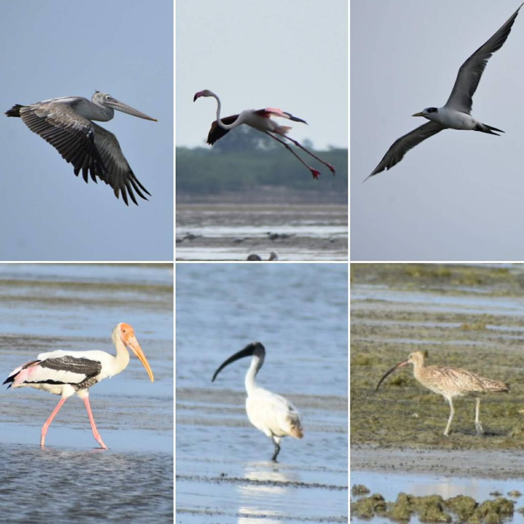
The birds at Lake Pulicat
Aquatic birds and shore birds that had migrated down from far across the globe birds to the Pulicat lake birds’ sanctuary. Pelicans, painted storks, kingfishers, herons, spoonbills, egrets, ducks, terns, gulls and several other species hovered on and off around us. But the peace within us came when the sound of the motorized boat came to a mute and there was an endless visual of the lake merging with the sky in a shade of ‘pink’. The greater flamingoes nesting peacefully in an unexplainable size of the flock. We spent quality time just watching them for a good hour or so before the sun started to turn the sky in hues of red.
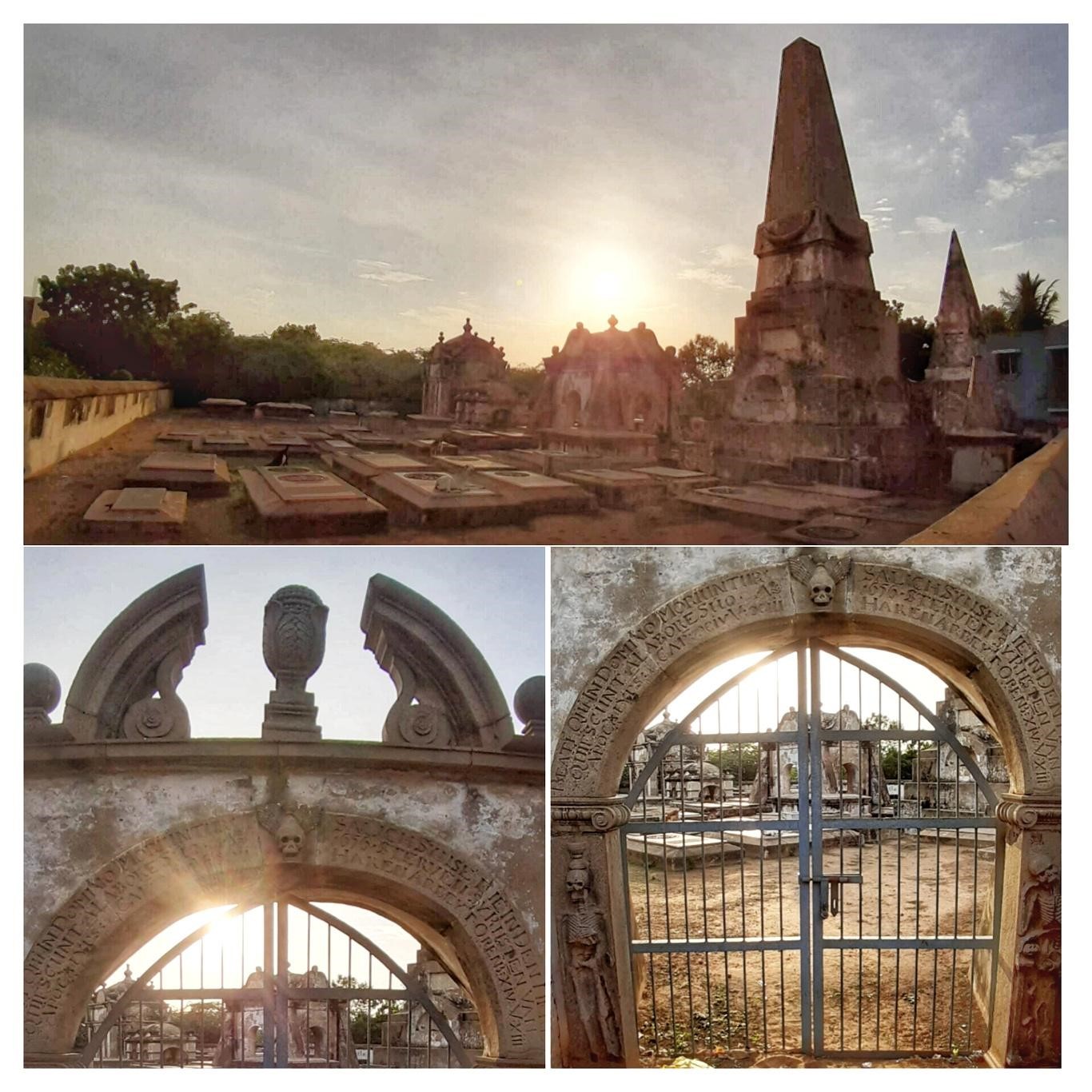
We returned to the bank and continued to drive in the direction of Sriharikota. While we were exiting from the village and were at a traffic signal waiting to enter the highway, my eyes fell on an interesting but ignored piece of construction by the roadside. I decided to go near and noticed that the entry gates were locked. The architecture style was different than anything I had seen before in the region and some strange alphabets were engraved on its entrance arches. Although interesting, it still seemed eerie and gave me some sense of it being an old, abandoned site of a graveyard. Since it was locked, I clicked a few pictures of the place from outside and returned to the car and continued our drive to Sriharikota.
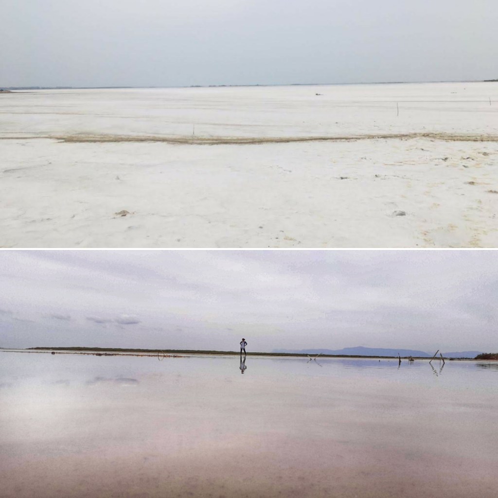
Top: Lake Pulicat enroute to SHAR in winter; Lake in Summer
When I looked it up on the internet, I found some interesting information about that old site I had just visited. There are about five main settlements dating back to the Dutch era across India namely at Gujarat (Surat), Kerala (Cochin), Andhra Pradesh (Machilipatnam), Tamil Nadu (Pulicat) and West Bengal (Hooghly) where forts or cemeteries can be found. This day, I had visited a Dutch cemetery which used to be a part of Fort Geldria or Fort Geldaria at Pulicat. Pulicat was the seat of the Dutch Republic’s first settlement in India, and the capital of Dutch Coromandel. This fort was the only fortification in the Indian empire whereas all other positions of the Dutch Company were trading posts. today, this cemetery houses about 76 tombstones, mostly carved in the Netherlands.
The Dutch cemetery at Pulicat
It is interesting how I came across a random site that holds so much historical importance in India’s history of colonization and it is also unfortunate that how inaccessible or neglected are these sites that holds stories of an era bygone. Thus, the sun had set on Pulicat ending our quick visit to this lakeside settlement.
Chamarajpet is one of the two well planned residential areas of Old Bengaluru. Chamarajpet is in the South whereas the other one is Malleswaram, in the North of the original geography of Bengaluru. Chamarajpet is where my parents lived and worked through all the years at the time of my schooling at Madikeri. So, this locality is like my 1.5th home 😛 (first home is in Madikeri and 2nd home was at Vasanthanagar). I came to Bangalore (and thus, to Chamarajpet) only when I had a long vacation from school. Twice a year, to be precise: Once during the monsoon and once during the summers).
One of the earliest memories I have from this locality is of my family and all our neighbours watching and distributing drinking water and snacks to people who gathered for prayers during festivals at the ‘Eidgah grounds‘ and for the all-night harikatha renditions that happened at the ‘Male-Mahadeshwar temple’ in 2nd main. A large jamun tree in the premises of our house was often mobbed by kids from the entire locality for its fine fruits and the aroma of Rasam from the ‘Vataaras’ of 3rd main are some unforgettable memories.
Eidgah ground at Chamarajpet
There were several things that I saw on TV (Doordarshan) and wanted to learn along with regular school while growing up. But there was unavailability of trained people who could teach me any of these extra curricular skills in the small town (Madikeri). Whenever I visited Bangalore during vacation, my effective time spent with my working parents were mostly for eating out in the evenings and making day trips over the weekends. A major chunk of my Bangalore visits was mostly meant for attending summer schools. With a very large community of literary scholars living in and around Chamarajpet, I could learn different art forms. I attended crash courses across various streets of Chamarajpet (and Basavanagudi) to learn sketching, painting, dance and music.
Every stone, structure and lane has history in Chamarajpet. Makkala koota, Bangalore fort area, Tippu’s palace, all the temples around the fort and the old pete area: Talk about them to my mother and she would be in tears of nostalgia. These are the places she saw every day during her career that spanned nearly four decades.
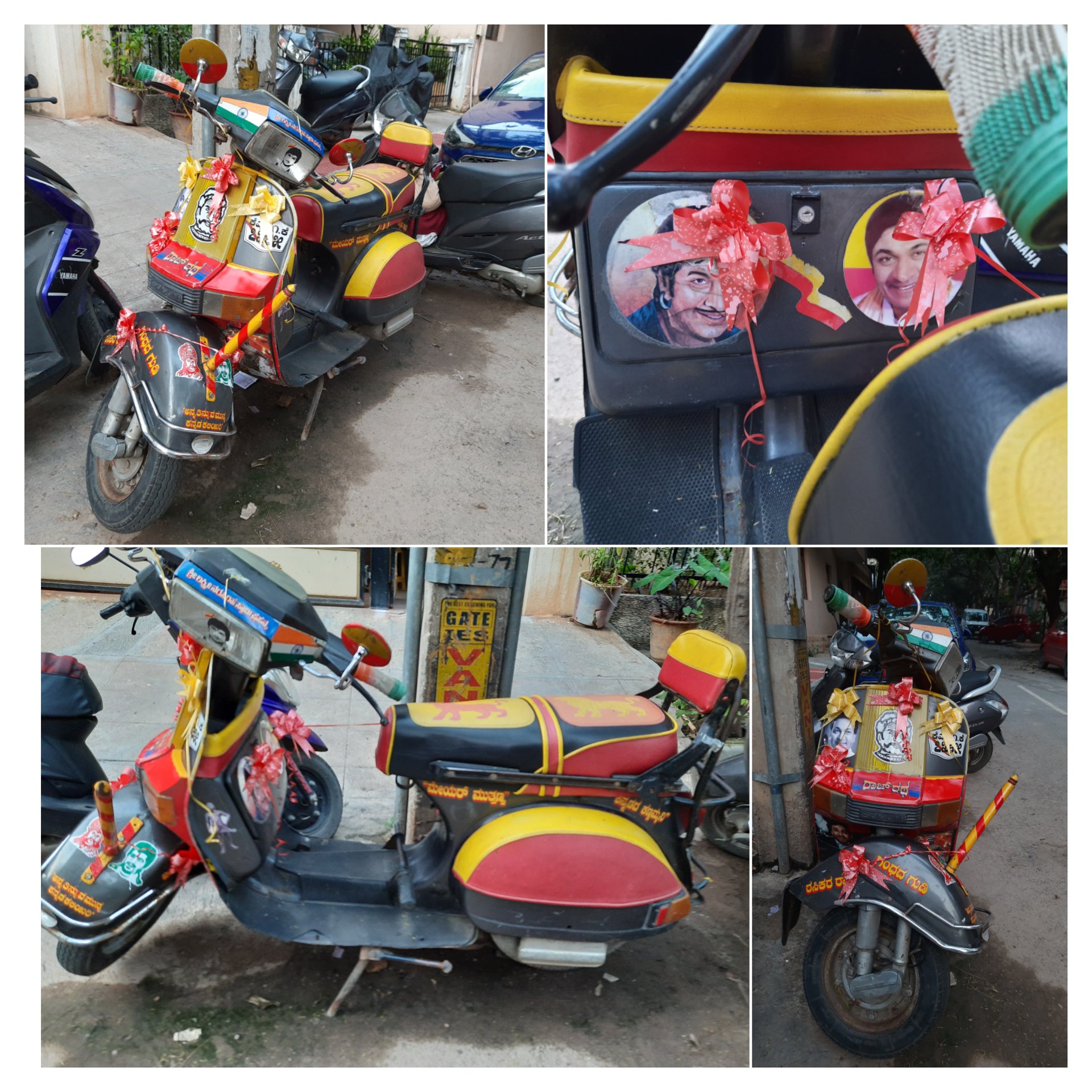
A scooter decked up in a Sandalwood theme (Kannada film industry)
Talking about my family’s favorite eateries, many things have changed and so many old-world structures have been erased now. However, Karnataka Bhel house in 3rd main road along with Gajanana fruit juice center and Iyengar’s bakery in 4th main have managed to stand the test of time.
My family has lived here for 15 years and there is a bond with every lane and its people that we share in Chamarajpet. Here live so many friends, who are more than family to us! Going to Chamarajpet every time is nothing less than travelling to our hometown! So, it is definitely difficult to quantify how much part of me belongs to this area!
This was a post monsoon, weekend trip I had planned with two other friends who had joined me from Bangalore to Mahabaleshwar. The main agenda of this trip was to visit the ‘Khas plateau’ in its bloom season, but it was just for a day (Click here to read more about my visit). Since we were travelling all the way, we decided to extend the weekend for a little longer by adding a few other places and make it a backpacking trip around Satara district.
Our Itinerary:
Day 0: Leave from Bengaluru to Satara (overnight private bus) Day 1: Satara to Wai (MSRTC bus), Visit to Menavali village & Dhom Dam; Wai to Panchgani (Local bus), Local sightseeing and night’s stay at Panchgani (Walk and shared taxi for local transportation) Day 2: Panchgani to Mahabaleshwar & local sightseeing at Mahabaleshwar (hired taxi for full day); Mahabaleshwar to Satara (MSRTC bus) and night’s stay at Satara. Day 3: Visit to Khas plateau & local sightseeing at Satara town (hired taxi); Return from Satara to Bengaluru (overnight KSRTC bus)
The details:
Day 1: Wai and Panchgani.
Since we required to start our Khas plateau visit from Satara, we decided to visit the places around the town later (on day 3). So, we moved ahead on the day of our arrival at Satara.
After alighting at Satara bypass on NH4 that morning, we hired an autorickshaw to reach the bus stand located in the town. From there, we boarded a MSRTC bus to our first major destination of the day: Wai.
Part 1: Places to see in Wai
I had come across the name of this place in a newspaper supplement. I had read that a large part of Shahrukh Khan’s “Swades’ movie was shot in and around Wai. Since we had to anyway pass through this place to reach our intended destination of the trip, I thought it was a good idea to add Wai it our itinerary. However, we had no idea of what to see and things to expect in Wai. We decided to just go there and explore the place by ourselves. Upon our arrival at Wai, we enquired with a few locals who guided us to the banks of the Krishna river.
A. Menavali village: A walk of good couple of miles from the Wai bus stand, we arrived at this village located on the banks of river Krishna. The locals call this as the Wai ghat as well. Apart from being a prominent setting for several Bollywood movies, the Wai ghat is also an important destination for history and archeological buffs. It holds great treasures from the times of the Marathas and the Peshwas. It is especially known for the contributions by the 18th century Maratha stateman- Nana Phadnavis.
Phadnavis Wada: Wada is a local name for a residential mansion with an inner courtyard. Residential complexes leading to river banks on one end and housing temples is a signature architectural style of the Peshwa era. The Phadnavis Wada located on the Wai ghat is one of the handful of such structures that still remains intact.
We did a quick visit to the Dholya Ganapathi mandir & Sri Kashi Vishweshwar Mandir (This temple is called as the Kashi of Maharashtra), both situated on the river bank.
Wai ghat on the banks of river Krishna at Menavali village
As we took a stroll along the ghat, I realized that reality was far from the destination on reel. The real Wai looked very laid back and rustic. However, we decided to sit by the riverside and spend some time by photographing the local kids enjoying their time by diving and swimming in the polluted waters of the ghat.
B. Dhom dam: This waterbody is a good place for water sports with a nice view of the surrounding mountains. Located at about 10kms from Wai and connected by frequenting local shared jeeps, it is a nice place for catching a sunset. But, we gave this is a miss since we hadn’t booked our accommodation and has to reach our next destination ASAP. The bus left Wai and travelled around the curvy road of the mountain. The entire journey was beautiful with great views of the Dhom dam whose waters reflected the clear blue sky.
Part 2: Places to see in Panchgani
We had alighted at our next major destination: Panchgani. Although Panchgani is a small hill town that doesn’t extend beyond a stretch of 2 kilometers, surprisingly, it is an educational hub of Maharashtra. Around 42 international schools are located here. Given its small area, all the popular tourist places in Panchgani are located close by. So, we decided to get off with our backpacks at the entrance of the hill station, explore the landmarks and then find a place for our stay. The details of our time in Panchgani is as given below:
a. Harrison’s Foley view point: This is the first major landmark you come across, even before you actually enter the town. However, we thought of giving it a miss because our next stop was going to give us a view of this Foley as well.
b. Sydney point: We got breathtaking view of the Dhom dam from here. After a long day travelling and walking with our backpacks, we thought this was just a perfect place for us sit down and soak in some relaxing views. We sat down right there on the footpath, facing the dam and spent some peaceful time amid nature. After spending some good time and having all our limbs relaxed, we walked back towards the main road.
c. Table land: Our actual plan was to check-in to a hotel and sleep early that evening. However, we changed our minds and decided to visit the table land to use up our time in the remaining daylight. Sometimes, even with no plans, god really wants you to be at the right place at the right time. That’s how this evening turned out to be. As we went up the road leading to this place, it looked like quite a mela up there. There were so many makeshift shops set up and the place had been littered all around with plastic bottles and wrappers. But, as we walked past the maddening crowds, we saw that the table land was a vast stretch than expected. We decided to walk the entire land before dark. The grassland was naturally gifted with vast stretches of native flowers: all white, purple and yellow. It was a magical place that got us busy photographing the silhouettes of the grazing cattle, the horse riders etc. against a beautiful backdrop of the setting sun. An artificial lake amid the grassland added romance to this place. The sky was painted in all hues with a beaming full moon reflecting in the lake’s water, adding to the spectacle. It felt like as if the sun had gone down sooner that day. With that, we had to scoot out of the place as area suddenly started to feel deserted and had no guiding lamps to the main road.
d. Rajapuri caves: This place falls on the way up to the table land. We were told that the cave has a temple dedicated to lord Ayyappan and hence, women of menstruating age are not allowed inside. With that, we headed back to the town and checked-in to a hotel.
We wanted to have some food that are a must try in Panchgani. So, we dumped all our luggage in the hotel room and set-out to walk around the town, yet again.
Panchgani is famous for channa, chikki and fudge: the shops say this all over the place. So. we picked up some of these to carry back home.
What caught our attention was a bottle of strawberry wine at a wine store.
The day’s events concluded with a sumptuous spicy hot ‘veg Kolhapuri with roti‘ for dinner.
On the following morning, the idea was to be at the table-top for sunrise. However, we snoozed the alarm for a little longer and we woke up only when the hotel staff rang the doorbell. We then started our day with a yummy plate of Poha for breakfast and hired a taxi to our next destination: Mahabaleshwar.
Day 2: One day at Mahabaleshwar
The hill station is a favorite haunt of tourists from the nearby metropolis and afar. Mahabaleshwar can be broadly classified into two parts, the New and the Old. Both have been explained in detail in a separate post as the list of things to see and do in Mahabaleshwar is going to be long.
Kate’s point and the elephant head view point at Mahabaleshwar
Day 3: Satara and Khas Plateau
This day was the sole reason that had got us to plan this entire trip. We woke up early to reach Khas plateau for sunrise and get some wonderful photographs. Being early gave us the benefit of avoiding the scorching sun and also to escape the crowds that would normally pour in at a later time.
Apart from my visit to Khas plateau that requires a separate post, I am listing the places of interest around Satara town for those wishing to explore this region:
a. Around Khas plateau: If you have sometime in hand, you can drive further from the Khas lake to reach the boating village of Bamnoli and take a boat tour to Vasota fort or Tapola. b. Vajrai and Thoseghar waterfalls: These picturesque places were a disappointment when we arrived there as these are mainly rainfed cascades. c. Chalkewadi windmill station: Considering that we had visited a windmill station earlier, back in our home state and to save time, we gave this place a miss. d. Forts for the history buffs: Sajjangad, Ajinkyatara, Pratapgad, Kalyangad are places that can all be covered, but only with the convenience of having own transport. We skipped our visits since we were largely dependent on public transportation and taxi service that was expensive. e. Natraj temple: This ancient structure located in the center of Satara town, is worth visiting
The Pink balsam carpet at Khas valley
Food to try in Satara:
Kandi peda: This is a specialty sweet of this region
Zunka baakri: This is roti made of a locally available variety of maize, we had it for a late lunch that kept us filled throughout our return journey.
Fresh strawberry with cream in Mahabaleshwar.
We boarded a bus back to Bengaluru and thus, ending a long weekend in Satara.
So yeah, the bike is fixed. I am fresh. I remove and keep my sweatshirt in my bag in a way that I can pull it out without having to open the bag. It’s already about 12:30 by now. I set out to cover as much distance as possible by dusk. Well I took Nashik-Shirdi road because that was the shortest distance. Oh boy, shortest distance turned out to be a nightmare. The road is okay for maybe about an hour from Pune; there on, it is more of a fucking off-roading course. The road is literally non-existent for a hundred kilometres atleast, riddled with huge potholes and roadhumps where it is not necessary. One fucking hell of a road! Pretty fortunate not to have crashed on this section because of the unmarked roadhumps. Even in broad daylight, I couldn’t go past 40kmph without risking a fall or ruining my bike. The road pretty much stays the same till Malegaon.
The stretch at Sangamner
I leave Dhule just before darkness prevails. It becomes a very monotonous situation from here. Almost zero traffic after dark and no street lights or illumination for the highway. It is just me, riding alone in the dark, among occasional trucks. I have to ride through Khargath Sendhwa. The Road seemed twisty turvy with occasional potholes and what looked like debris on the sides. I passed a R15 couple here in this section. Without much thought, I continue my journey in the darkness. I did stop once, near what I can explain as a petrol pump- pretty much away from me. Just when I’m stretching my ass off, the R15 guys show up right next to me. They stopped to enquire about my destination and why I’m riding alone. I initially thought I’m about to get mugged, but these guys actually advised me to stop for the night as the journey on this road, at this hour was not safe. And they ride off.. Of that was so not expected, from a stranger..!
Above: Tollgate at Kalghat; Below: Tollgate at Dhule
Well now, I also ride out almost as soon as they left. I next stopped at Khargate tollgate. Here, I had to listen to three people advising me to stop and take the night off because it is not safe to ride alone on this road. Oh okay, now I’m kinda curious and cautious about riding anymore. So, I ride a little further from the tollgate till I find a brightly lit place which had boarding and lodging. I decide to finally take off for the night and catch a shut eye for the ride next day. It’s about 9.00p.m. now. And I take a room that is pretty huge for a single guy like me. All I had to do was to uncloth myself. That was it, I set an alarm for 5.00 in the morning because I can’t wake up any sooner. That’s all I remember. One super deep sleep I was in, as soon as I hit the bed. So peaceful sleep I got, like proper deep sleep…
The alarm went off on time, only to be snoozed till 7.00a.m. because I’m lazy to ride out in the cold. So I finally get off the bed, take bath etc. and ready by 8.00.a.m. I have 2 cups of tea and vacate the place. Remember, I’m still a 1000kms away from my destination.
Photo stop near Gujri
By 8:15 I’m already on road riding out, not till I spot a board indicating a town called Gujri. Oh well Gujri, what better name to have a picture taken with. Just a brief picture stop. Okay.. that’s the last stop major picture stop of the day. The whole day went riding pretty much non-stop, except for the fuel stops. So yeah, I rode and rode the whole day because this was my last day to reach in time. I pass through Dhar, Ratlam, Mandsaur, Neemuch City and Chittorgarh. This Chittorgarh happens to have a massive fort. But for me today, no time. So onward… The whole road has been good wide road, so no tension. But now new tension, I can rain see clouds in the far distance. So I take a brief pitstop to cover my bag and continue.
Nothing much worth mentioning along the route there onwards. However, it’s become pretty late by now. Almost past lunchtime. I ride till I reach Kishangarh. Oh, this place is like Jigani neighbourhood of Bangalore. Only Marbles in this city. This city is filled with marble sellers. Italian, Indian, whatever marble you want you will get it here. A Marble market city. So by the time I leave this city, it is already 5.00.p.m. I drape my blanket and get prepared for the “Thand”. The next city is Kunchaman city. This city seemed a little dirty with slush almost everywhere. Then I realise that it had rained here. It’s kinda wet and cold. So take the road to Jhunjunu via Sikar. This road is good but single lane, no street lights. Almost reached Sikar, when I’m having a tough time riding the bike. Because it suddenly became unbearably cold and was completely covered in fog. Even the other vehicles seem to be driving super slow. I almost fell off once because of a mound in the middle of the road. I almost immediately stopped, to take stock of the situation. The road was wet because it had rained. Not only had it rained, but it was a hailstorm and the temperature had dipped to near zero. The mounds on the road were mounds of hail stones and I had almost fallen off because of them. Shit crazy it was. Who expects rain in the middle of a desert region? Yeah, so I pass through that area and reach Sikar. Then reach Jhunjunu and finally take the deviation towards Alsisar. This fucking maps can take through some crazy routes if you are not careful enough..!
Hailstones at Sikar
However, it took through some road and put me back on the right road in a while. Yeah peace. . It is 11:30pm and I’ve reached my destination. “Alsisar Mahal“. And I’m all set for the festival. It is cold and I am tired. I had been waiting to just get a place to sleep.
And so yeah, I reached a music festival in just around 50+ hours from Bangalore. To the ‘Magnetic fields ‘ music festival from the ‘Silicon City’ Bengaluru in 50hours..!
To be continued….. Part 3
(Are you enjoying reading this piece this far? If yes, Please subscribe or hit the Follow button to read my stories from the road. If no, please leave your comments below and tell me how and where I can improve upon)
Visiting the Saurashtran region of India was a last-minute inclusion in the itinerary of our trip which was otherwise planned only to ‘The Rann of Kutch’. It was noon by the time my friend and I arrived at Junagadh, by a train from Ahmedabad. After checking into a hotel at a walkable distance from the station and freshening up, we relished a sumptuous ‘Gujarati Thali’ at a nearby restaurant. After a while, we set out to explore this historical city of Junagadh, a place lesser known on a typical backpacker’s circuit.
With a short autorickshaw ride, we reached the entrance of the Uparkot fort. This place is what gives its name to the city. ‘Juna-Gadh’ in local language means ‘Ancient Fort’. This fort dates to 3rd century BC, to the Mauryan Era. It must have been a massive structure back then. With several dynasties ruling this region over time, there are many historical remnants of structures that were eventually added. However, all are in bad shape now. The Buddhist cave, the Jumma Masjid, the tomb of Nuri Shah, the Naghan Kuvo stepwell are among the few that have stood in time. But Adi-Kadi Vav and Nawabi lake are the structures that I found interesting among all. Adi-Kadi Vav is a stepwell facing the Girnar hills, to which we had to descend a flight of stairs to reach water (mind you! The water is extremely dirty with all the trash). Whereas the Nawabi lake is an artificial pond that required an ascend of a spiraling staircase where the reflection of the Girnar hills looked beautiful in its water. This spot also had a dozen peacocks walking around the pond. Our walk tour ended in a couple of hours and we decided to walk back to the town.
Adi-Kadi Vav rockcut stepwell at Uparkot fort
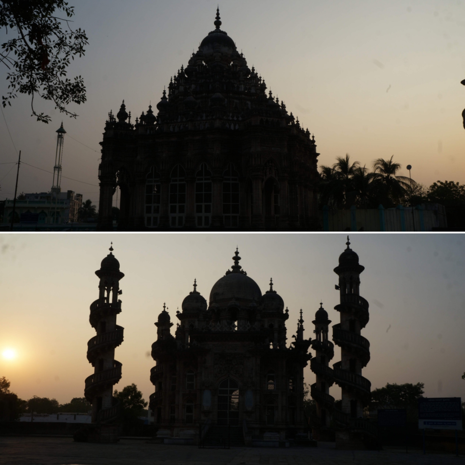
This gave us ample opportunity to photograph the rustic, old world and yet vibrant streets of the old city. Almost every corner of the lanes and its doors seemed like they had stories to narrate. As planned, we arrived at ‘Mahabat ka Maqbara’ at sunset time. These twin tombs of the past rulers are very beautiful, and it is only enhanced by the shades of the setting sun. We were very particular to photograph this place at the golden hour and were happy souls towards the day’s end for capturing those amazing silhouettes.
The twin tombs at Mahabat ka Maqbara
After a long walk further in the quest to explore the market area of the old city, we kind of came to realize that we were lost in the cramped streets of a place that seemed like Namma Bengaluru’s Pete area. Google maps was of very little help so much so that we reached the same spot after walking around in multiple directions. Finally, we hopped into an autorickshaw to get us to the hotel, not minding the short walkable distance that was indicated by Google. We wanted to get some rest as our night was going to be long. We set the alarm to wake up by 10.00.p.m. so that we could start to hike by 11.00.p.m.
However, I slept a wee bit longer and had been shaken up neither by the alarm nor by the panic-stricken friend’s endless calls from outside my closed room doors. When I woke up from deep slumber, it was 01.00.am and my friend was almost in the verge of fainting to know that I was not responding inside a closed room 😀 We then got an auto ride to the base of the Girnar hills, the climb of 10,000 stairs had to be done before sunrise. The plan was to ascend at night, catch the sunrise from the peak and descend back before the harsh sun rose up during the day. Post breakfast, we would leave for our next destination. We were already running behind schedule.
We commenced our hike and there was barely anyone else with us. The winds were very strong and the rustle of the trees as we passed through the initial stretch of forest was creepy in the moonless night. The Girnar hills is believed to be older than the Himalayas and a pilgrimage site for people across faiths. Several structures like emperor Ashoka’s rock edict, Jain temples, ancient inscriptions etc. are things that kindle the history buffs if they are not interested in the pilgrimage including the Jain tonks or several other temples from across time in history. However, after climbing about 5,000 stairs, my legs were tired and couldn’t catch up with my friend’s pace. I could have completed it though, only at a slower pace. But, we wouldn’t have been able to make it back in time if we had to catch a morning bus to our next destination. Fearing which, I decided to sit back and let my friend go ahead and complete the hike. However, he was not okay with the idea to let me sit alone all night (it was bloody dark and windy with NO ONE around) and decided to head back to the hotel with me. So, the descent of 5000 odd stairs on our way back wasn’t easy either. I was unprepared for this long hike and I guess it was a wise decision for me not to continue the ascent. It would’ve taken a real toll on my legs and the rest of the trip would’ve been screwed up. But what makes this a memorable trip is the fact that this was the first EVER hike that I gave up halfway, without completing.
Then, we telephoned the same rickshaw guy to give us a ride back to the hotel. It was a short but a nice ride. The proximity of the Gir National park had herds of Nilghais, boars and other wild animals on the highway that we were travelling on. A stay in the ‘Gir National Park’ is a dream for another day. Perhaps when I have more days in my itinerary and more money in my wallet. Maybe that time, I will have more stamina to reach the peak of Girnar too. But for now, we were reaching our hotel for some more sleep.
This was the first time I was stepping into the state of Rajasthan. Time has been kind on me yet again bringing me to the right place when the time was right! And this time it was to Ajmer during the holy month of Ramadan. Ajmer-Marwar region was a separate state until it was merged with Rajasthan. At a distance of 130kms by road from Jaipur, it is believed to be the second holiest place in Islam after Mecca. Apart from exploring Ajmer town, if you are a traveler, you can also include Pushkar in your itinerary, which is located less than 25kms from Ajmer. Apart from being a holy place for the Hindus, Pushkar is a popular haunt for the hippies from world-over. You can use the below itinerary if you have a weekend in hand. However, I could only explore Ajmer on this trip.
A weekend Itinerary:
Day 1: Bangalore to Jaipur (Flight); Jaipur to Ajmer (Hired car); Visit Ajmer dargah, explore Taragarh hill, Adhai-Din-Ka-Jhonpra, Akbar Palace & museum, Soniji-ki-Nasiyan Jain temple, Mayo college campus. (Night’s stay at Taj- Ajmer gateway) Day 2: Visit Pushkar lake for sunrise, explore Pushkar town (and the annual camel fair, if you time your visit right); return to Jaipur (by road), Jaipur to Bangalore (flight)
The Details:
I was visiting Ajmer on a business trip with three of my colleagues (Click here to read about my job as a car doctor). Hence, I somehow managed to squeeze in sufficient time into my trip so that I could venture out in this city and explore most of whatever it has to offer for the traveller in me. Needless to say, no visit to this holy city is complete without heading to the Ajmer Sharif Dargah dedicated to the Sufi Saint Khwaja Moinuddin Chishti.
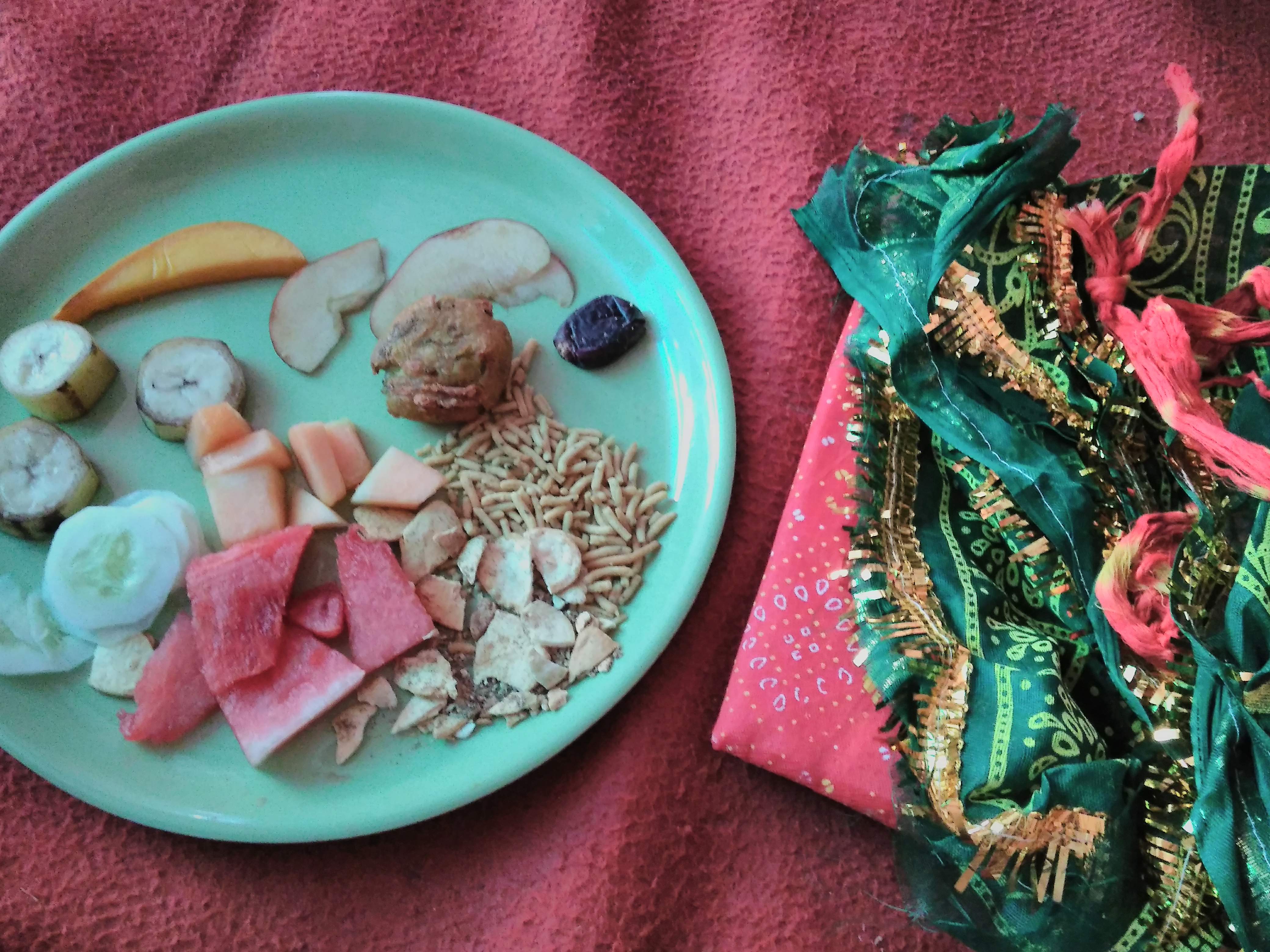
Apart from it being the holiest and the busiest of the times on the Dargah’s calendar, our visit also coincided with the 27th day of the holy month: revered as the ‘Night of Destiny’ in the Islam faith. This is a place where most people struggle to get past the crowds even on normal days. We were fortunate to have contacted one of the trustees of the Dargah who managed our entire visit and made it effortless. It was evening time and we had just finished offering our prayers by donating a Chadar to the diety. What we hadn’t realized was that we were there on the premises of this holy place at the time of breaking the day’s fast. We were offered some fruits, nuts and food by the trustees and other devotees who were distributing food there. I was overwhelmed with the thought of having had such an opportunity, at such a time!
Breaking the fast at Ajmer dargah Sharif
The Dargah is located at the base of the Taragarh hill, atop of which a fort is situated. The view of the entire hill overlooking the Dargarh is so beautiful with a township constructed on the steep slopes of the hill. Since, photography is prohibited inside the Dargarh premises, I wasn’t able to capture most of the things. It’s a welcome move in some places like these and respect the sanctity of the place. Enough is said and written about this place on the internet. So, I wish to cover about the other things this historic town has to offer.
After our visit, we walked the by lanes around the Dargah to explore the best of Ajmer. Not in terms of places but in terms of its lip-smacking street food. With a lot of Mughalai and Nawabi influence and it being the Ramadan season, the best of the spread was available. Needless to say, Ajmer is a haven for food lovers. By the time the last ray of the day’s sun had vanished, we were stuffed until our glottis.
If you are a history buff and want to find something to feed your wanderlust, you can take a walk to Adhai-Din-Ka-Jhonpra and the Akbar Palace and museum that are located closer to the Dargah. Soniji-ki-Nasiyan is a nice two-storeyed wooden Jain temple that can be visited enroute to Dargah Sharif. If you are at the luxury of time, a quick ride to quick ride to the Mayo college campus can be ended with some peaceful sunset time spent by the banks of the Ana Sagar Lake. But, for me- something else was awaiting!
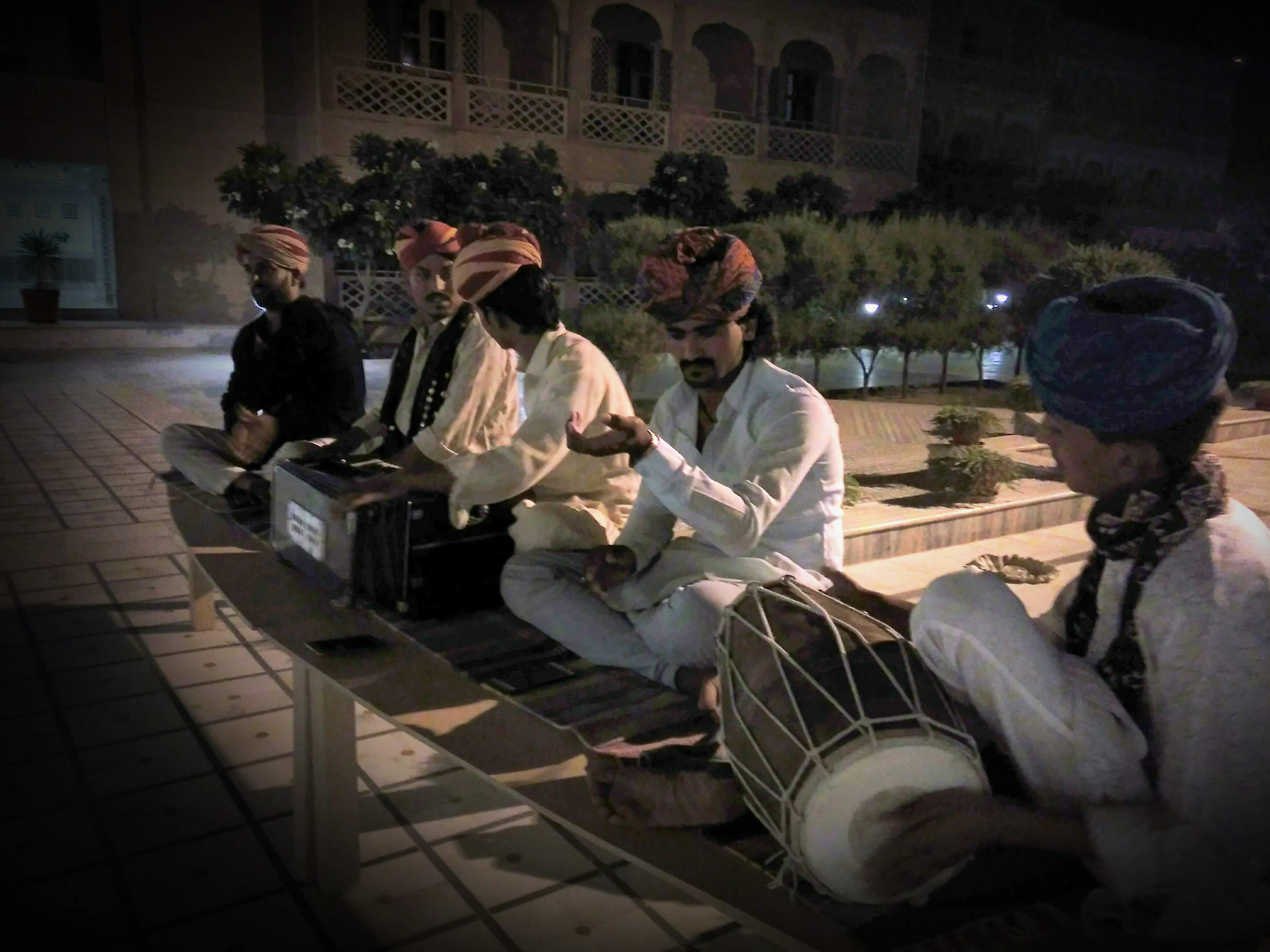
The folk singers performing live in the courtyard of the Taj
I had my stay booked at the Taj- Ajmer gateway for the night, a world in itself to visit and hang around. The drive from Ajmer city towards it outskirts on Pushkar road, through winding roads with the backdrop of the setting golden sun was a picturesque treat after a tiring day of work and toil. All this seemed like only a grand welcome to the beautiful Taj property that’s nestled in the midst of nowhere in the lap of the Aravalis. The sky was dark, when we arrived at this palatial hotel. The entire driveway was lit with dim sodium lamps from the gate through the lounge. A faint outline of the Aravalli hills standing calmly on the backdrop only enhanced its grandeur. It was a warm welcome as the live Rajasthani folk music with the timbre of the Morchang and Khartal resonated from the courtyard. The host personally lead me to the room while explaining the delicately chosen wall murals and paintings as we walked through the elegant corridor. Though my stomach was stuffed with Ajmer’s street food, I did manage to make some space for the delectable dinner that I was hosted at the restaurant. With all items seasoned and cooked to perfection, each dish seemed better than the other. With a refreshing dip in the pool, a day was called!
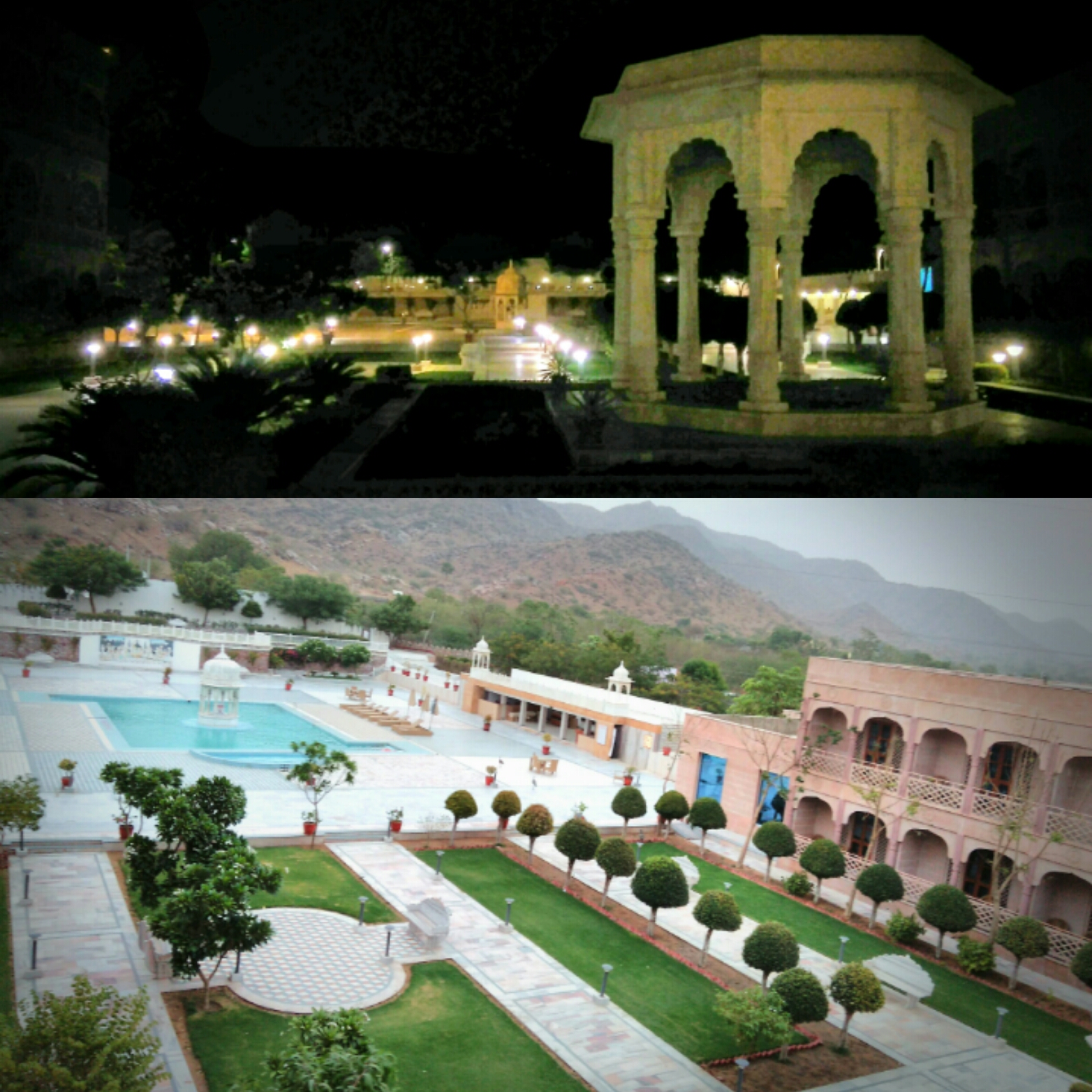
Top: The courtyard at night Below: the morning view from my balcony
I looked forward for the morning as much as I did for the previous evening! I had set the alarm for sunrise but was woken up rather early by the calls of dozens of feral peacocks that had come from the forest/hills just behind the pool. I opened my balcony doors and voila! It was a magical morning with peacocks dancing in the courtyard and a modestly calm sun peeping out of shadowy grey clouds with the glorious green Aravalis forming a backdrop… I soaked in this special moment as much as I could from my balcony before I realised that it was time for me to pack-up. Finishing up the morning chores and ending my stay with the Taj with a wonderful breakfast spread, it was time for me to say good bye to this beautiful city of Ajmer and this beautiful Taj property- the Ajmer gateway!
Fact file:
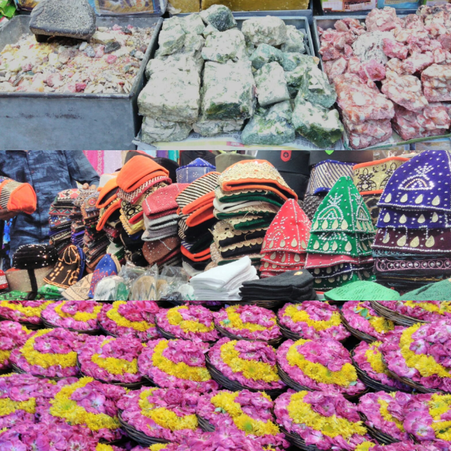
Must-do:Make a wish by offering the Chadar or the decorated shawl to the deity/tomb at the Dargah Sharif. Must eats: while the street food and the never-ending list of non-veg dishes are to die for in the month of Ramadan, Kadi Kachori and Soan-Halwa are an all-season recommendations. Must buys:variety of prayer caps and incense.
This visit to Tarangambadi was a part of our family’s backpacking trip, mainly conceptualized to cover a portion of the Coromandel coast. Our itinerary for this trip was Bangalore – Mayiladuthurai – Poompuhar – Tarangambadi – Karaikal – Nagapattinam – Velankanni – Tanjavur – Trichy – Bangalore.
This post is about destination no.3 on the first day on the east coast road. I had read about this place in one of the history texts about the Colonial empire in India. I had visited Portuguese, British and the French settlement towns during my earlier travels. The Danish colonized in India for over 200 years with three important settlements. Serampore (in West Bengal), Tranquebar (in Tamil Nadu) and Nicobar Islands (in Andaman & Nicobar Islands, all along the Bay of Bengal. To read about the existence of these places in modern day’s context, there was barely any information available online from a traveler’s perspective. Since we were anyway doing the ECR tour, my curiosity to know more about a Danish settlement motivated me to add Tranquebar in our itinerary. ‘Tranquebar’ as the Scandinavians called it, is a humble town known as ‘Tarangambadi’ in present times.
As we continued our secular pilgrimage, I bought tickets to a destination that was unheard of to my family until that moment. I requested the conductor to inform me when we arrived there. Accordingly, we alighted the bus at a small junction. The place looked very laid back, simple, untouched by any major developmental investments, just like any other fishing hamlet on the coasts of India. The bus conductor pointed to a small road to the right and guided us telling “one kilometer ahead is the fort”, and blew the whistle indicating the driver to proceed. My parents looked at me with a blank look on their face. I could sense that ‘Where are you taking us on this hot afternoon?’ question in their eyes. Although with the first look of the place, I too had similar apprehensions running in my mind, I wanted to walk further to see what was really there!
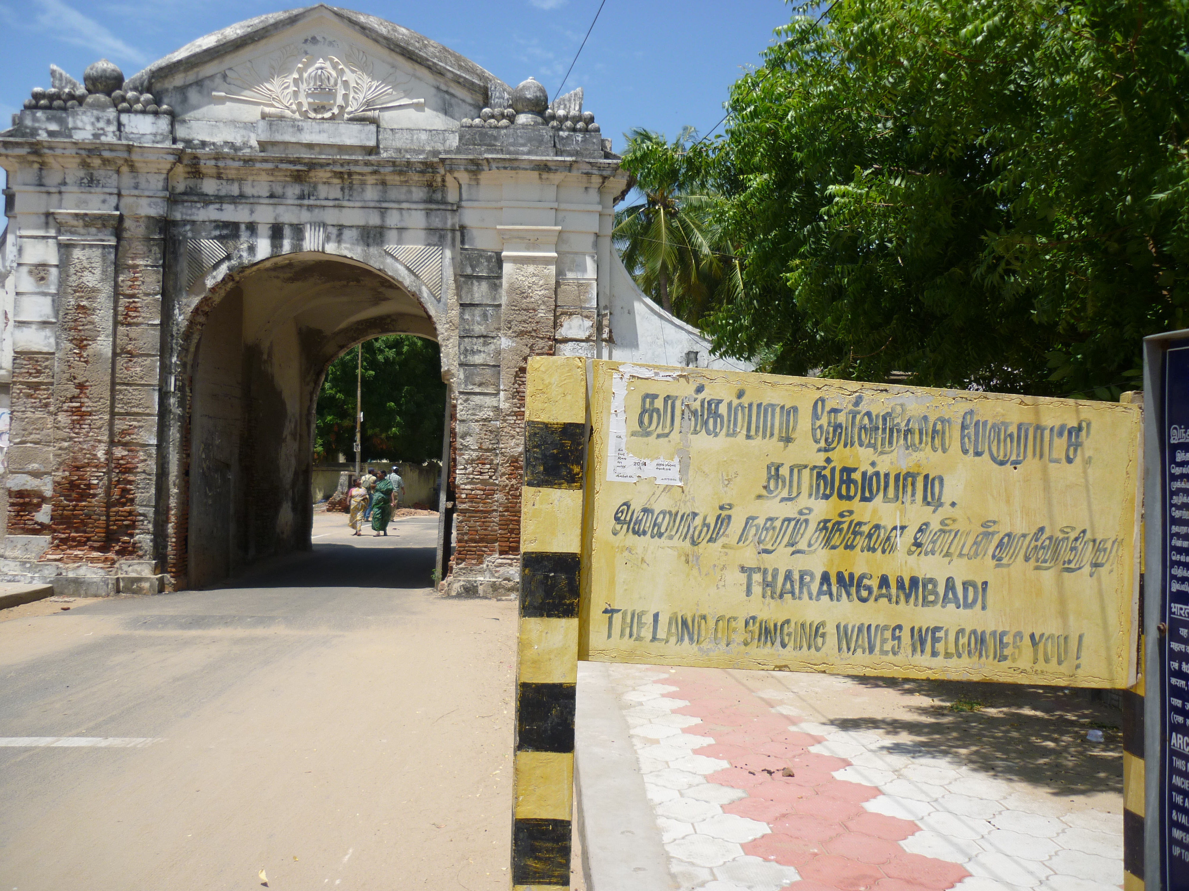
We walked for about half a kilometer and an old arch done with Danish art welcomed us at the entrance of the town. A board by the side of the arch read: ‘Welcome to- The land of the singing waves- Tranquebar’.
The arch at the entrance of Tarangambadi/Tranquebar
As we walked through this town welcome gate, the feel of the place transcended us instantly to a different country, or a different era- perhaps. The roads were super empty & clean and old Danish buildings stood tall on either side of it. The Zion church, the Teresa’s convent school, the Danish governor’s bungalow among several other structures that tell tales of an era bygone finally led us to a fort. ‘Fort Dansborg’ as it is called, is a structure peacefully nestled on the calm shores facing the Bay of Bengal. The moment we got a glimpse of the beach from the fort entrance, we got the link to the name of this quaint little place- Tranquebar: the land of tranquil waters. The place had tranquility overloaded not just in its waters, but in its air, land and whatever we saw around. I’m usually not a beach person, but this place was magical!
Since there are just countable properties (heritage bungalows turned resorts) in the town, Tranquebar is still unconquered on the tourist radar. Also, the unavailability of affordable food in a long stretch of kilometers, the budget hoppers are those who just drop in for day trips. Hence, except for a handful of fishermen, evenings and early mornings are idyllic with you being your only company if you choose to take stroll along the calm beach. This is by far, one of the BEST beaches along the east coast that I have been to.
The serene shoreline around the Tranquebar fort
The fort is well maintained and converted into a museum. An important port between 1600s to early 1900s, the walls of the port now lay dilapidated, majorly battered by the tsunami in the year 2004. A stroll along the beach take you to the Masilamaninathar temple. It dates back to 13.C.E. and is believed to have mythological importance. The sculptures on the walls of this temple and the shikara have been corroded by the salts.
Although there isn’t much to see around in Tranquebar, it was a place that filled our mind with peace and tranquility even with just a few hours spent there. My parents too, were equally excited about the place where I had brought them to. I must admit that Tarangambadi is a place that I would COME BACK soon. Then, with more time and a hotel reservation at one of those bungalows on its beaches. But for now, it was a hard but a helpless option for us to pull ourselves out of this place. Unsatisfied with the quick visit, we promised ourselves to come back exclusively to stay here as we left for our next destination- Nagore.
Karnataka Bundh: The whole city of Bangalore was protesting against the Kaveri water verdict- 32 buses vandalized in the city and all that jazz. Well, I was away from the entire hustle bustle, where fighting for the water of Kaveri made no sense for the people. That day, I was spending time with my mom who was away from home since the last couple of months, on business travel.
My itinerary: Day 0: Bangalore to Bidar (Overnight bus) Day 1: Jharani Narasimha Swami Cave temple, Karanja reservoir, Basavakalyan (Basaveshwara temple, Basavanna statue, Basavanna Guhe, Akkamahadevi Guhe Anubhav Mantapa, Basavakalyan fort) Day 2: Nanak Jira Gurudwara, Bareed Shahi park, Bidar Fort; Return from Bidar to Bangalore (night bus).
The details: People in the Mysore-Karnataka region know Bidar and the rest of the districts of Kalyana Karnataka or Uttara-Karnataka mostly through media that only talks about them when there is a drought in the state. This somewhat had influenced me to paint a dry and a dusty picture of the region inside my head. There was not much that I had heard about this part of Karnataka on a typical tourist circuit of state and that’s why I chanced upon travelling to Bidar for a weekend. Since my mom was posted there for some time, I thought it was an opportunity for me to go and see what is in the northern-most district of my home state. Mom usually has a vehicle at her disposal whenever she travels and stays during the entire business trip. This solves most of the commutation problems.
Day 1: When I reached there after a long overnight bus journey of 12hrs, I had a roaring welcome in the city, quite literally…!! An IAF “Hawk” flew past right above my head during their daily flying sorties. Right then, I had my first GK (general knowledge) moment of the tour. Bidar has been an important training base since the early 1960’s for the Indian Airforce. Bidar serves as the main base for Hawk AJTs and the Suryakiran HJTs. The first thing that I learnt about Bidar and is never shown or spoken about on mainstream media.
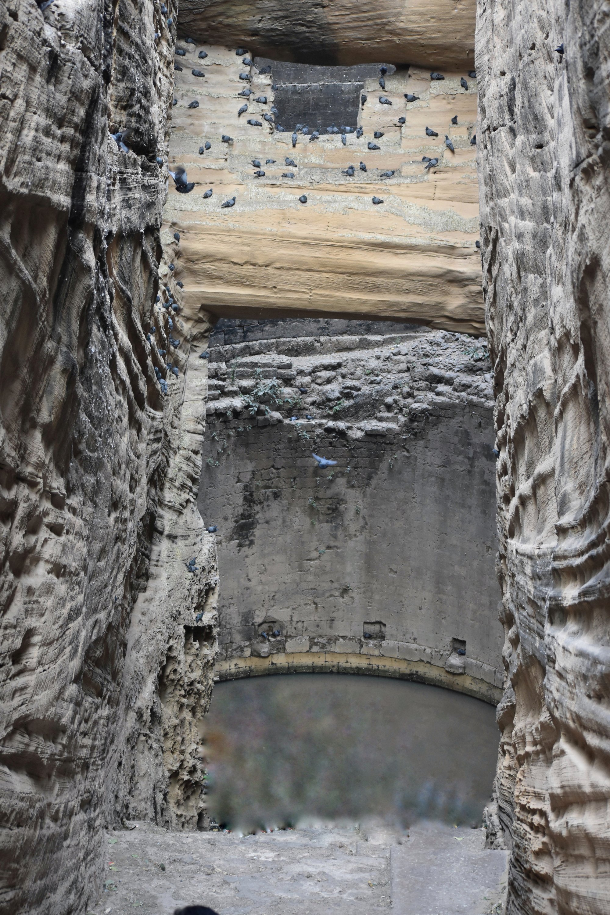
My mom received me at the bus stand and took me to the Inspection bungalow where she was staying at. After freshening up and post a quick breakfast, we headed to “the Jharani Narasimha Swami Cave temple”. The myth mentions that Lord Narasimha killed Hiranyakashipu and then proceeded to slay the demon Jalasura, a staunch devotee of Lord Shiva. After being killed by Lord Narasimha, the demon Jalasura turned into water and started flowing down the feet of Lord Narasimha. Today, devotees have to walk across a cave with water (1.7mts depth) to worship the idol. With bats flying around, roaches swimming with us and dimly lit path to lead us, it was a new experience for me, and I was seeing such a religious site for the first time.
Inside the cave- enroute to the Narasimha idol
We then proceeded towards our next destination. Enroute, we stopped by the Karanja dam, a small reservoir built across the Karanja river.
In a while from there, we had arrived at Basavakalyan- our main destination for the day. There, we visited the Basaveshwara temple, 108ft high Basavanna statue, Basavanna Guhe and Akkamahadevi Guhe. Then it was a turn to the right that took us to “Anubhav Mantapa”. This is a replica of the ShivanubhavaMantapa- an academy of mystics, saints and philosophers of the ‘Lingayat’ faith in the 12th century. Anubhav Mantapa is often referred as the first parliament in the world.
A view of Hyder Mahal at the Basavakalyan fort
From there we visited the Basavakalyan fort, sparsely visited apart from a few localites who come there to play cricket. But it is indeed a monument forgotten on the maps. The lights falling on the inner chambers of the fort called for some good photography. Some of points of interest inside the Basavakalyan fort for an explorer may be the open-air theatre at the entrance of the fort and the view of Hyder Mahal from the Kadak Bijli Toph viewpoint. With that, it was dark, and we returned to our place of stay.
Day 2: We started the day by spending some tranquil moments at the ‘Nanak Jira’. This Gurudwara is known for being the second occurrence out of the supernatural powers of Guru Nanak. The first one was ‘Sri Punja Sahib’. This is now in Pakistan and strictly prohibited for free visits. Hence Gurudwara Sri Nanak Jira Sahib is referred to as the ‘Second Punja Sahib’ of India and hence a very holy site for the Sikhs. The sweet water flowing from a spring is believed to clear one off, all sins.
The Nanak Jhira Gurudwara
Next, on the list was the Bareed Shahi park. The tombs of the Bahamani rulers lay here. This is small but a nice park maintained just to provide some lung space for morning joggers and evening walkers. We were told that this was a neglected piece of history just a year ago and good efforts have been made by the authorities for its restoration.
We had an invitation from one of the colleagues at my mom’s office to visit his home for lunch. To think of it, it is by far and large one of the MOST sumptuous and wholesome meal I have had all my life. Hahaha call it the downside or the funny part of relishing such a wonderful meal- My mom and I were handed over a large towel to wipe off our teary eyes and watery noses. The regional cuisine here is notoriously famous for being high on chilly. But even with the hot flames flying out of our senses, we couldn’t resist the taste of the flavorful spread. It was a typical North-Karnataka cuisine with a spread of over 50 dishes. We were overwhelmed by their hospitality and the flavorful cooking. Apart from the Millet roti and gunpowder, most of the dishes were new discoveries for me. I even had a box packed with roti and keema-curry for my return journey by train in the night.
The Bahamani tombs
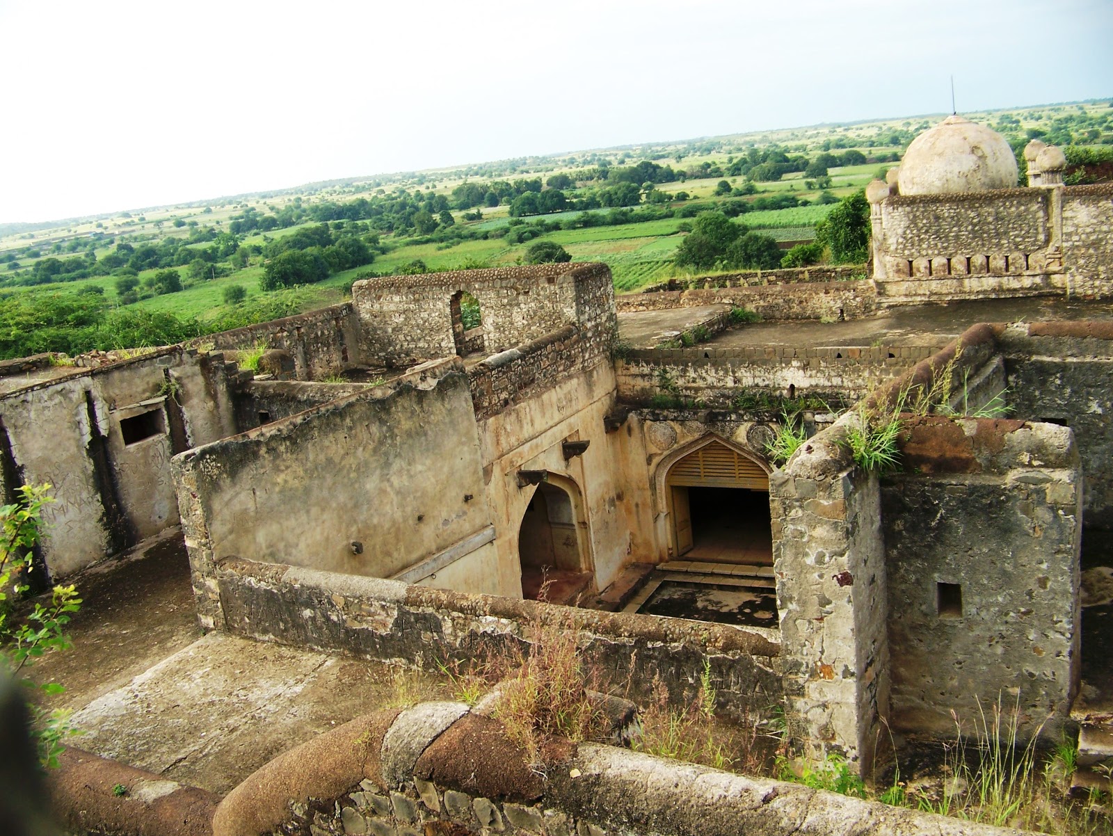
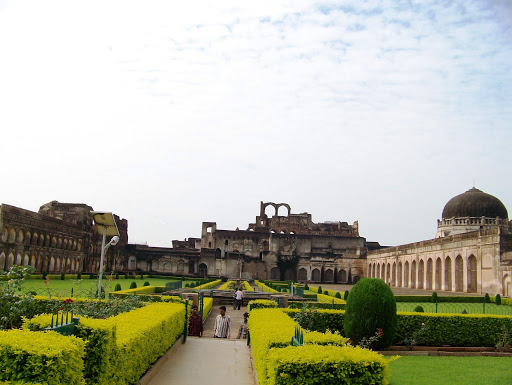
The last and final destination was the Bidar Fort: It is a multi-layered fort to say in simple words. It does not have a quantifiable boundary, though a few localites specify some digits to measure its expanse. The entire city of Bidar is actually within a fort wall which was the area where the citizens lived back during the rulers’ time. The second round of the wall is where the ministers lived. The third and the innermost zone is where today’s tourism is concentrated, the area where the King & the queen lived. This fort needs a minimum of half a day to explore for a person interested in history, architecture or archeology. In a tourist circuit in Bidar that I barely heard of, this fort came in as a surprise when I had least expected. It is HUGE!
The Royal Residence within the main fort
Bidar has so much to offer for a backpacker on a tight budget. Apart from the travel distance between places, everything else is very affordable. Even the entry to all the major landmarks on the potential tourist trail was free. In spite of it, very few people plan a trip to this district. Maybe because the name pulls down an image of a dry, barren, hot, poor, drought prone landscape. What my eyes met here was contradicting to the imagination that I had, largely based on what I heard in the media. In reality, the city was lush green, well fed with good rains and clean (at least compared to the cleanest places of Bangalore).
Souvenirs to take back: Bidariware is a local form of metal art that has a GI (Geographical Identification) tag and extremely laborious and artistic. It takes an 8 stepped process to create one piece of art and a symbol of royalty, that’s been carried on from 14th century, largely promoted by the Bahamani Sultans.
So, a lesson to take back: Stop imagining how a place would be; go there and see it yourself.