Category Archives: Statewise Travel

Journey away from Bangalore that includes night journey and an overnight stay… Especially ones planned on long weekends with Saturday and Sunday off :)

A town in the foothills of Kinnaur Kailash- Kalpa

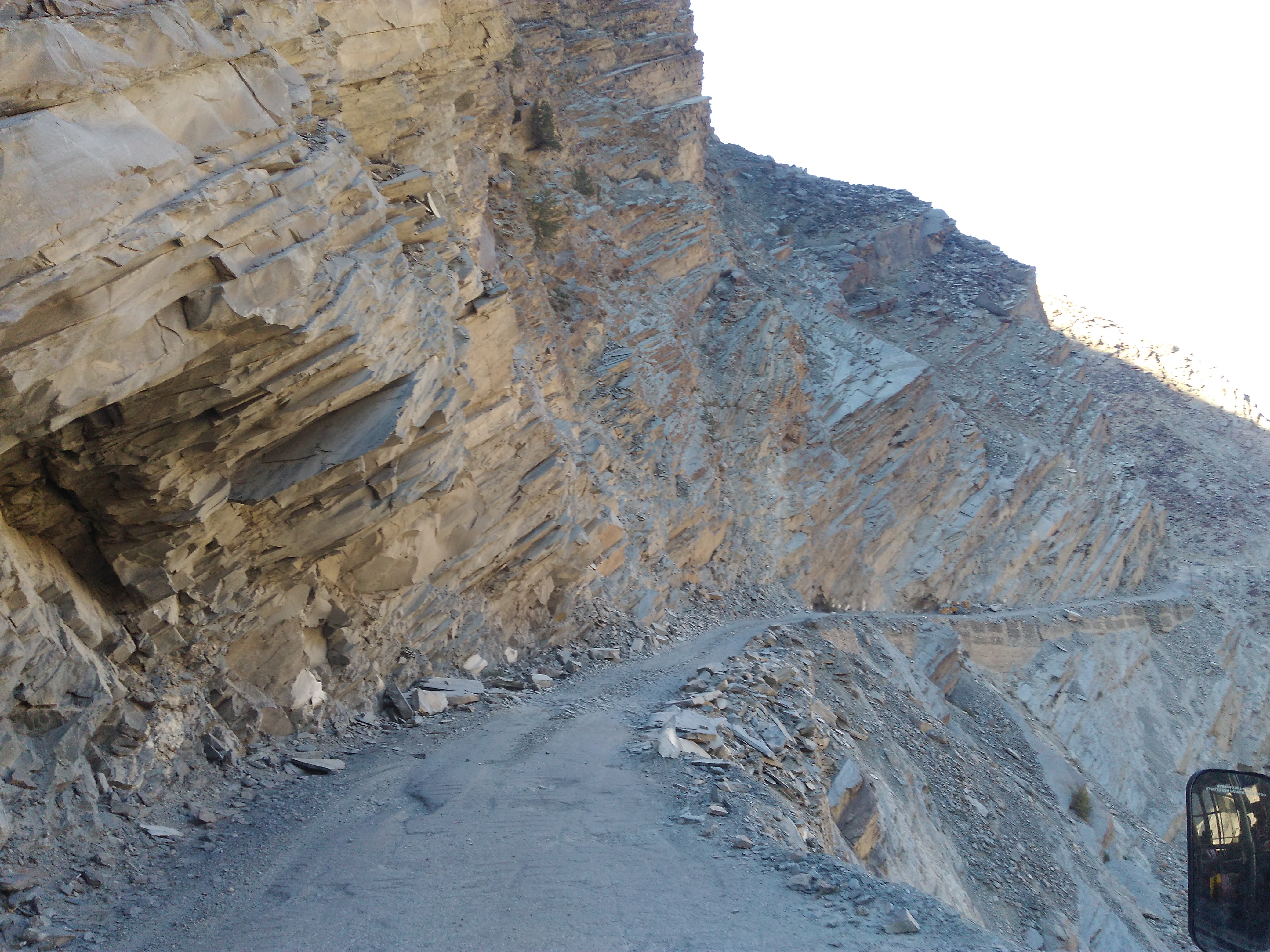
That morning, I had arrived at Reckong Peo and already done 4 rounds of the main road in the town with my heavy backpack, an uphill climb and down. I was searching for a hotel or a homestay. The only one that I found near the bus stand was out of my budget. I enquired with a few in the town and they suggested me to go to Kalpa. Kalpa is around where, all sightseeing places are situated and has a range of options to stay at. Accordingly, I sat in a local tempo traveler and started my ride towards Kalpa.

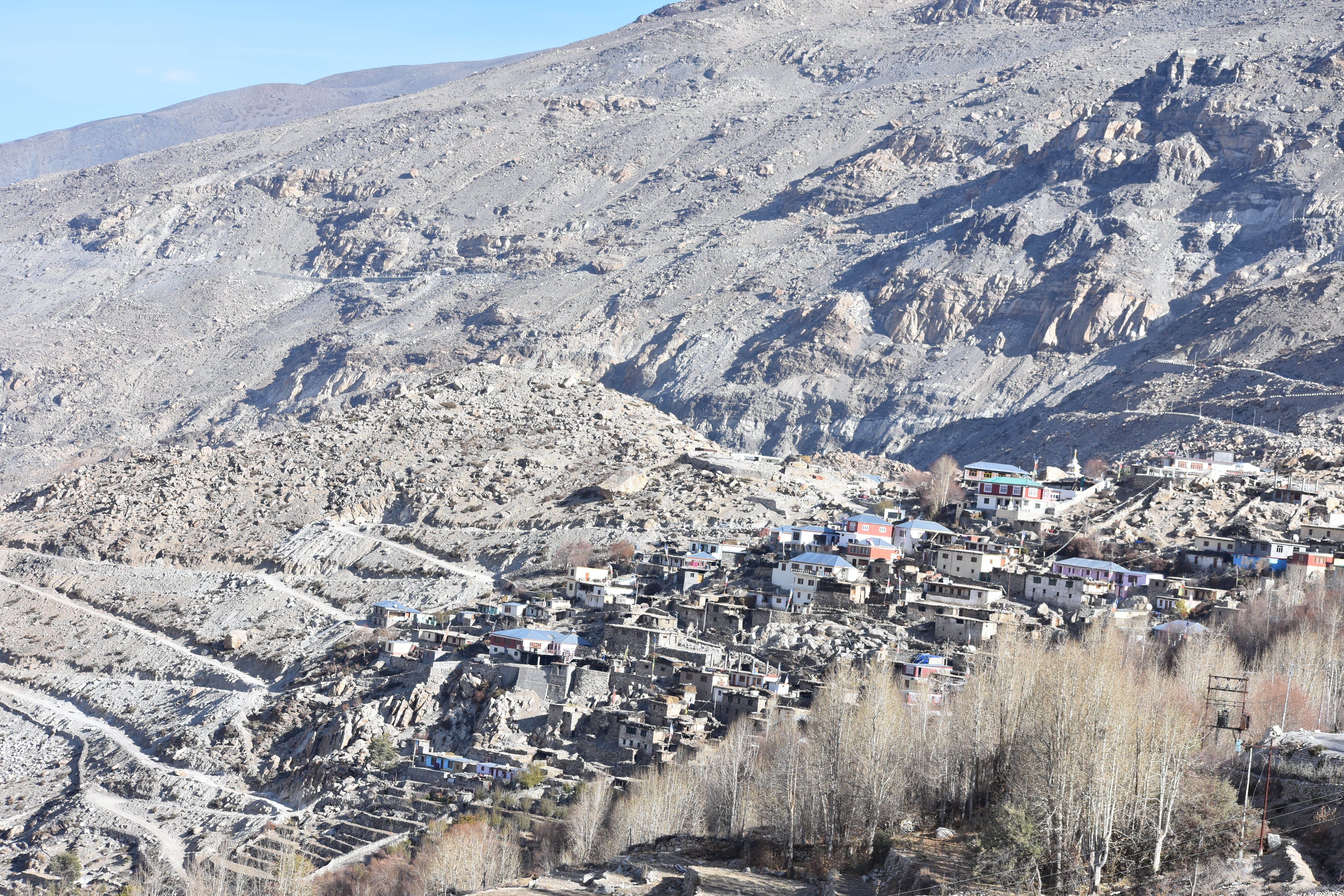
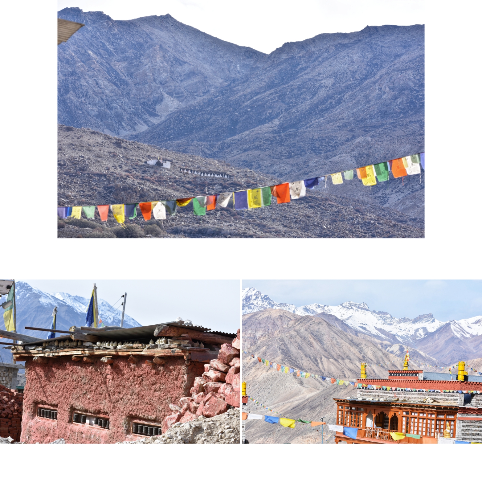
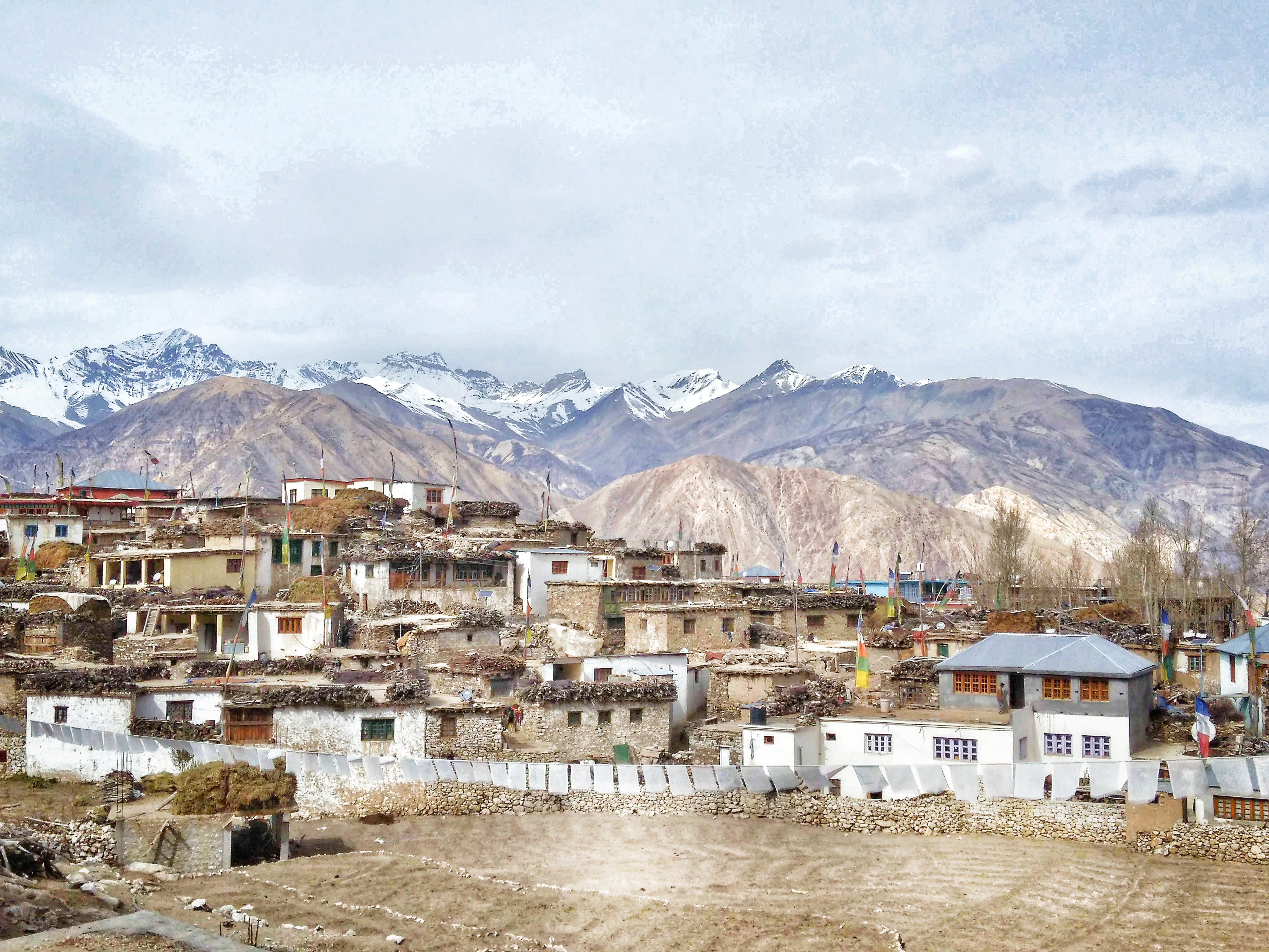
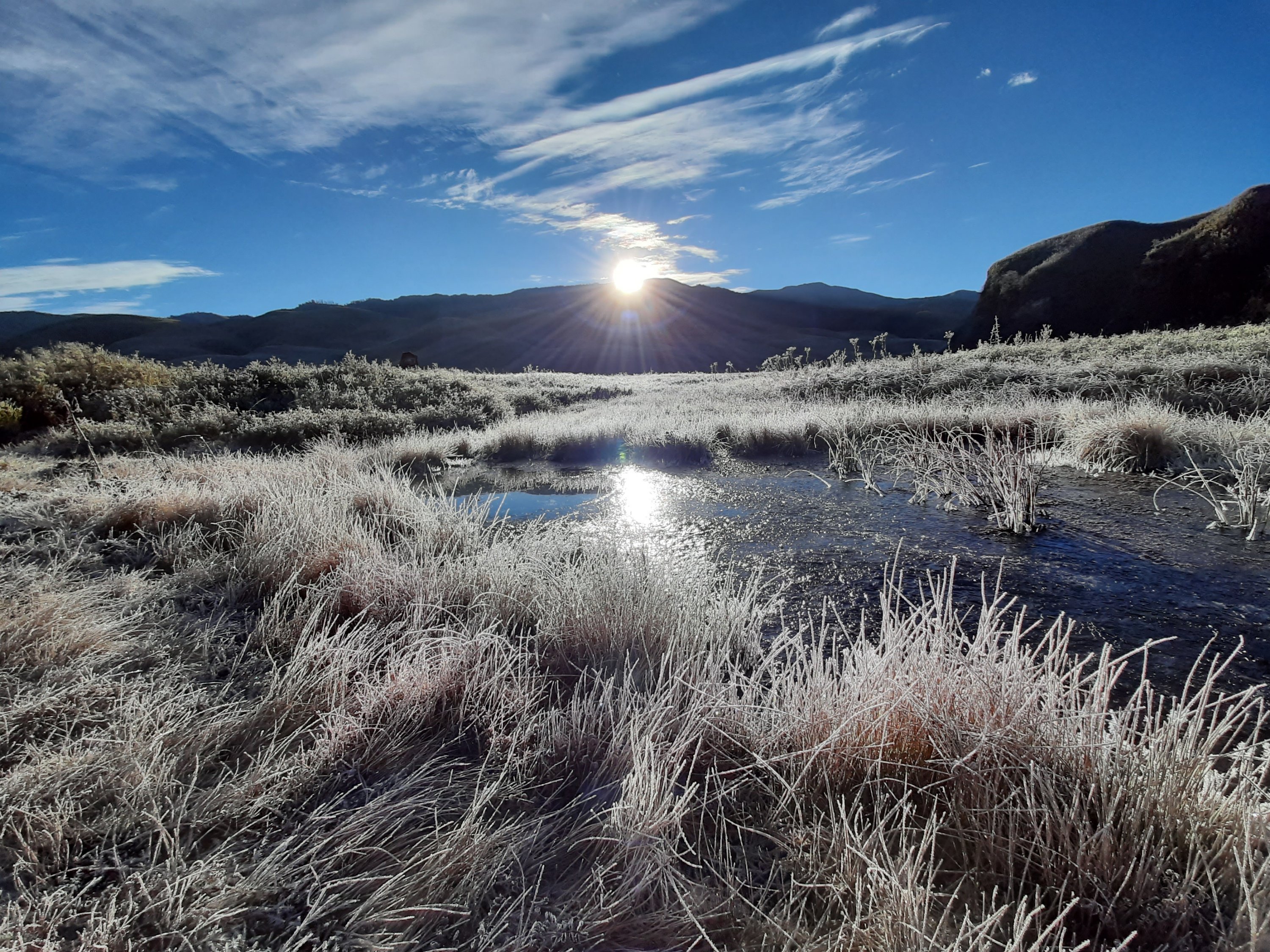
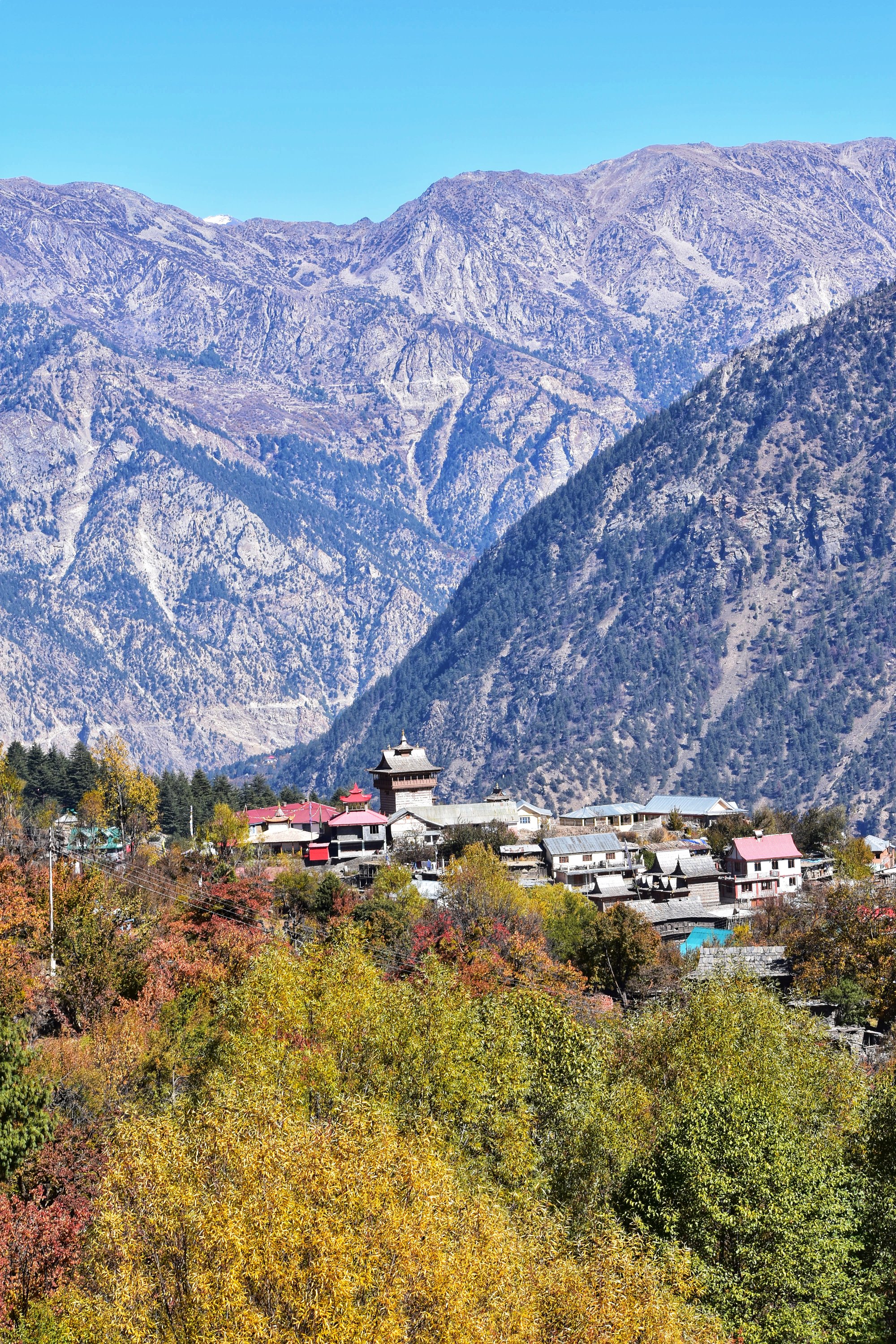
A narrow winding road, lined with apple trees on both sides with golden foliage, finally took me to a seemingly small town. The conductor announced: “Kalpa, last stop!” with narrow cluttered lanes, shops and eateries inside small sheet moulds, houses tucked behind high rise stone walls- the town looked very old school. Imagine a quaint town overlooked by the beautiful mighty mountains.. for me, it was a moment of ‘awe’ at first sight. I enquired with a few shops at the bus-stop for my stay and they guided me to walk further inside the village. I found a good one and the hotel was very new. So, the clean room, warm blankets and 24×7 hot water were just perfect for me to settle in there. But what lured me the most to the hotel room was the view from the window. Kalpa is very famous for its apple orchards. I was there towards the end of the apple season and so all the leaves were just about to shed their golden leaves. So, imagine a golden stretch against a background of white Himalayan mountains? I was mind blown!

dsc_0452-018559220294925433462.jpeg
A view of the Kalpa apple orchards with the Kinnaur Kailash mountains in the backdrop

My stomach was growling, and I fed it with Paratha at a small restaurant opposite my hotel. The lady running the eatery was quite amused to see a lone girl who had travelled so far. She enquired about myself and asked me to return in the evening after I had finished my sightseeing. “I am busy attending to customers, come in the evening when both of us are free, let us chat up and spend some time”, she said.

I walked down the alley to the only Buddhist monastery I had seen in the entire trip thus far. It was a very small one compared to all the other ones I had seen in Ladakh or back home in Karnataka. But irrespective of their size, Buddhist monasteries always have their own charm and pull. I lit a couple of incense sticks, rolled a few prayer drums and sat there for a few moments watching the mountains in silence before continuing my walk further, randomly through the alley.

dsc_05774351779720330587028.jpg
A street in Kothi village, Kalpa

I stopped along my way to ask a man across a fence, for directions to Roughi village. He was working in his apple orchard, busy getting the fruits harvested. He called me inside his farm and enquired where I wanted to go. He told me that my destination was 6+kms away. It would be difficult for me to get a vehicle at that time. I said I was Ok to walk the way as I was more curious in exploring the place. He was quite surprised when I asked him if I could help in plucking the pome. After a while, he handed over a packet full of apricots when I began my hike towards Roughi.

img_20181030_113054-012396872187485960449.jpeg
A walkway past an apple orchard at Kalpa

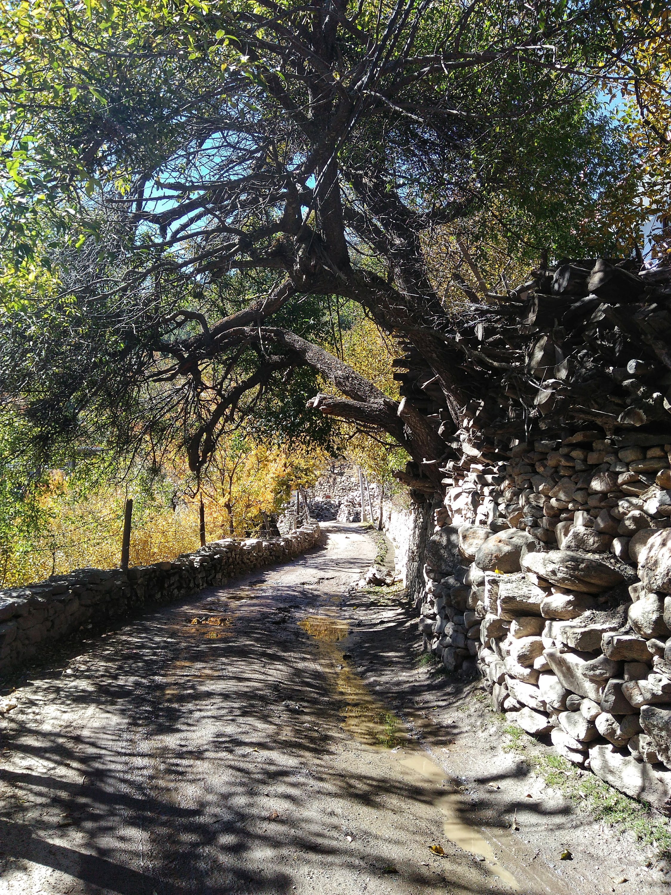
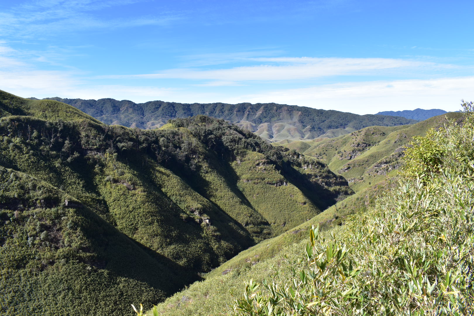
The walk and the scenery are best, only when witnessed and cannot be expressed in words. Only little would my limited photography skills help. I quickly made friends with a dog at a random house along my way. The dog accompanied me, and the owner let it come. Re-iterating again, the view was unbelievable. The stretch of road happens to be one of the steepest and I tried to take a peep down the deadly valley below. I pulled myself back after my head went into a tizzy. The dog continued to walk when I walked and stopped when I paused for a photo. There was a point when he was tired and panting and I had to make a bowl out of a plastic sachet from my bag for him to have some water. That said, we together reached Roughi village just after noon 😊

img_20181030_125004-016029300518488148138.jpeg
A bus passes the suicide point, enroute Roughi village

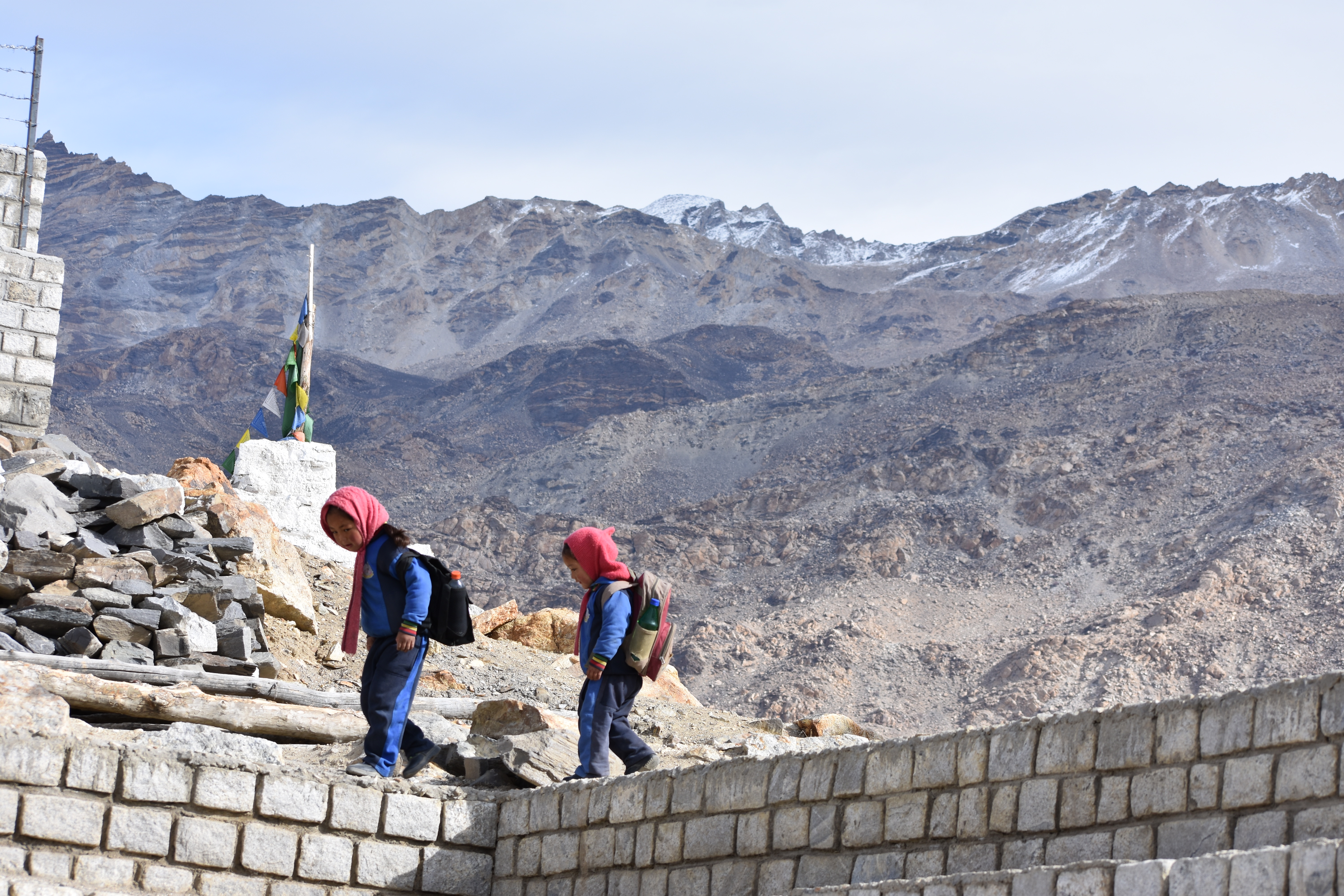
Beautifully groomed orchards, the suicide point, a quaint village in the foothills- Roughi was a warm tiny settlement with nothing very specific to do. After wandering around for a while, I made friends with a few kids who were returning from school, ate a few fresh apples from my bag that I had been received from random passersby on the road and finally settled down at the village entrance, hoping to find a ride back. I was all alone on the road. I spent almost an hour waiting and I was losing my patience as well as fearing the cold that would be brought in by the setting sun. There was no way I could stay there because I had dropped off all my essentials in the hotel in Kalpa itself. I started to walk rather than waiting there. After covering almost a mile, I heard an engine from behind. I turned back and waved them to stop. It was a couple in an Alto car, heading towards Reckong Peo. They obliged to drop me off along their way.

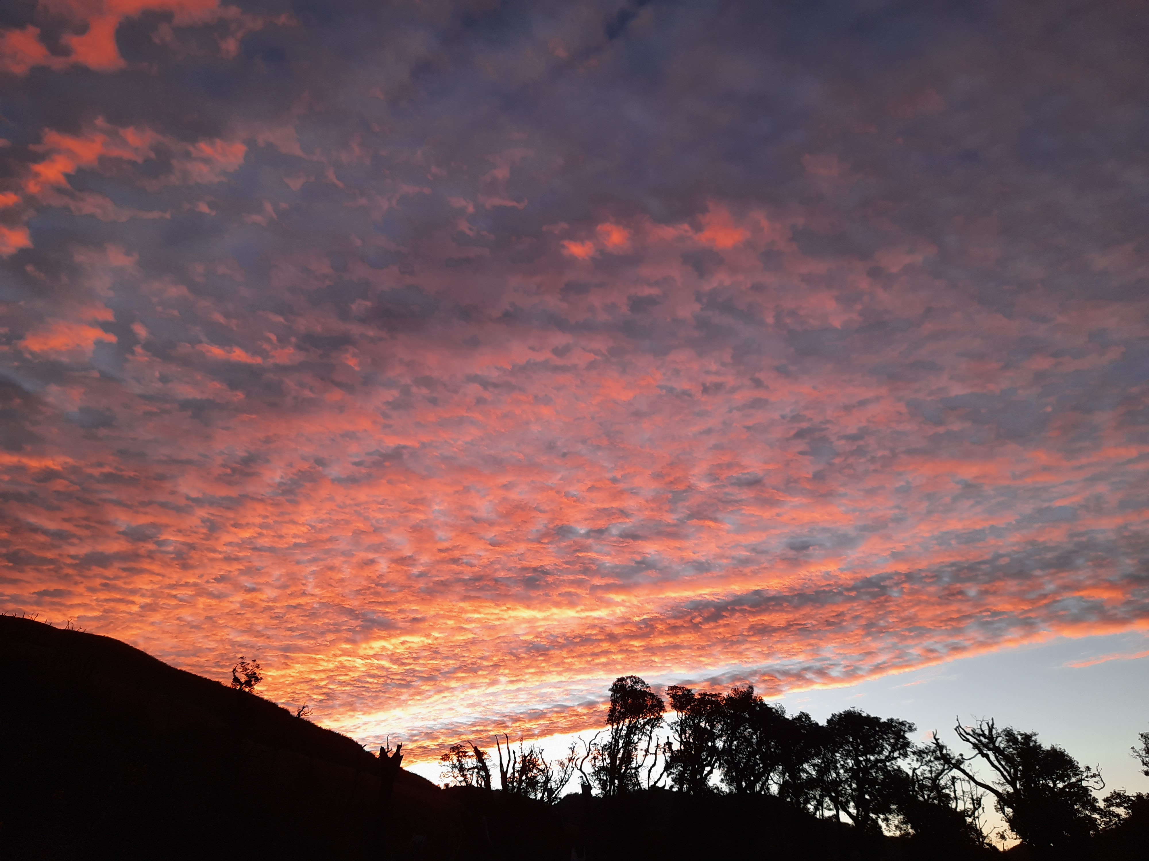
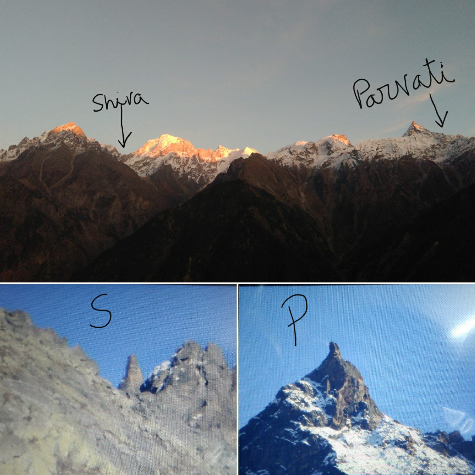
There was still time for sunset, and I thought I could use the daylight to explore the lanes of Kothi village. Although I aint a trained architect, the structure of the ancient Kalpa fort was something that I loved. I walked down through the villages, spoke up with inquisitive villagers, visited the chandika temple and finally settled down at the viewpoint to grab the golden hour of the setting sun over the Kinnaur Kailash mountains. I had seen the mountain from the rear side at Sangla. Now here I was, experiencing the moments of tranquility, in front of one of the holiest destinations of Lord Shiva. Believers who cannot make it to the Kailash mountains in China come here. Hence, Kinnaur Kailash is believed to be the alternate abode of the Lord.

This trip has been compiled into a book. If you like to read about the complete journey, you can avail it on Amazon or read it for free with your kindle. Use the link below.

As I was admiring the sight and capturing it in my DSLR, an old Bengali couple identified me as the one who had taken some nice photographs of them at the Kamru fort in Sangla, a couple of days ago. They asked me for a favour. They asked me to zoom into the peaks of the mountains with my camera and show them their deity… I was perplexed and asked them what it was. They explained……. “To the left side of the mountain was the Shiva Linga and right side was his consort- Parvati”. I was quite amused at hearing this and tried to capture images of both the manifestations with my camera. When I showed the images to them, to my utter surprise- they both started jumping and screaming and clapping with joy. They both folded their hands in front of my camera screen and chanted their prayers. Next thing I saw was the lady kept her palm on my head and saying, “We were saddened that we couldn’t get a closer view of his manifestation even after travelling this far. You showed us our lord! May he bless you with all the best and happiness in the world”, they wished me a good future. For me, it was quite an experience. I was unsure if I had to call it their innocence of praying the camera or admire their faith that had brought them this far. But I was feeling very good about myself that I was able to bring so much joy to someone. I was feeling an inexpressible emotion from within.

20200516_2239468185497903676550374.jpg
Top: Sunset over Kinnaur Kailash; Below: magnified view of the manifestation of Shiva and Parvati

As the sun went down, my jaws started to chatter in the biting cold. I rushed to my room, warmed up myself with the thermals I had and stayed indoors until I felt comfortable. Around 7.00.p.m., I decided to step out to meet the aunty running the restaurant just outside. She said she would be free after closing the shutters at 07.00.p.m. I had carried millet Rotis from home which I thought I will share with her while buying some curds from her to make a dip for my rotis. She was excited at seeing me and called her family members to meet me. The restaurant was only an extension of her house, separated by a closed wooden door. Hence, she took me in and showed me around how traditional Kinnauri houses looked in Kalpa. We were back in the restaurant, chatting up over a hot glass of chai that she made for me. I gave her my rotis for tasting and she made me pulkas for supper. I returned to my hotel after a good couple of hours with her.

The next morning, I woke up early to catch the bus to my next destination, Nako. I grabbed a quick bite of bread omlette at the restaurant before saying a goodbye to my new friend at Kalpa.

A day at the doors of a holy place at Spiti valley- Nako

I missed the morning bus from Reckong Peo and that gave me some time to take part in the annual mela in the district headquarters. I boarded the next bus at noon, from Peo towards my destination for the day- Nako, a small township in the Hangrang Valley, a part of the Spiti valley. The place gets it’s name from a Tibetan word ‘Nego’ which translates to ‘The Door to a holy place’.

IMG_20181031_161950
The road from Kinnaur valley, leading to Spiti valley

The transition from Kinnaur valley to Spiti valley was evident in its landscape. The road changed from green to rocky to barren along the way, each being spectacular. The snaking road was accompanied by the crisscrossing Spiti river amid a mind-blowing scenery all along the way. Although I was travelling solo, I felt accompanied through warm conversations with the driver and the conductor of the HRTC bus. They were quite surprised and amused to hear that I was from South India, spoke fluent Hindi, was travelling alone and without a fixed itinerary. The bus was stuck in a couple of roadblocks caused by landslides for almost 3 hours in total and that meant- I arrived late at my destination. From all the online research I had done about the place, I knew that Nako was decently popular on the tourist radar and finding a place to stay wouldn’t be difficult. When finally the bus stopped at the Nako bus-stop at 07.00.p.m., I was in for the BIGGEST surprise of my life!

The bus stop was on the highway. That was the LAST public transport of the day. It was pitch-dark already. All the civilization I had read about, did not seem to exist there. Apart from the bright stars twinkling in the clear sky, the only light I could see was that of a dimly lit lantern hanging in a tiny shop. The conductor looked at me blankly and said- this is Nako. “Talk to the shopkeeper and he might help you to find a place to stay”, he said and signaled the driver to proceed their ride.

“Where am I going to stay tonight? Can I trust the shopkeeper? Do I have any other option apart from approaching the shopkeeper?” A million things were running in my head. I stood there for a moment to let my thoughts settle down first. But before that, the biting cold and the rough winds rushed me to the shop for some warmth. In the dim light, I saw hope. The shop was run by an old man and the wrinkles on his surprised face multiplied when I asked him if I could get a place to stay. He nodded a yes and asked me to wait until he attended his last customer and lowered the shutters of his little grocery store.

He walked me through steel shutters behind his shop, got a bunch of keys from his house and asked me to follow him to the floor above his house. He said he runs a homestay (Somang dhaba, hotel and homestay) during summer. Since I was there during offseason, the room wasn’t used for a long time. The room had a low voltage bulb and had no running hot water. I could stay there for the night if I could manage with whatever was available. He was not going to charge me for it. The room had a decent washroom, carpeted floor, enough blankets and a comfortable looking bed. The thought of saying no to the old man and getting adventurous in pursuit of a better homestay in the cold night did not even pass through my head. This place was more than what I had expected to get. I agreed to stay there and grabbed the room keys from him.

As I unpacked my bag to pull out my thermals, Mr.Somang knocked at my door with a bucket of hot water for me to freshen up and told me that he had informed the small dhaba next door to stay up for me so that I can go have my supper. If there was any other problem, I could knock at his door, Mr.Somang lived with his wife in the ground floor. The dhaba was a tiny shed put-up with sheets, was run by a Nepali family and fed the occasional truck drivers who stopped by for chai and Paratha. I had the same for my supper too. As I answered the family’s curious questions, I sat warming myself around the fireplace in their kitchen for some time before heading back to my room.

DSC_0603
The township as viewed from the Nako helipad

I was in for a surprise when I woke up in the morning. The view from the window transcended me to another world that I had imagined only on Microsoft Window’s wallpaper. Barren, dry arid landscape and distant snowcapped mountains. A lonely road ran uphill, and I had slept in a roadside house that had this magnificent view. I immediately jumped out of my bed, fetched a bucket of hot water from the host’s house, freshened up and got out quickly, to sink in the morning vibes of the place. I took a walk to the nearby helipad from where I could get a 360deg view of the surrounding mountains. That was the first time I was seeing a landscape so arid, so dry, so different and so beautiful.

DSC_0626
The view from Nako helipad

As I walked further, is when I realized that the real civilization of Nako village existed only if I walked further away from the main road. Doing this on a moonless night, in order to find a place to stay would have been next to madness. I was greeted by tiny tots with their heavy backpacks and playfully jumping on their way to school. The sounds of mooing cattle and crowing roosters echoed in the silent streets.

DSC_0661

The sweet smell of incense arising from the monastery had engulfed the ambience as I walked towards a small red structure made of clay and red oxide. Prayer drums on its outside indicated that it was the ancient Buddhist monastery where people seemed to be coming to offer their morning prayers. An interesting structure caught my attention to up in the hills. “That’s the old and the main monastery from the 11th century ”, a passerby answered to my question. But it seemed quite far for a lonely walk, so I decided to keep it for some other day. When I have company, perhaps!

IMG_20200426_223708
The Old and the new monasteries at Nako

The further I walked into the village, the more magical it started to seem. The structure of the houses was unique to Nako, from what I had seen all this while. The houses are built at an elevation from the ground with wooden beams holding the dry stones, slate roofs covered with hay and all houses painted with white lime. While I was finding my way to the Nako lake through the muddy lanes, reaching random dead ends and taking blind turns, I felt lost in the maze. Just then, a man appeared in front of me and greeted me with a warm smile. He saw me taking photos on my cellphone and asked me if I minded a selfie with him. Although bad at taking selfies, I did not mind getting myself pictured in that unique looking place.

IMG_20181101_105225-01
The Nako village

He invited me to his house for a cup of chai and not for a second did I think again. I nodded a yes with joy and followed him to his pretty haven whose courtyard overlooked the Nako lake. His wife got excited at the alien visitor in their little abode and got me chai and biscuits along with some hearty conversations. She took me around her home, and I was quite amused at the style in which it was built (almost entirely of clay, stones and hay), a first time for me. Apart from a heartfelt thank you, I did not have anything to give them back for their wonderful hospitality. And neither did they expect anything in return. I bid goodbye and walked down the lane to the lake, a holy place for the villagers.

IMG_20181102_172816
The Nako lake / The sacred pond of Nako

Apart from a few grazing horses, I was the only human there that morning. It was the first time I felt like meditating and decided to sit by the waters for some peaceful moments. The Nako lake is considered holy among the Tibetan Buddhists as Lord Padmasambhava is believed to have meditated here. It is no surprise why I was feeling the unusual calmness and serenity at that place.

A few running kids got me back to reality that I had been sitting there for a while by then. I woke up and got back to the homestay to figure out a way to get to my next destination. But that’s going to be another interesting story (Click her to continue reading)….

This entire journey has been compiled into a book. You can avail it on Amazon or read it for free using your Kindle. Use the link below:

Travelling down the memory lane- Malgudi days

The unfortunate lockdown that the pandemic has brought has sure got the netizens busy. I’m not a TV person but sitting in a spot for video conferences all day (for work) gets me worked up sometimes. My terrace is too hot to go out in this hot summer month. This has given me some time to indulge in watching some series online. Not to fall into the fancy of the latest trending series on OTT platforms, I preferred to catch up on some old classics that were a hit on Doordarshan, back in the days of my childhood. That’s why I chose to start with Malgudi days.

While some claim that Agumbe was the ‘Malgudi town’ and there exists a ‘Malgudi house’, nobody really knows where the entire ‘Malgudi days’ serial was shot. However, since most of the episodes were predominantly shot in and around Shimoga, the present-day railway station at Arasalu (near Shimoga) is named as the ‘Malgudi station’ in honour of the famous serial. One of the trains too is named as the ‘Malgudi Express’ by the Southern railways. The popular serial telecast in the late 1980s comprised of 39 episodes shot and directed by Late.Shankarnag. Banking in on its popularity, the other 15 episodes were later directed by Kavita Lankesh in 2016. From what established a cult in Indian cinema, I am keen on taking a trip down the streets of Shankar Nag’s Malgudi because that is what I grew up watching.

Based entirely out of Karnataka, the rural setting, the culture and top-of-the-notch actors were totally relatable for me as I watched it. As I continued to watch the episodes, what started to intrigue me were the familiarity with several places featured in the episodes. I also started to take note that all were not in Shimoga. ‘Armchair travelling’ is a fancy outcome of being locked down by the pandemic and that got me to travel through my home-state Karnataka and map some of the heritage structures that have been featured in the classic ‘Malgudi days’. So, here are my relative screenshots from the serial and photos of the landmarks, as they stand today. You too can contribute your findings and let us unravel the mysterious locations of the old-timer 😊

1. Episode name: Oldman of the temple- Mandir ka budda
The episode opens with the author R.K.Narayanan himself telling that Malgudi is a fictitious town. It being located in Southern India is only half truth. The truth is, it is applicable to anyone anywhere across the world. Here, starts my quest to map the locations of Malgudi, spread across the state of Karnataka.
a. Ofcourse, Sheshadri and his friends are seen sitting on a platform of a tree that is present even today, at the town centre of Agumbe.
b. The old dilapidated temple that the Old man- Krishna Bhattar’s spirit lived in the episode is the ‘Thimmarayaswamy temple at Bettadadasanapura’ on the outskirts of Bangalore.

2. Episode (serial) name: Swami and his friends.

a. This is an 8-episode long story and is one of the most iconic part of the series. The ‘Doddamane’ in Agumbe perhaps is what was Swami’s house. We still need to look at several other structures that have been featured in the serial.

b. Although I am unable to locate the structure that housed ‘Albert Mission School’ in the series, I sure know where the School logo ‘Fide Et Labore’ featured in it came from. It was easy for me to point it out as my brother happens to be an alumnus of the 150+ years old ‘St. Joseph’s European High school’. Given the setting of pre-independence days in the serial, it was obvious for a Bangalore based director to be inspired to borrow the school logo from here.

c. Swami’s Friend- Rajam lived in a huge bungalow. This is the Thippagondanahalli IB (Inspection Bungalow)

d. Yes, most part of the series was shot at Agumbe. But when the team had packed up and Director Shankar Nag felt that a few scenes needed a re-take, the entire street of Malgudi was setup at a street adjacent to Yediyur lake in Bangalore.

img_20200419_1558003885394149311384243.jpg

Top- The map of Malgudi as conceptualized by Shri.R.K.Narayanan; Below- The present day Arasalu railway station

3. Episode name: A Hero
With some actors replacing the characters of ‘Swami and his friends’, it somewhat is a continuation of the 8-episode series. Though the house indicated as Swami’s house in this episode may not be wholly same as the 8-episode series, it is true that a large part of this episode (The attic of Swami’s house and the riverbank) are common.

4. Episode name: The hoard- Maha Kanjus
This too has been shot in the ‘Doddamane’. The main road facing entrance, the sit-out on either side at the entrance with wooden pillars and doors and the central courtyard indeed are from the ‘Doddamane’ of Agumbe.

img_20200419_1558408646436733945467627.jpg
Episode: The Hoard; Location: Doddamane, Agumbe

5. Episode (serial) name: Mithai Wala- The vendor of sweets.
All I have heard is that ‘Malgudi’ itself is a fictional town created for the serial. The name was derived as a combination of two prominent townships of Old Bengaluru: Malleswaram and Basavanagudi. The story of its origin can’t go away from its offspring, right? What has always been popular as the ‘Shooting house in Basavanagudi’ is in fact the house where the Mithai Wala lives in this 8-episode long series.

img_20200419_1820188489192852779148580.jpg
Series: The vendor of sweets; Location: The shooting house of Basavanagudi

6. Episode name: Nitya
Nitya, the protagonist is taken to a distant hill-temple where his parents had a prayer to be offered. The entire setting of the hill-temple is the present-day popular trekking destination- Devarayanadurga’ in Tumkur district, on the outskirts of Bangalore.

img_20200419_1556242313197449996913817.jpg
Episode: Nitya; Location: Devarayandurga

7. Episode name: The seventh house- Saathvan ghar
This episode has been shot across multiple locations. However, there were a couple of them I could identify.
The scene where the couple and their families go to offer pooja in a temple is Devarayanadurga, same as the one in the episode Nitya.
a. The scene where the couple meet after college has the Town hall building of Mysore in the backdrop.
b. The scene where the protagonist rides to see an astrologer is the temple at Kaiwara. It has largely been renovated as on today. But the Narayanappa temple in the background, the rocky hillock on one side and a motorable road seen in a glimpse indicate it is indeed Kaiwara.

img_20200419_2359087779830708236567927.jpg
Episode: The seventh house; Location: Top- , Below- Kaiwara

8. Episode name: Iswaran
a. The college or the senate hall with its Gothic style of architecture featured in the episode is the ‘Central College of Bangalore University’ located in the heart of Bangalore.
b. The Protagonist, Iswaran watches a movie at a cinema. The palace featured in the movie is the ‘Bangalore Palace’.
c. Time and again, Sarayu river has been mentioned in the episode. Given the typical setting of Karnataka and the writer’s hometown of Mysore, the lifeline of this region is river Kaveri. I believe that the river where the protagonist drowns in at Sangama, near Srirangapatna.

img_20200419_1557072785711876990109400.jpg
Episode: Iswaran; Location: Top- Central college, Below- Bangalore palace

9. Episode name: The performing child- Abhinetri
Given the fact that it is still one of the iconic lung space of Bengaluru and there runs a toy-train amid a lot of greenery, the train journey featured in the child’s dream is in Cubbon park.

10. Episode name: Roman image- Rome ka Murthi
a. The stone temple that Sheshadri and Professor walk around after climbing up a rocky hillock that overlooks green meadows is the ‘Mantapa’ located at the peak point of Kodachadri.
b. The red structure where professor Bandopadhyay is indicated to be working on a renovation of a Jaipuri palace- is the Shivappa Nayaka’s Palace located near Shimoga.

img_20200419_1559211829629155025381725.jpg
Episode: The Roman idol; Location: Top- Kodachadri, Below: Shivappa Nayaka’s palace, Shimoga

11. Episode name: The watchman- Chowkidar
Although the structure and the surroundings seems to be in a dilapidated condition in this episode, it has been largely renovated and restored as on date. The entire episode has been shot in the ‘Thimmaraya swamy temple complex at Bettadadasanapura’ in Bangalore. The large trees in the premises, the temple pond, the entrance stone pillars and the fortress like wall encompassing the temple premises on a rocky hillock are the things that stand testimony to the famous episode.

img_20200419_1603378700133774239826933.jpg
Episode: The watchman; Location: Bettadasanapura temple

12. Episode name: A horse and two goats- Muni
Given the rural setting of the protagonist’s house and the fact that he eats Ragi mudde, it is a story from the Mysore region. The place where he goes to graze his goats daily in a eucalyptus grove and the slopy terrain of the hills where the road passes, could it be the road that leads to Chamundi betta? Or could it be Nandi hills? (as guessed by ‘The light baggage)

13. Episode name: Trail of the green blazer – Pocket maar

The temple where the protagonist offers his prayers with a coconut before heading for stealing is the Panchalingeshwara temple at Begur, located in the outskirts of Bangalore. (Information contributed by ‘The Light Baggage‘)

img_20200421_0011247701976065440120278.jpg
The Panchalingeshwara temple at Begur

Are there any familiar locations that you could identify in the serial? Let me know..

Here are the remaining episodes 🙂

14. Episode name: Leela’s friend- Siddha

15. Episode name: The missing mail- Dhakia

16. Episode name: Engine trouble- Engine Ki kahani

17. Episode name: Forty-five a month- 45 rupiya

18. Episode name: The career- Ramji Ki Leela

19. Episode (series name)- Naga

20. Episode name: Sweets for angels- Kaali

21. Episode name: A willing slave- Aaya

22. Episode name: Cat within- Paap ka gada

23. Episode name: The gateman’s gift- Govind Singh Ki Bhent

24. Episode name: The edge- Dhara

A gastronomic walk tour of South Bengaluru

You have probably read my earlier post on exploring the offbeat landmarks of Old Bengaluru. Here is another one. This time, it was a culinary trip of Old Bengaluru to a friend who had flown down to this southern metropolis, from the so-called Northern part of India. I had been asked to take him on a gastronomic tour of my city. For someone who has a penchant for everything old school, I thought Old Bengaluru would be perfect to call it a day. ‘From vintage automobiles, architecture, iconic restaurants serving traditional recipes to by lanes and alleys that narrate their own individual story of the city, this section of Bengaluru has everything that would tickle a bone or two of this mad man’, I thought.

Having largely spent my teenage in North Bengaluru and given my familiarity with the area, Malleswaram was my first choice. However, given the convenience of commutation from my current place of stay, I chose to show him around South Bengaluru. But when one says South Bengaluru, it is a world in itself and the geographical area is large to fit all in one day. Hence, I took time to mark a quick map of restaurants to cover, along with giving a peak into the cultural heart of the city. This part of the metro lays in stark contrast to the Bengaluru, that the millennials from Whitefield and Marathahalli know of.

The obvious choice was a walk tour of Basavanagudi and the Pete area. These are the two most important clusters of true Bengaluru that have held onto the roots, despite the rapid and traumatic transition this city has seen in the last decade in the name of urbanization and modernization. Under the canopy of massive native trees, the aroma of the by-two filter kaapis shared at the numerous Shanti Sagar and darshini food joints, the air here feels different from anywhere else. With almost every street dotted with Classical dance and music schools and happy nonagenarian couples whizzing in their Padminis and Ambassadors, it has a different vibe here. One can find some of the traditional old houses and landmark restaurants only in these localities to really experience old Bengaluru. Each of these iconic eateries have a near century old history and their old school ambience is still intact inside the heritage structures that house them. With a small appetite for food and a big quest for exploration, the portions of food were limited only to the signature dishes of each restaurant, to accommodate more places. So, here is my itinerary of a gastronomic tour of Bangalore of yore.

20200223_162027
The Big bull temple, Basavanagudi

Meet-up point: Basavanagudi is the name of a temple (It translates to ‘Bull- Temple’). Basavanagudi is the name of a locality in South Bangalore, named after the temple. It is an extension of the Pete area, which was specifically created to accommodate the upper class, and more-specifically the Brahmin community. No trip to South Bengaluru is complete without a visit to this landmark temple built by Kempegowda, the founder of Bengaluru. Apart from the Big Bull temple, the Dodda Ganapathi and the Bugle rock (a small watch tower from the Kempegowda era) are a must visit on the same premises. If you time it up well, you can part-take in the annual groundnut fair in the locality. (Read here to know more about the history of the Kadlekai Parishe). After meeting my friend here, we started our gastronomic tour to our first food stop.

Food stop 1 (Breakfast): As synonymous as Dosa is with South India, Vidyarthi Bhavan is with South Bengaluru. Ask anyone for the best Dosa in the city and this place scores on top unanimously. It is a restaurant started initially to cater to the student community of the area which started a new culture of a hangout place for friends in those days. On most days, the queue can extend well up to a kilometer. My friend and I wiped off our plates of their signature Masala dosa for breakfast. (Click here to read further about the history of Vidyarthi Bhavan)

img_20200224_1412454363645349424467729.jpg
Vidyarthi bhavan, Basavanagudi

Food stop 2 (Light eats): No foodie who visits Bangalore is satisfied without taking an evening walk on the Eat street at VV-Puram. However, I decided to go here in the morning, in order to avoid the maddening rush. Honey cake and Congress bun at the iconic VB Bakery was what we needed. This is the first Iyengar bakery to be established in Karnataka which has paved a new culture in baking (Read here for more about V.B.Bakery). Avarebele (Val bean) is a favorite ingredient of the Bengalureans, who have a dedicated annual fair to celebrate this pulse (Click here to read further about Avarekai mela). Hence, picking up a packet of avarebele mixture for home from one of the stores there was an obvious choice.

Food stop 3 (11 o clock, coffee): It is an important break time for the employed section of the society. Brahmin’s Coffee bar is a household name for their filter coffee and the delectable chutney served with idly on their very limited menu. This tiny eatery is in a corner of Shankarapuram, which is also famed for the Shankaramatha, a learning center of the advaitha philosophy. We had a quick stopover for a hot cuppa this little place is known for, before heading to Pete. (Read further about Brahmin’s coffee bar here)

Food stop 4 (Lunch): To satiate the hunger pangs, I planned to treat my friend with an authentic Bangalorean affair. With multiple theories surrounding the origin of the military hotel culture, the history of these restaurants dotting across the southern part of Karnataka is unclear. Bangalore is home to some of the best in the state. I don’t think there would be any better meal than ‘Ragi Mudde oota’ savored at a military hotel to get a peek into the local flavor, including the ambience. Hence, we were lunching that afternoon at S.G. Rao’s military hotel, located in the cotton Pete area. A typical military hotel meal includes Kaal soup, Ragi Mudde and Mutton biriyani. (Click here to read further about S.G. Rao’s military hotel)

img_20200224_1409468968974703455226303.jpg
S.G.Rao’s military hotel, cottonpete

Food stop 5 (dessert): A meal is complete only with a nice dessert. If there is one sweet meat that is synonymous with Karnataka (Mysore state), it is Mysore pak. Since I couldn’t take my guest to Mysore for that, the closest I could get is at Sri Venkateshwara sweet meat stall located at Bale Pete, a short walk away from cotton Pete. Their Mysore pak and dumroot are the sweets my friend packed for his roommates back in his hometown. (Click here to read about Sri Venkateshwara sweet meat stall).

img_20200224_1408538818613838394713036.jpg
Sri Venkateshwara sweet meat stall, Balepete

The Pete walk: An old Bengaluru exploration is nothing without a walk along the narrow snaking lanes of the Pete area, the true business epicenter of both New and Old Bengaluru. This area is segmented into various sections and named according to the commodity sold and the communities that resided there in the yester years. From green groceries, handloom, steel, plastic to precious metal, everything is available in this locality. An early morning walk in the famed flower market is an experience in itself. We limited ourselves to just the mainstream sections while exploring some of the ancient temples, mosques and heritage houses of the Kempegowda era. In the meanwhile, we kept munching on numerous snacks from several popular stalls on our way. Although these eateries are old, the flavors are largely north Indian, owing to the Marwari and Baniya community that reside here in majority.

The heritage structures of the Victoria hospital, Bangalore fort and Tippu Sultan’s summer palace all lay on the side of the road for the history and architecture buffs who have a little more time in hand. But this is all we could fit in our day. Thus, ended a gastronomic tour of South Bengaluru.

I hope you enjoyed this virtual tour with me too… did you? Or did you not? Share your thoughts with me…

There are many other iconic restaurants in Basavanagudi if you have a larger appetite. These are a few other places that you must check out when you are here: The new modern hotel, Mahalakshmi Tiffin room, Janata Tiffin rooms  are a few among many others.

Souvenirs to buy:

  • Coffee filter and freshly roasted coffee powder: The best filter coffee is available only in South Bengaluru, and hence my friend thought this was a more significant thing to buy from here.
  • Channapatna wooden toys: These are GI tagged handicrafts made with organic colors and largely popular in the western market, it comprises a large collection of traditional toys.

As the Neelakurinji blossoms, the Nilgiris spectacles

Heard of the blue hills? Does the name ‘Nilgiris’ strike any bell? For those who know less, it is a part of the Western Ghats, a UNESCO World heritage site in the southern peninsula of India. The ‘Neel-giris’ literally translates to ‘Blue-Hills’ because these hills get their colour from a particular phenomenon. A particular species of the Strobilanthes kunthiana flowers, locally called the Neela-Kurinji bloom once in twelve years. When in full bloom, the entire hill range looks blue, thus giving the hills their name. The last mass-flowering of the neelakurinji flowers happened in 2018 and I left no leaf unturned to witness this spectacle. There were a couple of hotspots identified by the Kerala forest department where arrangements were made to allow visitors to see the flowers.
My friends and I decided to visit the Eravikulam National park, located close to Munnar. This stretch of the hills was where most of the blossoms were supposed to happen. After finalizing the visit dates in Sept’18, the Delhi friends had booked their flight tickets to fly down and the remaining of us booked our bus tickets from Bangalore to Munnar. I had got all the necessary entry permits from the forest authorities and booked accommodation in Munnar for all of us. All this was done months in advance to have a confirmed entry anticipating the tourist influx for such a spectacle, if we waited until later. We were all set and waiting for the travel to finally happen.

Come July’18, the rain gods had wreaked havoc in the western Ghats. The entire stretch of western Ghats in Karnataka and Kerala had been damaged by the heaviest rains in eight decades. The damage done was massive to geography, property and life along these areas. In the event of things, damage was done even to the neelakurinji plants and the blossoms were feared to be washed out. Once the rain gods had calmed down and the ground situation of floods seemed to have receded, we waited to see if there was any luck in waiting until September. We were in constant touch with a few locals who gave us the updates on the status of the blue hills. Come September and we decided to go ahead with our original plan. We all had finally arrived at Munnar and were heading towards Eravikulam National Park.

Once there, Yes, there were enough plants destroyed. The stronger few, had managed to bear flowers. We walked along the laden path, feeling grateful for at least so many of the plants had survived. Since these plants blossom only once every 12 years, it means that their reproduction cycle is longer than usual. This also means that, most of the Neelakurinji vegetation is lost in the 2018 monsoon and the next flowering cycle of the year 2030 may not happen at a mass-scale as it is usually supposed to happen at all!! Anyway, we enjoyed whatever we were witnessing.

img_20200216_1230514763208106210940115.jpg
The Neelakurinji flowers at Eravikulam National park

Also, Neelakurinji is only a sub-species of the larger group of flowers called the Kurinji. The Kurinji flowers come in several colors- white, peach, purple, etc. Here is a collection of the Kurinji flowers from Eravikulam National park that we saw during our visit.

img_20200216_1232387674453963735820057.jpg
The various Kurinji flowers at Eravikulam National park

So that said, I was back in my hometown the following week and visited our piece of farmland to check on its status after the monsoon. It used to be a spice plantation that remained unmaintained for a long time before we, siblings ventured into developing it. our farm is a short walk away from the main road. When we arrived there and decided to walk, the entire path was filled with what seemed like some weed that had overgrown during the monsoon. We used a machete to make way for ourselves to walk further. Just a few steps into the area, we were surrounded with pink/ maroon flowers all around us. ‘These weeds had flowered expansively’, we wondered. We took a lot of photos, made way for ourselves, finished our work and returned home. When we discussed about the weeds with the elders in the family, we were surprised to hear that these plants also belonged to the Kurinji family.

img_20200216_1228147702483363187051058.jpg
The Kurinji flowers from our farm in Kodagu

Further, an important month in the Kodava and the Tamil calendar is the month of Kakkada or Aadi. In Kodagu, on the 18th day of this month a special dish is prepared using a locally available herb. Its juice is believed to contain 18 medicinal values. It leaves a very deep blue/violet pigment when cooked and consumed only on this day. And what is this plant called? Don’t even guess… Locally called ‘Maddh thoppu’ or ‘Aadi soppu’, it is also a variety of Kurunji.
So, Kodagu primarily has three types of Kurinji; the flowering weed(Maley Kurinji(as in hill), Etth Kurinji(as in cattle) and Maddh Kurinji(as in medicine).
A little bit of googling allowed me learn that there are many sub-species of the Kurinji and each have their own flowering cycles. While some bloom annually, some bloom once in six years and some take a couple of decades. Neelakurinji was just one among them.

Lesson learnt: How often do we tend to ignore the little things from our own backyard? We think these are too trivial to spend time and look for things elsewhere. It is often that people associate that better things come only when money is spent and distances are travelled, but the truth may be that it is something that we have been conveniently ignoring in our own vicinity.
What is your take on this thought?

A festival to Raid the graveyard- Mayana Kollai

Come the night of Mahashivaratri, there will be festivities across the country. People stay up all night and participate in bhajans, pooja offerings, chariot pulling etc. all to keep themselves awake for the night, so that their beloved Lord, Shiva gets good rest after taking care of them all year. But it is the day that follows the revered night, that is the essence to this story of mine. The day that follows Mahashivaratri is when Shakthi, the consort of Shiva and thus, the female power is celebrated across the Northern part of Tamil Nadu. The companionship of Mother Angalamman to Shiva, the graveyard dweller is celebrated with a festival called the ‘Mayana Kollai’. As a friend explains, Mayana Kollai translates to the ‘Raid of the graveyard’ in Tamil. I had planned to witness this festival at one such temple dedicated to Angalamman, closer home, at Kaveripattinam.

The festivities had started as early as the sunrise at the Angalamman temple, with the Goddess being taken on a temple car/ chariot. She is supposed to travel along the streets of the town, to the graveyard by evening from where she returns to the temple by night. All other rituals that are part of this journey of her’s are what make this festival more interesting. It is a festival where the entire town / village participates with no barrier of caste or societal status. The chariot leaves the temple with the idol of Angalamman.

20200222_1339022711065229733285812.jpg
The diety- Angalamman being taken on a procession on the temple car / chariot

She is greeted by devotees who throw a mixture of salt crystals and black pepper or beans all along her way. She is hailed as a symbol of fertility who is calm throughout the year and takes on her powerful form on this day, once in a year. The villagers get their body pierced with various things near the temple premises and walk across the village to the graveyard, where the piercings are removed. This body paining is what they believe, is a gratitude to the almighty for the wishes that have come true or as a part of a prayer that needs to be fulfilled. The size and things pierced can vary depending on individual’s prayers. While those with tridents pierced around their mouth are a very common sight, the more pious go further to get their torso pierced with hundreds of lemons. Yet, a few pull cars, buses, trucks or large stones with ropes that are hooked through their bare skin.

20200222_1103493355118405534738936.jpg
Stones being readied to be hooked to the body as a man with a trident pierced to his cheeks walks past

If u peek into one of the many shops (I don’t know if that is the correct noun for such places) around the town, apart from those getting the body piercings, you will find another set of people. Men and children will be getting their faces painted and dressed up in sarees, a representation of Angalamman. With metal arms attached to the backs, elaborate costumes, jewelry and crown worn, Angalamman is impersonated by these people. They hold tridents and dance to the beats of drums across the streets. Several times on their way, they get possessed or get into a state of trance, until they all finally congregate at the graveyard. Animal sacrifice too is a common sight on the streets on this day.

img_20200228_1030393231357977862522692.jpg
Stalls where the body piercings and paintings will be done

It is evening by the time the temple car and everyone else reaches the graveyard. That is when the most interesting part of the rituals takes place. The folk impersonating the goddess gather around a random grave and dig it up. The bones from the grave are pulled out and chewed by them. This is called the ‘bone chewing’ ritual or what gives the festival its name: Mayana Kollai or the ‘Raid of the graveyard’.

20200228_104051-01534021689575161698.jpeg
Men and kids dressed up like Angalamman

There are several legends and references that explain the significance of this ritual, depending on the region. Here are some of the references I found on the internet.

  1. The significance of the costume (Click here to read further)
  2. The significance of the Bone chewing ritual (Click here to read further)

Post this ritual, the goddess calms down and returns to the temple on the temple car. The festival culminates when the it reaches its home.

While witnessing all this self-violence, I started to deeply think, why this is necessary to please the gods. Although I couldn’t find a convincing conclusion, what I realized is that this form of ritual is not unique to Hinduism alone. It has been largely practiced worldwide, across all major religions. Some of the closest references are:

Whichever faith be it and whatever the belief, the intentions of every person involved is the same. To get closer to god. Aren’t all our beliefs connected?

The traditional fire making of the Nagas

One of the earliest science lessons we learnt in school is that friction causes fire. We all have grown past reading how the early cavemen generated fire by rubbing two stones together and eventually how this accidental discovery lead to a massive turnaround in the evolution of mankind.

Leaving the past behind, the modern man uses a matchstick or a lighter to create fire, all based on the same science of friction. But, there in Nagaland, the culture still exits where albeit the formal education and access to matchboxes and lighters, the tribes continue to use their indigenous methods of lighting a fire. In order to keep this tradition alive, there are competitions conducted among the various tribes of the state to see who ignites the fire faster. I witnessed one such event during the hornbill festival-2019 in Nagaland.

img_20200216_1315148673833036174924531.jpg
The nine other participating Naga tribes at the fire making competition

The traditional method of fire making is done by using wooden log and fiber. Wooden saw dust is placed between small crevices made in the log around which the long fiber is then rapidly pulled along, to create friction. The log and the fiber are the two surfaces creating friction and the saw dust is the fuel/ catalyst. It was a very distinct way of lighting fire to watch. The person who first lights a candle using the fire ignited by him in this traditional method gets to take home the trophy.

dsc_08571738360150418706737.jpg
The winner of the contest (Naga fire making)

Here is a video to see how this fire is made in the indigenous Naga way.

The Folk Musical Instruments of Nagaland

It is that traveling exposes one to a multitude of cultures and people. The diverse geography of India is home to some of the most unheard traditions and untold folklores. During my 10 day stint of backpacking in Nagaland, I was introduced to so many of it all, as this little Indian state, tucked in the far North-east is home to more than 17 tribal sects and sub-tribes; each having their own culture, language, traditions and cuisine. Here, is a small list of indigenous musical instruments used in the folk culture of the Nagas.

Mrabung:

Mrabung is an indigenous musical instrument of the Zeliang Nagas. It is a single stringed instrument that is crafted with a hollow/ cured bottle gourd and a fretless wooden neck of about 12 inches long. It is played with hair string bow (Usually a cluster of horse tail tightly tied together to two ends of a thin wooden stick). This bow is used to strike the chords (like a violin) with one hand and the string along the neck is pressed down with the other hand at appropriate places to get the required tune and legato of the song. It is played during merry making in social gatherings and festivals where men and women congregate. I was narrated with a popular folklore of the Nagas wherein, a singer called Arum played the Mrabung. His music captivated the farmers so much that everyone working on the field left their work undone and sat around Arum listening to his songs. Arum had to be barred from playing any songs further just so the people went back to work on their farms. Click below to see an artisan playing the Mrabung.

Atutu:

The Atutu is a handcrafted bamboo trumpet used by the Pochury tribes of Meluri. A particular variety of bamboo is used in making the varied components that are fitted together to make this crafted trumpet. It is played to mark special occasions. For example, blowing of this trumpet towards the end of February means to herald and announce the advent of the Nazhu festival. Also, the male members of the tribe play it in their morungs in the evenings throughout the festival. Apart from this, the trumpet sound is used to ward off birds and animals from the rice fields and prevent from crop damage. In earlier days, trumpeting was a way to alert the collective habitat or a village of a possible enemy attack or as a signal of declaration of a war.

20191204_1102368093835930586387810.jpg
The Atutu: The bamboo trumpet

Dholak:

This common musical instrument has its own version and avatar in every region of India. Be it weddings or festivals, it is the most common and almost an essential part of any merry making in Indian celebrations. Similarly, each tribe in Nagaland has its own version of the dholaks or the Indian hand drums. Made with an outer casing of wood, laced tightly with cotton strings and the drumming surfaces made with the locally available materials, more often animal hide. Here are samples of the dholaks used by the Garos (Long slender shaped, narrowing at the ends), the Mech Kacharis (fatter and shorter than the Garos) and the Aao tribes (Shorter and fatter than the previous two types and Uniform sized throughout its length) of Nagaland. (Click the below link to watch the ceremonial dances of the Naga tribes with their dholaks)

This is my humble attempt at documenting some unique musical instruments that are lesser known to the world outside North-east India. These have been listed based on my actual experiences and interactions with the Nagas during the hornbill festival-2020. If you know any such unique musical instruments, please do share in the comments section below. I would be happy to learn it from you 🙂

A valley frozen in time- Dzukou

Rolling hills that has many faces to call it BEST described… Every description depends on who saw it during which time of the year. I was heading to this valley in early winter, 1st week of December to be precise. That’s when the days are warm and nights are cold, but there is no snowfall.

So, as planned my friend and I set foot to see a valley that borders the states of Nagaland and Manipur. ‘It’s a magical place’ is the only thing we had heard. I had done enough research about getting there from Nagaland side and learnt that there are two routes with different difficulty levels. One starts from Jakhama village and the other is through Vishema village. Since we had hired a trek guide, we decided to take the route recommended by her. Initially, not knowing what terrain we would be trekking through, we had carried our large backpacks with all the stuff for our fortnight long trip in Nagaland. But then, our guide asked us to carry just thermals and enough water. “Food and blankets can be bought at the peak” we were told. Anyway, additionally we carried our sleeping bags and some food since we had to utilize what we had carried all the way from Bangalore 😛 We left our luggage at our guide’s house in Jakhama and took a short taxi ride to the start point of the trek. (Watch the video below)

We started to climb up from Jakhama by around 11.30.a.m. and the path was unassumingly steep. The entire trail was encompassed in a thick canopy of trees through which the sun rays could hardly penetrate. Although we were climbing at peak noon, it felt as if it was post sunset. The heat generated by the body while burning the calories seemed insufficient to warm us up. The trail only got steeper at almost 80deg gradient and we kept thanking our guide for telling us to leave our excess luggage at the base. Then suddenly, the forests opened to the blue skies… Before our eyes could adjust to the bright light, we were staring at our first glimpse of the valley. I was at a loss of breath. Not because of the tiring climb or the cold winds that was making it difficult for me stand on my feet, but because I was transported to a different world by the setting sun which had engulfed the green valley. I don’t know if I can express that feeling rightly with words, to simply put it: I was SPELLBOUND!

DSC_0713
The first view of the valley

It was a short walk further from there. The trail along the cliff with the green hills appearing one after the other and the sky changing its shade with every second, kept us going until we had finally made it to the guest house for the night’s stay. At 4.30.p.m., when we reached there, it just got dark with the last ray of white light. But the sky continued to mesmerize us as it turned from red to black, in between illuminating the silhouettes of the surrounding hills. I had started to freeze and shiver by this time as the temperatures dropped to single digits. But I did not want to move from there as I stared at what was the clearest night’s sky I had seen in a long while. So many stars twinkled over the Dzukou valley! As reality started to hit me hard, I had started to get cramps in my feet and had to hurriedly go and warm myself with the thermals and the firewood that was lit to cook food in the kitchen.

20191202_053509

As the night passed, the temperatures dropped further. Our thermals and sleeping bags didn’t seem enough and we borrowed additional blankets to help ourselves in the large hall which had just walls, a roof and a wooden floor to sleep on. I could barely sleep through the cold night. Although awake, I was waiting for the alarm to ring at 05.00.a.m. We were supposed to head out to see the Dzukou valley…

At 05.00.am. I was the first one to get up and step out for the hike down to the valley. The morning light was still dim, and I felt the earth below my feet crackle. It did not take me too long to realize that all the grass on which I was walking and the entire valley that surrounded me was frozen. The temperatures had dropped below zero and the frozen valley at a distance looked splendid! Soon, the others joined me, and we walked down the valley to witness what is supposed to be the main reason for our trek to Dzukou. The sunrise! We walked past what the locals call as the cave and walked over a frozen stream. We clenched bits of frozen waterfalls along the way too… And when the sun rose above and shone over the valley- It looked surreal. It seemed like the phrase ‘Frozen in time’ was framed after someone saw this place. The frozen dew drops reflected the lights of the rising sun and the sight was beyond my ability to describe. What I was experiencing from within was a sense of emptiness, accomplishment, happiness- well a medley of emotions. There has been NO place I had been to more beautiful than this, no I’m not exaggerating.

20191202_0647561534095250733529797.jpg
A frozen pond in Dzukou at Sunrise

The entire valley has a peculiar kind of bamboo grass which gives it its green color. The same valley looks as if it is covered in red/ pink during monsoon. That’s when the lilies, endemic to Dzukou valley bloom. And come during the peak of winter: The entire valley is painted white in snow. This is a photo my guide had shared with me of how the valley looked just 10 days after we returned. The valley does not fail to mesmerize people irrespective of the season they come. Well, after spending a good amount of time, we returned to the guest house, packed up to head back to Kohima, for the hornbill festival.

dsc_07144379477596795501608.jpg
The sky on our way to Vishema

By now, we were a big team of trekkers and backpackers who had all bonded over at the guest house and together we decided to take the Vishema route for our return. It was a brilliant decision, I guess! Had we taken the same route for our return; we would have missed the magical sky behind the forest canopy. The sky seemed surreal with every turn in the trail. The valley too looked magical at every corner. It was flat land that we were walking on mostly, apart from a short trail of very steep rocks to slide down from, until we finally arrived at the base. A pre-booked Sumo was waiting to pick us back to Kohima. I want to bluntly end this post because this place is something better experienced than written about.

img_20200203_2330265481290338984320661.jpg
The view point from the guest house. Top: After snowfall; Below: before snowfall

About the trek in short:

  • I believe what one calls difficult or easy largely depends on individual’s fitness level and trekking experience. According to me, the distance to the peak is short and could be done in 1-1.5hrs if it was me alone. But it was the first hike EVER for my friend and it took us around 4hours to reach the guest house at the peak.
  • Although people feel Vishema route is easier onwards, in my opinion- we made a good decision by walking the Jakhama route while going up. Since it is steep, climbing would be slow but the distance is shorter. In contrary, if we took Jakhama route to climb down, the gradient would put enormous strain on our knees which is why I suggest taking the Vishema route for the descent.
  • Cooked (basic & hygienic) food and potable running water is available at the top, so apart from energy bars for your walk, avoid carrying unwanted luggage.

This blogpost has been featured in ‘DH Travel’, the Travel Supplement of Deccan Herald National daily on 05 November, 2023.

Two Premier Institutes of India- A shared history

HAL (Hindustan Aeronautics Limited), Asia’s largest and India’s first aerospace establishment was founded and is headquartered in Bangalore. If you want to walk down this journey of how aviation industry has evolved in India, a visit to the HAL Aerospace Museum, India’s first aviation museum located at the HAL premises is highly recommended. From the first aircraft, Harlow PC to be assembled at its stables to manufacturing the most modern helicopters, planes and equipment for present day requirements of the Indian airfare, navy, railways and space research, HAL’s journey has been a long one. One is bound to get amused in another world by taking a walk between vintage planes, flight simulators, mock ATC and all things associated in this subject of fantasy at the museum hall. Now, this place leads me to my next destination: The IISc (Indian Institute of Science).

20200110_150500-016449904529442837535.jpeg
An exhibit of the Pushpak aircraft at HAL

That morning, I had ordered a plate of idlis at this little restaurant on the IISc campus. Just like any other day at that restaurant, the environment was abuzz with the chitter chatter of the people I was surrounded by. A typical scene on any given day includes the best scientists of India and abroad discussing new experiments over a plate of food in what is one of the premier research institutes in the country! Irony has it that similar discussions happened under the same roof, sometime in history. But back then, the discussions were about something more strategic and destructive. It was right here that a bunch of people discussed a war plot. What is now the top-of-the-notch science and technology institution in India, served as a hub for maintenance and repairs of the aircrafts during World-War II.

In the late 1930s, a factory meant for automobile maintenance was setup by an industrialist named Walchand Hirachand in the present day IISc campus. History has it that on his way to China, Hirachand chanced upon a meeting with William D. Pawley who was attached to the Intercontinental Aircraft Corporation of New York, an American aircraft exporter. This connection lead to the procurement of the necessary tools and equipment from the US to setup an aircraft production line in India. It was in December 1940, with funds from the Mysore state, the Hindustan Aircraft Private Limited came into being. The plan was to manufacture the Harlow trainer, Hawk fighter and the Vultee attack bombers at this factory. However, this required huge manpower that was trained in Aeronautics which lead to the establishment of the department of Aeronautical engineering.

A 1942 file photo of the HAL main gate
A 1942 file photo of the HAL main gate. Photo courtesy: HAL museum gallery

The structure that housed the aeronautical engineering department was designed by German architect Otto Koenigsberger. Otto Koenigsberger was a young Jew who had fled his country during the Nazi regime and was later in time, employed as the government architect of the erstwhile Mysore state. His architectural design is an amalgamation of European and traditional Indian styles and can also be seen in the present-day metallurgical department and the hostel office on the IISc campus along with many structures across India. Talking about the aeronautical engineering building- it is an oblong structure with high ceilings and narrow corridors that integrated natural climate control. He has also designed the closed-circuit wind Tunnel, the first of its kind in India and hydrogen plant among other things that are associated with aircrafts. With all the technical back up from IISc, it was in 1941 that Hindustan Aircraft Limited (HAL) assembled the first aircraft in India: A Harlow PC-5.

20200110_143916-01353855705706501306.jpeg

Meanwhile, the threat posed by Imperial Japan loomed large in the on-going World War II because of which there was a need by the British Royal Air Force to boost its military hardware supplies in Asia. With all likelihood, HAL was most suitable as a base for the South East Asia Command of the allied forces for servicing their aircrafts. Hence, all the aircraft manufacturing plans in India were abandoned to support the repair and overhaul services of the American aircrafts and the factory was eventually taken over by the US Army Air Forces in 1943. This led to rapid expansion in the facilities and became the 84th Air depot for overhaul and repair of American aircrafts during WWII. The very same hydrogen plant on the IISc premises was used as a loading dock to supply hydrogen for the American aircrafts. Later in 1964, the factory was taken over by the Government of India and has morphed into the modern-day Hindustan Aeronautics Limited (HAL) in its present-day location. However, the original Aeronautical engineering department continues to contribute enormously towards research and has its own little airstrip on the present day IISc campus.

As I finished my plate of idlis, I wondered how unassuming I was. This deceptively functional place had just served my meal that had just been cooked inside a hydrogen plant that powered the military aircrafts during WWII.

This article featured in the ‘Spectrum’ supplement of Deccan Herald National daily, on February 01, 2020 edition.