Lockdown 5.0. simply put, was just another normal day in Karnataka, except that the educational institutions were still under lockdown. So, unwinding on a weekend after a long work week was normal too. With friends, I chose to hike on a Sunday morning to Madhugiri betta, the second highest monolithic hill in Asia. We started from Bangalore at 04.30.am. hoping to start the hike as soon as the gates were opened. While KSTDC has been abundantly promoting post-Covid tourism in the state, we had a surprise awaiting us at the trek base. Since Madhugiri fort comes under ASI’s protected monuments (controlled by the central government), we were told that trekking wasn’t permitted by the Central government. Hence, we were left with two options. Either return home or find another hill nearby where we could hike.
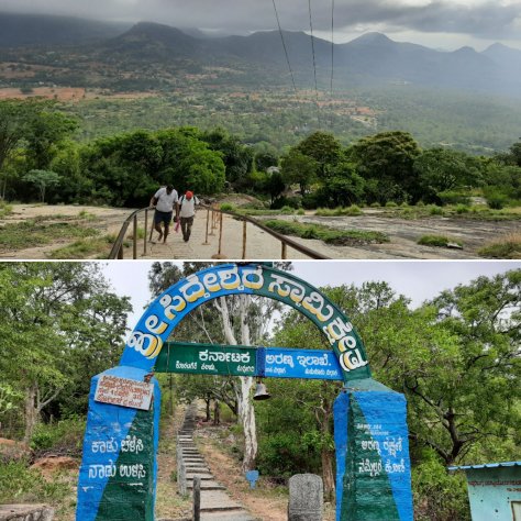
We chose the latter. So instant suggestions that came from someone in the group was Devarayanadurga and Siddarabetta. Then, we decided to give Devarayanadurga a miss as we all favoured a hike over a flight of stairs. We arrived at the base of Siddarabetta where we noticed a board that said, ‘climbing the hill with footwear was a sin’. Since many people use this path to visit a temple situated halfway, we didn’t want to hurt the local sentiments by wearing our shoes. Thinking that ‘a barefoot hike was definitely going to be an experience’ in our heads, we left our shoes back in our car.
Below: The welcome arch at the base; Top: The initial climb
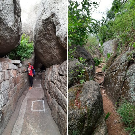
The initial part of the climb, until the Siddeshwara Swamy temple was steep but easy with well laid out steps and iron rods to hold onto. When we reached a small temple kind of a spot, the path split into two. The Siddeshwara Swamy temple was to the left, where too many people seemed to be as if there was no pandemic going on and there exists no concept called ‘Social distancing’. We decided to distance ourselves from the gathering and took the path to the right. With having to pass between too many boulders, it did seem a little confusing initially. The distant passing clouds now seemed as if they had come to meet and greet us. But after walking a little ahead, we reached an area that was a transition from dry rocky mountain to rain soaked green forests. The real challenge of walking barefoot started there, with unassumed ground with gravel and possible thorns from the shrubs.
Left: The rocky path to the temple; Right: The forest path to the view point
A little further, we reached an open rocky area where the view in front of us was playing hide and seek with each passing cloud. Apart from the drizzle and gusty winds that made it difficult for us to stand, we were mind-blown by the view we saw each time the clouds cleared out. There exists a small rain fed pond, a couple of meditating chambers that house Shiva Lingas (history unknown) and dilapidated remains of an old fortress. There was nobody else other than us in this entire stretch. We walked further and crossed two more hills before deciding to return, or else we would lose our way back.
Top: The dilapidated fortress wall; Bottom left: A large rock; Bottom right: One of the meditating chambers
It started to rain on our return, and we were quite drenched by the time we made it to the car that was parked just at the base point. The small eateries and stalls were slowly opening by that time which we chose not to visit, in order to avoid any social contacts with anyone else outside the group that we had gone in. We ate a few biscuits as a substitute for breakfast that we had carried from home and decided to stop the car next, only at home. It was a much-needed break and a pleasant little hike.
The view at from the peak
Summary:
It is an easy hike and very good for beginners.
Be careful to carry all snacks only in a closed backpack as there are too many monkeys on the way.
I missed the morning bus from Reckong Peo and that gave me some time to take part in the annual mela in the district headquarters. I boarded the next bus at noon, from Peo towards my destination for the day- Nako, a small township in the Hangrang Valley, a part of the Spiti valley. The place gets it’s name from a Tibetan word ‘Nego’ which translates to ‘The Door to a holy place’.
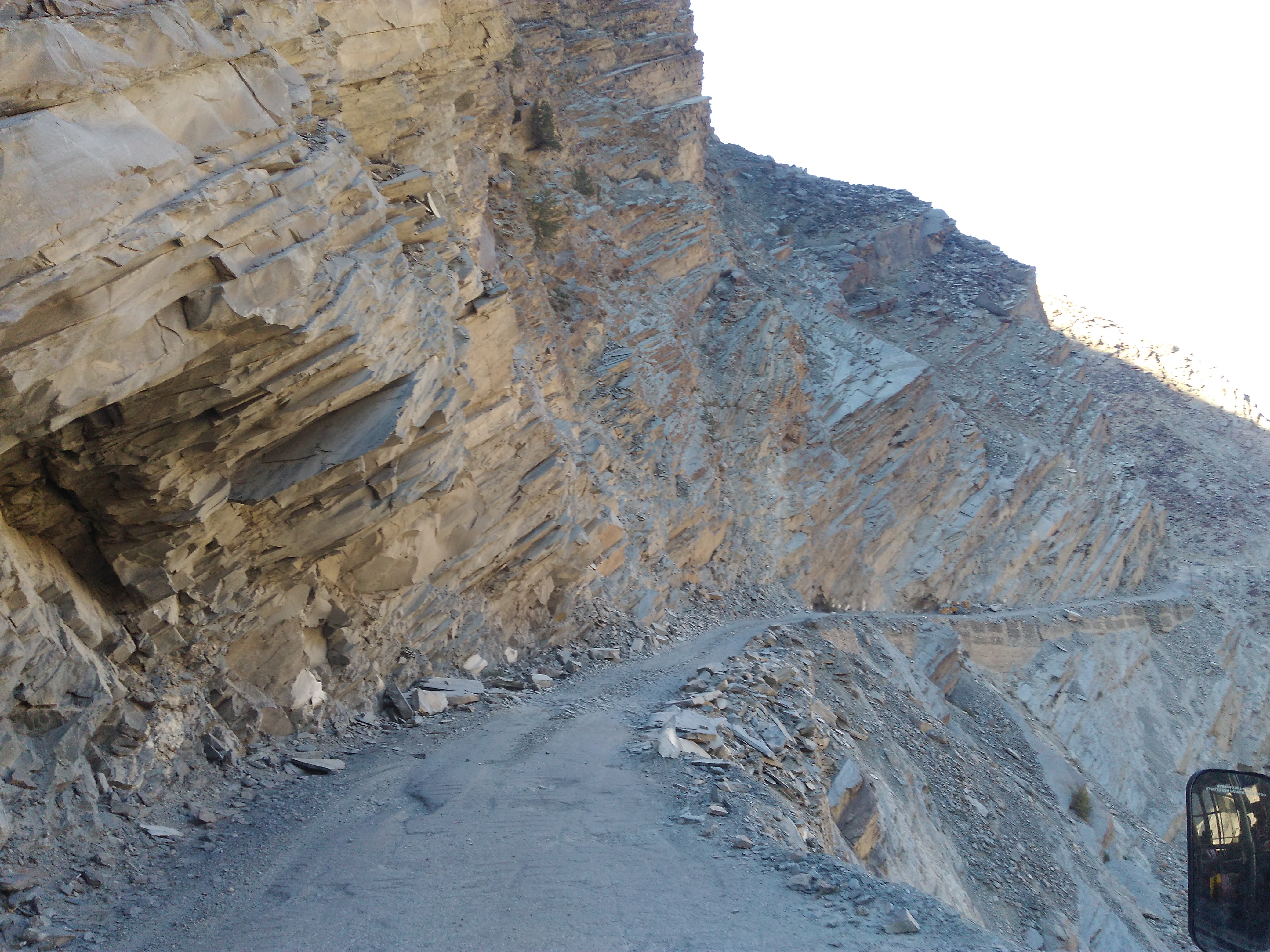
The road from Kinnaur valley, leading to Spiti valley
The transition from Kinnaur valley to Spiti valley was evident in its landscape. The road changed from green to rocky to barren along the way, each being spectacular. The snaking road was accompanied by the crisscrossing Spiti river amid a mind-blowing scenery all along the way. Although I was travelling solo, I felt accompanied through warm conversations with the driver and the conductor of the HRTC bus. They were quite surprised and amused to hear that I was from South India, spoke fluent Hindi, was travelling alone and without a fixed itinerary. The bus was stuck in a couple of roadblocks caused by landslides for almost 3 hours in total and that meant- I arrived late at my destination. From all the online research I had done about the place, I knew that Nako was decently popular on the tourist radar and finding a place to stay wouldn’t be difficult. When finally the bus stopped at the Nako bus-stop at 07.00.p.m., I was in for the BIGGEST surprise of my life!
The bus stop was on the highway. That was the LAST public transport of the day. It was pitch-dark already. All the civilization I had read about, did not seem to exist there. Apart from the bright stars twinkling in the clear sky, the only light I could see was that of a dimly lit lantern hanging in a tiny shop. The conductor looked at me blankly and said- this is Nako. “Talk to the shopkeeper and he might help you to find a place to stay”, he said and signaled the driver to proceed their ride.
“Where am I going to stay tonight? Can I trust the shopkeeper? Do I have any other option apart from approaching the shopkeeper?” A million things were running in my head. I stood there for a moment to let my thoughts settle down first. But before that, the biting cold and the rough winds rushed me to the shop for some warmth. In the dim light, I saw hope. The shop was run by an old man and the wrinkles on his surprised face multiplied when I asked him if I could get a place to stay. He nodded a yes and asked me to wait until he attended his last customer and lowered the shutters of his little grocery store.
He walked me through steel shutters behind his shop, got a bunch of keys from his house and asked me to follow him to the floor above his house. He said he runs a homestay (Somang dhaba, hotel and homestay) during summer. Since I was there during offseason, the room wasn’t used for a long time. The room had a low voltage bulb and had no running hot water. I could stay there for the night if I could manage with whatever was available. He was not going to charge me for it. The room had a decent washroom, carpeted floor, enough blankets and a comfortable looking bed. The thought of saying no to the old man and getting adventurous in pursuit of a better homestay in the cold night did not even pass through my head. This place was more than what I had expected to get. I agreed to stay there and grabbed the room keys from him.
As I unpacked my bag to pull out my thermals, Mr.Somang knocked at my door with a bucket of hot water for me to freshen up and told me that he had informed the small dhaba next door to stay up for me so that I can go have my supper. If there was any other problem, I could knock at his door, Mr.Somang lived with his wife in the ground floor. The dhaba was a tiny shed put-up with sheets, was run by a Nepali family and fed the occasional truck drivers who stopped by for chai and Paratha. I had the same for my supper too. As I answered the family’s curious questions, I sat warming myself around the fireplace in their kitchen for some time before heading back to my room.
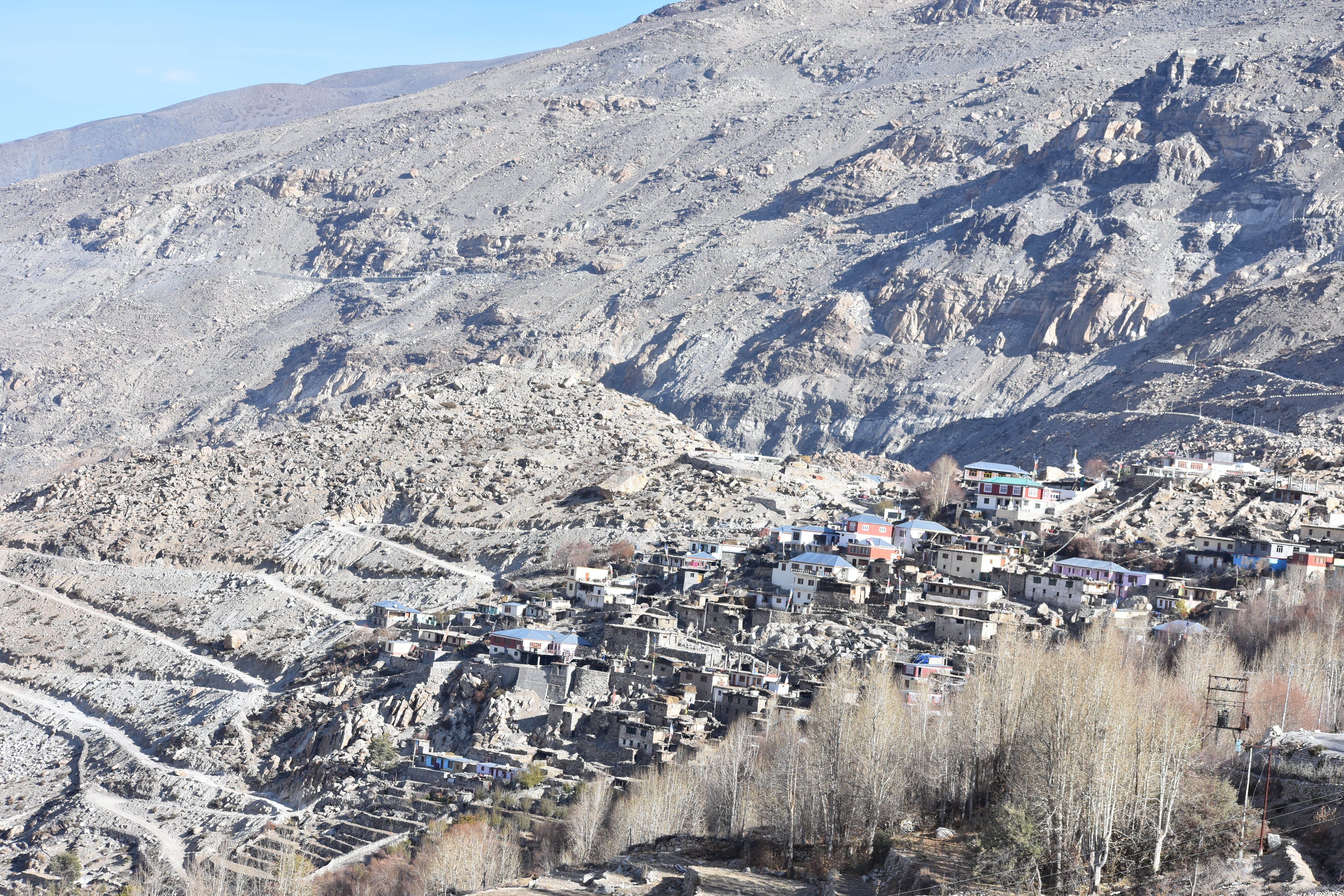
The township as viewed from the Nako helipad
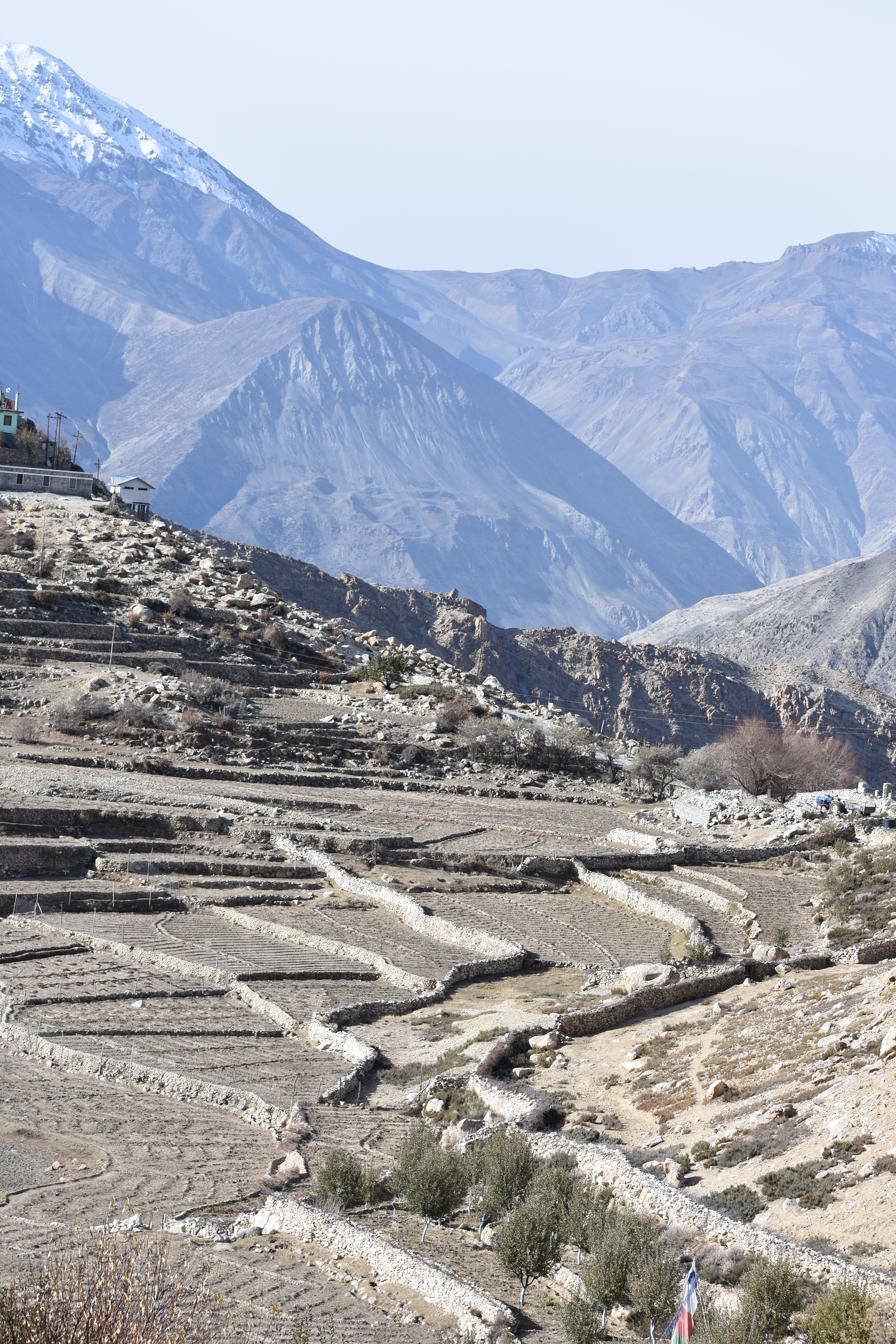
I was in for a surprise when I woke up in the morning. The view from the window transcended me to another world that I had imagined only on Microsoft Window’s wallpaper. Barren, dry arid landscape and distant snowcapped mountains. A lonely road ran uphill, and I had slept in a roadside house that had this magnificent view. I immediately jumped out of my bed, fetched a bucket of hot water from the host’s house, freshened up and got out quickly, to sink in the morning vibes of the place. I took a walk to the nearby helipad from where I could get a 360deg view of the surrounding mountains. That was the first time I was seeing a landscape so arid, so dry, so different and so beautiful.
The view from Nako helipad
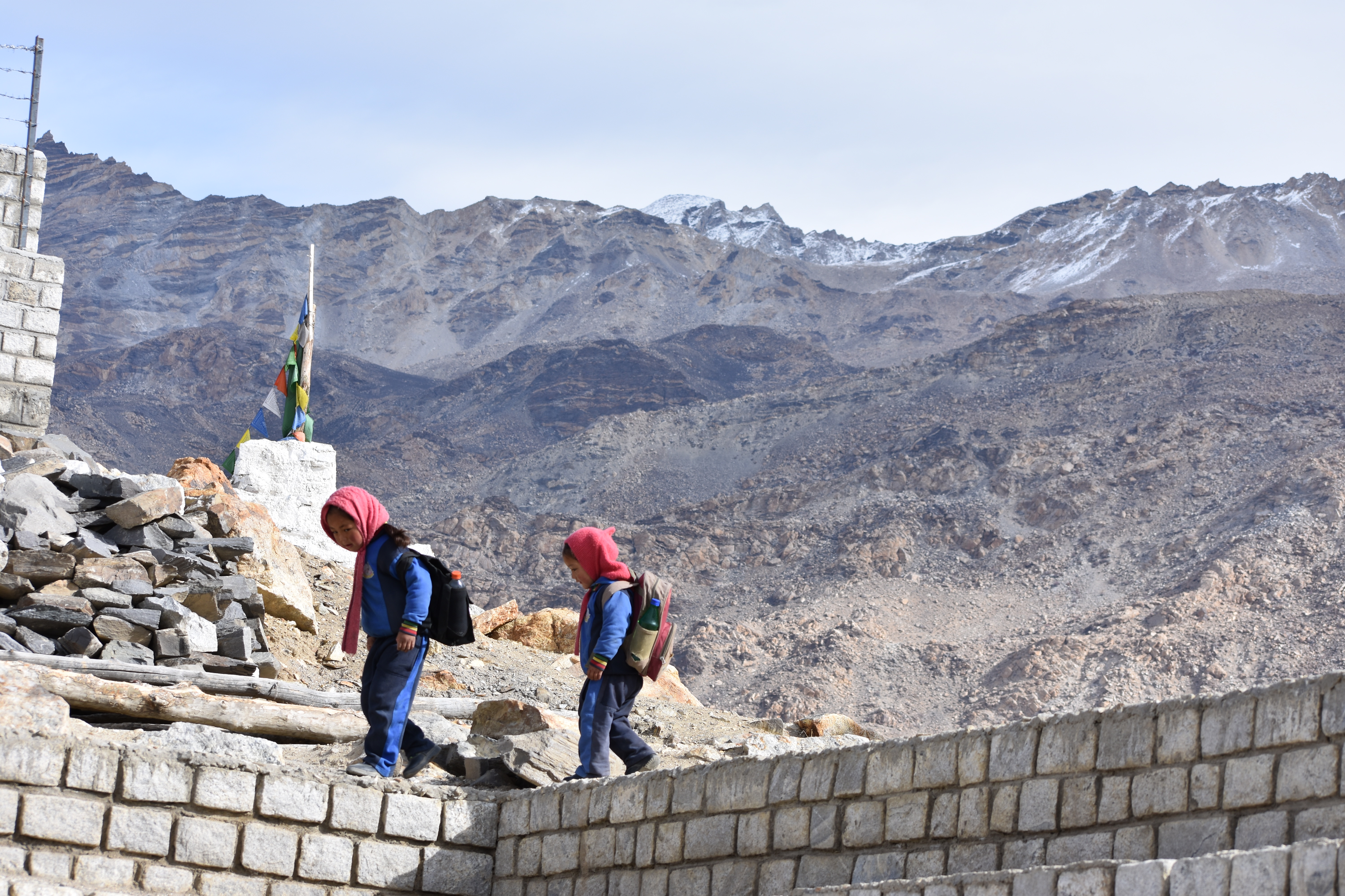
As I walked further, is when I realized that the real civilization of Nako village existed only if I walked further away from the main road. Doing this on a moonless night, in order to find a place to stay would have been next to madness. I was greeted by tiny tots with their heavy backpacks and playfully jumping on their way to school. The sounds of mooing cattle and crowing roosters echoed in the silent streets.
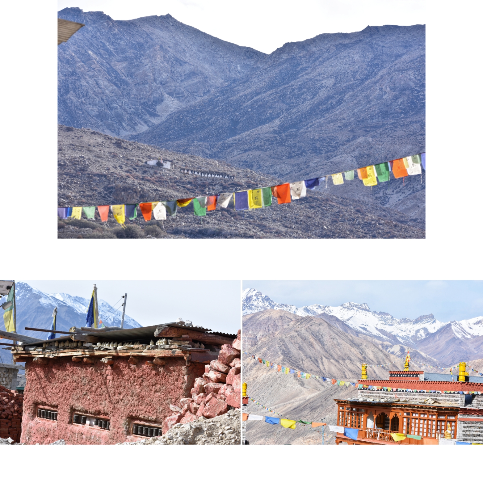
The sweet smell of incense arising from the monastery had engulfed the ambience as I walked towards a small red structure made of clay and red oxide. Prayer drums on its outside indicated that it was the ancient Buddhist monastery where people seemed to be coming to offer their morning prayers. An interesting structure caught my attention to up in the hills. “That’s the old and the main monastery from the 11th century ”, a passerby answered to my question. But it seemed quite far for a lonely walk, so I decided to keep it for some other day. When I have company, perhaps!
The Old and the new monasteries at Nako
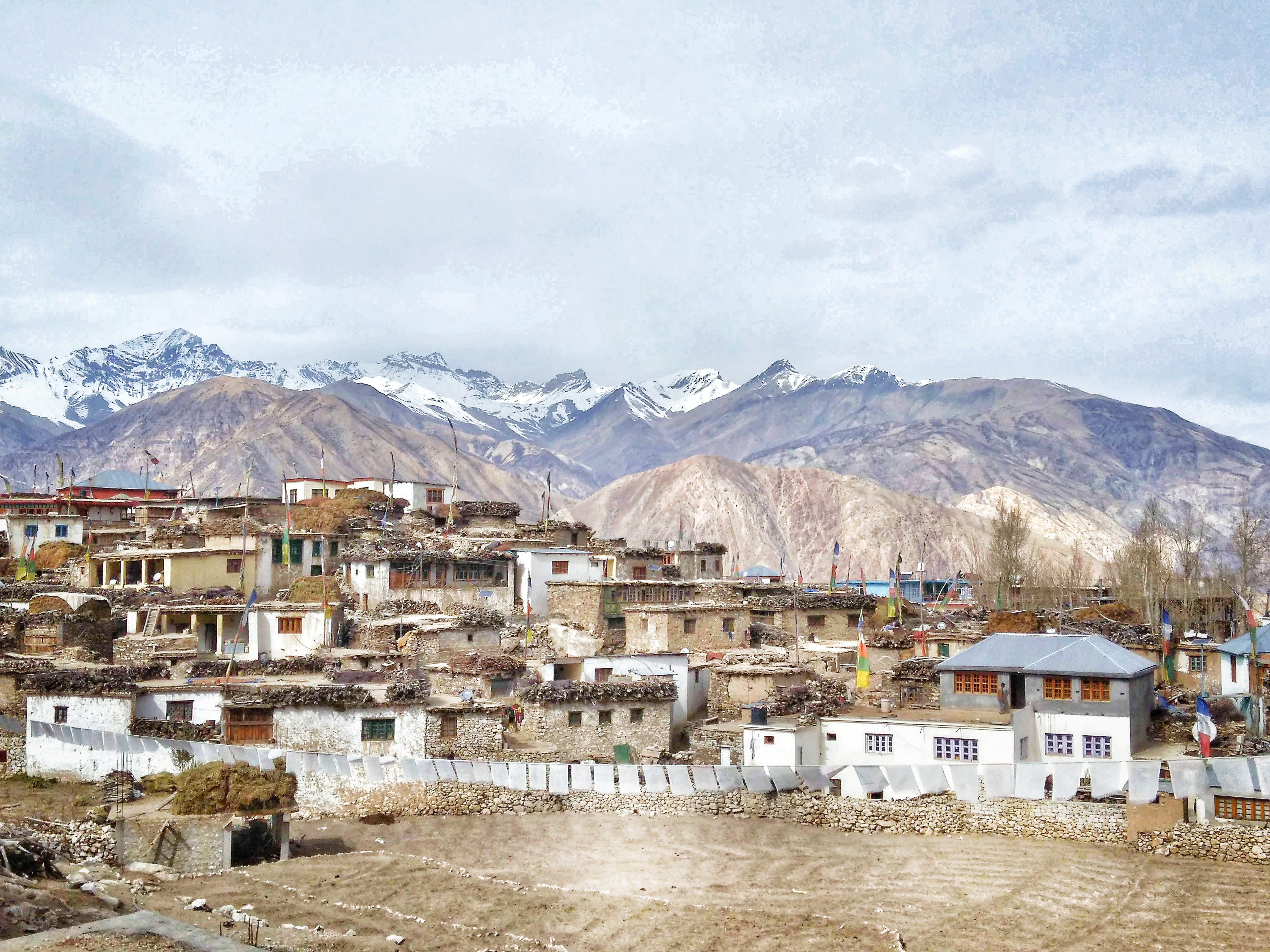
The further I walked into the village, the more magical it started to seem. The structure of the houses was unique to Nako, from what I had seen all this while. The houses are built at an elevation from the ground with wooden beams holding the dry stones, slate roofs covered with hay and all houses painted with white lime. While I was finding my way to the Nako lake through the muddy lanes, reaching random dead ends and taking blind turns, I felt lost in the maze. Just then, a man appeared in front of me and greeted me with a warm smile. He saw me taking photos on my cellphone and asked me if I minded a selfie with him. Although bad at taking selfies, I did not mind getting myself pictured in that unique looking place.
The Nako village
He invited me to his house for a cup of chai and not for a second did I think again. I nodded a yes with joy and followed him to his pretty haven whose courtyard overlooked the Nako lake. His wife got excited at the alien visitor in their little abode and got me chai and biscuits along with some hearty conversations. She took me around her home, and I was quite amused at the style in which it was built (almost entirely of clay, stones and hay), a first time for me. Apart from a heartfelt thank you, I did not have anything to give them back for their wonderful hospitality. And neither did they expect anything in return. I bid goodbye and walked down the lane to the lake, a holy place for the villagers.
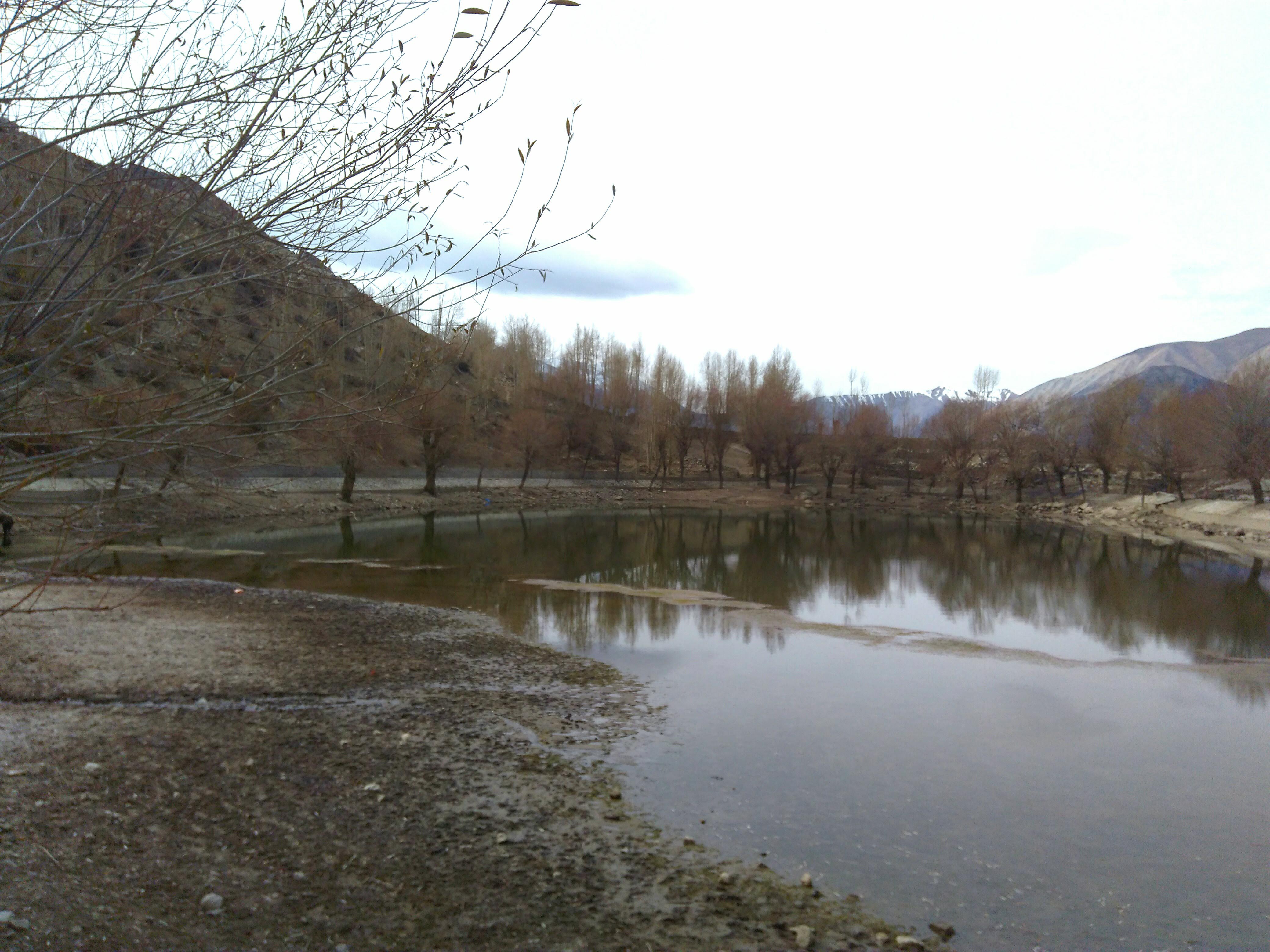
The Nako lake / The sacred pond of Nako
Apart from a few grazing horses, I was the only human there that morning. It was the first time I felt like meditating and decided to sit by the waters for some peaceful moments. The Nako lake is considered holy among the Tibetan Buddhists as Lord Padmasambhava is believed to have meditated here. It is no surprise why I was feeling the unusual calmness and serenity at that place.
A few running kids got me back to reality that I had been sitting there for a while by then. I woke up and got back to the homestay to figure out a way to get to my next destination. But that’s going to be another interesting story (Click her to continue reading)….
This entire journey has been compiled into a book. You can avail it on Amazon or read it for free using your Kindle. Use the link below:
Heard of the blue hills? Does the name ‘Nilgiris’ strike any bell? For those who know less, it is a part of the Western Ghats, a UNESCO World heritage site in the southern peninsula of India. The ‘Neel-giris’ literally translates to ‘Blue-Hills’ because these hills get their colour from a particular phenomenon. A particular species of the Strobilanthes kunthiana flowers, locally called the Neela-Kurinji bloom once in twelve years. When in full bloom, the entire hill range looks blue, thus giving the hills their name. The last mass-flowering of the neelakurinji flowers happened in 2018 and I left no leaf unturned to witness this spectacle. There were a couple of hotspots identified by the Kerala forest department where arrangements were made to allow visitors to see the flowers. My friends and I decided to visit the Eravikulam National park, located close to Munnar. This stretch of the hills was where most of the blossoms were supposed to happen. After finalizing the visit dates in Sept’18, the Delhi friends had booked their flight tickets to fly down and the remaining of us booked our bus tickets from Bangalore to Munnar. I had got all the necessary entry permits from the forest authorities and booked accommodation in Munnar for all of us. All this was done months in advance to have a confirmed entry anticipating the tourist influx for such a spectacle, if we waited until later. We were all set and waiting for the travel to finally happen.
Come July’18, the rain gods had wreaked havoc in the western Ghats. The entire stretch of western Ghats in Karnataka and Kerala had been damaged by the heaviest rains in eight decades. The damage done was massive to geography, property and life along these areas. In the event of things, damage was done even to the neelakurinji plants and the blossoms were feared to be washed out. Once the rain gods had calmed down and the ground situation of floods seemed to have receded, we waited to see if there was any luck in waiting until September. We were in constant touch with a few locals who gave us the updates on the status of the blue hills. Come September and we decided to go ahead with our original plan. We all had finally arrived at Munnar and were heading towards Eravikulam National Park.
Once there, Yes, there were enough plants destroyed. The stronger few, had managed to bear flowers. We walked along the laden path, feeling grateful for at least so many of the plants had survived. Since these plants blossom only once every 12 years, it means that their reproduction cycle is longer than usual. This also means that, most of the Neelakurinji vegetation is lost in the 2018 monsoon and the next flowering cycle of the year 2030 may not happen at a mass-scale as it is usually supposed to happen at all!! Anyway, we enjoyed whatever we were witnessing.
The Neelakurinji flowers at Eravikulam National park
Also, Neelakurinji is only a sub-species of the larger group of flowers called the Kurinji. The Kurinji flowers come in several colors- white, peach, purple, etc. Here is a collection of the Kurinji flowers from Eravikulam National park that we saw during our visit.
The various Kurinji flowers at Eravikulam National park
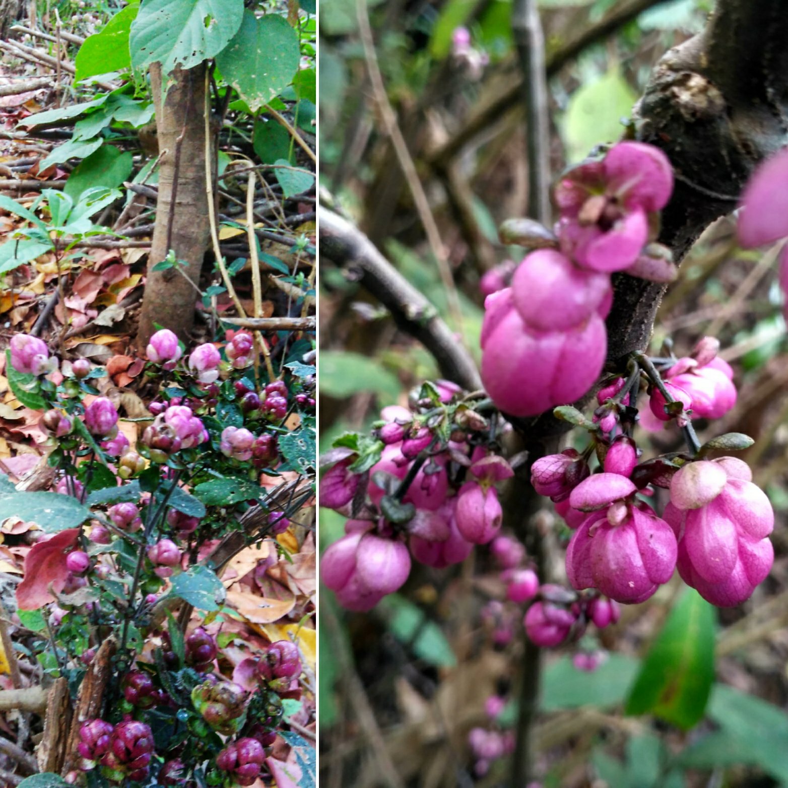
So that said, I was back in my hometown the following week and visited our piece of farmland to check on its status after the monsoon. It used to be a spice plantation that remained unmaintained for a long time before we, siblings ventured into developing it. our farm is a short walk away from the main road. When we arrived there and decided to walk, the entire path was filled with what seemed like some weed that had overgrown during the monsoon. We used a machete to make way for ourselves to walk further. Just a few steps into the area, we were surrounded with pink/ maroon flowers all around us. ‘These weeds had flowered expansively’, we wondered. We took a lot of photos, made way for ourselves, finished our work and returned home. When we discussed about the weeds with the elders in the family, we were surprised to hear that these plants also belonged to the Kurinji family.
The Kurinji flowers from our farm in Kodagu
Further, an important month in the Kodava and the Tamil calendar is the month of Kakkada or Aadi. In Kodagu, on the 18th day of this month a special dish is prepared using a locally available herb. Its juice is believed to contain 18 medicinal values. It leaves a very deep blue/violet pigment when cooked and consumed only on this day. And what is this plant called? Don’t even guess… Locally called ‘Maddh thoppu’ or ‘Aadi soppu’, it is also a variety of Kurunji. So, Kodagu primarily has three types of Kurinji; the flowering weed(Maley Kurinji(as in hill), Etth Kurinji(as in cattle) and Maddh Kurinji(as in medicine). A little bit of googling allowed me learn that there are many sub-species of the Kurinji and each have their own flowering cycles. While some bloom annually, some bloom once in six years and some take a couple of decades. Neelakurinji was just one among them.
Lesson learnt: How often do we tend to ignore the little things from our own backyard? We think these are too trivial to spend time and look for things elsewhere. It is often that people associate that better things come only when money is spent and distances are travelled, but the truth may be that it is something that we have been conveniently ignoring in our own vicinity. What is your take on this thought?
Rolling hills that has many faces to call it BEST described… Every description depends on who saw it during which time of the year. I was heading to this valley in early winter, 1st week of December to be precise. That’s when the days are warm and nights are cold, but there is no snowfall.
So, as planned my friend and I set foot to see a valley that borders the states of Nagaland and Manipur. ‘It’s a magical place’ is the only thing we had heard. I had done enough research about getting there from Nagaland side and learnt that there are two routes with different difficulty levels. One starts from Jakhama village and the other is through Vishema village. Since we had hired a trek guide, we decided to take the route recommended by her. Initially, not knowing what terrain we would be trekking through, we had carried our large backpacks with all the stuff for our fortnight long trip in Nagaland. But then, our guide asked us to carry just thermals and enough water. “Food and blankets can be bought at the peak” we were told. Anyway, additionally we carried our sleeping bags and some food since we had to utilize what we had carried all the way from Bangalore 😛 We left our luggage at our guide’s house in Jakhama and took a short taxi ride to the start point of the trek. (Watch the video below)
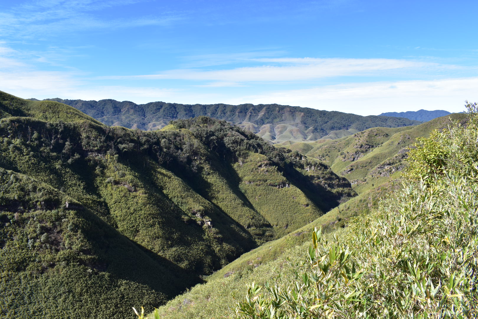
We started to climb up from Jakhama by around 11.30.a.m. and the path was unassumingly steep. The entire trail was encompassed in a thick canopy of trees through which the sun rays could hardly penetrate. Although we were climbing at peak noon, it felt as if it was post sunset. The heat generated by the body while burning the calories seemed insufficient to warm us up. The trail only got steeper at almost 80deg gradient and we kept thanking our guide for telling us to leave our excess luggage at the base. Then suddenly, the forests opened to the blue skies… Before our eyes could adjust to the bright light, we were staring at our first glimpse of the valley. I was at a loss of breath. Not because of the tiring climb or the cold winds that was making it difficult for me stand on my feet, but because I was transported to a different world by the setting sun which had engulfed the green valley. I don’t know if I can express that feeling rightly with words, to simply put it: I was SPELLBOUND!
The first view of the valley
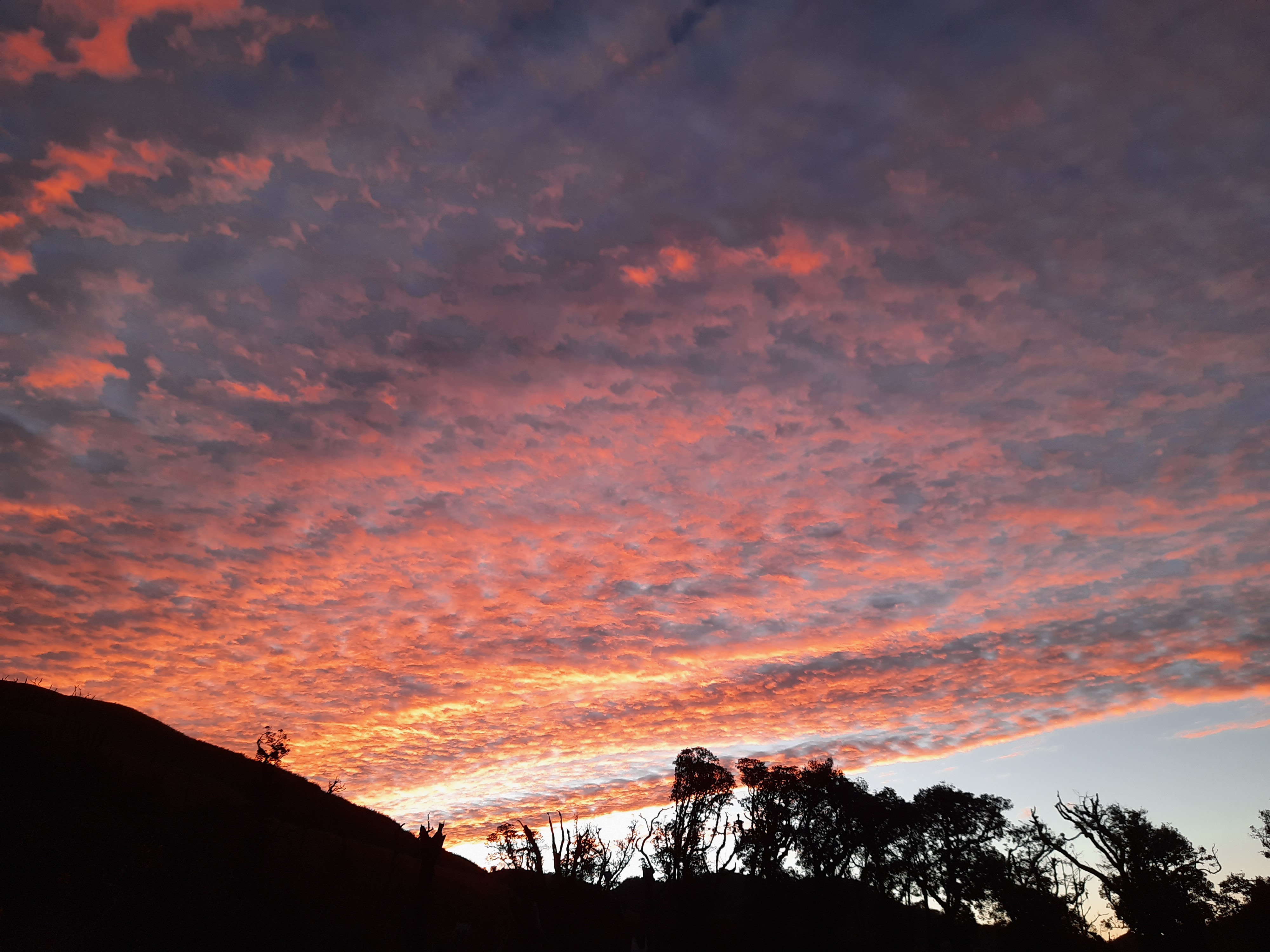
It was a short walk further from there. The trail along the cliff with the green hills appearing one after the other and the sky changing its shade with every second, kept us going until we had finally made it to the guest house for the night’s stay. At 4.30.p.m., when we reached there, it just got dark with the last ray of white light. But the sky continued to mesmerize us as it turned from red to black, in between illuminating the silhouettes of the surrounding hills. I had started to freeze and shiver by this time as the temperatures dropped to single digits. But I did not want to move from there as I stared at what was the clearest night’s sky I had seen in a long while. So many stars twinkled over the Dzukou valley! As reality started to hit me hard, I had started to get cramps in my feet and had to hurriedly go and warm myself with the thermals and the firewood that was lit to cook food in the kitchen.
As the night passed, the temperatures dropped further. Our thermals and sleeping bags didn’t seem enough and we borrowed additional blankets to help ourselves in the large hall which had just walls, a roof and a wooden floor to sleep on. I could barely sleep through the cold night. Although awake, I was waiting for the alarm to ring at 05.00.a.m. We were supposed to head out to see the Dzukou valley…
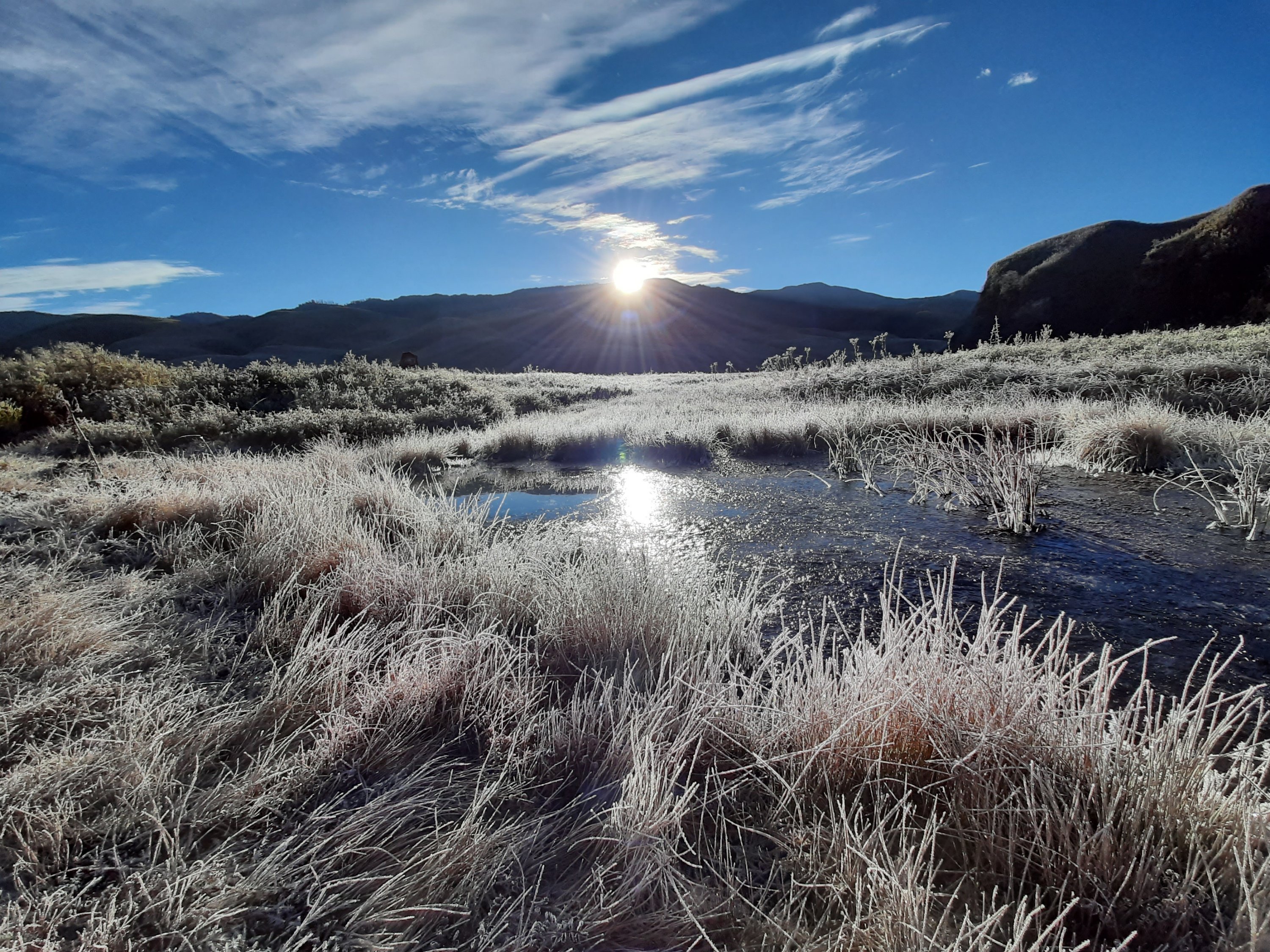
At 05.00.am. I was the first one to get up and step out for the hike down to the valley. The morning light was still dim, and I felt the earth below my feet crackle. It did not take me too long to realize that all the grass on which I was walking and the entire valley that surrounded me was frozen. The temperatures had dropped below zero and the frozen valley at a distance looked splendid! Soon, the others joined me, and we walked down the valley to witness what is supposed to be the main reason for our trek to Dzukou. The sunrise! We walked past what the locals call as the cave and walked over a frozen stream. We clenched bits of frozen waterfalls along the way too… And when the sun rose above and shone over the valley- It looked surreal. It seemed like the phrase ‘Frozen in time’ was framed after someone saw this place. The frozen dew drops reflected the lights of the rising sun and the sight was beyond my ability to describe. What I was experiencing from within was a sense of emptiness, accomplishment, happiness- well a medley of emotions. There has been NO place I had been to more beautiful than this, no I’m not exaggerating.
A frozen pond in Dzukou at Sunrise
The entire valley has a peculiar kind of bamboo grass which gives it its green color. The same valley looks as if it is covered in red/ pink during monsoon. That’s when the lilies, endemic to Dzukou valley bloom. And come during the peak of winter: The entire valley is painted white in snow. This is a photo my guide had shared with me of how the valley looked just 10 days after we returned. The valley does not fail to mesmerize people irrespective of the season they come. Well, after spending a good amount of time, we returned to the guest house, packed up to head back to Kohima, for the hornbill festival.
The sky on our way to Vishema
By now, we were a big team of trekkers and backpackers who had all bonded over at the guest house and together we decided to take the Vishema route for our return. It was a brilliant decision, I guess! Had we taken the same route for our return; we would have missed the magical sky behind the forest canopy. The sky seemed surreal with every turn in the trail. The valley too looked magical at every corner. It was flat land that we were walking on mostly, apart from a short trail of very steep rocks to slide down from, until we finally arrived at the base. A pre-booked Sumo was waiting to pick us back to Kohima. I want to bluntly end this post because this place is something better experienced than written about.
The view point from the guest house. Top: After snowfall; Below: before snowfall
About the trek in short:
I believe what one calls difficult or easy largely depends on individual’s fitness level and trekking experience. According to me, the distance to the peak is short and could be done in 1-1.5hrs if it was me alone. But it was the first hike EVER for my friend and it took us around 4hours to reach the guest house at the peak.
Although people feel Vishema route is easier onwards, in my opinion- we made a good decision by walking the Jakhama route while going up. Since it is steep, climbing would be slow but the distance is shorter. In contrary, if we took Jakhama route to climb down, the gradient would put enormous strain on our knees which is why I suggest taking the Vishema route for the descent.
Cooked (basic & hygienic) food and potable running water is available at the top, so apart from energy bars for your walk, avoid carrying unwanted luggage.
This post is part of my fortnight long backpacking in the north eastern state of Nagaland in India, specifically covering Dimapur- Kohima– Phek districts of the state during the Hornbill festival.
More often than always, the stories we carry back from our travel are about the people we meet and less about the places we see. Our definition of whether our trip is good or bad is defined by the way we are made to feel by the people we come across. My experience in Pfutsero too has been one of those, where the warmth of the people made me fall in love with Nagaland. All I knew about Pfutsero was that it is the largest town in Phek district, and it is the highest inhabited place in the state of Nagaland. High altitude also means that it is the coldest place in the entire state. Having very little information available on the internet only meant that the place is still off the radar of mainstream tourism. This is what got me inquisitive and itched me to visit Pfutsero which would give ample scope to explore and experience something so raw and unknown to the outside world.
From the day I arrived at Nagaland, I had started to talk to a lot of people to get information about getting from Kohima to Pfutseru. With lack of clear information and high cost of travel, I had almost dropped the plan until the end of my 10-day trip in the state. One last try at finding a cheaper travel to Pfutsero, landed me in a small grocery store at Kezekie taxi stand in Kohima. My friend and I realised that we were at the right place. The courteous owner of the store guided us with all the required information and got our seats booked in the shared taxi that plied from Kohima to Pfutsero the next morning.
My itinerary to explore Phek district:
Day 1: Leave from Kohima to Pfutsero (shared taxi), visit Glory peak (Frozen lake trek if time permits), explore Pfutsero town (Night’s stay at the tourist lodge) Day 2: Chida lake/ Lowho, Lazami village (spirited stone), Kami village view point, return to Kohima.
Video of the view from Glory peak
The Details:
As instructed, we had reached Kezekie by 07.00.am. the following morning to be assured of a seat. But thanks to the traffic, it was 10.30.a.m. by the time we left Kohima. However, there was one ambiguity before leaving for Pfutsero- We hadn’t booked a hotel at Pfutsero for our stay yet. Despite several failed attempts of calling the mini-tourist lodge at Pfutsero, their phone continued to remain switched off. But my friend and I were up for some adventure and decided to travel without a confirmed stay, go there and find one.
Phek district is inhabited by the members of the Chakesang tribes in majority. With the friendliness of the grocery store owner, we had already started to feel the positive vibes of the place we were going to. She had given the contact information of her family who lives in Kezakeno, another village in Phek. She had not just shared the contact info, in fact forced us to stay with her family. We were feeling grateful and partially sorted in the eventuality of not finding a hotel at Pfutsero.
Day 1:
There were both good roads and no roads, all adding up to a patchy drive to Pfutsero. Apart from the mountainous roads that seemed charming outside, the people with whom we shared our drive made our trip indeed a memorable one. One of them helped us to contact the tourist lodge and confirmed our stay at Pfutsero even before we reached. I had clearly started to feel overwhelmed with the hospitality of the people in this part of the country where the locals wanted to make all visitors feel at home. Almost everyone whom we got talking to, was excited to invite us over for a meal with them. Finally, it was 02.00.p.m. when we reached Pfutsero and a cup of hot tea was what we relished at our co-passenger’s house before checking-in at the tourist lodge. A colourful garden welcomed us into her wooden house that was perched on the slope of the hill. Its windows opened out into a majestic view of the entire town and overlooked a lake surrounded by green lawn. The dreamy house seemed to be no less than out of a Bollywood flick. We soon bid her a warm goodbye and headed to the tourist lodge, freshened up and proceeded to the target destination, before the sun called it a day!
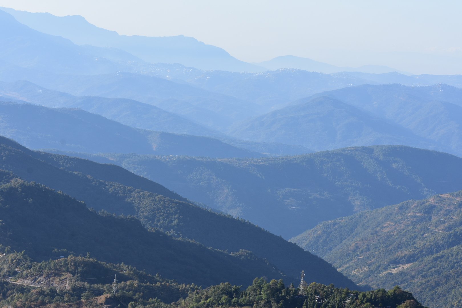
Glory peak is the highest point in Pfutsero. A short taxi ride of 3kms through an under-construction road, jaw-dropping view of the surrounding valleys and a climb on a watch tower got us to the top of the town. Mt. Saramati is the highest peak in Nagaland and Mt. Everest needs no introduction. On a clear, bright afternoon, both the mountains can be seen from Glory peak. Since, we had reached there before sunset, the distant mountains were partially hidden by the haze and hence we could get a clear view of only Mt. Saramati. Nevertheless, the 360deg view of verdant hills from the glory peak was something to die for.
View from Glory peak, Pfutsero
For those who have an additional day at hand, a day hike to the frozen lake from the glory peak is highly recommended by the locals. We decided to explore the town a little bit, before it was dark. A hike down the peak was fun as the staircase leading to the town passed through thick forests, strange creepers and colourful butterflies. We spent time exploring the town until sunset. It seemed dusty with poor roads. Apart from a few local snacks, we couldn’t find anything interesting. However, there is one souvenir shop run by an NGO that supports local artisans. One can buy some traditional Chakesang tribal jewellery, textile and food products as souvenirs from here.
The dropping Pfutsero temperature had started to numb our fingers and we decided to head back to the lodge. The lodge is situated on top of a hill and the setting sun looked glorious from the corridor. After wearing my thermals and gloves, I decided to take a stroll around the lodge. It is located adjacent to defence property and that gave me a sense of confidence to venture alone after dark. All the people from the neighbourhood were busy in decorating a nearby church for Christmas. They got me talking to them and eventually I joined them in their chore of setting up the wreaths and light bulbs. It was a fun evening until I decided to head back for the warmth of my room. The lodge was a HUGE property, but we were only two girls staying there that night. Although it was a little scary at the first thought to be the only guests, we were soon occupied in long conversation with the caretaker family of the property living in the same building, later to be joined by the owners. The conversation covered a range of topics and ran into the night. Given the lesser crowd of the cliched tourists, company of comforting hosts and warm conversations, we couldn’t have asked for a safer and a better place to be!
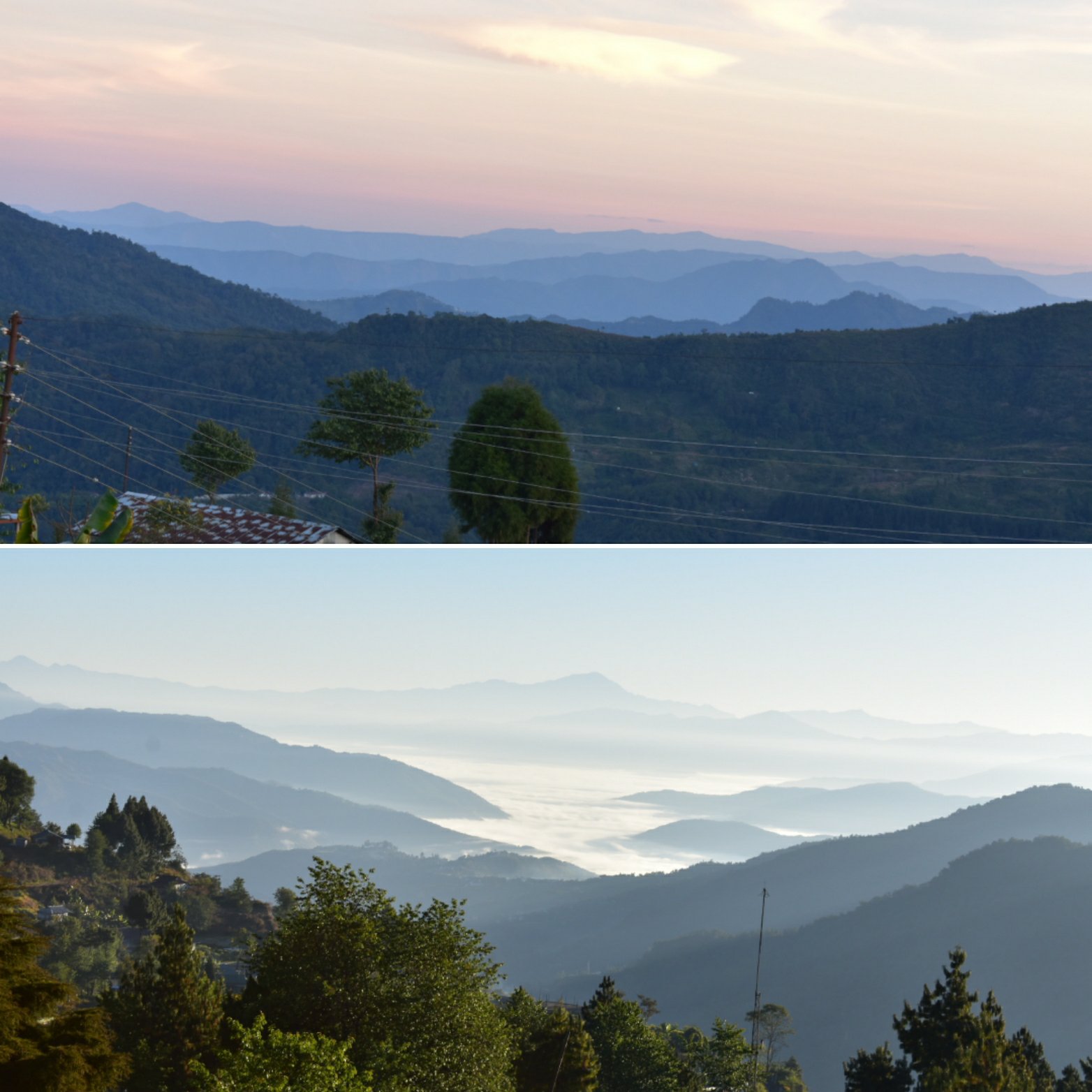
Top: Sunset view from Tourist lodge corridor, Pfutsero; Below: Sunrise view from Tourist lodge room, Pfutsero
Day 2:
The comfort of the heater, cosy blankets and carpeted floors let us sleep like logs, unaware of the freezing sub-zero Pfutsero temperature outside. We were woken up by the alarm next morning, only to be mind-blown by the view of the rising sun over the clouds from our balcony. We packed up and prepared to leave as that was our last day in Nagaland and we had to make it to Dimapur for the night’s train. Meanwhile, we had booked a personal taxi for our return, since we wanted to explore Kezakeno on our way back.
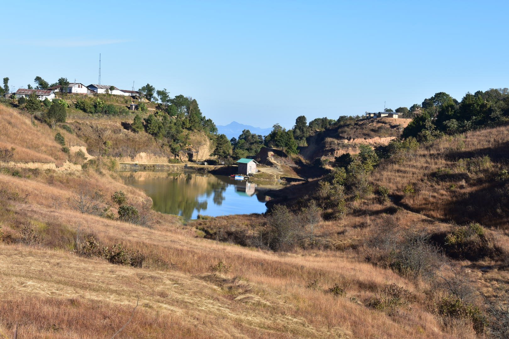
The first stop was at- Chida lake. Locally called as Lowho, this off-road destination is a favourite hangout among the locals who come here for games like fishing and boating. Some enjoy a trekking trail from glory peak to Chida along the Kapamedzu range as well. There is a Border Security Force camp at Chida and hence, it is also referred as Chida Post at times. Since we had reached very early, we were the only tourists there and the place looked absolutely calm and serene.
Lowho lake at Chida, Kezakeno
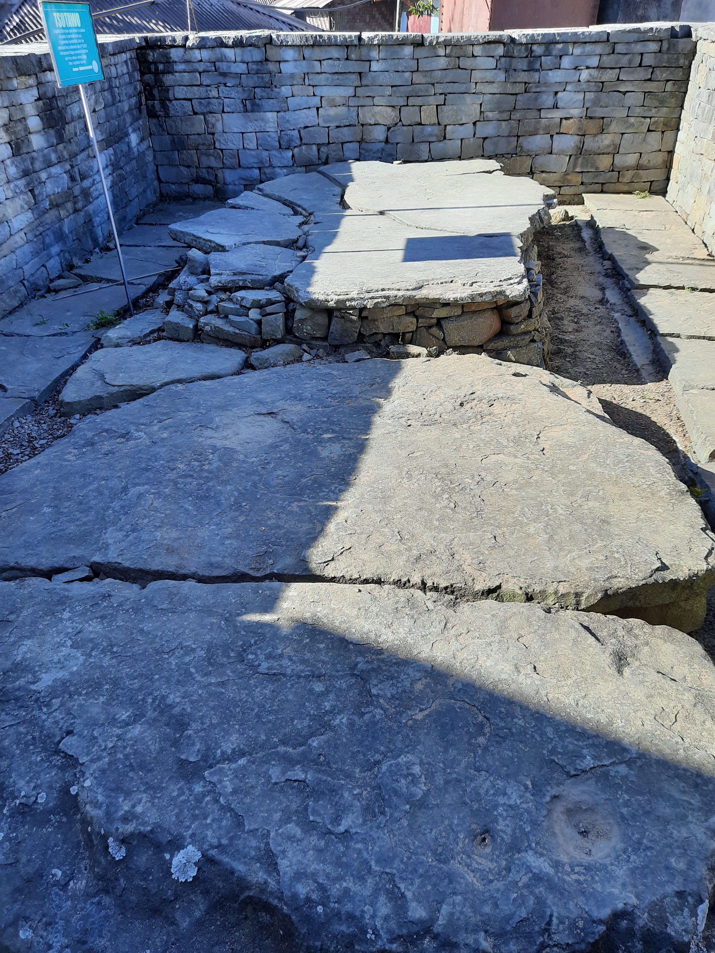
From there, we headed to Lazami village. This tiny village is of very high historical importance as it is the site from where the various Naga tribes are believed to have migrated to different parts of the state. A veteran from the village was excited to narrate the legend of Tsotawo, the spirited stone in the village. We were warmly invited by almost every person in this village into their house. We finally settled down at a little traditional house for breakfast and a large cup of tea. We carried back love in the form of guavas and local walnuts given by our hosts from this village. Seeing so much affection in these hills was a wonderful feeling that cannot be expressed, for which a city soul in me would want to come back again.
The spirit stone
While continuing our journey from there, we did have a stop at Kami village view point to admire the terraced paddy fields of Lekhromi village, the view looked magnificent under the oblique rays of the early sun.
Making our way through the maddening traffic jam of Kohima is for another story to be written about, some other day! Thus, ended our 2 days of amazement and overwhelming hospitality in the Land of the Chakesang Nagas- Phek district.
Terraced farms at Lekhromi village, Phek
Fact file:
Must eats:
Pfutsero is famous for its organic farming and terrace cultivation. We bought fruits (some known and some new) from the local shops that we could eat once we were back in our room.
One would find a lot of bakeries in the town selling local cookies and muffins. Sticky rice cake, banana cake and banana chips are few of the things I recommend.
Getting around:
Daily shared taxis ply between Kohima and Pfutsero. There are limited seats and the taxis leave immediately when filled. The taxi leaves Pfutsero around 6.00.a.m to Kohima and the same returns to Pfutsero on the same day on a first-cum-first serve basis. So, if one is not early enough to get a seat, he will have to hire a full taxi for him/herself or stay back until the next morning to share it. A one-way shared taxi seat costs 300Rs. Per head and a personal taxi would cost 5-6000rs. irrespective of whether it is a 1 or a 2-way journey.
Within Pfutsero, most places are at walkable distances. But internal taxis are available for local commute. Talk to one of the shopkeepers in the town and they must be able to help in finding one.
Stay:
A very well-maintained tourist lodge and a government run mini lodge are available at a very affordable price.
There are a few homestays available for a more local experience.
This post is part of my fortnight long backpacking in the north eastern state of Nagaland in India, specifically covering Dimapur- Kohima- Phek districts of the state during the Hornbill festival.
Before planning my visit to Nagaland, I had followed a few bloggers who had posted encaptivating photos of what they called the ‘Greenest village in India’. My friend and I had our stay booked at a homestay in this little-known village and were supposed to head there on the first day of our arrival in Nagaland. It was past noon by the time our shared taxi from Dimapur reached Kohima and the temperature had started to drop. Khonoma village, our destination was 20kms away and we stood on the highway, clueless about how we were supposed to get there. The connectivity through public transportation across Nagaland is something that needs the attention of the authorities. Meanwhile, without being able to find an honest taxi driver among all those who were quoting higher than what I had read about, we had started to feel stranded.
We finally managed to get a taxi and the courteous driver ensured our ride on the roadless path was comfortable and entertaining. On our request, the best Nagamese songs from his playlist were streamed and he made humble efforts to explain the meaning of each song and its relevance in Naga culture. It was a long ride considering that we took over an hour to cover the short distance. In Nagaland, each district is inhabited by a particular Tribe in majority and each village represents a particular clan within the tribe. Every tribe has its own language and surprisingly, each village has its own dialect which another clan might struggle to understand. ‘Khonoma is inhabited by the Kuthotsu clan of the Angami Tribe’, we were told.
A village tour of Khonoma
On reaching Khonoma, we registered our entry at the tourism office from where we took directions to our homestay. As a first impression, it felt like it was just another settlement on the hills, something similar to my hometown. But as I began to walk towards the homestay along the narrow lanes and past the tourism office- a new world started to unfold. The entire village is built on a slope, overlooking the paddy fields. The slope makes it a requirement to climb winding stairs to get from one house to another, from one street to another. As you do this, you will not just pass by umpteen number of morungs but also walk through gardens full of colourful flowers and traditional Angami Naga gates. All this, while you are being mind-blown by the gorgeous view of the never-ending terraced fields of paddy and vegetables. If not the same, I bet this is far better and untouched than the terraced farms of Bali that has flooded the Instagram feeds. The guava trees around every corner of the village and the widely covered creepers of the Chayote squash added a vibrant hue of green to the entire valley. The extremely warm and obliging villagers allowed me to pluck a few guavas that tasted like nectar. Those were definitely the best guavas I had in my life till date. We then walked down the streets to our homestay, a cozy simple house that stood overlooking the terraced fields. Since we had little time before sunset (The sun sets by 04.00.p.m.), we dropped our luggage, freshened up quickly and ventured out to explore the village and make the most of the daylight.
Naga Heritage museum at Khonoma
As we strolled around the lanes, we were intrigued by the several morungs and the traditional Angami houses that we passed by. Morungs are Naga structures that are comparable to Gurukuls of olden days. The elders of the village would pass on their knowledge about life skills and tradition to the younger generations here, usually in the evenings after finishing their day’s chores. Although the Morung system is slowly passing into oblivion in modern days, Khonoma is one of the few places where these structures are conserved in their entirety. Every Morung and house had animal skulls (ranging from one to hundreds in number) hanging around their roofs and walls. We were quite fascinated with the collection that ranged from Mithuns and mountains goats to boars and other cattle. As we stood there, watching a few women who were busy with their job of de-husking paddy with a large pestle and stone, we were greeted by them with warm smiles to have a cup of tea in their house. I instantly accepted their invitation, jumping into the idea of seeing how a traditional Angami Naga house looked like inside.
The different skulls inside a traditional Naga house
Basic mud-smeared walls with knitted bamboo doors and their wooden roofs adorned with hundreds of skulls all around. “These skulls are prized possessions that represent the heroics of our ancestors. The Nagas are primarily hunters and our forefathers saved up the skulls of all their kills. The larger the collection, higher was his societal stature until the government brought a ban on hunting. Given the history of Nagas being head-hunters before the coming of missionaries, don’t be surprised if you bump into human skulls in some of the remote villages elsewhere”, explained a member of that house. Although the other members in that family couldn’t speak English or Hindi, they continued to smile at us for as long as we were there. However, communication is never a problem in Nagaland with almost 90% being proficient in either English or Hindi.
We visited the Naga heritage museum and then walked up to a small hill where the church stands at a vantage point, outside the village entrance, overlooking the entire hill range. From there, we walked back to the village and climbed up a few stairs to reach the highest point of the village. The setting sun let the hills in the background cast their shadow on the undulating green paddy terrace. The view of the range of hills and the entire village from there was a sight to behold for which, we had lost our senses and not to the dropping temperatures that had started to numb our skin 😃 After the sun had called it a day behind the hills, we munched on some local snacks like sticky rice roti, pakora at a café at the village entrance. We grabbed a few packets of Puffed sticky rice and Naga chilli smeared channa from a small shop before heading to the homestay. We hurried up to warm ourselves in the comfort of our homestay’s kitchen where firewood was setup to cook the night’s supper. Sips of hot tea and long conversations with our Angami host and other guests culminated with a delicious Angami meal that comprised of boiled vegetables and steamed rice with vegetable stew- all grown organically in our host’s backyard. The country chicken curry was a bonus for the non-vegetarian in me 😊
The plan for the next morning was to catch the sunrise from the paddy fields by walking along the stream that flowed down the valley. However, the freezing temperature made it impossible for us to get out of our cozy layers of blankets. The plan that had to follow our breakfast was a visit to Dzuleke, a quaint little village located 10kms away. It consists of merely 32 houses and the residents are also from Kuthotsu clan who decided to move out from Khonoma to a more secluded place when the land on the outskirts were open for new settlements. Today, it is supposed to be one of the prettiest villages that is promoted by the state’s tourism board and accessible only by foot or one’s own vehicle. Since a one-way ride was costing us 1500Rs., we dropped our plan of a day trip to Dzuleke.
There is one NST bus (Nagaland State Transport) that connects Khonoma to Kohima every morning. But the state is largely shut on a Sunday and it is an important note to consider if you are planning your travel/stay in Nagaland. After the day got a bit warmer, we packed our bags and headed out in a personal taxi to our next destination- Naga heritage village at Kisama, the main arena of the Hornbill festival.
Meanwhile, some interesting things I found in this village:
Large bird feathers are made into a garland and hung high around the farms. “It is just for decoration purpose”, I was told on asking what it signified.
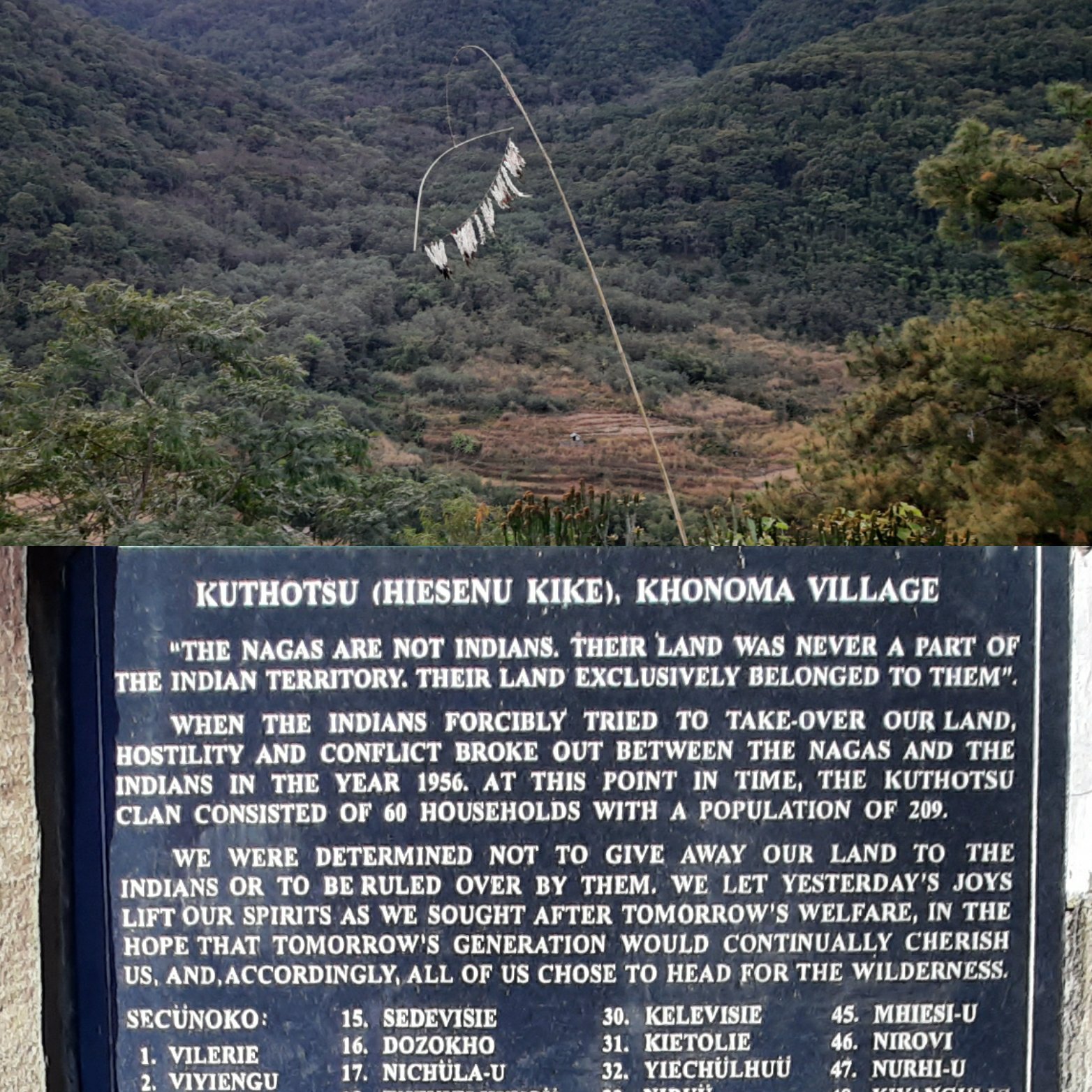
There a large stone erected which signifies the previous rift between the Nagas and the Indians on the mainland (It is quite an interesting read how the Nagas fought the Indian army)
Stone pulling Ceremony is an annual traditional event held across the Angami villages to commemorate a certain important day. It takes place in one village per year on a rotational basis. So that way, it takes about 5 to 10 years by the time this ceremony reoccurs in a particular village. This event is usually timed around the Hornbill festival as there will be people from across Nagaland and outside visiting Kohima (The region where the Angami tribe is a majority).
The stone referred here is a large monolith that weighs several tons and the size and shape is not fixed. It is at the villagers’ liberty to pick the monolith they want to use for the occasion and can be either quarried from the village itself or bought from somewhere else depending on the resources. The large stone slab is then placed on a sled that is made of tree trunks and pulled using thick entwined vines from the forest. Thousands of Angami Naga men pull the large monolith over a few kilometers to finally errect it upright, engrave the details of the event and mark the day.
This year, the stone pulling ceremony was held at Mima village. It was organised to commemorate the 75th anniversary of christianity in the village. The monolith was symbolized for forgiveness, friendship and peace to the enmities that the village had with various villages before the coming of the gospel to Mima village.
The typical stone pulling ceremony (Click here to watch the complete video) is solemnised by the pastor from the village’s church with recitals from the Angami bible before the start. It is then followed by firing a round of shots from the muzzle loaded guns in the air. The captain stands on the slab and shouts Angami cheers through a loudspeaker to motivate the pullers. While all the strong and younger men folk of the village join hands to pull the stone, The eldest two men of the clan walk, leading the tribe. The women get dressed in their traditional attire and walk with a khophi (an utility basket woven with bamboo or cane) hung on their back and they stay around as a mark of support to the pullers. A few of these women carry cotton in containers made of dried bottle guard and walk ahead of the pullers as a part of the tradition. And yet, the remaining women go around distributing gruel made of ‘Job’s tears or Chinese pearl barley’ to all the passersby and the participants from their traditional Aluminium pots. It is served in bamboo cups that are carried in the baskets hung around their foreheads. The gruel provides an instant boost of carbohydrates for the toiling men in the hot sun.
In a Christian majority state, the tribal traditions are still thriving. It was a different experience watching the entire village dressed in their ethnic best and gathering to pull the stone uphill from the starting point to its destination. I somehow drew parallels with the chariot pulling tradition of the Puri Jagannath and several other temples of South India.
Isn’t it true that we all somehow follow the same way of life, only with different names for our faith and the process we follow to achieve it?
When you feel things are not going right, life has its own ways to heal its kids, you see? While I was feeling morally weak, an unexpected trip to Gokarna was awaiting my way. This time, I was going to lead a group of people, or at least assist a leader with ‘Plan The Unplanned’. With many firsts of experiences in its kitty, I was looking forward for this weekend trip.
So, after braving the outbound traffic on a Friday evening, the group of 25 of us left Bangalore and alighted at Gokarna the next morning. Blame it on the bus driver or the roads, 11.30.a.m. was late by all standards to reach Gokarna for the team that left GGpalya at 11.00.p.m. on the previous night. Anyway, that’s where the leadership aspects began to be tested. Considering that we were 3+hrs behind schedule and all 25 in the group were first time hikers, controlling the overall time to cover all that was mentioned in the itinerary was crucial.
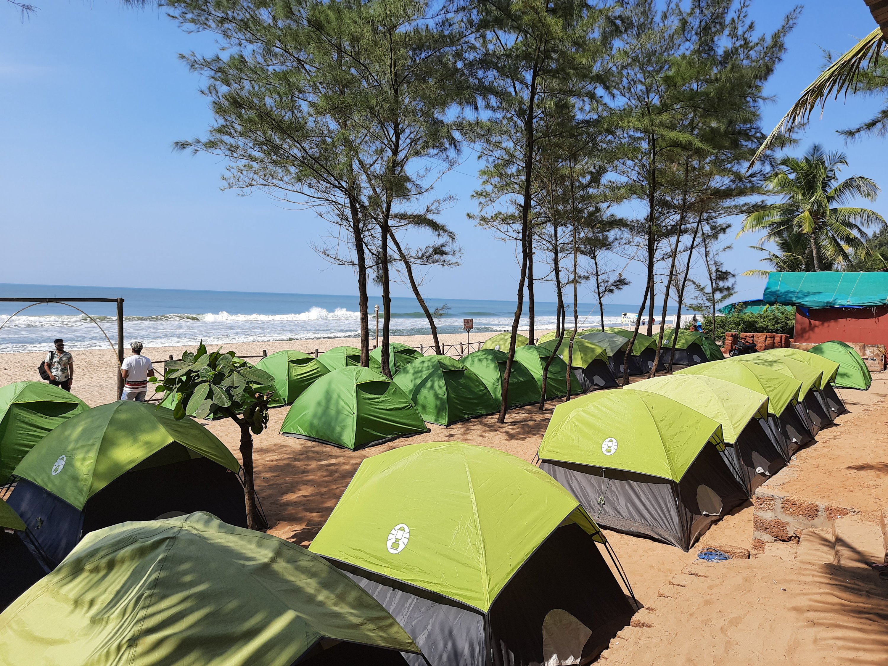
That said, we checked-in to the campsite where our tents were pitched by the seashore. Without wasting much time, the team freshened up and started the hike quickly after a filling breakfast. A minibus took us to the start point of our hike- the Belekan beach. From there, the actual weekend started to unfold. Since the internet is filled with itineraries for a Gokarna trip, I will not add another one to them. Unlike my usual style of writing long detailed posts, I’d like to keep this short and to the point.
The beachfront campsite at Gokarna
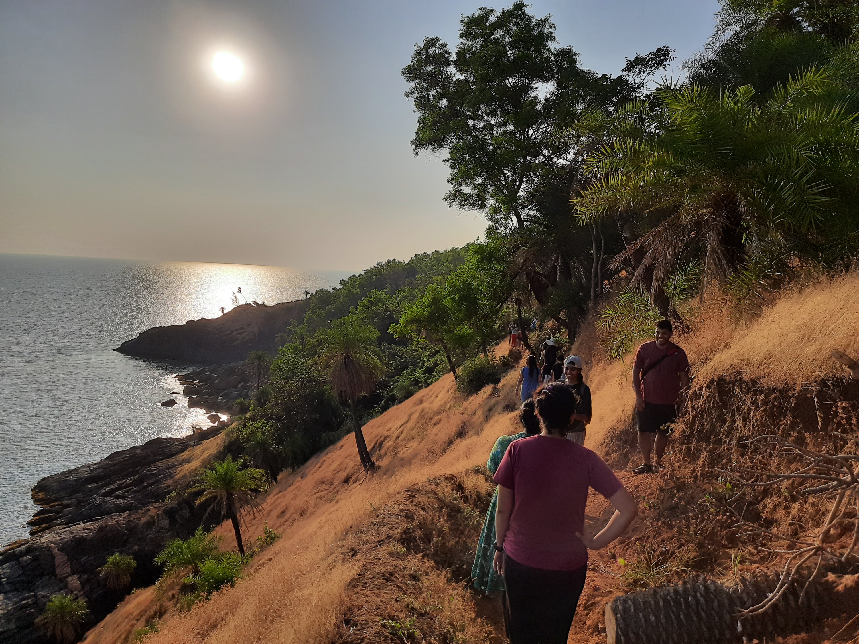
For the experienced trekkers, this was merely a walk along the coastline. But even for them, the small stretches of forests opening to amazing views of the blue sea now and then made the walk worthwhile.
Despite being late, we caught up with the schedule and spent ample time to take a swim in each of the beaches along the trail. Paradise beach for a snack break (fresh tender-coconut water and cut-pineapple with masala are a mandate on any Indian beach), Half-moon beach for a filling lunch (The beachside shacks serve an array of cuisines catering to its large visitors’ base from across the globe), Om beach for chasing the most mesmerizing sunset of the year, Kudle beach for a sumptuous dinner and finally walking along the Gokarna main beach to reach our campsite on a moonlit night… We spotted dolphins from the rock of peace, something that I had been wanting to see for the longest time. And then, I got that long pending hair braid done by a beachside vendor (Click here to read about it in detail). These were the highlights of my beach walk. Until then, I thought my day was GREAT!
The hiking trail between paradise and Om beach
But wait, my co-leads took it up a notch higher. It was late into the night by the time the team had settled down in their tents. And I too was settling down to call it a day. By that time, my co-leads asked me to ditch my tent for the night and join them with my sleeping bag on the beach. The beaches of Gokarna are infamously known only next to Goa for having some badass drunken hippies strolling around. I did not want any misadventures on my first assignment as a lead. Although I was a little hesitant to do something wacky, I soon hit the sands with my co-leads and a fellow traveler.
Just in a bit and even before I realized it, I was sleeping under a clear sky, watching the stars. Well… watching a meteor shower! It was that night when the Geminids meteor shower was at its peak. We laid on the beach counting the number of shooting stars. When only one of us saw the meteor, the others would pull her leg telling that she was hallucinating. When all of us saw it together, we would shout in unison scaring away a few drunken people loitering around the beach. They would wonder who was drunk 😀
Eight… Nine… Ten… We counted the number of stars until we fell asleep to the lullaby sound of the waves. When I opened my eyes again, I was lying on the beach and seeing the white lights from the distant ships disappear into the light of the breaking dawn. This beach experience is something that killed it for the mountain girl in me!!! Only because I could strike a similar chord of interests with an awesome pair of co-leads and I can’t thank them enough for the night!
Yeah, managing a large group comes with its own set of challenges. Managing medical emergencies in the middle of the trail, accommodating quick changes in the itineraries and finding alternate destinations when abnormality struck were the unexpected things which I believe we handled with diligence. All said and done, the trip has been a memorable one in more than one way and a thumbs up to my new journey with Plan The Unplanned 😊
Snow-capped mountains, lush green meadows, pine trees, tulip gardens, skis and snow boards… Do these things paint a perfect picture of a state known for its valleys? If you guessed it to be J&K, Yeah, you’re right! To be more precise, did you guess it to be Kashmir valley? If you did, then you can’t be more wrong. I’m talking about the least talked region of the state: Jammu.
For those who have heard little about Jammu, the mention of scenic or adventure hotspots comes as a surprise for all they know is only its religious places, the most popular being the Vaishno Devi shrine. For tourists visiting this region, there are several lesser-known destinations around Jammu city that are as beautiful as its popular counterpart in the Kashmir region. But, continue to remain unexplored and Bhaderwah being one among them. Bhaderwah is a town located in the Doda district and is called as ‘Mini Kashmir’ by the locals. This nickname itself gives a fair picture of the beauty of this place.
Places to visit in Bhaderwah:
• Day trip to Bhaderwah town covering Vasuki Nag temple, Gupt Ganga temple, Bhaderwah fort, Tilligarh rose garden and Gatha lake resort • Jai Valley trek • Sonbain glacier trek • Kailash Kund terk • Peer ki pindi (camps of Akbar) trek • Seoj Dhar Meadow trek • Day trip to Chattargala Pass • Day trip to Sarthal valley • Day trip to Basohli
The Details:
There are several attractions in Bhaderwah to mesmerise all genre of travellers who visit here during any time of the year. Bhaderwah is also called as ‘Nagon ki bhoomi’ (land of snakes) giving one a sense of its connection with mythology. Vasuki Nag is believed to be the keeper of Bhaderwah and hence the temple dedicated to this snake lord holds significance in the local culture. Thousands of pilgrims participate in the annual ‘Kailash Kund’ yatra that starts from the Vasuki Nag temple. The highlight of the temple is the idol of the presiding deity that is carved out of a black stone and is standing at an inclination. The temple is nestled within the narrow lanes of the town that snakes through ancient and traditional wooden houses from the time when the valley was ruled by the kings of Bhaderwah and Chamba. The town’s association with Mahabharata too can be felt at the ‘Gupt Ganga’ temple, on the banks of river Neru. The Pandavas are believed to have lived here during their exile. The Bhaderwah fort situated atop the town gives a good view of the entire region.
The Gupt Ganga river bank
The annual Tulip festival, Tilligarh rose garden and Gatha lake resort are some nice places for a day’s outing. Trekkers seeking to explore some breath-taking vistas can hike up the Jai Valley, Sonbain glacier, Kailash Kund, Peer ki pindi (camps of Akbar) or Seoj Dhar Meadow and connect with nature. If you are an adventure buff, the Jammu tourism has put in great efforts to cater to this segment with various outdoor activities like rafting in the Chenab river, rappelling, rock climbing, parasailing etc. Since Bhaderwah witnesses high snowfall, its high valleys are a great place for winter sports like skiing and snow-boarding too. It is slowly catching up as an alternate to Gulmarg in the state.
The Bhaderwah fort
Dirt roads and numerous water crossings in the region don’t fail to keep the adrenaline rushing for bikers who choose to ride here. The biking enthusiasts can opt the road through Padri, the highest motorable road in this region. Chattargala Pass is the highest motorable road and the most untouched point in Bhaderwah and offers a 360-degree spellbinding view of the entire region. It connects Bhaderwah with Basohli, another town of historical importance. One might be lucky to spot the endangered white vultures at this point or even some musk deer or Asian bears after a short hike up the hills.
One of the river and waterfall crossing on the way to Baderwah
The road to Basohli is picturesque with meadows, streams and typical pine trees all along the way. Sarthal valley is one of my favourite pit-stops along the way. With nothing much to do, it is beautiful with its laid-back scenery with Bakarwals (Shepherds) settlements amid green meadows and gushing streams from the glaciers. The seven-tiered waterfall located here is worth a short trek before riding up the treacherous road towards Basohli town. Basohli town itself is beautifully located on the backwaters of the Ranjit Sagar dam flanking it.
With political unrest being rampant in Kashmir, the main source of income through tourism has taken a huge toll in the state in the last couple of years. Jammu is very safe for all kinds of travellers and the tourism department is putting their best efforts to familiarize tourists with the other unexplored areas of the state. If visiting this state has long been on your bucket list and the unrest at the borders has kept you away, I think it is time you relook into your plan to visit the Mini Kashmir instead!
Fact file:
Getting there: Jammu is well connected by airport, rail and road. You can hire a self-drive car or a taxi from the city to visit the other sightseeing places. Bhaderwah is 280kms(about 5hrs) by road from Jammu city.
Stay: TRC (Tourist Reception Centre) guesthouses run by the J&K tourism dept., several homestays and budget hotels are available. Tilligarh tourist complex is a great place for one seeking luxury in nature.
Must try: Sip a cup of ‘Desi Chai’, a pink coloured tea that can be consumed either with salt or sugar.
Must buy: Basohli miniature paintings.
This visit to Bhaderwah was a part of our ‘Peace ride’, sponsored by Jammu tourism as a part of the Himalayan expedition to promote tourism in the lesser explored places of Jammu. The route we covered over the week was Jammu-Mansar-Basholi–Sarthal–Baderwah-Kishtwar-Gulabgarh-Sansari-Gulabgarh-Patnitop-Udhampur-Jammu. It has been over a year since this trip has been past and yet remains one of the best so far.
India has intrigued the world with its history, geography and culture- each individually dating back to several ages ago. I have been no different from the rest of the world. The LostLander has begun to embrace her landings after getting lost at random places in her incredible country. The more she is exploring her country, the more she has been discovering about its descendance and getting mind blown with new discoveries each time.
“The history of India’s physical geography is older than that of its civilization or even that of the human race. The subcontinent has been a distinct geological entity for millions of years. Therefore, to understand India, we must go back to the very beginning.”
-Sanjeev Sanyal
The fact that it is called as a subcontinent is associated to a larger theory of it being separated out of a supercontinent called ‘Rodinia’ and drifting apart from Africa, Antarctica and then Madagascar before it struck with the Asian continent. No, I’m not time traveling that far for now! It was just to put an exclamation to how amazing this country’s geography has evolved to be and what the natural bounty as we called it, has to offer in this beautiful country to an explorer… To take my article forward and with no biases, I divide the geography of this subcontinent into North and the South, just by drawing an imaginary line passing through its center, Seoni in Madhya Pradesh. Here is a humble attempt to take my readers through some of the beautiful destinations I have been to enjoy the natural marvels of Southern India. They are in random order and listed as and when I recollected them. For more details, you need to read my individual posts on them by clicking on their respective tags!
1. Kurusudai islands: Nestled off the coast of Rameswaram in the Gulf of Mannar, it is the only place in the world where the oldest and the last surviving living fossil is found in the world.
2. The table tops of Maharashtra: Be it the beautifully painted pink valleys of the Khas plateau, valleys of Matheran, Mahabaleshwar or any place thought of for a scenic drive for the Mumbaikars- have all formed out of large volcanic eruptions as the subcontinent merged with Asia. Not just that, these geographical features were strategically used by Shivaji to stop the invasion by the Mughals and hence called the Deccan traps.
3. Limestone caves of Andhra Pradesh: Belum caves, a part of a larger cave complex in the Erramalai region is the largest and longest cave system that is open to public. Similarly, the Borra caves is the deepest in the country. The speleothem formations are worth a visit which have formed due to continuous flowing of water over a thousand years, easily dating back to the Archaean age.
4. Gandikota: People call it as the ‘Grand Canyon of India. It is a beautiful gorge formed by the Pennar river as it squeezes from between the rock formation that has played witness to several kingdoms in history.
5. Eastern Ghats: Although I use a very generic term that specifies an entire region, they are older and mineral rich than their popular counterparts on the western side. All, again a resultant of several tectonic activities in the event of formation of the Indian mass.
6. Dhanushkodi: This abandoned town has more than just history of a cyclone. The revered ‘RamaSethu’ or the Adam’s bridge was formerly considered to be the largest Tombolo in the world and is believed to have formed due to the drifting of India and the Lankan land masses several thousand years ago..
Well… If all these have been the outcomes of several tectonic activities of the earth over a million years, there are yet several other amazing things that nature has to offer in the Southern peninsula.
7. Have you been to Wayanad in Northern Kerala? There is a heart shaped lake after a good climb up the Chembra peak in the western Ghats. It’s the nature’s way of telling ‘I Love You’!
8. Heard of the Barren island? It is the only active volcano in India, with the most recent eruption being in 2017. The sea area around it is considered to be one of the best dive sites in the world!
9. And then there is Baratang islands- It is the only mud volcano in India, situated in the Andaman group of islands.
10. Have you seen the Purple hills? Where do you think the Nilgiri hills in the western Ghats derive their name from? They’re so called because these green verdant hills are painted blue/purple (Neela in Hindi) by the Neelakurinji flowers, something that blooms only once in twelve years. The latest mass-blossoming being in 2018.
11. Cruised through the canals of Kuttanad? Mostly popular among the honeymooners and families alike for its backwaters and houseboats, what many don’t know about this region is that it is the only region in the world where paddy farming is done below sea level.
12. How about a boat ride in the Mangrove forests of the Bay of Bengal? The Sundarbans and Pichavaram forests are the first and the second largest mangrove marshlands in the world. A world heritage site that they are, an extremely important part of the ecology.
13. What happens when a meteor hits the earth? A massive crater is formed giving form to Lonar lake in Maharashtra. This Geo-heritage monument saline soda lake is the only high velocity impact crater lake on earth.
14. Seen the waterfalls of the Deccan plateau? Be it the Chitrakoot falls in Chhattisgarh, Gokak falls in Karnataka, Athirapally in Kerala or Hogeynakal in Tamil Nadu… They’re all so good they can give a good competition to the Niagara!
15. Heard of the Sentinelese tribesmen in the Andaman sea? They’ve long avoided contact with the outside world and their gene pool is believed to be one of the crucial links to early man and the evolution of mankind on the planet.
What India has to offer is abundant! And these are only a few places that I have been to in the southern India. Do you have any recommendations? Have I missed out on anything? I would LOVE to know… Please drop n your suggestions, recommendations, feedback in the comments section below 😊