I missed the morning bus from Reckong Peo and that gave me some time to take part in the annual mela in the district headquarters. I boarded the next bus at noon, from Peo towards my destination for the day- Nako, a small township in the Hangrang Valley, a part of the Spiti valley. The place gets it’s name from a Tibetan word ‘Nego’ which translates to ‘The Door to a holy place’.
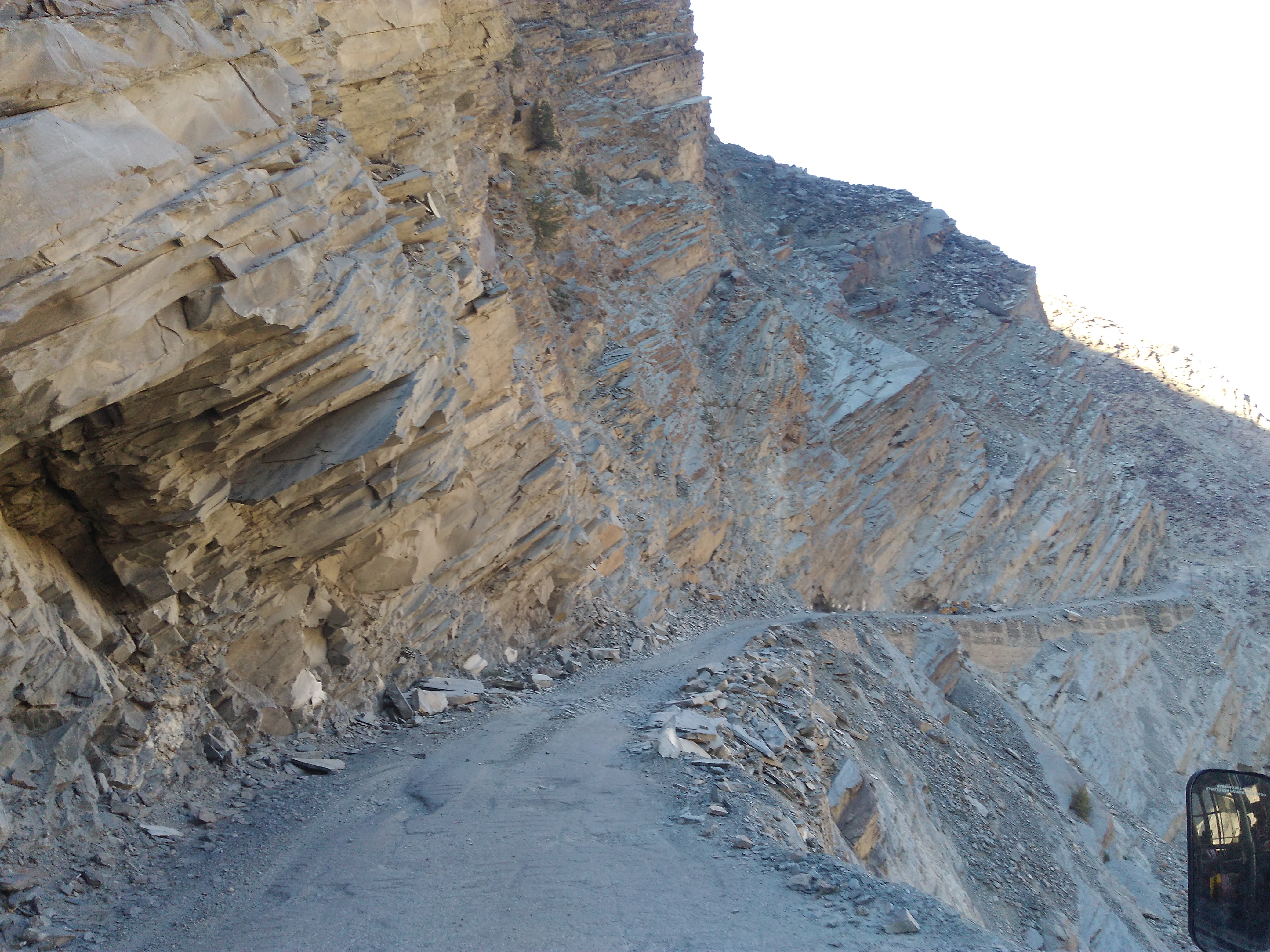
The transition from Kinnaur valley to Spiti valley was evident in its landscape. The road changed from green to rocky to barren along the way, each being spectacular. The snaking road was accompanied by the crisscrossing Spiti river amid a mind-blowing scenery all along the way. Although I was travelling solo, I felt accompanied through warm conversations with the driver and the conductor of the HRTC bus. They were quite surprised and amused to hear that I was from South India, spoke fluent Hindi, was travelling alone and without a fixed itinerary. The bus was stuck in a couple of roadblocks caused by landslides for almost 3 hours in total and that meant- I arrived late at my destination. From all the online research I had done about the place, I knew that Nako was decently popular on the tourist radar and finding a place to stay wouldn’t be difficult. When finally the bus stopped at the Nako bus-stop at 07.00.p.m., I was in for the BIGGEST surprise of my life!
The bus stop was on the highway. That was the LAST public transport of the day. It was pitch-dark already. All the civilization I had read about, did not seem to exist there. Apart from the bright stars twinkling in the clear sky, the only light I could see was that of a dimly lit lantern hanging in a tiny shop. The conductor looked at me blankly and said- this is Nako. “Talk to the shopkeeper and he might help you to find a place to stay”, he said and signaled the driver to proceed their ride.
“Where am I going to stay tonight? Can I trust the shopkeeper? Do I have any other option apart from approaching the shopkeeper?” A million things were running in my head. I stood there for a moment to let my thoughts settle down first. But before that, the biting cold and the rough winds rushed me to the shop for some warmth. In the dim light, I saw hope. The shop was run by an old man and the wrinkles on his surprised face multiplied when I asked him if I could get a place to stay. He nodded a yes and asked me to wait until he attended his last customer and lowered the shutters of his little grocery store.
He walked me through steel shutters behind his shop, got a bunch of keys from his house and asked me to follow him to the floor above his house. He said he runs a homestay (Somang dhaba, hotel and homestay) during summer. Since I was there during offseason, the room wasn’t used for a long time. The room had a low voltage bulb and had no running hot water. I could stay there for the night if I could manage with whatever was available. He was not going to charge me for it. The room had a decent washroom, carpeted floor, enough blankets and a comfortable looking bed. The thought of saying no to the old man and getting adventurous in pursuit of a better homestay in the cold night did not even pass through my head. This place was more than what I had expected to get. I agreed to stay there and grabbed the room keys from him.
As I unpacked my bag to pull out my thermals, Mr.Somang knocked at my door with a bucket of hot water for me to freshen up and told me that he had informed the small dhaba next door to stay up for me so that I can go have my supper. If there was any other problem, I could knock at his door, Mr.Somang lived with his wife in the ground floor. The dhaba was a tiny shed put-up with sheets, was run by a Nepali family and fed the occasional truck drivers who stopped by for chai and Paratha. I had the same for my supper too. As I answered the family’s curious questions, I sat warming myself around the fireplace in their kitchen for some time before heading back to my room.
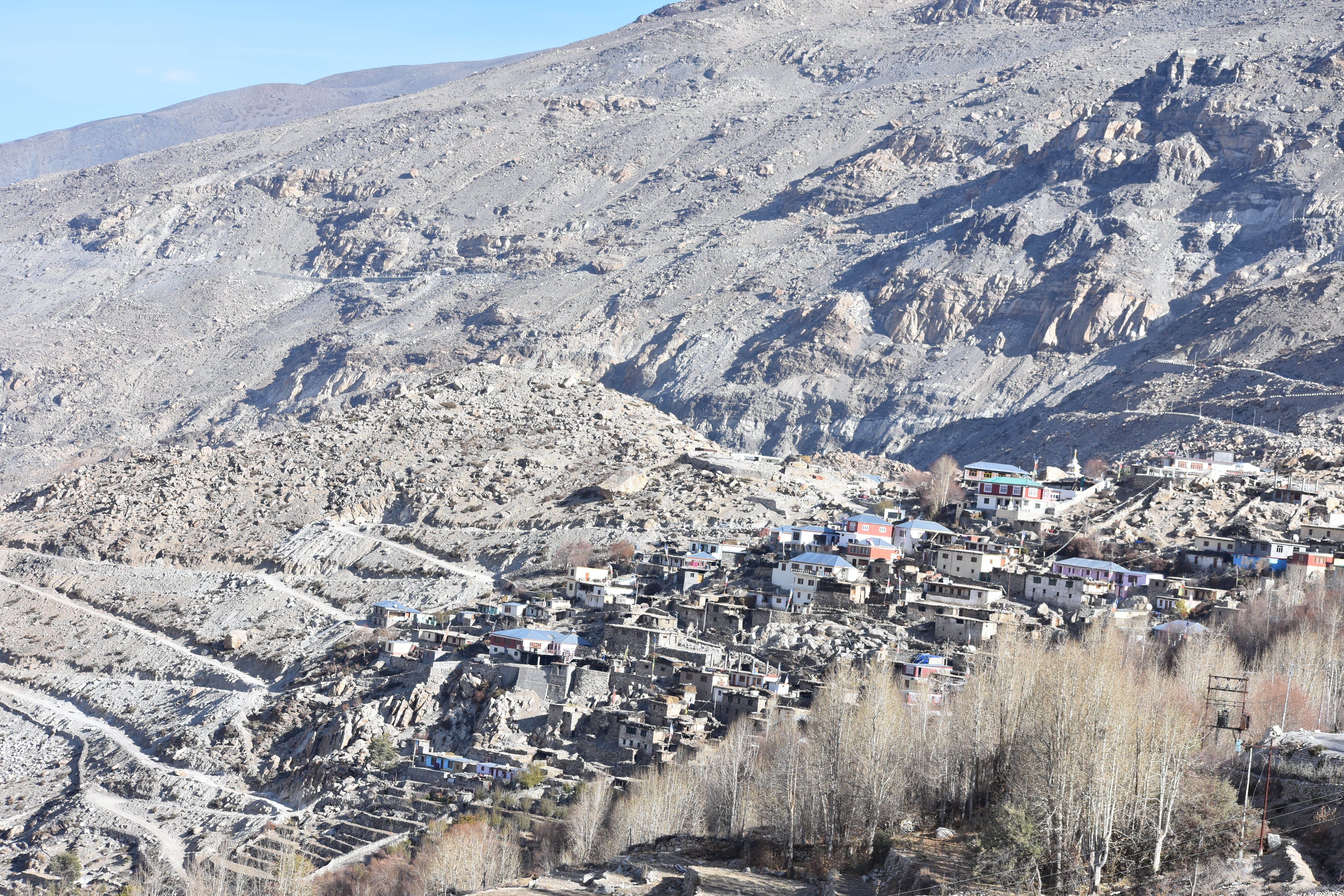
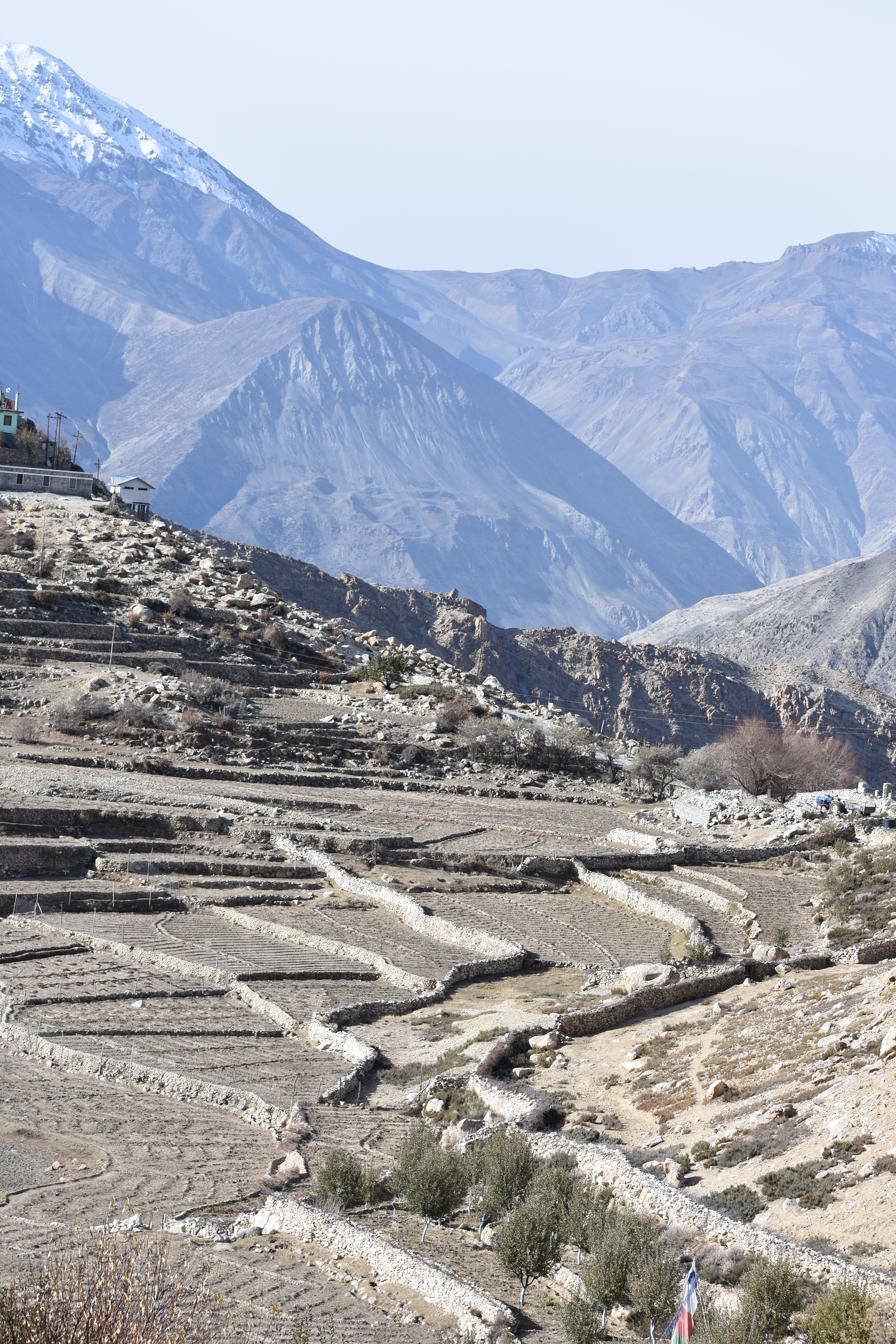
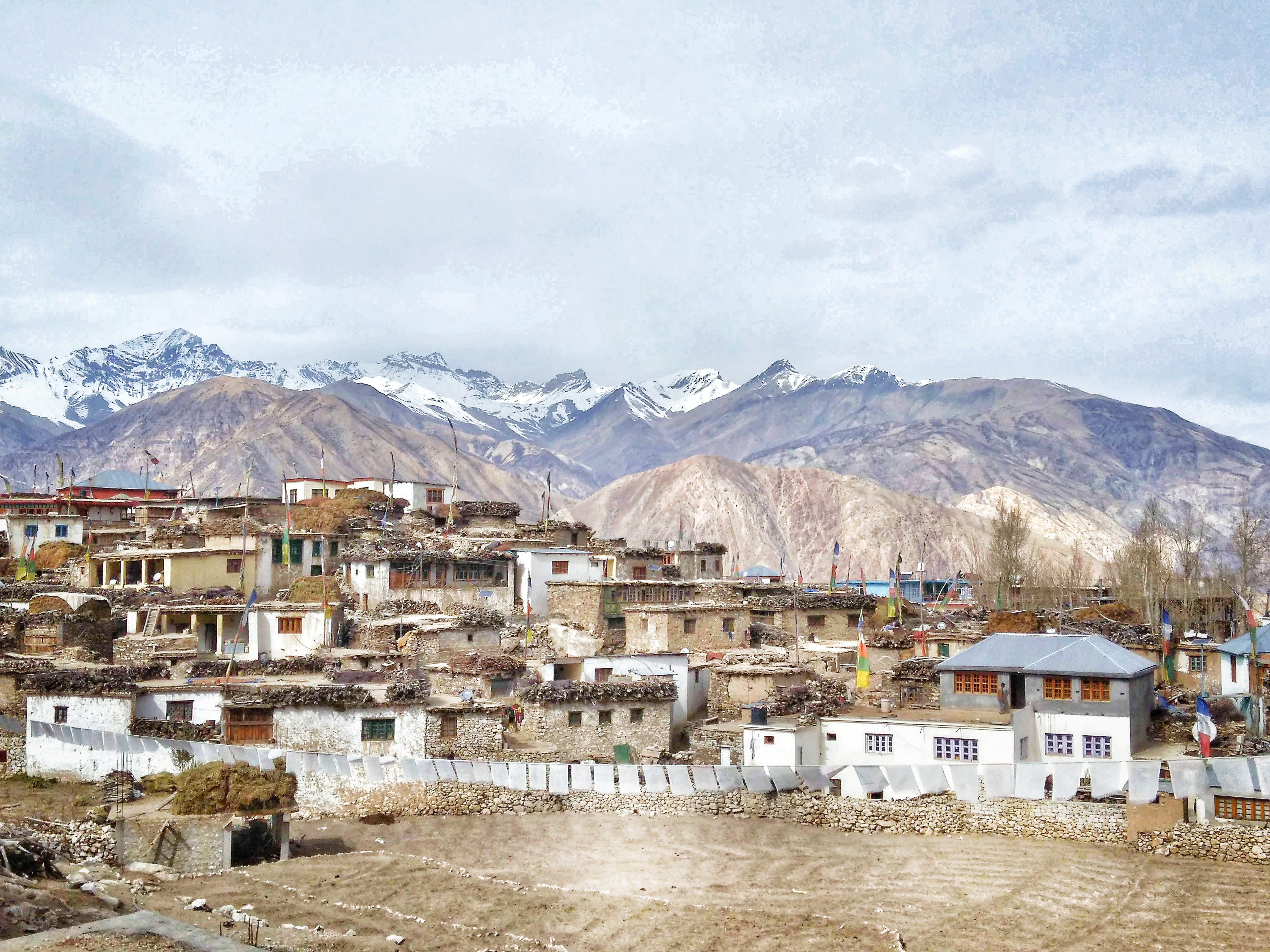
I was in for a surprise when I woke up in the morning. The view from the window transcended me to another world that I had imagined only on Microsoft Window’s wallpaper. Barren, dry arid landscape and distant snowcapped mountains. A lonely road ran uphill, and I had slept in a roadside house that had this magnificent view. I immediately jumped out of my bed, fetched a bucket of hot water from the host’s house, freshened up and got out quickly, to sink in the morning vibes of the place. I took a walk to the nearby helipad from where I could get a 360deg view of the surrounding mountains. That was the first time I was seeing a landscape so arid, so dry, so different and so beautiful.
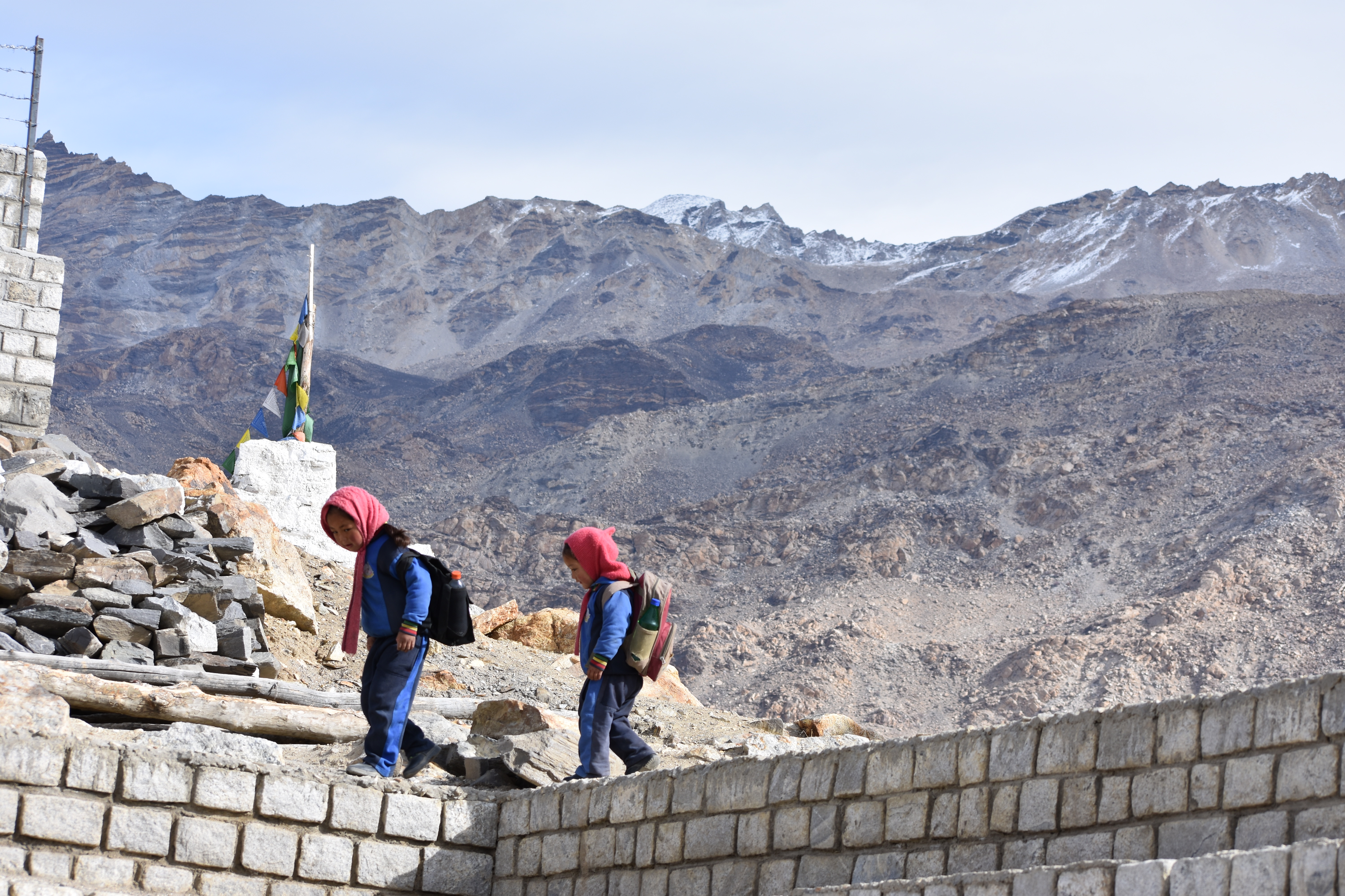
As I walked further, is when I realized that the real civilization of Nako village existed only if I walked further away from the main road. Doing this on a moonless night, in order to find a place to stay would have been next to madness. I was greeted by tiny tots with their heavy backpacks and playfully jumping on their way to school. The sounds of mooing cattle and crowing roosters echoed in the silent streets.
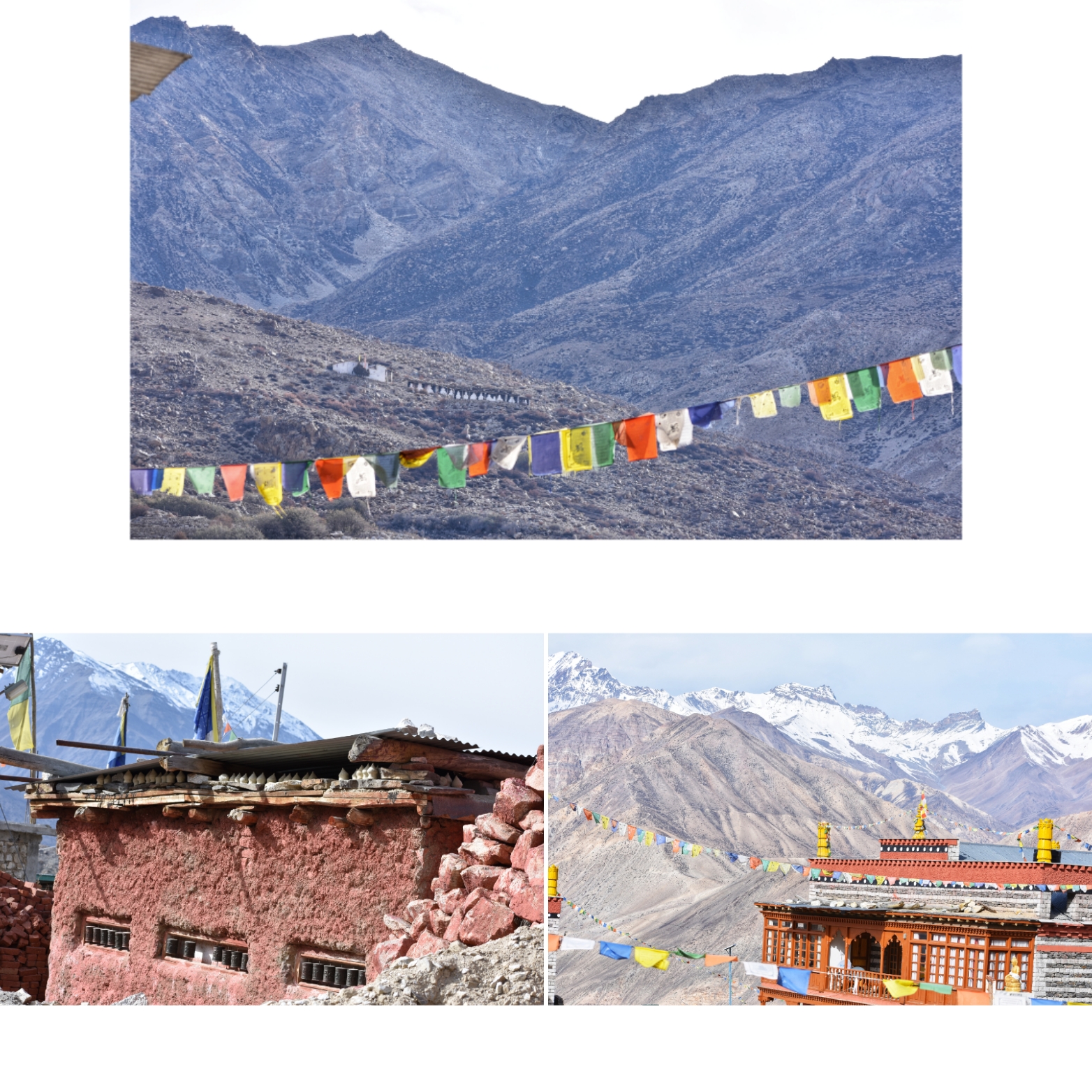
The sweet smell of incense arising from the monastery had engulfed the ambience as I walked towards a small red structure made of clay and red oxide. Prayer drums on its outside indicated that it was the ancient Buddhist monastery where people seemed to be coming to offer their morning prayers. An interesting structure caught my attention to up in the hills. “That’s the old and the main monastery from the 11th century ”, a passerby answered to my question. But it seemed quite far for a lonely walk, so I decided to keep it for some other day. When I have company, perhaps!
The further I walked into the village, the more magical it started to seem. The structure of the houses was unique to Nako, from what I had seen all this while. The houses are built at an elevation from the ground with wooden beams holding the dry stones, slate roofs covered with hay and all houses painted with white lime. While I was finding my way to the Nako lake through the muddy lanes, reaching random dead ends and taking blind turns, I felt lost in the maze. Just then, a man appeared in front of me and greeted me with a warm smile. He saw me taking photos on my cellphone and asked me if I minded a selfie with him. Although bad at taking selfies, I did not mind getting myself pictured in that unique looking place.
He invited me to his house for a cup of chai and not for a second did I think again. I nodded a yes with joy and followed him to his pretty haven whose courtyard overlooked the Nako lake. His wife got excited at the alien visitor in their little abode and got me chai and biscuits along with some hearty conversations. She took me around her home, and I was quite amused at the style in which it was built (almost entirely of clay, stones and hay), a first time for me. Apart from a heartfelt thank you, I did not have anything to give them back for their wonderful hospitality. And neither did they expect anything in return. I bid goodbye and walked down the lane to the lake, a holy place for the villagers.
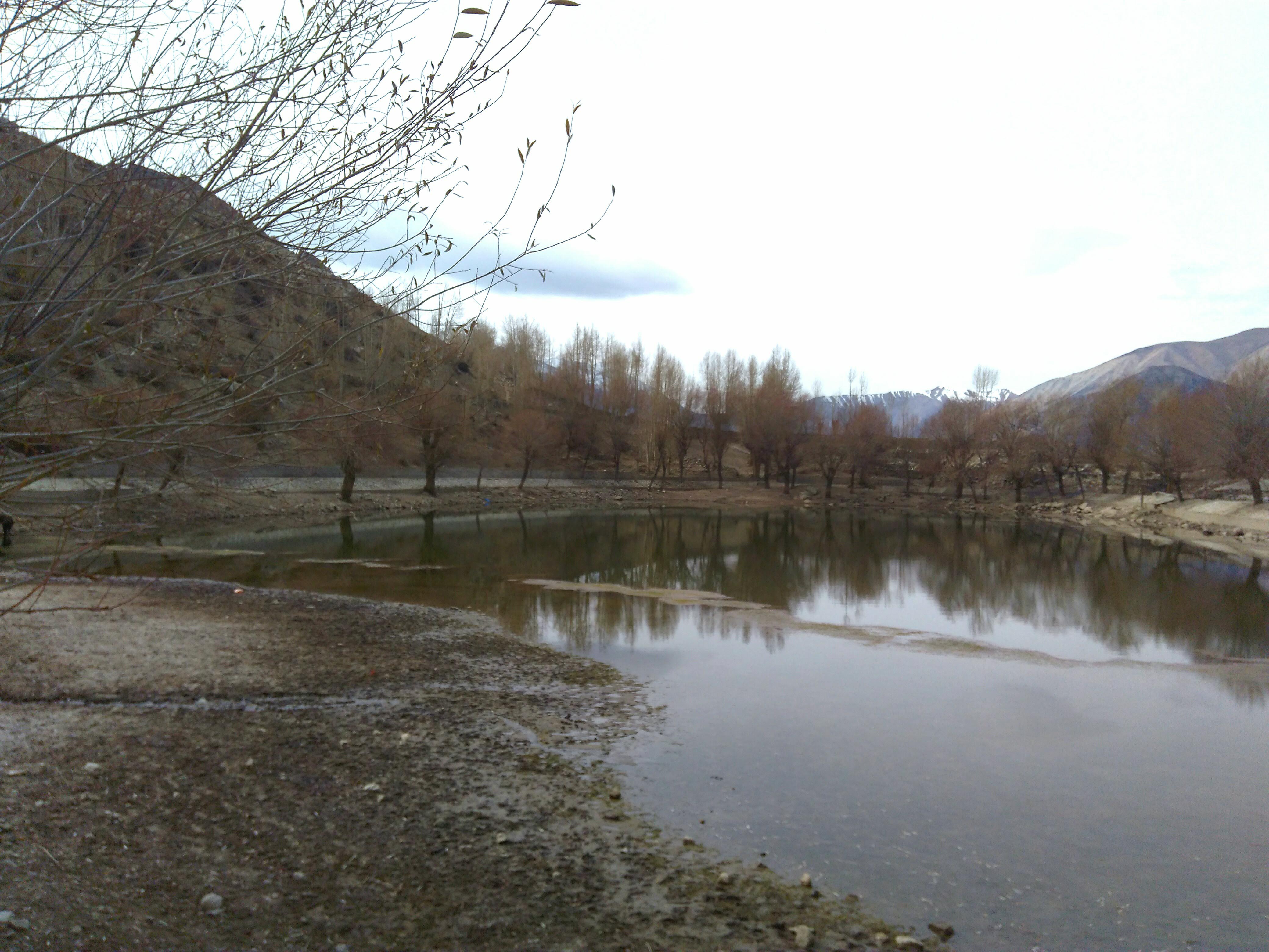
Apart from a few grazing horses, I was the only human there that morning. It was the first time I felt like meditating and decided to sit by the waters for some peaceful moments. The Nako lake is considered holy among the Tibetan Buddhists as Lord Padmasambhava is believed to have meditated here. It is no surprise why I was feeling the unusual calmness and serenity at that place.
A few running kids got me back to reality that I had been sitting there for a while by then. I woke up and got back to the homestay to figure out a way to get to my next destination. But that’s going to be another interesting story (Click her to continue reading)….
This entire journey has been compiled into a book. You can avail it on Amazon or read it for free using your Kindle. Use the link below:


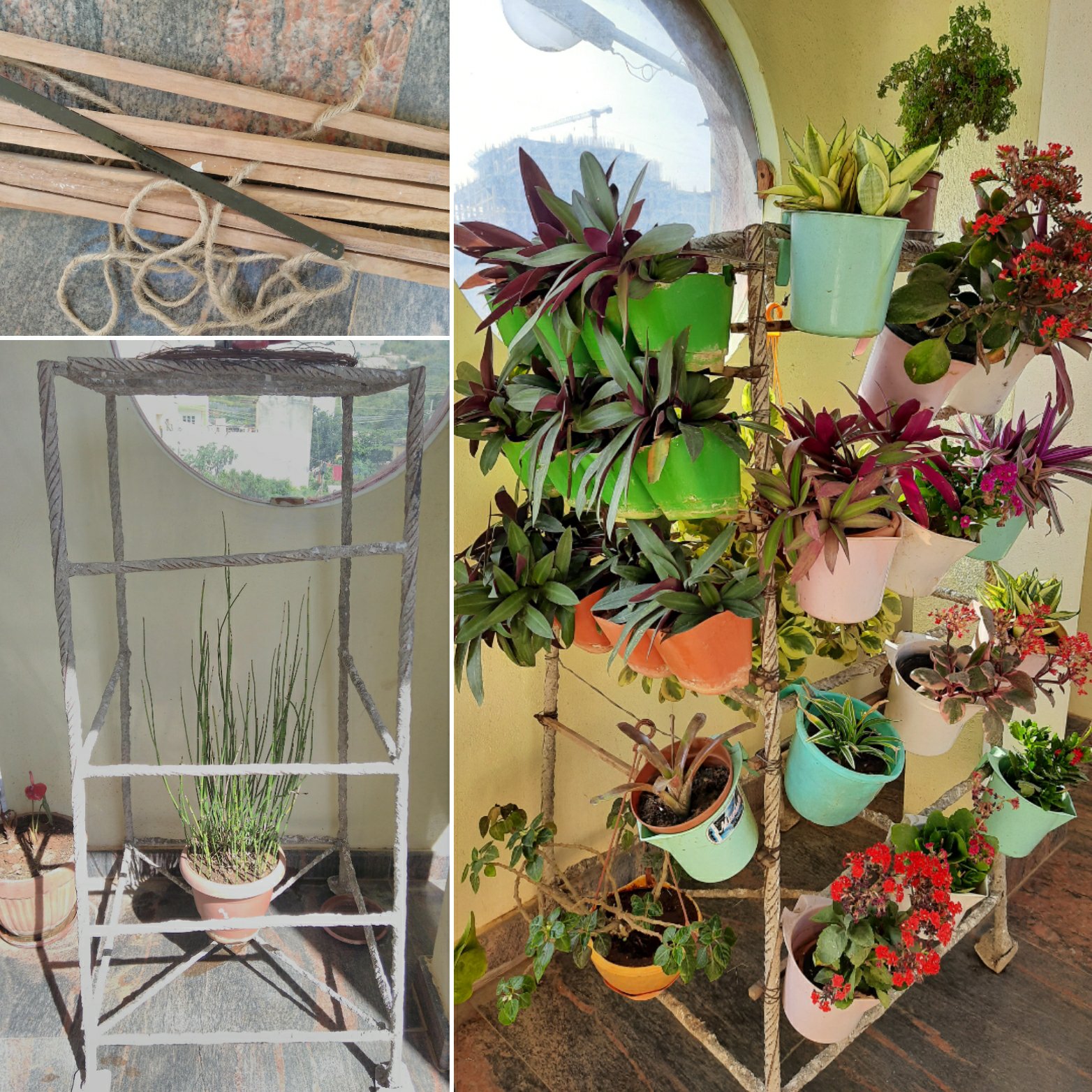 My DIY vertical garden